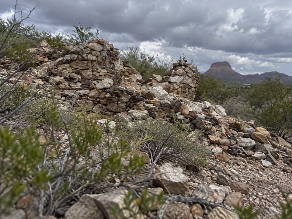
La Coyota in Big Bend National Park

Sight · Big Bend National Park

La Coyota

Ruins of a farming community that sold food to miners.

Type
Sight
Nearest trail
2.6 mi
Audio stories
5 nearby
  • Parking

Hear the audio tour

Desert Mountain Overlook

Overview

About La Coyota

Why stop

  • A rare window into early Mexican and Mexican-American family life in Big Bend.

Heads up

  • Only a few crumbling foundations remain.

Map

Where it is

Loading the Big Bend map
Full map
SightLa Coyota29.14482, -103.53740
Keep this map with you offline in the Parkwolf app

Plan your stop

Before you go

2 active Big Bend alerts

  • ClosureWeather-related road closuresDo not use these closed roads; NPS lists the closures as in effect until further notice.Official details
  • InfoBoquillas Crossing schedule changeBoquillas Crossing is open Friday through Monday, 9:00 a.m.–4:00 p.m.; NPS says it will not change to winter hours at this time. Check current park conditions before planning a crossing.Official details

Big Bend alerts
A park ranger sits on a dash-mounted phone, talking, as Parkwolf’s Tour Guide plays “Army Cutworm Moths: A Grizzly Bear Buffet” on Grand Loop Road below Dunraven Pass in Yellowstone
Parkwolf Tour GuideThe highest, rockiest slopes around here are a summer buffet for grizzly bears.

Big Bend Tour Guide

Your drive to La Coyota, narrated.

Parkwolf is a GPS audio tour guide for Big Bend National Park. As you drive, it chimes in with what’s ahead: hidden gems, upcoming stops, history, geology, and wildlife, right through your car’s speakers.

See the Big Bend audio tour

Recorded for this area

Desert Mountain Overlook
0:00 / 0:20
“Desert Mountain Overlook is coming up, a quick roadside stop for seeing the Chisos from the low desert. Look for Emory Peak, the South Rim, and Elephant Tusk along the skyline.”

Plays on the road 0.1 mi from La Coyota in the Parkwolf Big Bend Tour Guide.

More stories near here in the app

  • Cottonwood Campground
  • Castolon Historic District
  • Big Bend’s Tall Bluebonnet
  • The Engines Behind Castolon’s Cotton
  • 110 audio storiesacross Big Bend’s roads, triggered by GPS as you drive
  • Wildlife heatmapsfor Black Bear, Collared Peccary, White-tailed Deer, and 13 more
  • Works offlinemaps, 45 trails, 64 places, and audio download before you lose signal
  • CarPlay readysimple controls built for the drive
★★★★★
“Fantastic app with many points of information… It’s great to just turn on while you’re driving and it gives you an audio tour of the national Park. We love it!!!!”
JMJamesApp Store review
Download Parkwolf on the App StoreGet Parkwolf on Google Play

4.7 from 8,600+ ratings

Guide

More about La Coyota

A modest roadside history stopLa Coyota is the remnant of a small community beside Ross Maxwell Road near Alamo Creek.

La Coyota is the remnant of a small community beside Ross Maxwell Road near Alamo Creek. The road passes through its ruins, where only a few crumbling foundations remain. This is a stop for the story more than the scale of the ruins: it was the oldest documented community in Big Bend, home to nearly a dozen Mexican and Mexican-American families.

Finding what remainsThe site lies near Alamo Creek between mile markers 1 and 2, with auto parking.

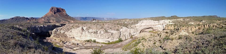
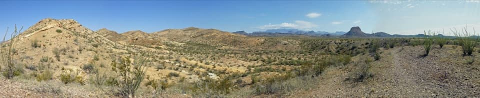
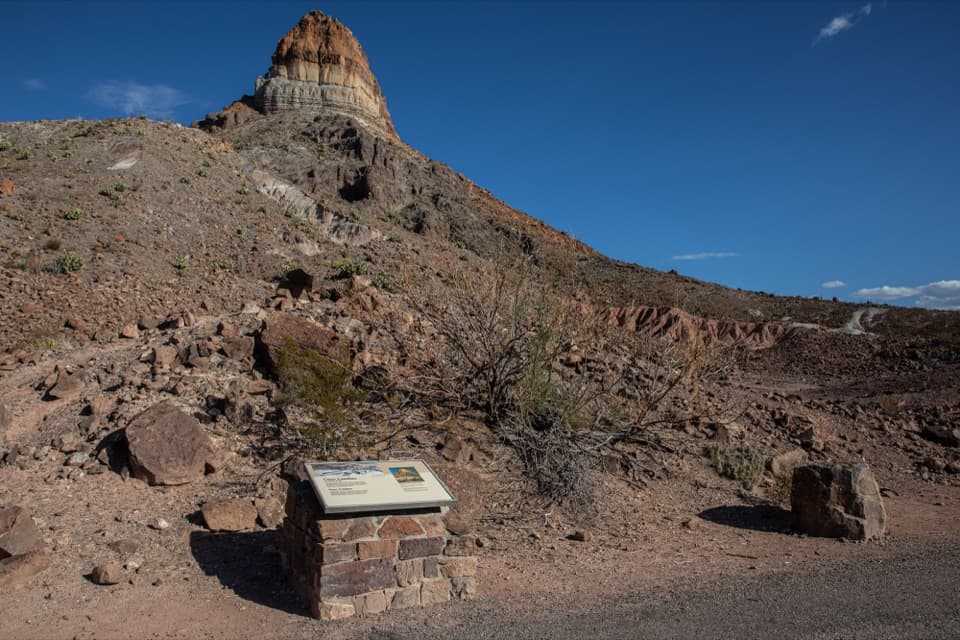
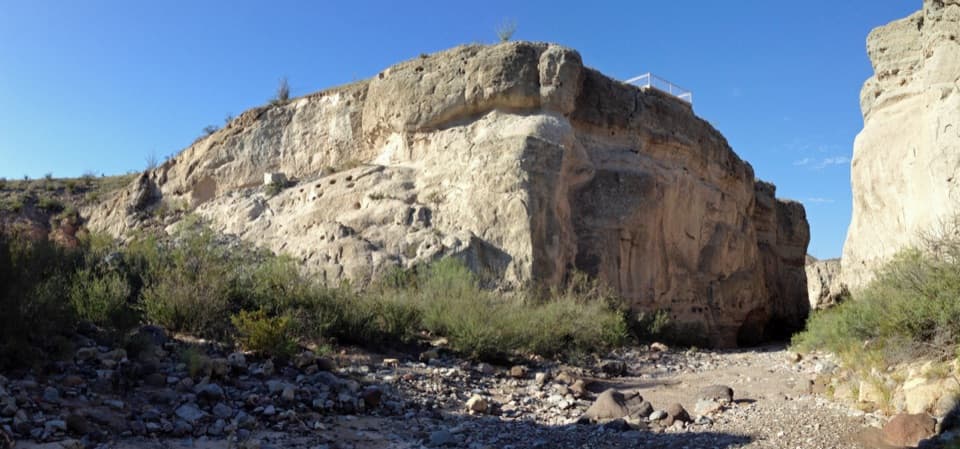
The site lies near Alamo Creek between mile markers 1 and 2, with auto parking. Look for the stone foundations among the desert scrub; a wide view that includes the mesa behind them shows the setting better than a close crop.

Families who made a home hereDon Severiano Chavarria moved to the area in 1884 with two sons and two daughters.

Don Severiano Chavarria moved to the area in 1884 with two sons and two daughters. His daughter Petra was born there the next year, and the family eventually grew to eleven sons and five daughters. The Garcia family also lived here, raising two boys and two girls in an adobe home. Their children helped with farm and cattle work, while Mr. Garcia worked ranch jobs and spent winters in Terlingua's mercury mines.

Farming and tradeA former resident recalled growing corn, wheat and vegetables with surface water, and keeping…

A former resident recalled growing corn, wheat and vegetables with surface water, and keeping hogs and chickens. Families sold surplus produce and tamales to miners in Terlingua. Runoff in the dry washes could sometimes cut residents off from home after storms.

A possible name originOne former resident thought La Coyota was named for a coyote shot while it tried to get into a…

One former resident thought La Coyota was named for a coyote shot while it tried to get into a henhouse. It is a remembered explanation for the name, not a settled etymology.

Wildlife

Wildlife in Big Bend

All Big Bend wildlife maps

Sighting maps show where each species has been reported across Big Bend. Wildlife moves, so no sighting is guaranteed.

Parkwolf’s Big Bend ranking

Top sights in Big Bend

All 64 places
  1. 1Santa Elena CanyonSight
  2. 2Sotol VistaSight
  3. 3Fossil Discovery ExhibitSight
  4. 4Window ViewSight
  5. 5Boquillas CanyonSight
  6. 6Langford Hot SpringsSight

Take Parkwolf to Big Bend.

The audio tour guide for the drive, plus offline maps, trails, and wildlife heatmaps for when the signal drops.

4.7 from 8,600+ ratings

Download Parkwolf on the App StoreGet Parkwolf on Google Play