Sunken Block Exhibit in Big Bend National Park

Sight · Big Bend National Park

Sunken Block Exhibit

A roadside geology stop that makes Big Bend's sunken basin click.

Photo: National Park Service
Type
Sight
Nearest trail
4 mi
Audio stories
5 nearby
  • Exhibit
  • Parking
  • Scenic viewpoint

Hear the audio tour

Sunken Block Exhibit

Overview

About Sunken Block Exhibit

Why stop

  • Makes Big Bend's faulted basin landscape easier to understand.

Heads up

  • The visit is brief, with the panel and view as the main draw.

Map

Where it is

Loading the Big Bend map
Full map
SightSunken Block Exhibit29.19323, -103.02395
Keep this map with you offline in the Parkwolf app

Plan your stop

Before you go

2 active Big Bend alerts

  • ClosureWeather-related road closuresDo not use these closed roads; NPS lists the closures as in effect until further notice.Official details
  • InfoBoquillas Crossing schedule changeBoquillas Crossing is open Friday through Monday, 9:00 a.m.–4:00 p.m.; NPS says it will not change to winter hours at this time. Check current park conditions before planning a crossing.Official details
Big Bend alerts
A park ranger sits on a dash-mounted phone, talking, as Parkwolf’s Tour Guide plays “Army Cutworm Moths: A Grizzly Bear Buffet” on Grand Loop Road below Dunraven Pass in Yellowstone
Parkwolf Tour GuideThe highest, rockiest slopes around here are a summer buffet for grizzly bears.

Big Bend Tour Guide

Your drive to Sunken Block Exhibit, narrated.

Parkwolf is a GPS audio tour guide for Big Bend National Park. As you drive, it chimes in with what’s ahead: hidden gems, upcoming stops, history, geology, and wildlife, right through your car’s speakers.

See the Big Bend audio tour

Recorded for this place

Sunken Block Exhibit
0:00 / 0:18
“Sunken Block Exhibit is coming up, a quick stop for the geology-minded. About twenty million years ago, the rocks beneath your feet were level with the Sierra del Carmen's crest.”

Plays as you drive up to Sunken Block Exhibit in the Parkwolf Big Bend Tour Guide.

More stories near here in the app

  • Mariscal Mine via River Road East
  • The Beaver in the Desert
  • The Spring’s Underground Plumbing
  • Langford Hot Springs
  • 110 audio storiesacross Big Bend’s roads, triggered by GPS as you drive
  • Wildlife heatmapsfor Black Bear, Collared Peccary, White-tailed Deer, and 13 more
  • Works offlinemaps, 45 trails, 64 places, and audio download before you lose signal
  • CarPlay readysimple controls built for the drive
★★★★★
“Fantastic app with many points of information… It’s great to just turn on while you’re driving and it gives you an audio tour of the national Park. We love it!!!!”
JMJamesApp Store review
Download Parkwolf on the App StoreGet Parkwolf on Google Play

4.7 from 8,600+ ratings

Guide

More about Sunken Block Exhibit

A brief stop with a wide viewSunken Block Exhibit is a roadside geology stop facing the pale limestone cliffs of the Sierra…

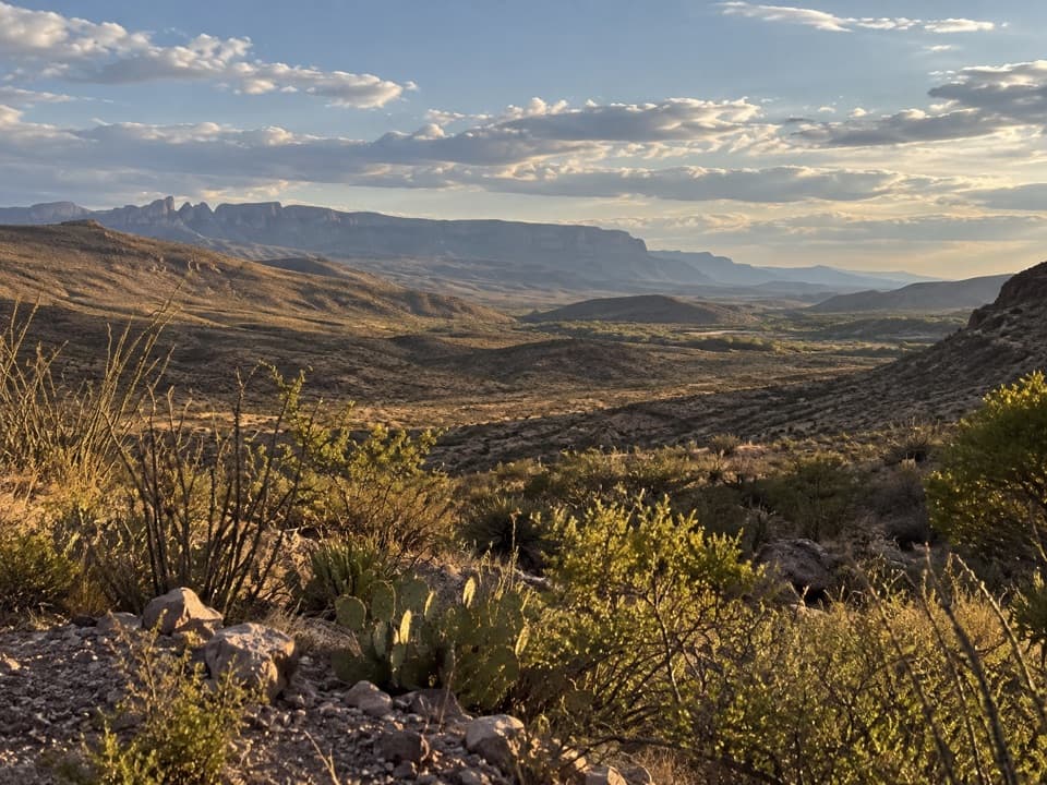
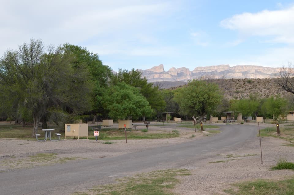
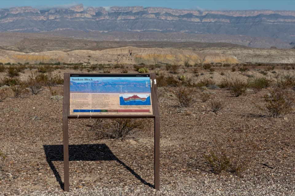
Sunken Block Exhibit is a roadside geology stop facing the pale limestone cliffs of the Sierra del Carmen. It's worth a pause if you want to understand how Big Bend's basin-and-range landscape took shape; the exhibit connects the desert floor in front of you to the park's larger geological story. Think of it as a short interpretive stop with an open view, rather than a destination built around a hike. Vehicle parking, including bus and RV parking, and wheelchair accessibility are listed for the site.

The basin behind the nameThe exhibit places the rocks below your feet level with the Sierra del Carmen's crest about 20…

The exhibit places the rocks below your feet level with the Sierra del Carmen's crest about 20 million years ago. As the western part of North America stretched, faults lifted mountain ranges and let broad blocks of land drop. The wedge between the Sierra del Carmen and Mesa de Anguila fell several thousand feet, forming the basin known as the Sunken Block. The wider regional account places the start of central fracture-zone development around 26 million years ago; those dates describe different markers in a long process, not one precisely dated instant.

What the basin keptErosion carried sediment into the lower basin, where it buried and protected rocks, fossils and…

Erosion carried sediment into the lower basin, where it buried and protected rocks, fossils and ancient soils. Together they preserve a 130-million-year record of life in Big Bend. Much later, the linked drainage systems gave the Rio Grande a route through the region; within the last two million years the river cut the park's canyons. The panel makes that big sequence easier to picture from one roadside stop.

Stay for the lightThe site is also recommended for sunset viewing.

The site is also recommended for sunset viewing. For a photo, step back enough to fit the exhibit panel and the Sierra del Carmen in the same frame; the sign anchors the broad desert view and identifies the stop.

Wildlife

Wildlife in Big Bend

All Big Bend wildlife maps

Sighting maps show where each species has been reported across Big Bend. Wildlife moves, so no sighting is guaranteed.

Parkwolf’s Big Bend ranking

Top sights in Big Bend

All 64 places
  1. 1Santa Elena CanyonSight
  2. 2Sotol VistaSight
  3. 3Fossil Discovery ExhibitSight
  4. 4Window ViewSight
  5. 5Boquillas CanyonSight
  6. 6Langford Hot SpringsSight

Take Parkwolf to Big Bend.

The audio tour guide for the drive, plus offline maps, trails, and wildlife heatmaps for when the signal drops.

4.7 from 8,600+ ratings

Download Parkwolf on the App StoreGet Parkwolf on Google Play