Cascades Picnic Area in Blue Ridge Parkway

Picnic area · Blue Ridge Parkway

Cascades Picnic Area

Shady picnic lawn with a short walk to Cascades Falls

Type
Picnic area
Nearest trail
Right here
Audio stories
5 nearby
  • Trailhead
  • Parking
  • Restrooms
  • Picnic tables

Hear the audio tour

E.B. Jeffress Park and The Cascades Trail

Overview

About Cascades Picnic Area

Tucked into E.B. Jeffress Park around milepost 272, Cascades Picnic Area is a mellow, grassy nook with shady groves and an easy gateway to one of the Parkway’s loveliest short waterfall walks. It’s popular with families and groups, but still feels spread out and peaceful.

Why stop

  • Trail to a beautiful waterfall starts right here
  • Spacious, shaded lawn with widely spaced tables

Heads up

  • Most picnic spots have limited views due to tree growth
  • Restrooms and water can be unavailable in the off-season
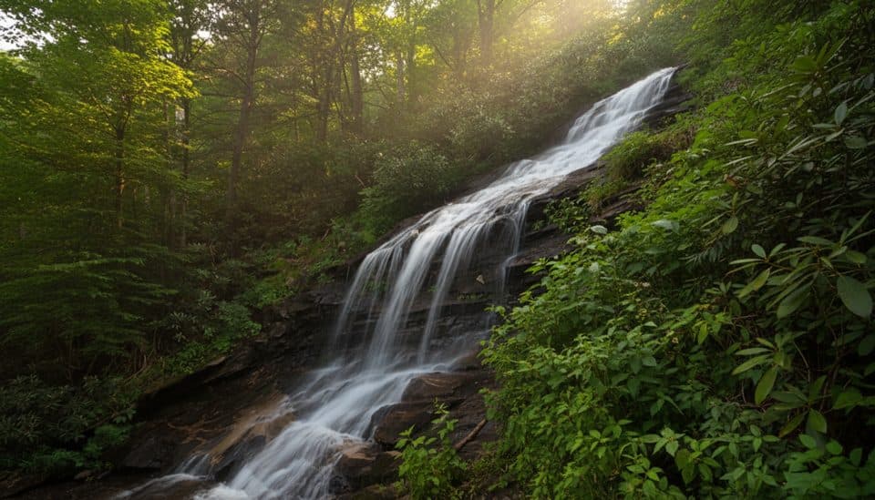
You get the rare two‑for‑one: a legit picnic spot and a quick nature walk to the Cascades—an elegant, long sliding waterfall on Falls Creek. The loop trail is peppered with interpretive signs, so it doubles as a mini field class on local trees and wildflowers.
Parkwolf’s verdictWhy go

Map

Where it is

Loading the Blue Ridge Parkway map
Full map
Picnic areaCascades Picnic Area36.24457, -81.45807
Keep this map with you offline in the Parkwolf app

Local know-how

Tips for visiting Cascades Picnic Area

  1. Arrive early on weekends to snag a shady table and easy parking.

  2. Wear shoes with good traction—the waterfall loop can be muddy and slick.

  3. Bring water; facilities may be closed or taps off in the shoulder season.

  4. Leaf-off months open up better ridge views from the picnic area.

  5. If a lower overlook is closed, use the upper viewpoint for a solid look at the falls.

Plan your stop

Before you go

Best time to visit

  • Weekdays or early mornings for elbow room, especially in spring–fall.
  • After rain, the falls are fuller but trails can be slick; in summer, bring bug spray.
  • For photography, soft morning or late‑day light works best. Leaf‑off seasons (late fall to early spring) improve long‑range views from the ridge.

Picnic logistics

There are established picnic tables and parking close by, plus public restrooms. Reports note that facilities can be closed or water turned off outside the main season, so come prepared with your own water and pack out all trash.

2 active Blue Ridge Parkway alerts

  • ClosureNorth Carolina Helene-related closuresAvoid the closed Parkway section from MP 344.2–355.3; recreation of any kind is prohibited there.Official details
  • ClosureVirginia Parkway closures and detourFollow the signed detour around the closed James River Bridge and avoid the closed Roanoke Mountain Loop. - James River Bridge (MP 63.5–63.Official details
Blue Ridge Parkway alerts
A park ranger sits on a dash-mounted phone, talking, as Parkwolf’s Tour Guide plays “Army Cutworm Moths: A Grizzly Bear Buffet” on Grand Loop Road below Dunraven Pass in Yellowstone
Parkwolf Tour GuideThe highest, rockiest slopes around here are a summer buffet for grizzly bears.

Blue Ridge Parkway Tour Guide

Your drive to Cascades Picnic Area, narrated.

Parkwolf is a GPS audio tour guide for Blue Ridge Parkway. As you drive, it chimes in with what’s ahead: hidden gems, upcoming stops, history, geology, and wildlife, right through your car’s speakers.

See the Blue Ridge Parkway audio tour

Recorded for this place

E.B. Jeffress Park and The Cascades Trail
Listen
“You're nearing E.B. Jeffress Park, a spot that's really two-in-one: a shady picnic area and an easy trail. The main reason to stop is the Cascades Trail, a short loop that leads down to a long, sliding waterfall.”

Plays as you drive up to Cascades Picnic Area in the Parkwolf Blue Ridge Parkway Tour Guide.

More stories near here in the app

  • American Chestnut: The Lost Giant and Its Return
  • Tompkins Knob and the Preacher's Cabin
  • Lewis Fork Overlook and Daniel Boone
  • Elk Mountain Overlook and the Yadkin Valley
  • 277 audio storiesacross Blue Ridge Parkway’s roads, triggered by GPS as you drive
  • Wildlife heatmapsfor Black Bear, Elk, White-tailed Deer, and 13 more
  • Works offlinemaps, 112 trails, 232 places, and audio download before you lose signal
  • CarPlay readysimple controls built for the drive
★★★★★
“…We knew we wanted to drive the Blue Ridge Parkway. The narration was impeccably timed. The facts and info provided were meaningful. Without it, the trip would not have been near as awesome.”
Ashl GApp Store review
Download Parkwolf on the App StoreGet Parkwolf on Google Play

4.7 from 8,600+ ratings

Guide

More about Cascades Picnic Area

What you’ll seeExpect a wooded ridge‑top lawn with picnic tables in sun and shade.

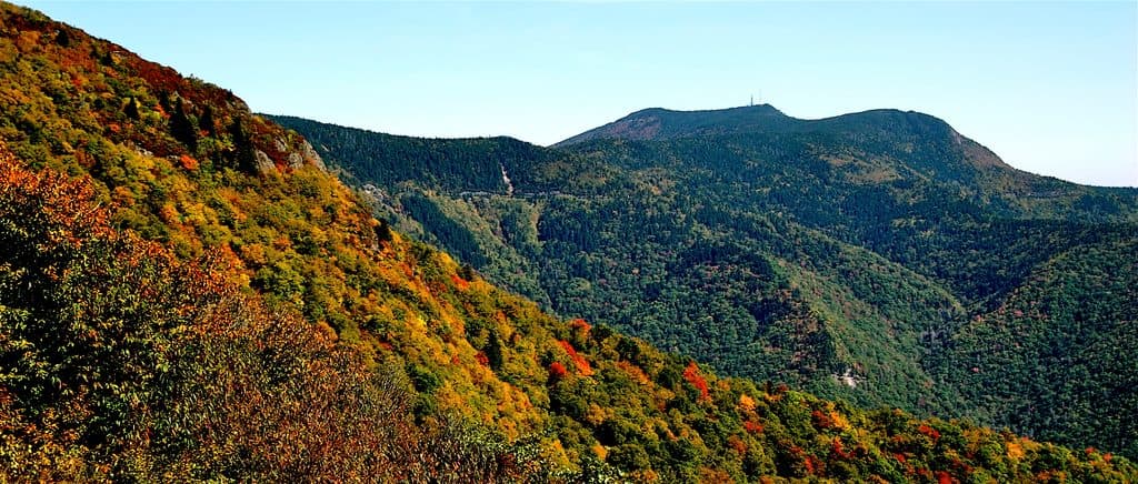
Expect a wooded ridge‑top lawn with picnic tables in sun and shade. Some tables once had wider vistas, but maturing trees now screen most long views; leaf‑off seasons open things up. Down the trail, the Cascades spill over resistant Blue Ridge bedrock, with two overlooks offering different angles on the falls.

The Cascades TrailThis short loop begins beside the picnic area and winds through laurel, azalea, dogwood, tulip…

This short loop begins beside the picnic area and winds through laurel, azalea, dogwood, tulip poplar and chestnut oak. Plan at least 30 minutes to enjoy it. The lower viewpoint involves steps and can be slick after rain; muddy patches and occasional partial closures do happen, so bring shoes with grip and roll with alternate viewpoints if needed.

WildlifeKeep an eye and ear out for songbirds, chipmunks, squirrels, and deer.

Keep an eye and ear out for songbirds, chipmunks, squirrels, and deer. Early and quieter hours sometimes turn up wild turkeys too. Binoculars make the most of birding and any distant ridge views.

A bit of contextE.B. Jeffress Park honors a key advocate for routing the Parkway through this region.

E.B. Jeffress Park honors a key advocate for routing the Parkway through this region. The Cascades tumble off the Blue Ridge escarpment toward the Yadkin River system—classic geology shaped by uplift and long erosion.

Wildlife

Wildlife in Blue Ridge Parkway

All Blue Ridge Parkway wildlife maps

Sighting maps show where each species has been reported across Blue Ridge Parkway. Wildlife moves, so no sighting is guaranteed.

Parkwolf’s Blue Ridge Parkway ranking

Top sights in Blue Ridge Parkway

All 232 places
  1. 1Linn Cove ViaductSight
  2. 2Mount MitchellSight
  3. 3Mount Mitchell State ParkSight
  4. 4Craggy Pinnacle OverlookSight
  5. 5Linville FallsSight
  6. 6Peaks of OtterSight

Take Parkwolf to Blue Ridge Parkway.

The audio tour guide for the drive, plus offline maps, trails, and wildlife heatmaps for when the signal drops.

4.7 from 8,600+ ratings

Download Parkwolf on the App StoreGet Parkwolf on Google Play