Parking
Start at Boone Fork Parking Area near Blue Ridge Parkway milepost 299.9, then follow Tanawha south about 0.6 mile to the signed Scout Trail junction. The shared lot can fill around midday and in fall; arriving early helps.

Blue Ridge Parkway, NC · VA
A steep laddered climb to a 360-degree summit
Overview
Map & elevation
Plan your hike

The highest, rockiest slopes around here are a summer buffet for grizzly bears.
Blue Ridge Parkway Tour Guide
Parkwolf is a GPS audio tour guide for Blue Ridge Parkway. As you drive, it chimes in with what’s ahead: hidden gems, upcoming stops, history, geology, and wildlife, right through your car’s speakers.
See the Blue Ridge Parkway audio tourRecorded for this trailhead
Boone Fork: The Climb to Calloway Peak“You're nearing Boone Fork Parking Area, a starting point for hikes into Grandfather Mountain State Park.”
Plays as you drive up to this trailhead in the Parkwolf Blue Ridge Parkway Tour Guide.
More stories near here in the app
“…We knew we wanted to drive the Blue Ridge Parkway. The narration was impeccably timed. The facts and info provided were meaningful. Without it, the trip would not have been near as awesome.”


Trail guide
Daniel Boone Scout Trail to Calloway Peak is a strenuous 7.2-mile out-and-back from Boone Fork Parking Area. The full walk includes a 0.6-mile Tanawha Trail approach each way and the 3-mile one-way Scout Trail; allow about five hours. It climbs roughly 1,900 feet from the Parkway to the summit. This is a hard hike with a real payoff: a wooded approach, a steep ladder-and-cable climb, and a bare rocky top with a wide view.
The Scout Trail crosses into Grandfather Mountain State Park. NC State Parks requires a free hiking permit completed at the trailhead before you start; follow the signs at the registration station. The state park allows hiking during daylight, so leave enough time to get back to Boone Fork before the gates close. This is the state park route, separate from the private Grandfather Mountain attraction.
From the parking area near Parkway milepost 299.9, follow Tanawha south across Boone Fork Bridge to the white-diamond junction. It takes about 0.6 mile. The connector is wooded and rooty; descriptions differ on whether it feels flat or steadily uphill, so treat it as uneven trail rather than an effortless warm-up. At the junction, follow the white diamonds. The blue-dot Nuwati Trail is a different route that leads to its own loop options.
The Scout Trail climbs steadily to the Cragway junction, about 1.3 miles from the Tanawha turn. Flat Rock View, around halfway up, is a good place to pause before the harder stretch. The path then winds through evergreen forest past Briar Patch campsite and a short Viaduct View spur, followed by Hi-Balsam Shelter and Raven's Roost campsite. The upper section gets rough and steep, with ladders and cables on the way to the peak. Keep your hands free for the climb, and take your time coming back down; descending the ladders can feel harder than going up.
A final ladder and scramble lead to the rocky summit at about 5,946 feet. The trees open suddenly, with a 360-degree view and a steep drop toward the Piedmont. Stay well back from the edge. For a trail photo, frame one of the ladders from below with the rock and white blaze visible; it shows the hands-on character of the route better than a distant-only view. Calloway Peak is the turnaround for this hike; the trail network continues toward the Grandfather Trail and Watauga View.
Blue Ridge Parkway ranger Clyde F. Smith and a Blowing Rock Boy Scout troop built the trail in the early 1940s. It later became overgrown and was reclaimed in the 1970s. The white diamonds still mark the named route through the mountain's steep upper terrain.
Boone Fork is a shared parking area for several hikes, and visitors report it can fill around midday and during fall weekends; arriving early helps. No reliable drinking-water source is documented along the route, so plan to carry what you need for the full outing. Pets are allowed in the state park on an attended leash no longer than six feet, but the park warns that steep trails are not recommended for pets; the laddered upper section makes this a poor choice for most dogs.
Wildlife
 1,214 sightingsBlack BearMost seen around 7 AMSighting map
 1,021 sightingsElkMost seen around 7 AMSighting map
 2,266 sightingsWhite-tailed DeerMost seen around 6 PMSighting map
 200 sightingsCoyoteMost seen around 6 PMSighting map
 1,130 sightingsWild TurkeyMost seen around 7 AMSighting map
 255 sightingsRed-tailed HawkMost seen around 11 AMSighting map
Sighting maps show where each species has been reported across Blue Ridge Parkway. Wildlife moves, so no sighting is guaranteed.
Keep exploring
 ModerateNuwati Trail3.2 mi · 2.5 hr · At the trailheadFollow an old logging road to a ledge above Boone Fork Bowl.
 ChallengingCragway Trail1 mi · 1 hr · 0.5 mi awayA steep, rocky mile with a wide view over Boone Fork Bowl.
 EasyCold Prong Pond Loop Trail0.5 mi · 20 min · 0.9 mi awayRhododendron shade meets an open meadow at the pond’s uncertain site.
 ModerateRough Ridge Trail1.2 mi · 1 hr · 1.7 mi awayA short climb to a boardwalk above the Linn Cove Viaduct.
 ChallengingTanawha Trail13.5 mi · 9 hr · 2.7 mi awayA 13.5-mile traverse from boardwalk views to Price Park fields.
 ModerateLinn Cove Viaduct Trail1 mi · 45 min · 2.7 mi awayA paved start, a rocky spur, and close viaduct views.
 EasyPrice Lake Trail2.7 mi · 1.8 hr · 3 mi awayAn easy shoreline loop around a 47-acre mountain lake.
 ModerateBoone Fork Trail5 mi · 3 hr · 3 mi awayCreek crossings, rocky scrambles, and a waterfall detour in one loop.
 Scenic pullout · 0.2 mi awayView Calloway PeakThe trail start may be more useful than its overgrown view.
 Scenic pullout · 0.6 mi awayGreen Mountain OverlookA brief stop, best when the leaves are down.
 Scenic pullout · 1.4 mi awayPilot Ridge OverlookA quick northbound pullout; trees may screen the mountain view.
 Scenic pullout · 1.6 mi awayWilson Creek Valley OverlookA quick pullout for South Mountain's layered ridges.
 Sight · 1.9 mi awayRough Ridge OverlookSteep climb puts the Linn Cove Viaduct below Grandfather Mountain.
 Scenic pullout · 2.1 mi awayWilson Creek OverlookA trail drops beneath the bridge to Wilson Creek.
 Sight · 2.3 mi awayYonahlossee OverlookA close view of Linn Cove Viaduct curling around the mountainside.
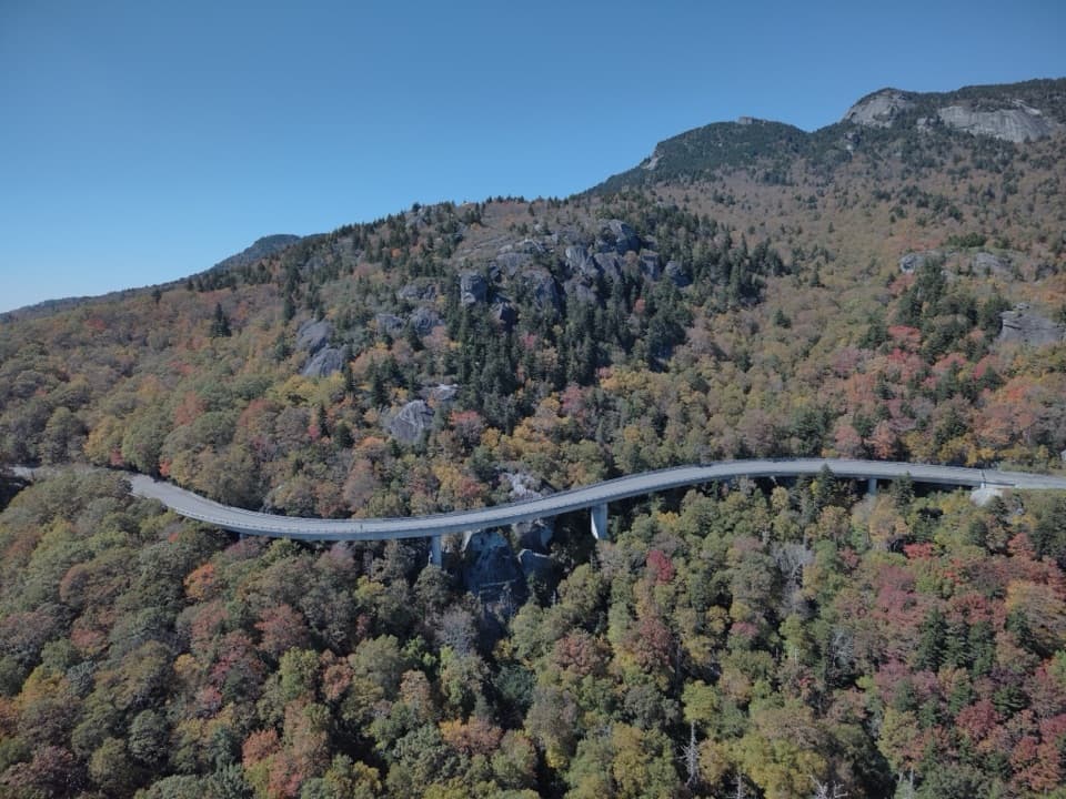 Sight · 2.5 mi awayLinn Cove ViaductA sweeping concrete curve hugs Grandfather Mountain’s steep slopes
Parkwolf’s Blue Ridge Parkway ranking

The audio tour guide for the drive, plus offline maps, trails, and wildlife heatmaps for when the signal drops.




