Parking
Linn Cove Visitor Center parking lot at Blue Ridge Parkway milepost 304.4. The trail starts at the far side of the lot.

Blue Ridge Parkway, NC · VA
A paved start, a rocky spur, and close viaduct views.
Overview
Map & elevation
Plan your hike

The highest, rockiest slopes around here are a summer buffet for grizzly bears.
Blue Ridge Parkway Tour Guide
Parkwolf is a GPS audio tour guide for Blue Ridge Parkway. As you drive, it chimes in with what’s ahead: hidden gems, upcoming stops, history, geology, and wildlife, right through your car’s speakers.
See the Blue Ridge Parkway audio tourRecorded for this trailhead
Linn Cove Viaduct: Built Around the Mountain“You're approaching Linn Cove Viaduct, the long concrete curve around Grandfather Mountain. For a quick look at its shape from outside the car, use the Yonahlossee Overlook pull-off.”
Plays as you drive up to this trailhead in the Parkwolf Blue Ridge Parkway Tour Guide.
More stories near here in the app
“…We knew we wanted to drive the Blue Ridge Parkway. The narration was impeccably timed. The facts and info provided were meaningful. Without it, the trip would not have been near as awesome.”


Trail guide
The Linn Cove Viaduct Trail is about a 1-mile out-and-back from the visitor-center parking lot to a boulder viewpoint beside the Parkway’s curving bridge. The first stretch is paved and easy, leading to an observation area beneath the viaduct. Continue on the Tanawha Trail for a rougher climb and a short spur to the elevated view. Allow about 45 minutes, longer if you stop to look around. The NPS’s 0.2-mile listing is for the short access trail and does not state whether that figure is one way; the distance here includes the rocky continuation and return.
Start at the far side of the lot on the paved path and walk beneath the bridge. Stone steps lead onto the Tanawha Trail. Near a wooden footbridge, look for a Tanawha sign on the left and a less obvious spur on the right. That spur drops steeply to large boulders with a close view of the viaduct. It is easy to walk past the turn, so pause at the junction instead of following Tanawha farther.
The paved under-viaduct section is an easy short walk. Beyond it, expect uneven stones, roots, steps, and tight gaps between boulders; muddy patches are reported after wet weather. The final spur is steep and the return climb comes at the end. If you want an easy outing, turn around at the paved observation area. Dogs are allowed on Parkway trails on a leash no longer than six feet and under direct control.
The viaduct completed a seven-mile stretch of the Parkway in 1987 after a long delay to protect Grandfather Mountain’s fragile habitat. Its 153 precast segments were set from above to limit disturbance on the slope. From the boulders, you can follow the roadway as it curves along the mountain rather than cutting a broad shelf across it.
The paved walk beneath the span is a worthwhile 0.3- to 0.4-mile return option if you want the close underside view without the rocky Tanawha section. It is a different payoff: you see the bridge supports from below, but not the boulder viewpoint’s wider curve across the mountain.
Wildlife
 1,214 sightingsBlack BearMost seen around 7 AMSighting map
 1,021 sightingsElkMost seen around 7 AMSighting map
 2,266 sightingsWhite-tailed DeerMost seen around 6 PMSighting map
 200 sightingsCoyoteMost seen around 6 PMSighting map
 1,130 sightingsWild TurkeyMost seen around 7 AMSighting map
 255 sightingsRed-tailed HawkMost seen around 11 AMSighting map
Sighting maps show where each species has been reported across Blue Ridge Parkway. Wildlife moves, so no sighting is guaranteed.
Keep exploring
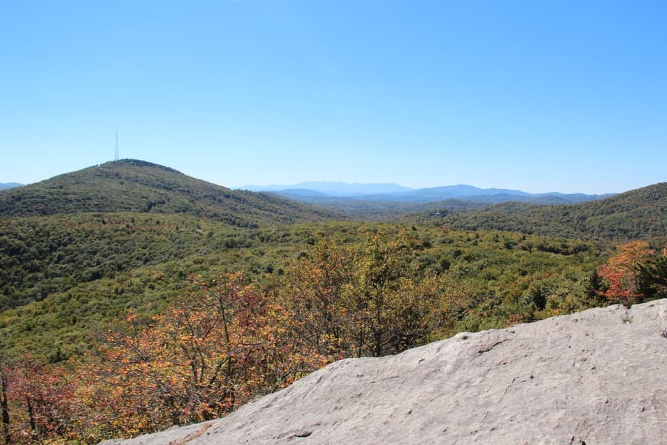 ModerateBeacon Heights Trail0.6 mi · 45 min · 1 mi awayTwo quartzite overlooks and Grandfather's ridge for a short, steep climb.
 ModerateRough Ridge Trail1.2 mi · 1 hr · 1.1 mi awayA short climb to a boardwalk above the Linn Cove Viaduct.
 ChallengingCragway Trail1 mi · 1 hr · 2.3 mi awayA steep, rocky mile with a wide view over Boone Fork Bowl.
 ChallengingDaniel Boone Scout Trail to Calloway Peak7.2 mi · 5 hr · 2.7 mi awayA steep laddered climb to a 360-degree summit
 ModerateNuwati Trail3.2 mi · 2.5 hr · 2.7 mi awayFollow an old logging road to a ledge above Boone Fork Bowl.
 EasyCold Prong Pond Loop Trail0.5 mi · 20 min · 3.6 mi awayRhododendron shade meets an open meadow at the pond’s uncertain site.
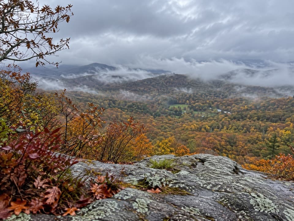 EasyFlat Rock Trail0.6 mi · 36 min · 3.7 mi awayA short rocky loop to an open ledge above the Linville Valley.
 ChallengingTanawha Trail13.5 mi · 9 hr · 5.3 mi awayA 13.5-mile traverse from boardwalk views to Price Park fields.
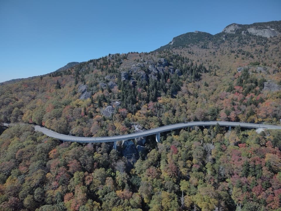 Sight · 0.3 mi awayLinn Cove ViaductA sweeping concrete curve hugs Grandfather Mountain’s steep slopes
 Sight · 0.5 mi awayYonahlossee OverlookA close view of Linn Cove Viaduct curling around the mountainside.
 Scenic pullout · 0.7 mi awayWilson Creek OverlookA trail drops beneath the bridge to Wilson Creek.
 Sight · 0.9 mi awayRough Ridge OverlookSteep climb puts the Linn Cove Viaduct below Grandfather Mountain.
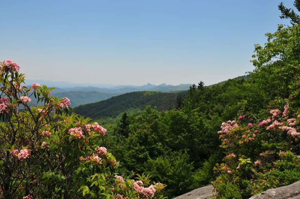 Sight · 1 mi awayBeacon Heights OverlookTwo quartzite viewpoints, reached by a short forest climb.
 Scenic pullout · 1.7 mi awayWilson Creek Valley OverlookA quick pullout for South Mountain's layered ridges.
 Sight · 1.8 mi awayGrandfather Mountain Nature ParkA summit drive, a mile-high bridge and plenty of reasons to stop.
 Scenic pullout · 2.1 mi awayPilot Ridge OverlookA quick northbound pullout; trees may screen the mountain view.
Parkwolf’s Blue Ridge Parkway ranking

The audio tour guide for the drive, plus offline maps, trails, and wildlife heatmaps for when the signal drops.




