Stewart Knob Trail in Blue Ridge Parkway

Blue Ridge Parkway, NC · VA

Stewart Knob Trail

Short moderate out-and-back from Stewart Knob Overlook with wooded miles and a Blue Ridge view

Length
2.1mi
Time
54min
Elev. change
272ft
Difficulty
Easy
  • Dogs allowed
  • High point 1,463 ft

Hear the audio tour

Stewart Knob's Quick Woodland Walk

Overview

About Stewart Knob Trail

Why go

  • Broad Roanoke Valley views are immediately available at the Stewart Knob Overlook
  • Continuous, easy-to-follow footpath makes a short Parkway stop feel like a real hike
  • Quiet forest setting close to the Parkway

Heads up

  • The full out-and-back is about 2.1 miles, not the previously listed 0.5 miles
  • Most of the trail is wooded; the strongest open views are at the overlook
  • Natural uneven footing and limited facilities at the overlook
Stewart Knob Trail is a short out-and-back that begins at Stewart Knob Overlook (Blue Ridge Parkway milepost 110.6). The stored route follows the footpath for about 1.0 mile one way, so plan on roughly 2.1 miles for the full walk. It is a good choice when you want a moderate woodland hike paired with a broad Blue Ridge and Roanoke Valley overlook.
Parkwolf’s verdictWhy hike it

Map & elevation

The route

Loading the Blue Ridge Parkway map
Full map
Elevation1,191–1,463 ft
TrailheadStewart Knob Overlook37.29724, -79.87190
Keep this map with you offline in the Parkwolf app

Plan your hike

Before you go

Parking

Park at the Stewart Knob Overlook pullout at Blue Ridge Parkway milepost 110.6; facilities are limited or unavailable at the overlook https://www.nps.gov/blri/planyourvisit/va-trails.htm https://www.virtualblueridge.com/parkway-place/stewart-knob-overlook/.

Safety

Expect roots, rocks, and uneven natural tread. Stay on the named footpath because a separate horse-trail route starts nearby, and keep pets leashed under Blue Ridge Parkway rules https://www.nps.gov/blri/planyourvisit/pets.htm.

2 active Blue Ridge Parkway alerts

  • ClosureNorth Carolina Helene-related closuresAvoid the closed Parkway section from MP 344.2–355.3; recreation of any kind is prohibited there.Official details
  • ClosureVirginia Parkway closures and detourFollow the signed detour around the closed James River Bridge and avoid the closed Roanoke Mountain Loop. - James River Bridge (MP 63.5–63.Official details
Blue Ridge Parkway alerts
A park ranger sits on a dash-mounted phone, talking, as Parkwolf’s Tour Guide plays “Army Cutworm Moths: A Grizzly Bear Buffet” on Grand Loop Road below Dunraven Pass in Yellowstone
Parkwolf Tour GuideThe highest, rockiest slopes around here are a summer buffet for grizzly bears.

Blue Ridge Parkway Tour Guide

Your drive to Stewart Knob Trail, narrated.

Parkwolf is a GPS audio tour guide for Blue Ridge Parkway. As you drive, it chimes in with what’s ahead: hidden gems, upcoming stops, history, geology, and wildlife, right through your car’s speakers.

See the Blue Ridge Parkway audio tour

Recorded for this trailhead

Stewart Knob's Quick Woodland Walk
Listen
“Ahead is Stewart Knob Overlook, which is an ideal spot if you're looking for a quick leg-stretcher. While it's not a major viewpoint, it has a very short, easy woodland walking path that starts right here.”

Plays as you drive up to this trailhead in the Parkwolf Blue Ridge Parkway Tour Guide.

More stories near here in the app

  • Roanoke Gap: How a River and a Railroad Built a City
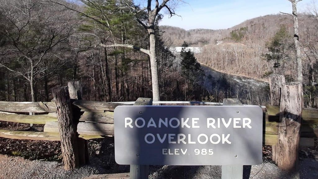
  • Roanoke River Overlook and Dam View
  • Election Day 1985: When the Roanoke River Filled the Gorge
  • 277 audio storiesacross Blue Ridge Parkway’s roads, triggered by GPS as you drive
  • Wildlife heatmapsfor Black Bear, Elk, White-tailed Deer, and 13 more
  • Works offlinemaps, 112 trails, 232 places, and audio download before you lose signal
  • CarPlay readysimple controls built for the drive
★★★★★
“…We knew we wanted to drive the Blue Ridge Parkway. The narration was impeccably timed. The facts and info provided were meaningful. Without it, the trip would not have been near as awesome.”
Ashl GApp Store review
Download Parkwolf on the App StoreGet Parkwolf on Google Play

4.7 from 8,600+ ratings

Trail guide

Hiking Stewart Knob Trail

The experienceFrom the overlook, the trail leaves the Parkway and follows a continuous dirt path through…

From the overlook, the trail leaves the Parkway and follows a continuous dirt path through mixed hardwood forest. The mapped corridor is easy to follow but includes natural, uneven tread, roots, and occasional rocks. The overlook supplies the main open panorama; the trail itself is primarily a quiet, wooded walk. Follow the path to its eastern turnaround and return on the same corridor.

What to expectThis is more substantial than the old half-mile listing suggests, but it remains a short outing…

This is more substantial than the old half-mile listing suggests, but it remains a short outing rather than a full-day hike. Allow about 45–60 minutes for the 2.1-mile round trip, more if you linger at the overlook. The National Park Service lists the trail as moderate, and the uneven surface can feel more demanding than the distance alone implies.

Logistics and tipsPark at the Stewart Knob Overlook pullout at milepost 110.
  • Park at the Stewart Knob Overlook pullout at milepost 110.6; facilities are limited or unavailable at the overlook.
  • The route is an out-and-back, and the mapped line stores the physical corridor once rather than duplicating the return leg.
  • Wear shoes suited to roots and rocks, and stay on the named footpath because a separate horse-trail route begins in the area.
  • Pets must be leashed under Blue Ridge Parkway rules. The overlook is the best place for the broad valley view; the trail is mostly forested.

Wildlife

Wildlife in Blue Ridge Parkway

All Blue Ridge Parkway wildlife maps

Sighting maps show where each species has been reported across Blue Ridge Parkway. Wildlife moves, so no sighting is guaranteed.

Parkwolf’s Blue Ridge Parkway ranking

Top-rated trails in Blue Ridge Parkway

All 112 trails
  1. 1Art Loeb TrailChallenging · 30.1 mi
  2. 2Rough Ridge TrailModerate · 1.2 mi
  3. 3Sharp Top TrailChallenging · 3 mi
  4. 4Tennent Mountain LoopModerate · 5 mi
  5. 5Daniel Boone Scout TrailChallenging · 7.2 mi
  6. 6Deep Gap Trail (Mount Mitchell)Challenging · 7.2 mi

Take Parkwolf to Blue Ridge Parkway.

The audio tour guide for the drive, plus offline maps, trails, and wildlife heatmaps for when the signal drops.

4.7 from 8,600+ ratings

Download Parkwolf on the App StoreGet Parkwolf on Google Play