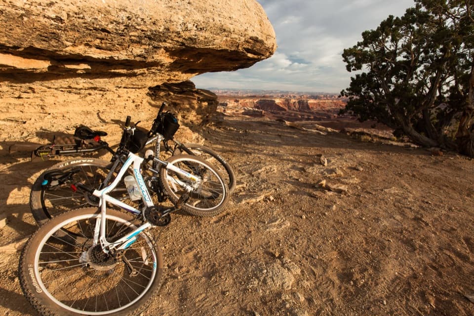
White Rim Overlook in Canyonlands National Park

#9 of 45 sights in Canyonlands

Sight · Canyonlands National Park

White Rim Overlook

A short walk to White Rim country above Monument Basin.

Photo: Wikimedia Commons
Type
Sight
Nearest trail
0.8 mi
Audio stories
4 nearby
  • Scenic viewpoint
  • Trailhead
  • Parking
  • Picnic tables

Hear the audio tour

White Rim Overlook

Overview

About White Rim Overlook

Why stop

  • A broad, layered view over Monument Basin and the White Rim

Heads up

  • Very limited trailhead parking and an exposed overlook edge

Map

Where it is

Loading the Canyonlands map
Full map
SightWhite Rim Overlook38.31999, -109.83524
Keep this map with you offline in the Parkwolf app

Plan your stop

Before you go

Footing, parking and a few essentials

The viewpoint is open to a steep drop, so keep back from the rim. The trail is rough and uneven and is not wheelchair accessible; dogs are not allowed, though service animals are. Use the paved trailhead spaces only; don't park off pavement or in the picnic area. A picnic table and vault or composting toilet are at the trailhead. Bring enough water for the walk; the Island in the Sky Visitor Center has water year-round.

2 active Canyonlands alerts

  • ClosureRain-damaged Needles backcountry roads impassableRecent rains have made several Needles backcountry roads impassable; do not drive these routes.Official details
  • CautionMaze access roads require high-clearance 4WDOnly use high-clearance 4WD to reach Hans Flat or Horseshoe Canyon in The Maze; low-clearance vehicles are not recommended on these damaged, rutted, muddy routes.Official details
Canyonlands alerts
A park ranger sits on a dash-mounted phone, talking, as Parkwolf’s Tour Guide plays “Army Cutworm Moths: A Grizzly Bear Buffet” on Grand Loop Road below Dunraven Pass in Yellowstone
Parkwolf Tour GuideThe highest, rockiest slopes around here are a summer buffet for grizzly bears.

Canyonlands Tour Guide

Your drive to White Rim Overlook, narrated.

Parkwolf is a GPS audio tour guide for Canyonlands National Park. As you drive, it chimes in with what’s ahead: hidden gems, upcoming stops, history, geology, and wildlife, right through your car’s speakers.

See the Canyonlands audio tour

Recorded for this place

White Rim Overlook
0:00 / 0:26
“You're nearing the White Rim Overlook trailhead, a good choice for a canyon view if you've got about ninety minutes to walk.”

Plays as you drive up to White Rim Overlook in the Parkwolf Canyonlands Tour Guide.

More stories near here in the app

  • Orange Cliffs Overlook
  • Grand View Point
  • Sand Dunes Inside the Stone
  • Buck Canyon Overlook
  • 43 audio storiesacross Canyonlands’s roads, triggered by GPS as you drive
  • Wildlife heatmapsfor Bighorn Sheep, Mule Deer, Coyote, and 13 more
  • Works offlinemaps, 63 trails, 65 places, and audio download before you lose signal
  • CarPlay readysimple controls built for the drive
★★★★★
“Fantastic app with many points of information… It’s great to just turn on while you’re driving and it gives you an audio tour of the national Park. We love it!!!!”
JMJamesApp Store review
Download Parkwolf on the App StoreGet Parkwolf on Google Play

4.7 from 8,600+ ratings

Guide

More about White Rim Overlook

A short walk to a huge viewWhite Rim Overlook is an east-facing viewpoint at the end of a mesa-top walk in Canyonlands'…

White Rim Overlook is an east-facing viewpoint at the end of a mesa-top walk in Canyonlands' Island in the Sky district. If Grand View Point's lot is full, this is a useful alternative: it gives a similar Monument Basin view with less height exposure on the walk, though its own trailhead parking is very limited. Plan on 1.8 miles round trip and about 1½ hours, for 159 feet of elevation change.

Take the right forkThe route starts beside the picnic area near the end of Grand View Point Road. After about 0.

The route starts beside the picnic area near the end of Grand View Point Road. After about 0.1 mile, the trail splits: stay right for White Rim Overlook; the left fork drops steeply down the Gooseberry Trail. The path begins as gravel, then crosses exposed sandstone on a cairn-marked line. Expect uneven rock and stone steps, even though the climb is modest.

Look east across the White RimAt the end, the sandstone point opens onto Monument Basin's buttes and pinnacles, the pale…

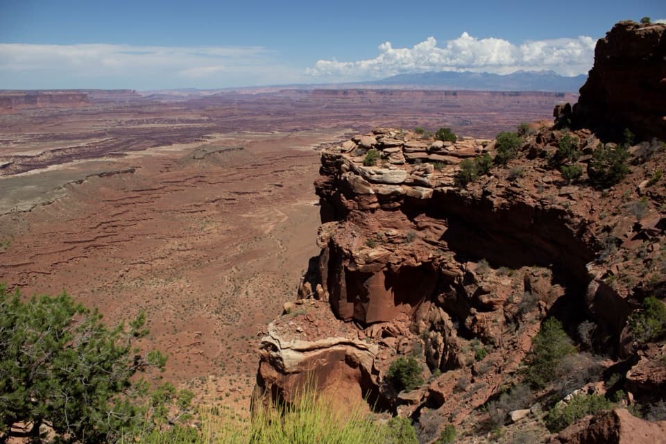
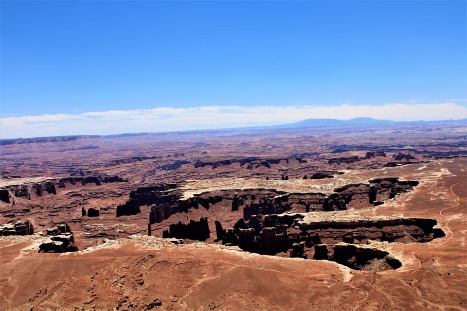
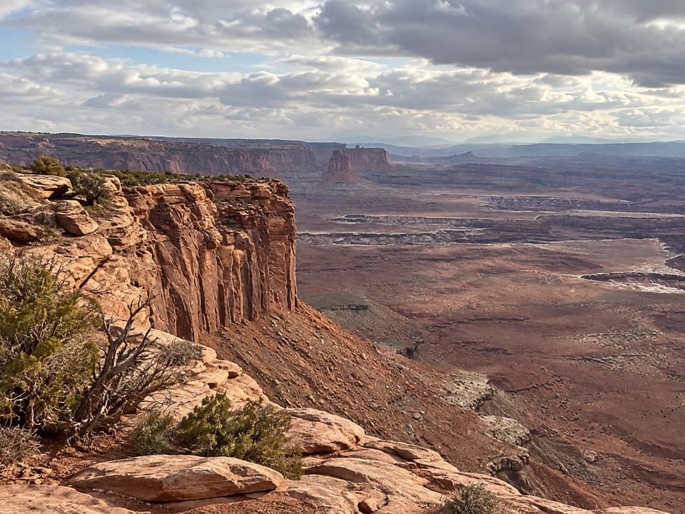
At the end, the sandstone point opens onto Monument Basin's buttes and pinnacles, the pale White Rim bench and the Colorado River far below. The La Sal Mountains form the distant horizon. The view is a panorama, not a single framed arch, so take time to pick out the different layers. For photos, include the White Rim and Monument Basin in the same frame, and aim for late afternoon light.

The sandstone behind the nameThe White Rim is a real geologic layer, not just a color in the view.

The White Rim is a real geologic layer, not just a color in the view. White Rim Sandstone formed from wind-blown beach sands during the Permian Period, roughly 245 to 286 million years ago. Its white, cross-bedded cliffs and caprock trace the inner gorge carved by the Colorado and Green rivers, giving this overlook its name and the bright band across the red canyon.

Wildlife

Wildlife in Canyonlands

All Canyonlands wildlife maps

Sighting maps show where each species has been reported across Canyonlands. Wildlife moves, so no sighting is guaranteed.

Parkwolf’s Canyonlands ranking

Top sights in Canyonlands

All 65 places
  1. 1Mesa ArchSight
  2. 2Grand View PointSight
  3. 3Green River OverlookSight
  4. 4Great GallerySight
  5. 5Upheaval DomeSight
  6. 6Druid ArchSight

Take Parkwolf to Canyonlands.

The audio tour guide for the drive, plus offline maps, trails, and wildlife heatmaps for when the signal drops.

4.7 from 8,600+ ratings

Download Parkwolf on the App StoreGet Parkwolf on Google Play