White Rim Overlook Trail in Canyonlands National Park

#6 of 63 trails in Canyonlands

Canyonlands National Park, UT

White Rim Overlook Trail

An easy slickrock walk to wide canyon and river views.

Photo: National Park Service
Length
1.8mi
Time
1.5hr
Elev. change
138ft
Difficulty
Easy
  • No dogs
  • High point 6,270 ft

Hear the audio tour

White Rim Overlook

Overview

About White Rim Overlook Trail

Why go

  • Wide White Rim, Monument Basin and Colorado River views for a short hike.
  • A gentler way to reach this overlook than the separate Gooseberry descent.

Heads up

  • Very limited parking at the shared trailhead.
  • Open, uneven slickrock offers little shade.

Map & elevation

The route

Loading the Canyonlands map
Full map
Elevation6,132–6,270 ft
TrailheadGooseberry / White Rim Overlook picnic-area trailhead38.32283, -109.84948
Keep this map with you offline in the Parkwolf app

Plan your hike

Before you go

Parking

Use the shared Gooseberry / White Rim Overlook picnic-area trailhead after Buck Canyon Overlook on the road toward Grand View Point. Parking is very limited. Use paved spaces; do not park in the picnic area or off pavement. A picnic table and composting/vault toilet are listed at the trailhead.

Safety

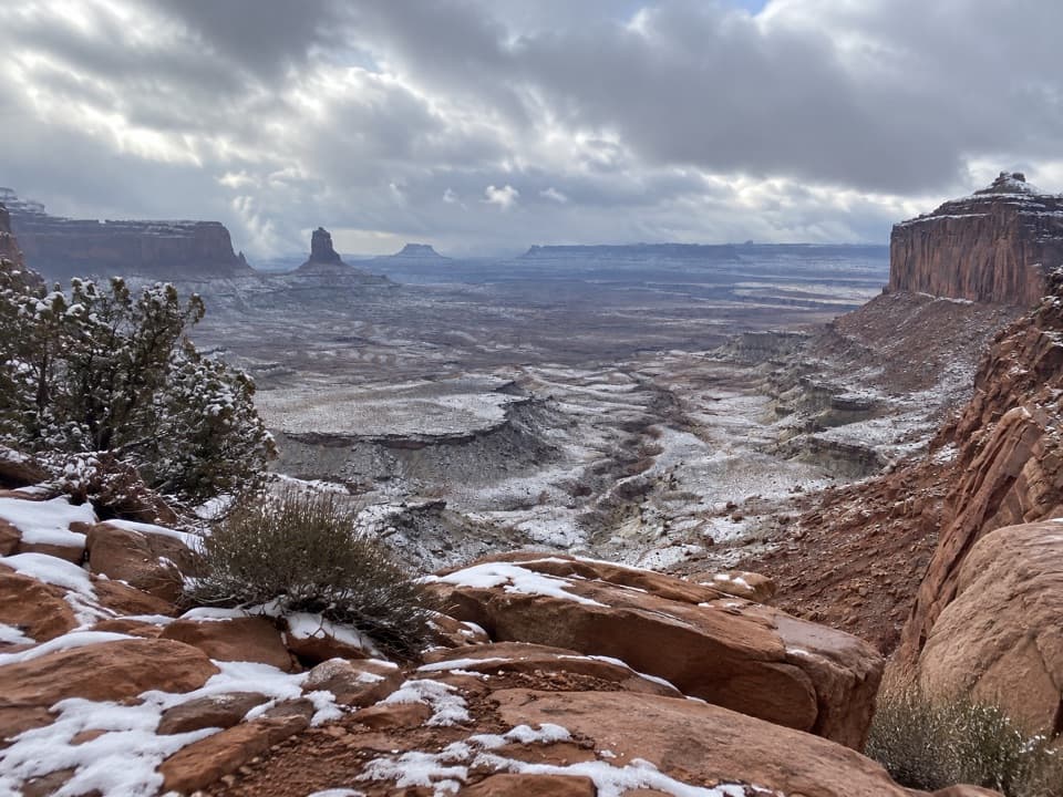
The overlook has exposed rim edges; stay back and avoid scrambling beyond the usual viewpoint. The mostly open route has little shade and no potable water. Winter snow or ice can make the rocky footing slick; traction devices are recommended by the park.

2 active Canyonlands alerts

  • ClosureRain-damaged Needles backcountry roads impassableRecent rains have made several Needles backcountry roads impassable; do not drive these routes.Official details
  • CautionMaze access roads require high-clearance 4WDOnly use high-clearance 4WD to reach Hans Flat or Horseshoe Canyon in The Maze; low-clearance vehicles are not recommended on these damaged, rutted, muddy routes.Official details
Canyonlands alerts
A park ranger sits on a dash-mounted phone, talking, as Parkwolf’s Tour Guide plays “Army Cutworm Moths: A Grizzly Bear Buffet” on Grand Loop Road below Dunraven Pass in Yellowstone
Parkwolf Tour GuideThe highest, rockiest slopes around here are a summer buffet for grizzly bears.

Canyonlands Tour Guide

Your drive to White Rim Overlook Trail, narrated.

Parkwolf is a GPS audio tour guide for Canyonlands National Park. As you drive, it chimes in with what’s ahead: hidden gems, upcoming stops, history, geology, and wildlife, right through your car’s speakers.

See the Canyonlands audio tour

Recorded for this trailhead

White Rim Overlook
0:00 / 0:26
“You're nearing the White Rim Overlook trailhead, a good choice for a canyon view if you've got about ninety minutes to walk.”

Plays as you drive up to this trailhead in the Parkwolf Canyonlands Tour Guide.

More stories near here in the app

  • Orange Cliffs Overlook
  • Sand Dunes Inside the Stone
  • Grand View Point
  • Buck Canyon Overlook
  • 43 audio storiesacross Canyonlands’s roads, triggered by GPS as you drive
  • Wildlife heatmapsfor Bighorn Sheep, Mule Deer, Coyote, and 13 more
  • Works offlinemaps, 63 trails, 65 places, and audio download before you lose signal
  • CarPlay readysimple controls built for the drive
★★★★★
“Fantastic app with many points of information… It’s great to just turn on while you’re driving and it gives you an audio tour of the national Park. We love it!!!!”
JMJamesApp Store review
Download Parkwolf on the App StoreGet Parkwolf on Google Play

4.7 from 8,600+ ratings

Trail guide

Hiking White Rim Overlook Trail

A short walk to a big viewWhite Rim Overlook Trail is an easy 1.

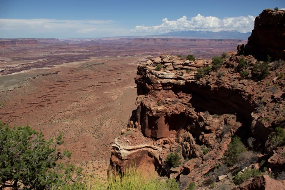
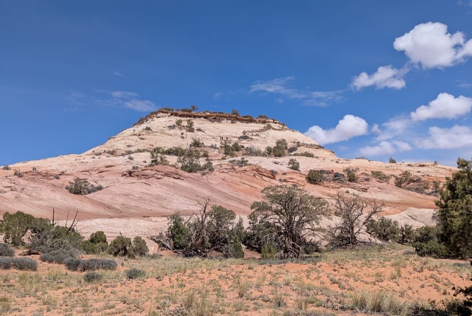
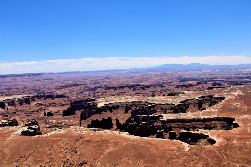
White Rim Overlook Trail is an easy 1.8-mile out-and-back from the shared Gooseberry/White Rim Overlook picnic-area trailhead in Canyonlands’ Island in the Sky district. Allow about 1.5 hours. The route crosses open slickrock and sandy patches among junipers and shallow potholes, with rough, uneven footing, a rocky rise and stone steps. At the end, the east-facing overlook opens over the White Rim and Monument Basin to the Colorado River and La Sal Mountains. It’s a good pick for a shorter canyon walk without the long, steep descent on Gooseberry.

Watch the early turnsAt the first fork, about a tenth of a mile in, take the right branch for White Rim Overlook.

At the first fork, about a tenth of a mile in, take the right branch for White Rim Overlook. The left branch drops onto Gooseberry, a much steeper, separate 4.6-mile round-trip hike that takes 4 to 6 hours and changes elevation by about 1,529 feet. Follow the cairns through the open rock; another sharp turn around 0.3 mile can be easy to miss in low light. After the turns, the path runs fairly straight across the slickrock toward the rim. Pets aren’t allowed on the trail; service animals are permitted.

At the rimThe view is the reason to come: the Colorado River winds through the canyon below, with…

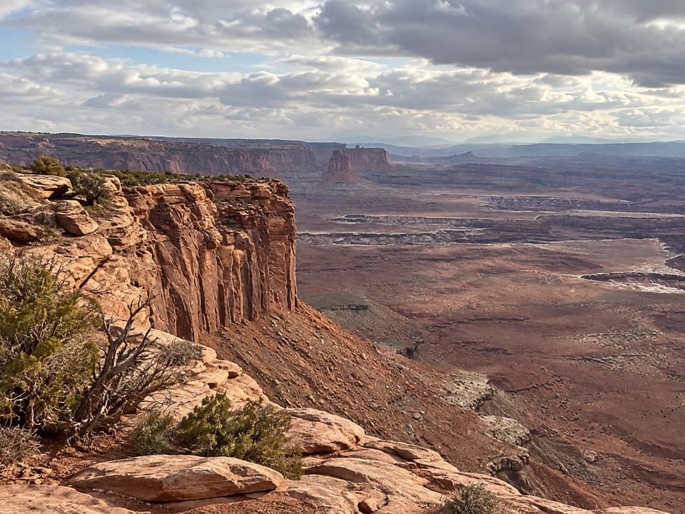
The view is the reason to come: the Colorado River winds through the canyon below, with Monument Basin and the White Rim in front and the La Sal Mountains beyond. Late afternoon gives the canyon layers their best light. The rock edge is exposed, and scrambling farther toward the sandstone tower adds risk without improving the usual overlook view, so keep to the established viewpoint. If Grand View Point Trail’s open rim feels like too much, this is a less exposed way to see Monument Basin, though there is still a natural drop at the end.

Getting there and what to expectThe shared trailhead is after Buck Canyon Overlook on the road toward Grand View Point.

The shared trailhead is after Buck Canyon Overlook on the road toward Grand View Point. Parking is very limited; use paved spaces only and don’t park in the picnic area or along the road. The trailhead has a picnic table and composting/vault toilet, but there’s no potable water on hiking trails. Summer sun and winter snow or ice can make the exposed, uneven footing harder; traction devices may help in winter.

Read the canyon wallsMonument Basin’s towers show how the park’s stair-step walls form.

Monument Basin’s towers show how the park’s stair-step walls form. Rivers cut into the rising plateau, and summer storms scour its slopes. Harder sandstone shelves can protect the softer rock beneath them, leaving ledges, balanced forms and spires standing above the basin. From the overlook, those layers are spread out in front of you, so the view gives you a clear sense of why this country breaks into mesas, benches and deep canyons.

Wildlife

Wildlife in Canyonlands

All Canyonlands wildlife maps

Sighting maps show where each species has been reported across Canyonlands. Wildlife moves, so no sighting is guaranteed.

Keep exploring

Near White Rim Overlook Trail

See it all on the map

Trails that start nearby

Places near the trailhead

Parkwolf’s Canyonlands ranking

Top-rated trails in Canyonlands

All 63 trails
  1. 1Mesa Arch TrailEasy · 0.6 mi
  2. 2Chesler Park Loop and Joint TrailChallenging · 10.7 mi
  3. 3Druid Arch TrailChallenging · 10.8 mi
  4. 4Grand View Point TrailEasy · 1.8 mi
  5. 5Horseshoe Canyon Trail to the Great GalleryChallenging · 7 mi
  6. 7Chesler Park Viewpoint TrailChallenging · 5.8 mi

Take Parkwolf to Canyonlands.

The audio tour guide for the drive, plus offline maps, trails, and wildlife heatmaps for when the signal drops.

4.7 from 8,600+ ratings

Download Parkwolf on the App StoreGet Parkwolf on Google Play