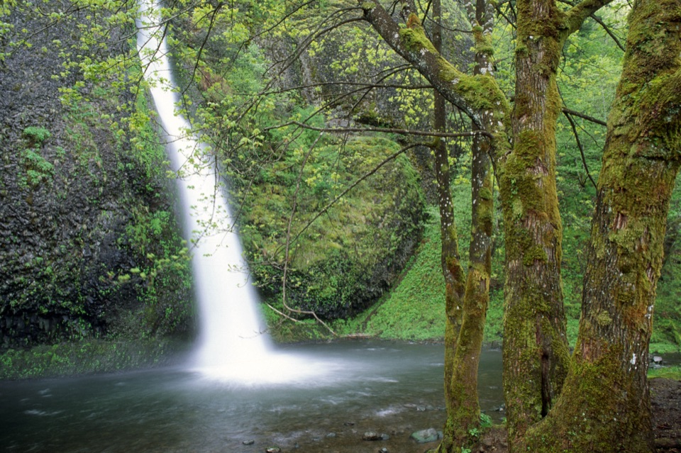
Horsetail Falls in Columbia River Gorge National Scenic Area

#8 of 60 sights in Columbia River Gorge

Sight · Columbia River Gorge National Scenic Area

Horsetail Falls

A basalt cascade you can see without hiking uphill.

Photo: Wikimedia Commons
Type
Sight
Nearest trail
0.1 mi
Audio stories
6 nearby
  • Parking
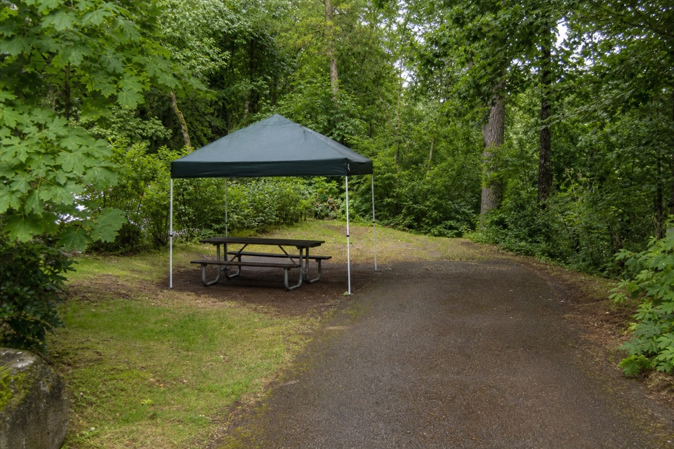
  • Picnic tables
  • Trailhead

Hear the audio tour

Horsetail and Ponytail Falls

Overview

About Horsetail Falls

Why stop

  • The uphill trail passes behind a second waterfall through basalt.

Heads up

  • The viewing area is across the highway from parking.
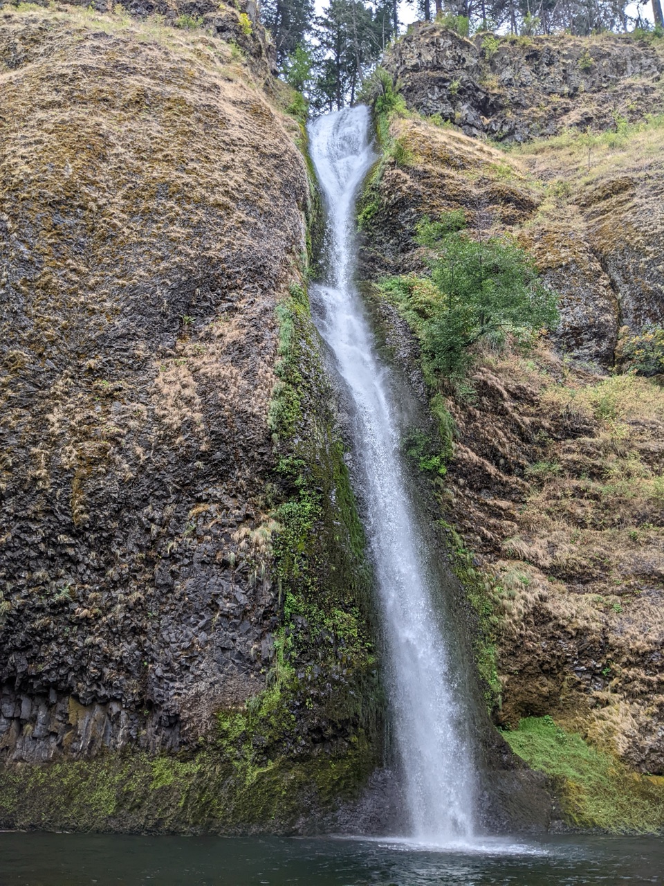
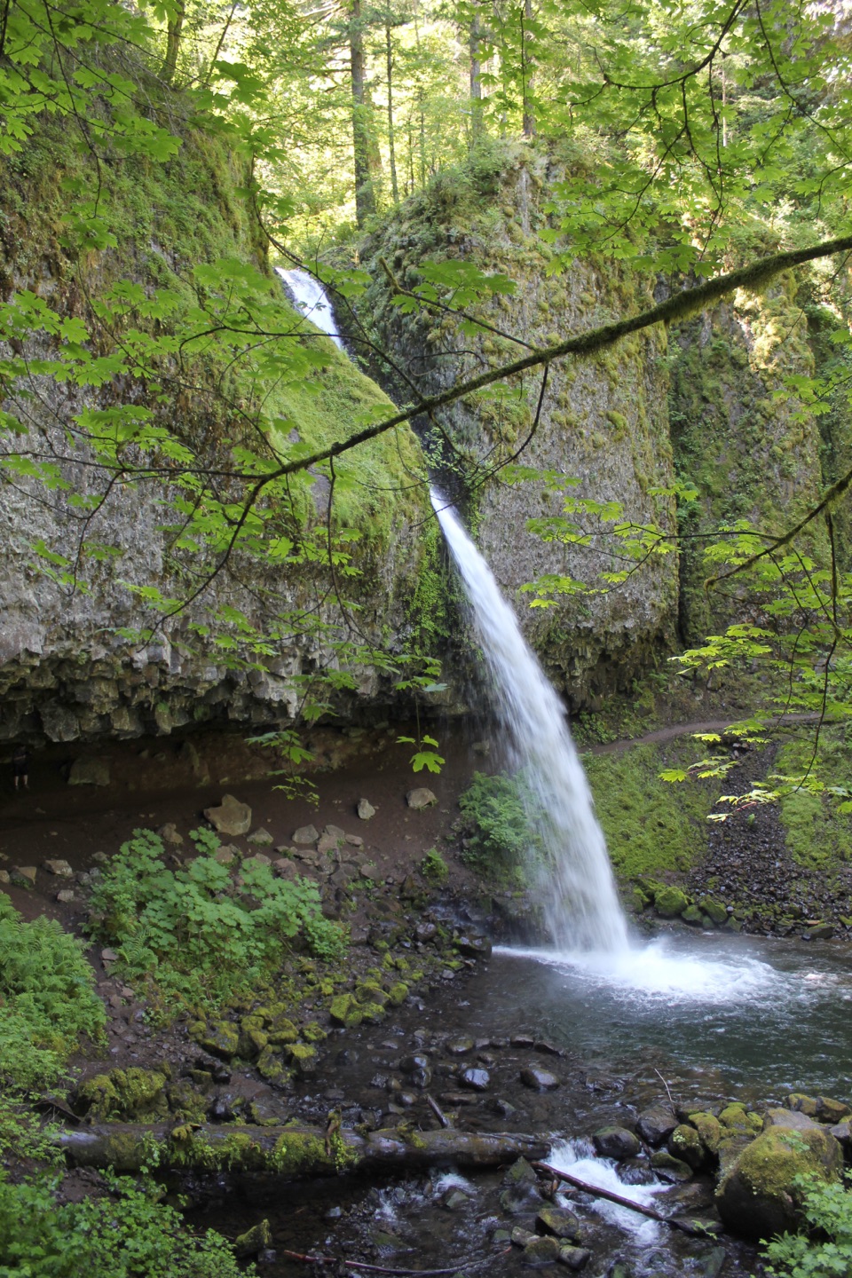
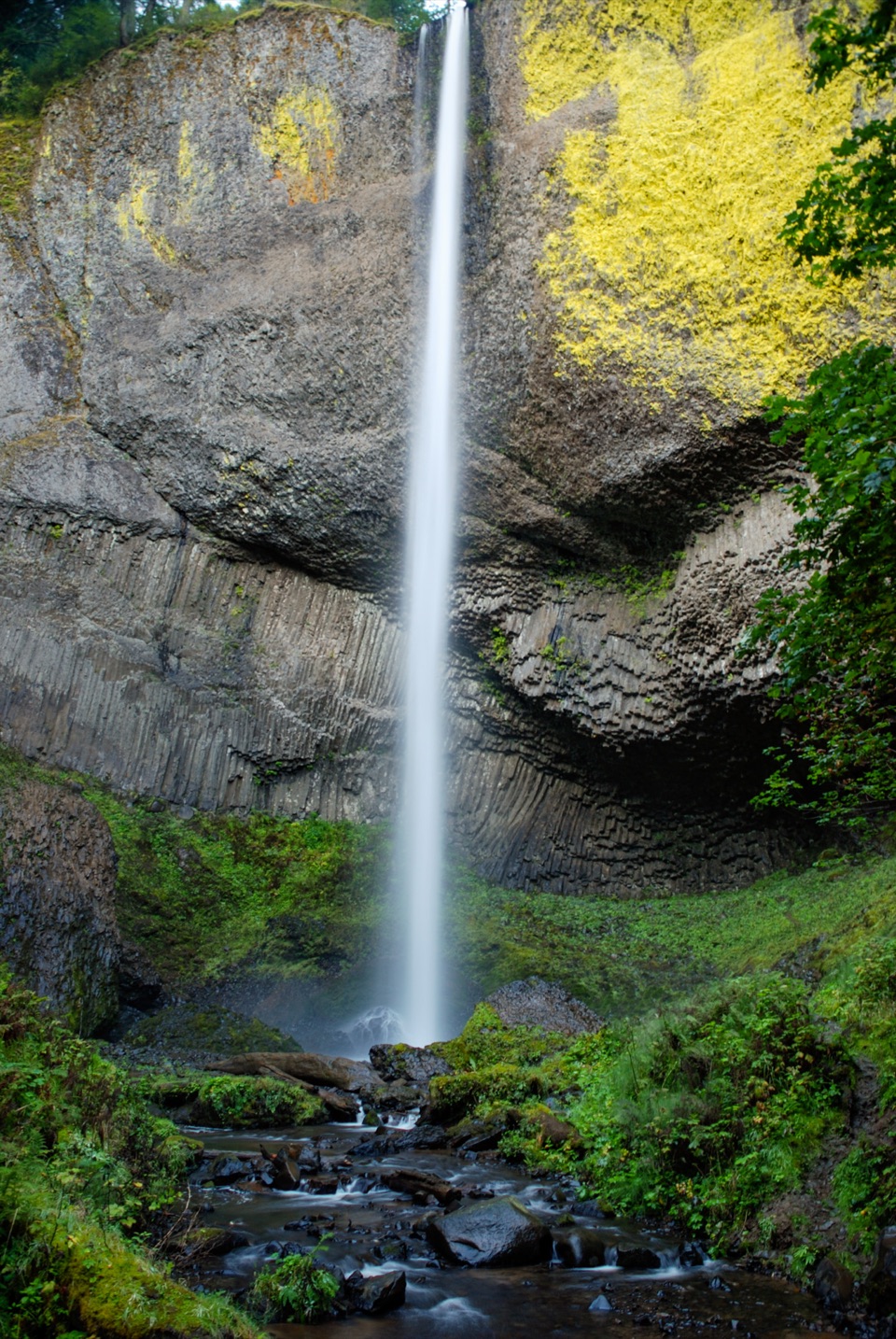
Horsetail Falls is a roadside waterfall on Horsetail Creek, where the Historic Columbia River Highway cuts through the Columbia River Gorge. Water pours over a rounded notch in columnar basalt into a rocky pool, with the main falls close to the road and visible without a hike. That makes it an easy place to pause on the Waterfall Corridor, whether you are linking several cascades or want a memorable stop without setting aside half a day. The falls are about 2.75 miles east of Multnomah Falls along the old highway. The name fits the curved rock face and the shape of the falling water.
Parkwolf’s verdictA roadside waterfall worth a pause

Map

Where it is

Loading the Columbia River Gorge map
Full map
SightHorsetail Falls45.58964, -122.06871
Keep this map with you offline in the Parkwolf app

Plan your stop

Before you go

8 active Columbia River Gorge alerts

  • ClosureEagle Creek Fire area closureMentions this placeDo not enter Oneonta Gorge or the specified trail sections because hazards remain following the Eagle Creek Fire.Official details
  • CautionAircraft and drone restrictions at developed recreation sitesMentions this placeAircraft and drone landings, drop-offs, and pickups are prohibited at six high-use developed recreation sites to protect visitor safety.Official details
See all 8 alerts
A park ranger sits on a dash-mounted phone, talking, as Parkwolf’s Tour Guide plays “Army Cutworm Moths: A Grizzly Bear Buffet” on Grand Loop Road below Dunraven Pass in Yellowstone
Parkwolf Tour GuideThe highest, rockiest slopes around here are a summer buffet for grizzly bears.

Columbia River Gorge Tour Guide

Your drive to Horsetail Falls, narrated.

Parkwolf is a GPS audio tour guide for Columbia River Gorge National Scenic Area. As you drive, it chimes in with what’s ahead: hidden gems, upcoming stops, history, geology, and wildlife, right through your car’s speakers.

Recorded for this place

Horsetail and Ponytail Falls
0:00 / 0:29
“You're nearing Horsetail Falls, where the creek pours over a rounded basalt lip into a pool just off the highway.”

Plays as you drive up to Horsetail Falls in the Parkwolf Columbia River Gorge Tour Guide.

More stories near here in the app

  • Oneonta Trailhead and Triple Falls
  • The Tunnel They Buried
  • Franz Lake Viewpoint
  • The Falls’ Hidden Supply
  • 217 audio storiesacross Columbia River Gorge’s roads, triggered by GPS as you drive
  • Wildlife heatmapsfor Bald Eagle, Black Bear, American Pika, and 13 more
  • Works offlinemaps, 111 trails, 78 places, and audio download before you lose signal
  • CarPlay readysimple controls built for the drive
★★★★★
“Fantastic app with many points of information… It’s great to just turn on while you’re driving and it gives you an audio tour of the national Park. We love it!!!!”
JMJamesApp Store review
Download Parkwolf on the App StoreGet Parkwolf on Google Play

4.7 from 8,600+ ratings

Guide

More about Horsetail Falls

The view from the day-use areaStart at the Horsetail Falls day-use area.

Start at the Horsetail Falls day-use area. The day-use parking area is on the other side of the Historic Highway from the viewing area and picnic tables, so you have to cross the road to reach them. Accessible parking spaces are available. There is no restroom at this stop, so plan around that if you need facilities close by. Give yourself a few minutes to look at the water spilling from the dark rock into its pool; the falls are close enough that the roadside view is the main experience, not a long approach. Picnic tables on the falls side make this a comfortable place to pause rather than a quick photograph from the car.

Continue uphill to Ponytail FallsTrail 438 climbs steeply from the day-use area toward Ponytail Falls, a separate waterfall also…

Trail #438 climbs steeply from the day-use area toward Ponytail Falls, a separate waterfall also called Upper Horsetail Falls. It is about 0.4 mile up the trail, where the path passes behind the cascade through a naturally eroded basalt overhang. That gives you a very different view, but it takes a real uphill walk and steep cliffs occur in places. If you want to make a longer outing, a 2.5-mile loop links three waterfalls and Oneonta Gorge, gains about 660 feet, and returns along the Historic Highway. Treat the loop as a hike, not an extension of the quick roadside stop, and check the trail before setting out.

Notice the shape, then fit it into the driveLook at how the creek spreads over the rounded lip before it narrows into the pool; the basalt…

Look at how the creek spreads over the rounded lip before it narrows into the pool; the basalt wall gives the falls its distinctive profile. A stereograph of Horsetail Falls made by photographer Joseph Buchtel, probably in the 1860s, is part of the Gorge’s early photographic record, and the descriptive name has lasted on maps.

For a phone photo, include some of the basalt face and the pool rather than filling the frame with white water alone. The cliff shows the waterfall’s shape, while the pool gives it context. Tables near the falls make a picnic an easy addition; otherwise, this is a useful short stop between Multnomah Falls and the Gorge’s other highway-side sights.

Wildlife

Wildlife in Columbia River Gorge

All Columbia River Gorge wildlife maps

Sighting maps show where each species has been reported across Columbia River Gorge. Wildlife moves, so no sighting is guaranteed.

Keep exploring

Near Horsetail Falls

See it all on the map

Trails nearby

More stops nearby

Parkwolf’s Columbia River Gorge ranking

Top sights in Columbia River Gorge

All 78 places
  1. 1Multnomah FallsSight
  2. 2Vista House at Crown PointSight
  3. 3Rowena Crest OverlookSight
  4. 4Portland Women’s Forum State Scenic ViewpointSight
  5. 5Latourell FallsSight
  6. 6Beacon RockSight

Take Parkwolf to Columbia River Gorge.

The audio tour guide for the drive, plus offline maps, trails, and wildlife heatmaps for when the signal drops.

4.7 from 8,600+ ratings

Download Parkwolf on the App StoreGet Parkwolf on Google Play