Oneonta Gorge in Columbia River Gorge National Scenic Area

Sight · Columbia River Gorge National Scenic Area

Oneonta Gorge

A lichen-lined slot canyon, still closed after the 2017 fire.

Photo: Flickr
Type
Sight
Nearest trail
0.7 mi
Audio stories
5 nearby
  • #11 of 60 sights

Hear the audio tour

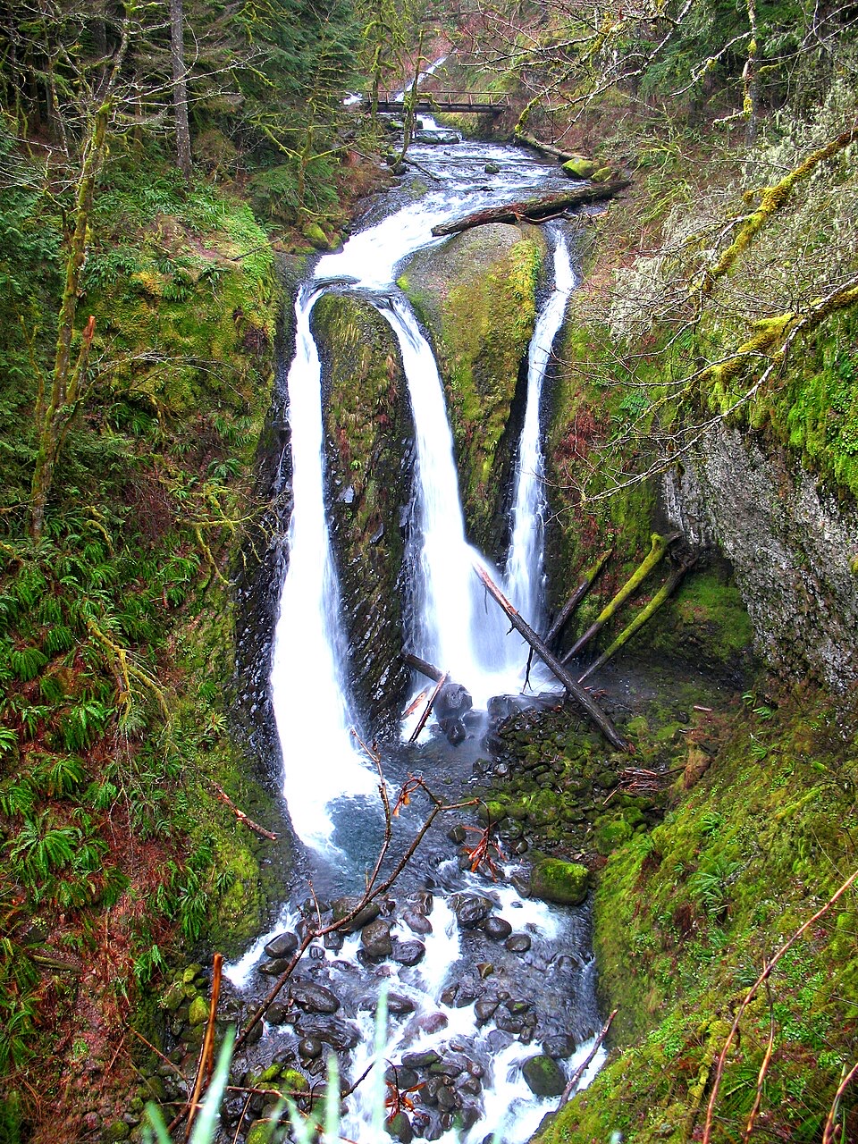
Oneonta Trailhead and Triple Falls

Overview

About Oneonta Gorge

Why stop

  • A lichen-bright canyon ending at a 100-foot waterfall.

Heads up

  • No confirmed legal roadside stop for a tunnel view.

Map

Where it is

Loading the Columbia River Gorge map
Full map
SightOneonta Gorge45.57923, -122.07234
Keep this map with you offline in the Parkwolf app

Plan your stop

Before you go

8 active Columbia River Gorge alerts

  • ClosureEagle Creek Fire area closureMentions this placeDo not enter Oneonta Gorge or the specified trail sections because hazards remain following the Eagle Creek Fire.Official details
  • CautionAircraft and drone restrictions at developed recreation sitesAircraft and drone landings, drop-offs, and pickups are prohibited at six high-use developed recreation sites to protect visitor safety.Official details
See all 8 alerts
A park ranger sits on a dash-mounted phone, talking, as Parkwolf’s Tour Guide plays “Army Cutworm Moths: A Grizzly Bear Buffet” on Grand Loop Road below Dunraven Pass in Yellowstone
Parkwolf Tour GuideThe highest, rockiest slopes around here are a summer buffet for grizzly bears.

Columbia River Gorge Tour Guide

Your drive to Oneonta Gorge, narrated.

Parkwolf is a GPS audio tour guide for Columbia River Gorge National Scenic Area. As you drive, it chimes in with what’s ahead: hidden gems, upcoming stops, history, geology, and wildlife, right through your car’s speakers.

Recorded for this place

Oneonta Trailhead and Triple Falls
0:00 / 0:26
“You're nearing Oneonta Trailhead, the start of the hike to Triple Falls.”

Plays as you drive up to Oneonta Gorge in the Parkwolf Columbia River Gorge Tour Guide.

More stories near here in the app

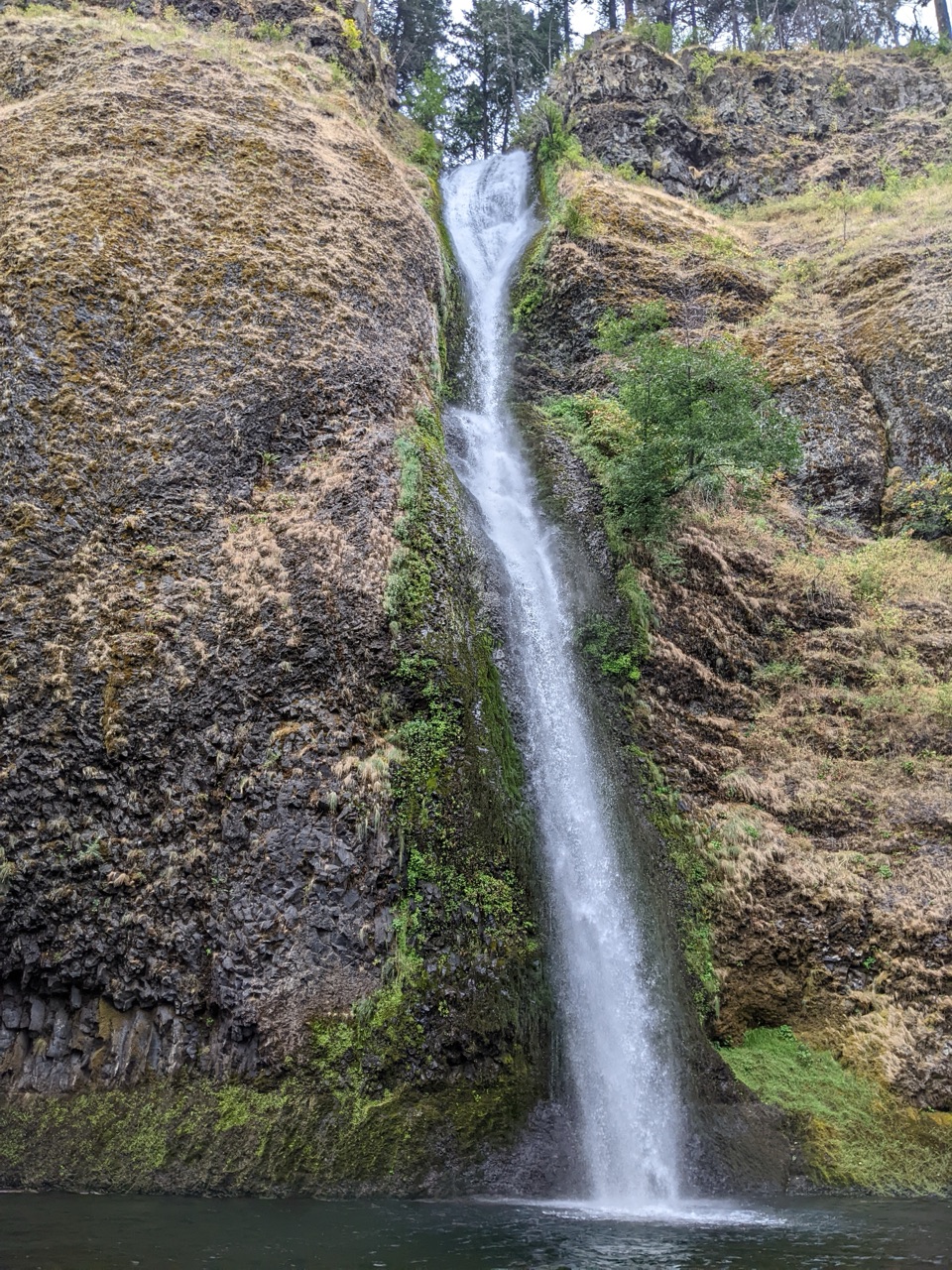
  • Horsetail and Ponytail Falls
  • The Falls’ Hidden Supply
  • The Tunnel They Buried
  • Franz Lake Viewpoint
  • 217 audio storiesacross Columbia River Gorge’s roads, triggered by GPS as you drive
  • Wildlife heatmapsfor Bald Eagle, Black Bear, American Pika, and 13 more
  • Works offlinemaps, 111 trails, 78 places, and audio download before you lose signal
  • CarPlay readysimple controls built for the drive
★★★★★
“Fantastic app with many points of information… It’s great to just turn on while you’re driving and it gives you an audio tour of the national Park. We love it!!!!”
JMJamesApp Store review
Download Parkwolf on the App StoreGet Parkwolf on Google Play

4.7 from 8,600+ ratings

Guide

More about Oneonta Gorge

A narrow canyon, with a closed creek routeOneonta Gorge is a narrow slot canyon on Oneonta Creek beside the Historic Columbia River…

Oneonta Gorge is a narrow slot canyon on Oneonta Creek beside the Historic Columbia River Highway in Oregon’s Columbia River Gorge. Its best-known destination is Lower Oneonta Falls, a roughly 100-foot plunge into a pool near the upper end of the canyon. The tight walls carry bright lichen, giving the short gorge its vivid green look. Before the closure, reaching the falls meant following the creek bed for about 0.3 mile; that short distance hid a rough route through rocks, water and a large logjam. The Forest Service currently closes the area inside the gorge walls, from Highway 30 to Horsetail Falls, after the 2017 Eagle Creek Fire. It has published no reopening date. Do not enter or wade up the creek.

Why the old route was memorableThe closure is the first thing to plan around, because Oneonta became famous for the walk…

The closure is the first thing to plan around, because Oneonta became famous for the walk itself. This was not a paved waterfall overlook or an ordinary trail to a viewing platform. The historic route descended stairs from the highway crossing into the creek, then used the watercourse as the path. Pools could require swimming or chest-high wading, and conditions shifted with water levels and logjams. Lower Oneonta Falls waited about a third of a mile upstream. Those details explain both the appeal and the commitment of the old outing, but they are historical route details only; they are not instructions for reaching the falls now. Do not look for an alternate approach along the creek.
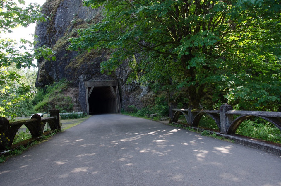
A landmark on the old highwayOneonta’s other story belongs to the highway.

Oneonta’s other story belongs to the highway. The gorge was one of the original “beauty spots” chosen for the Columbia River Highway, whose first alignment and bridge here date to 1914–15. The timber-lined Oneonta Tunnel runs 125 feet through a 200-foot basalt outcrop beside the creek. A new bridge and bypass road were built in 1948, leaving the old passage out of the driving route. It reopened in 2009; the Eagle Creek Fire later burned through the tunnel and destroyed its timber lining. The creek, canyon, highway and tunnel form one layered landmark: a natural slot that helped shape a celebrated road, then a place whose access and structures were altered by fire.

Keep the visit in perspectiveKeep Oneonta Trail 424 separate in your plans: it is a different Forest Service trail, not a…

Keep Oneonta Trail #424 separate in your plans: it is a different Forest Service trail, not a workaround into the closed gorge. For a photo, the historic tunnel and stone parapets work together; the rails show the opening’s scale. A current legal place to stop or walk for that view has not been confirmed, so do not treat the image or map pin as access guidance. The photograph shows the tunnel entrance, not the lichen-lined creek corridor or Lower Oneonta Falls. Check the current closure before traveling; until the Forest Service changes it, count Oneonta as a landmark to understand through the highway’s history, not a creek-bed hike to attempt.

Wildlife

Wildlife in Columbia River Gorge

All Columbia River Gorge wildlife maps

Sighting maps show where each species has been reported across Columbia River Gorge. Wildlife moves, so no sighting is guaranteed.

Keep exploring

Near Oneonta Gorge

See it all on the map

Trails nearby

More stops nearby

Parkwolf’s Columbia River Gorge ranking

Top sights in Columbia River Gorge

All 78 places
  1. 1Multnomah FallsSight
  2. 2Vista House at Crown PointSight
  3. 3Rowena Crest OverlookSight
  4. 4Portland Women’s Forum State Scenic ViewpointSight
  5. 5Latourell FallsSight
  6. 6Beacon RockSight

Take Parkwolf to Columbia River Gorge.

The audio tour guide for the drive, plus offline maps, trails, and wildlife heatmaps for when the signal drops.

4.7 from 8,600+ ratings

Download Parkwolf on the App StoreGet Parkwolf on Google Play