Overview
About Cathedral Spires Pullout
Why stop
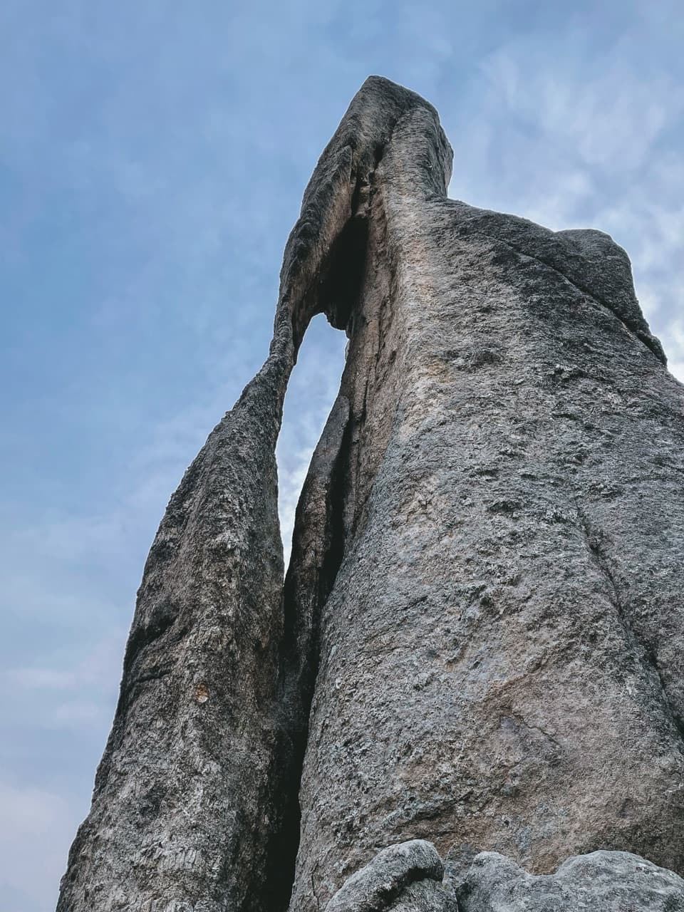
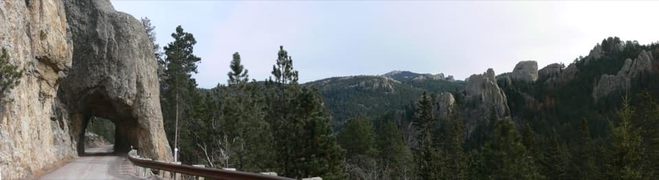
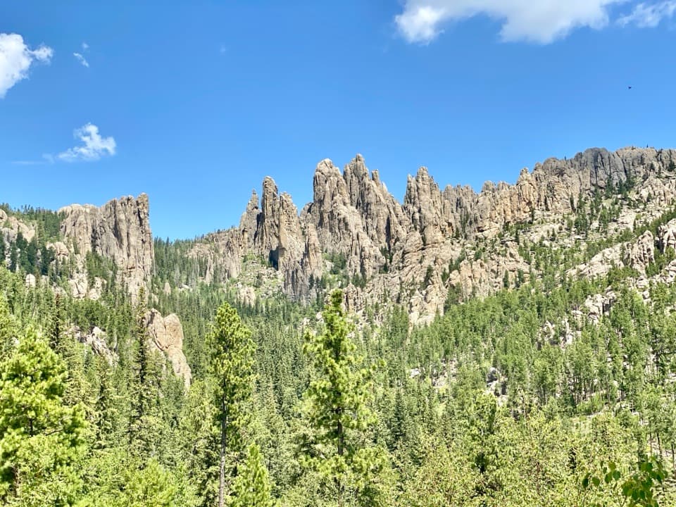
- Wide view of the granite spires and pine valley.
Heads up
- Vehicle access depends on the seasonal opening of Needles Highway.
Map
Where it is

The highest, rockiest slopes around here are a summer buffet for grizzly bears.
Custer Tour Guide
Your drive to Cathedral Spires Pullout, narrated.
Parkwolf is a GPS audio tour guide for Custer State Park. As you drive, it chimes in with what’s ahead: hidden gems, upcoming stops, history, geology, and wildlife, right through your car’s speakers.
Recorded for this place
Cathedral Spires: Roadside or on Foot“You're nearing the Cathedral Spires area, named for granite pillars that resemble a row of organ pipes. For a quick look, choose the roadside viewing pullout, where the towers rise above a pine-covered valley.”
Plays as you drive up to Cathedral Spires Pullout in the Parkwolf Custer Tour Guide.
More stories near here in the app
- Needle’s Eye: The Rock and the Tunnel
- Little Devils Tower: The Summit Scramble
- The Pine That Smells Sweet
- Sylvan Lake: Rocks and Water
- 82 audio storiesacross Custer’s roads, triggered by GPS as you drive
- Wildlife heatmapsfor Bison, Wapiti, Bighorn Sheep, and 13 more
- Works offlinemaps, 40 trails, 49 places, and audio download before you lose signal
- CarPlay readysimple controls built for the drive
“We recently toured Badlands, Custer State Park, Mount Rushmore and more! We learned so much from this app as we toured each of these sites. The audio tours are worth the money.”


Guide
More about Cathedral Spires Pullout
The roadside viewCathedral Spires Pullout is a roadside viewing stop on Needles Highway (SD 87 North), with a…
Cathedral Spires Pullout is a roadside viewing stop on Needles Highway (SD 87 North), with a view toward jagged granite pillars rising above a pine-covered valley. It is a quick way to see the rock skyline that defines this stretch of the Needles area. The Cathedral Spires Trailhead is a separate stop farther north, for the hike.
Make it part of the driveNeedles Highway is a 14-mile scenic road; South Dakota Game, Fish and Parks allows 60 minutes…
Needles Highway is a 14-mile scenic road; South Dakota Game, Fish and Parks allows 60 minutes or more for the drive. There is a surface parking area at the pullout. Give yourself time to stop and look around instead of treating the highway as a shortcut. The road closes to vehicles with the first snow and reopens no earlier than April 1, depending on conditions.
Why the skyline is so jaggedThe Cathedral Spires are granite pillars in the Black Hills' igneous core.
The Cathedral Spires are granite pillars in the Black Hills' igneous core. The Forest Service describes the central dome around Black Elk Peak as hundreds of separate intrusions, with surrounding metamorphic rock dipping away. That regional geology helps explain the clustered needles and pillars along the skyline. The Forest Service says the Black Hills likely looked much as they do now 40 million years ago; that is a regional estimate, not a date for these particular spires.
A road traced on foot and horsebackSouth Dakota governor Peter Norbeck marked the highway's course on foot and horseback, and…
South Dakota governor Peter Norbeck marked the highway's course on foot and horseback, and construction was completed in 1922. The route was carefully planned through the granite scenery, so this is a drive to take slowly, with time for the pullouts.
Frame the whole viewFor a photo, include several of the narrow spires with some of the pine-covered valley beneath…
For a photo, include several of the narrow spires with some of the pine-covered valley beneath them. The valley gives the rock towers a sense of height and keeps the wider skyline in the picture.
Wildlife
Wildlife in Custer
 993 sightingsBisonMost seen around 7 AMSighting map
 91 sightingsWapitiMost seen around 6 AMSighting map
 258 sightingsBighorn SheepMost seen around 7 AMSighting map
 85 sightingsMountain GoatMost seen around 7 AMSighting map
 256 sightingsBurroMost seen around 6 PMSighting map
 707 sightingsPronghornMost seen around 6 AMSighting map
Sighting maps show where each species has been reported across Custer. Wildlife moves, so no sighting is guaranteed.