Norbeck Trail #3 in Custer State Park

Custer State Park, SD

Norbeck Trail #3

Creekside miles turn into a steep, rocky wilderness climb.

Length
12.6mi
Time
7.5hr
Elev. change
1,795ft
Difficulty
Challenging
  • Dogs allowed
  • High point 6,923 ft
  • #11 of 40 in Custer

Hear the audio tour

Iron Creek: The Centennial Trail Traverse

Overview

About Norbeck Trail #3

Why go

  • A gradual creekside approach leads into rugged granite country.
  • The route reaches Black Elk Wilderness and the Trail 9 junction.

Heads up

  • The 12.6-mile return is a full-day outing with a steep finish.
  • Parking at the horse-camp start is not clearly settled, and junctions can be easy to miss.

Map & elevation

The route

Loading the Custer map
Full map
Elevation5,128–6,923 ft
TrailheadIron Creek Horse Camp west-side trail access43.82754, -103.47338
Keep this map with you offline in the Parkwolf app

Plan your hike

Before you go

Parking

Reach Iron Creek Horse Camp from Camp Remington Road (CSP 345) and use the trail access on the camp’s west side. Public parking for hikers at that end is unclear, so confirm the legal place to leave a car before starting. Upper Iron Creek Trailhead on Needles Highway is a separate, shorter approach to Trail 9.


Safety

Several Iron Creek crossings lead to a steep, rocky final climb; Trail 3, 7, and 9 intersections can be easy to miss on the return. The last two miles are away from the creek, and untreated creek water should not be drunk. Dogs must be leashed or under strict voice control in Black Elk Wilderness.

A park ranger sits on a dash-mounted phone, talking, as Parkwolf’s Tour Guide plays “Army Cutworm Moths: A Grizzly Bear Buffet” on Grand Loop Road below Dunraven Pass in Yellowstone
Parkwolf Tour GuideThe highest, rockiest slopes around here are a summer buffet for grizzly bears.

Custer Tour Guide

Your drive to Norbeck Trail #3, narrated.

Parkwolf is a GPS audio tour guide for Custer State Park. As you drive, it chimes in with what’s ahead: hidden gems, upcoming stops, history, geology, and wildlife, right through your car’s speakers.

Recorded for this area

Iron Creek: The Centennial Trail Traverse
0:00 / 0:29
“You're coming up on Iron Creek Trailhead, the northern access to the park's Centennial Trail.”

Plays on the road 0.8 mi from the trailhead in the Parkwolf Custer Tour Guide.

More stories near here in the app

  • When Mud Became Schist
  • Hole-In-Wall: A Bridge and a Rock Opening
  • Granite's Slow Recipe
  • The Pine's Two Kinds of Cones
  • 82 audio storiesacross Custer’s roads, triggered by GPS as you drive
  • Wildlife heatmapsfor Bison, Wapiti, Bighorn Sheep, and 13 more
  • Works offlinemaps, 40 trails, 49 places, and audio download before you lose signal
  • CarPlay readysimple controls built for the drive
★★★★★
“We recently toured Badlands, Custer State Park, Mount Rushmore and more! We learned so much from this app as we toured each of these sites. The audio tours are worth the money.”
milesdavis11App Store review
Download Parkwolf on the App StoreGet Parkwolf on Google Play

4.7 from 8,600+ ratings

Trail guide

Hiking Norbeck Trail #3

A long out-and-back to Trail 9Norbeck Trail 3 is a 12.

Norbeck Trail #3 is a 12.6-mile out-and-back from the west side of Iron Creek Horse Camp to its junction with Trail 9 near Black Elk Peak. The route is 6.3 miles one way, then returns on the same corridor. Allow about 7.5 hours; this is a full-day walk into the Black Elk Wilderness, not a summit loop. Trail 9 continues another 0.4 mile from the junction to Black Elk Peak, adding nearly 400 feet, so the summit is beyond this hike. The first five miles gain only around 800 feet. After the last crossing of Iron Creek, the trail climbs roughly 900 feet over its final mile or so, a much harder finish than the gentle start suggests.

Creekside miles, then a dry finishThe lower stretch follows or parallels Iron Creek through forest and rises gradually.

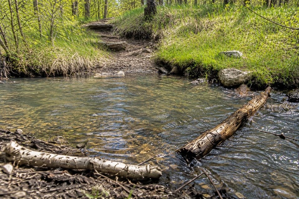
The lower stretch follows or parallels Iron Creek through forest and rises gradually. It crosses the creek several times; the crossings are generally small, but wet stones call for steady footing. The water can look clear and still needs filtering or treatment before drinking. The last two miles are away from the creek, so do not count on a refill near the upper climb. Start with enough water for the full walk and return.

A steep, rocky upper slopeAfter the final creek crossing, the trail leaves the stream and turns into a narrower, rockier…

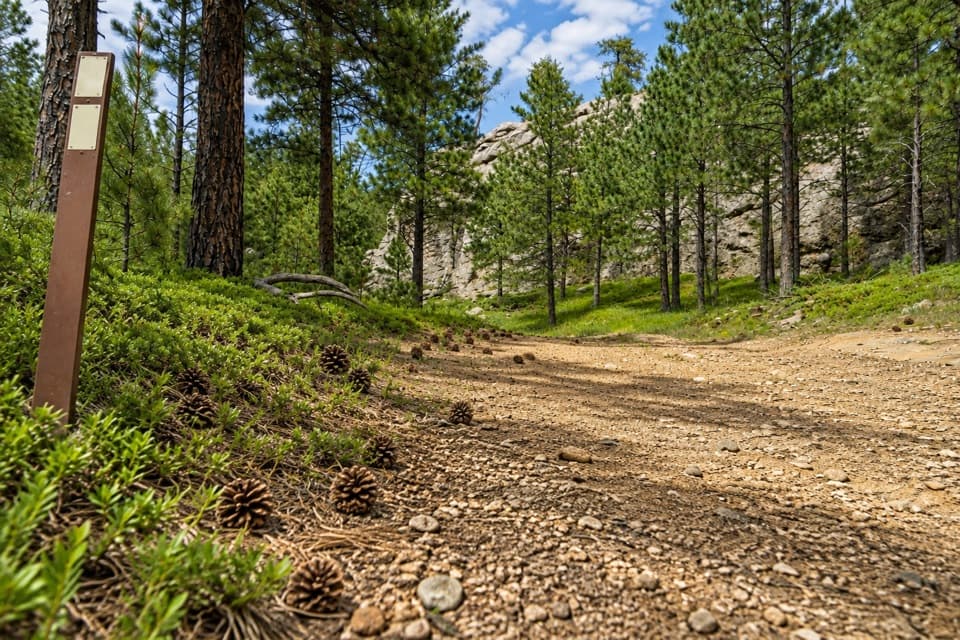
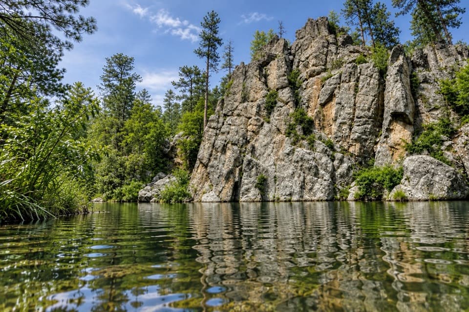
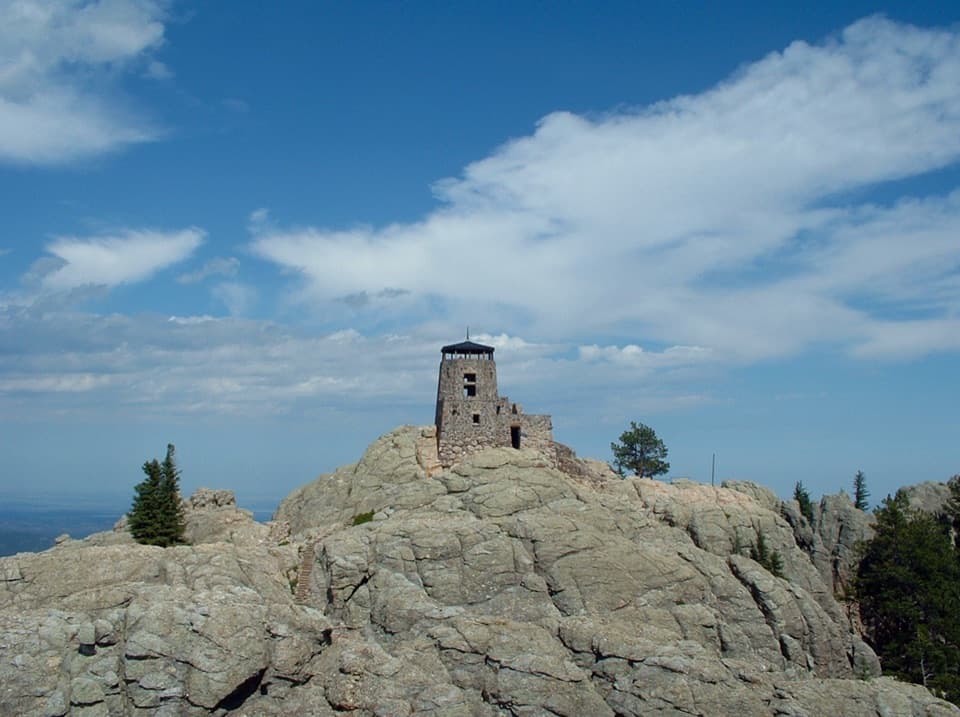
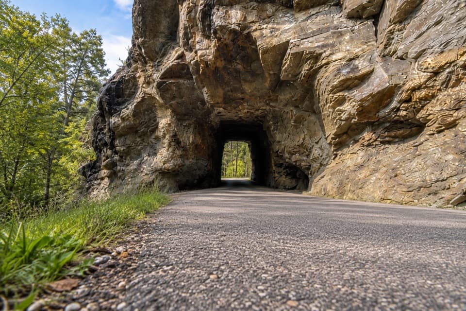
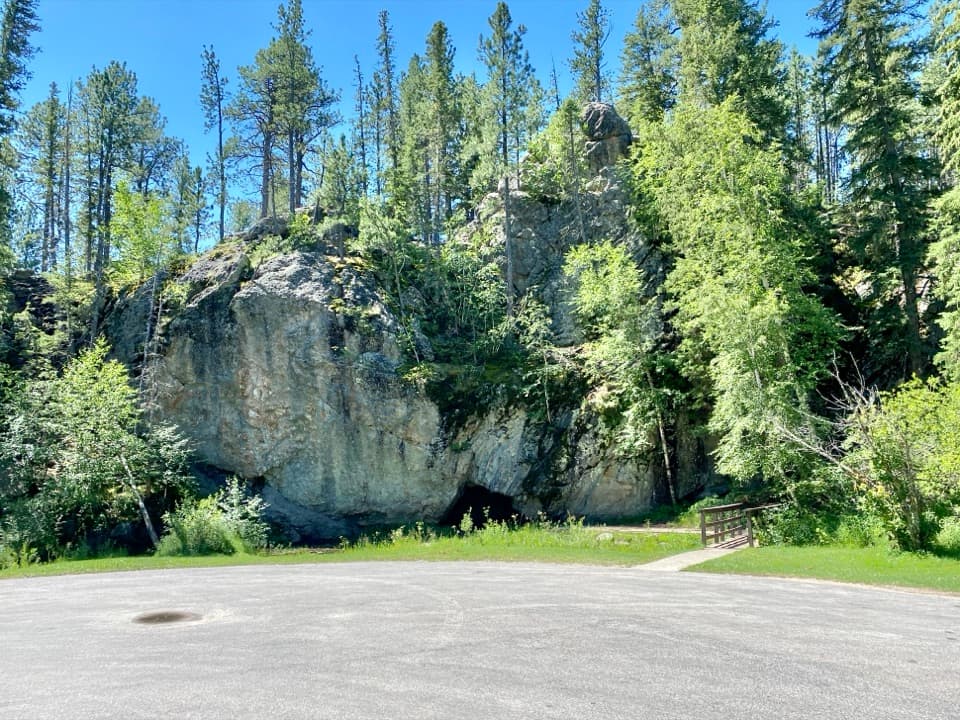
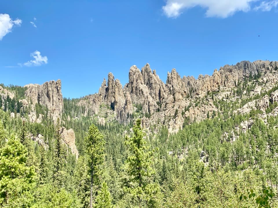
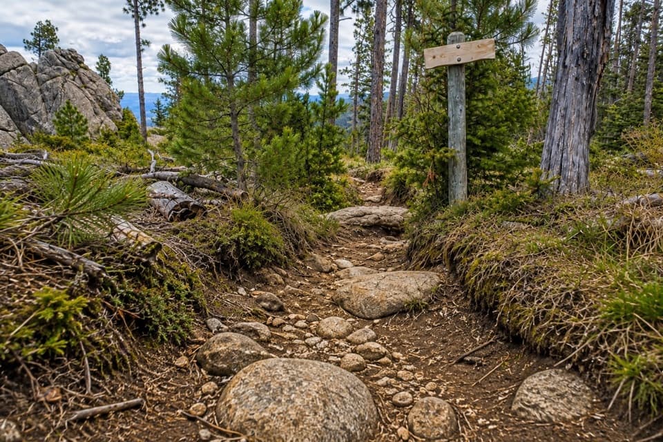
After the final creek crossing, the trail leaves the stream and turns into a narrower, rockier climb. It winds through a rugged canyon with granite overhangs and caves, then reaches drier, higher forest. From the climb, the back side of Cathedral Spires sits to the left; the southern Black Hills open behind you as you look back. The granite outcrops are the main visual reward here, rather than a summit view: Trail #3 finishes at the Trail 9 junction. For a photo, keep the rocky tread and foreground stones in the frame with Cathedral Spires to the left so the scene reads as a real walk through the rock.

Take the junctions slowlyThe route passes through a maze of numbered trails.

The route passes through a maze of numbered trails. At the Grizzly Creek Trail 7 junction, stay left to remain on Norbeck Trail #3. Other intersections with Trails #3, #7, and #9 can be easy to miss, especially on the return. Keep the mapped line available and confirm each junction before continuing if the tread seems to disappear. Turn around at Trail 9 if this is the Norbeck walk you planned. Continuing toward Black Elk Peak changes the route and the time commitment.

Wilderness access and rulesThe upper hike enters Black Elk Wilderness, designated in 1980 and named for Oglala Lakota holy…

The upper hike enters Black Elk Wilderness, designated in 1980 and named for Oglala Lakota holy man Black Elk; the area is sacred to many American Indians. Dogs are allowed, but in the wilderness they must be leashed or under strict voice control. Bicycles and motorized travel are not allowed there. The intended start is the west side of Iron Creek Horse Camp, but public parking instructions at that end differ; confirm where hikers may leave a car before setting out. Upper Iron Creek Trailhead on Needles Highway is a separate, shorter start, about 3.7 miles one way to the same Trail 9 junction, with ample parking. Choose it if 12.6 miles is too much, but do not mix its mileage with this route.

Wildlife

Wildlife in Custer

All Custer wildlife maps

Sighting maps show where each species has been reported across Custer. Wildlife moves, so no sighting is guaranteed.

Keep exploring

Near Norbeck Trail #3

See it all on the map

Trails that start nearby

Places near the trailhead

Parkwolf’s Custer ranking

Top-rated trails in Custer

All 40 trails
  1. 1Black Elk Peak Trail #9 SouthChallenging · 6.6 mi
  2. 2Cathedral Spires TrailChallenging · 1.2 mi
  3. 3Sunday Gulch TrailChallenging · 3 mi
  4. 4Little Devils Tower TrailChallenging · 3 mi
  5. 5Sylvan Lake Shore TrailModerate · 1 mi
  6. 6Black Elk Peak LoopChallenging · 7.1 mi

Take Parkwolf to Custer.

The audio tour guide for the drive, plus offline maps, trails, and wildlife heatmaps for when the signal drops.

4.7 from 8,600+ ratings

Download Parkwolf on the App StoreGet Parkwolf on Google Play