Custer Connector Trail in Custer State Park

Custer State Park, SD

Custer Connector Trail

A gentle paved link from Custer to Gordon Stockade.

Length
3.2mi
Time
1.6hr
Elev. change
135ft
Difficulty
Easy
  • Dogs allowed
  • High point 5,308 ft
Parkwolf audio tour82 stories across Custer’s roads

Overview

About Custer Connector Trail

Why go

  • A gentle paved connection between Custer and Gordon Stockade
  • The reconstructed fort gives the route a distinctive endpoint

Heads up

  • Point-to-point; without a ride, walking back makes it 6.4 miles

Map & elevation

The route

Loading the Custer map
Full map
Elevation5,174–5,308 ft
TrailheadCuster Connector junction on the George S. Mickelson Trail (MP 45)43.76767, -103.59041
Keep this map with you offline in the Parkwolf app

Plan your hike

Before you go

Parking

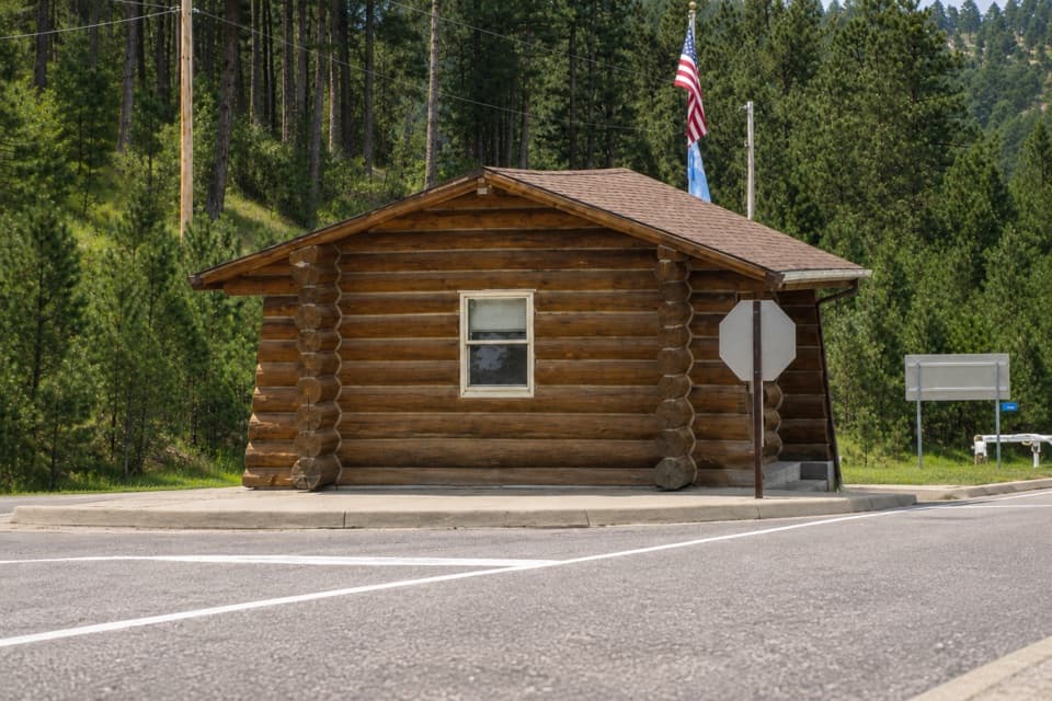
The town end joins the George S. Mickelson Trail at South 11th Street, near milepost 45. The nearby named Harbach Park Trailhead is at milepost 44.5, about half a mile south; add that approach if you park there. At the park end, follow the West Entrance and Gordon Stockade signs to the trail access and parking shown on the park map. Arrange a ride between ends or plan to walk back.


Safety

The Gordon Stockade end is inside Custer State Park, where every visitor needs an entrance license. Pets are allowed but must be on a leash no longer than 10 feet.

A park ranger sits on a dash-mounted phone, talking, as Parkwolf’s Tour Guide plays “Army Cutworm Moths: A Grizzly Bear Buffet” on Grand Loop Road below Dunraven Pass in Yellowstone
Parkwolf Tour GuideThe highest, rockiest slopes around here are a summer buffet for grizzly bears.

Custer Tour Guide

Your drive to Custer Connector Trail, narrated.

Parkwolf is a GPS audio tour guide for Custer State Park. As you drive, it chimes in with what’s ahead: hidden gems, upcoming stops, history, geology, and wildlife, right through your car’s speakers.

More stories near here in the app

  • Gordon Stockade: Gold and the Treaty
  • Doran Trail: Stone Paths Above Stockade Lake
  • How Water Striders Stay Afloat
  • Stockade Lake: Water or a Ridge Walk
  • 82 audio storiesacross Custer’s roads, triggered by GPS as you drive
  • Wildlife heatmapsfor Bison, Wapiti, Bighorn Sheep, and 13 more
  • Works offlinemaps, 40 trails, 49 places, and audio download before you lose signal
  • CarPlay readysimple controls built for the drive
★★★★★
“We recently toured Badlands, Custer State Park, Mount Rushmore and more! We learned so much from this app as we toured each of these sites. The audio tours are worth the money.”
milesdavis11App Store review
Download Parkwolf on the App StoreGet Parkwolf on Google Play

4.7 from 8,600+ ratings

Trail guide

Hiking Custer Connector Trail

A town-to-park walkThe Custer Connector is a 3.2-mile, one-way path from the George S.

The Custer Connector is a 3.2-mile, one-way path from the George S. Mickelson Trail at South 11th Street in Custer to the Gordon Stockade area at Custer State Park’s west entrance. It’s an easy walk on mostly asphalt, with a few short wooden bridges and concrete-panel transitions. Allow about 1½ hours one way. The route trends gently downhill from town toward the Stockade by about 120 feet; turn around and you’ll walk back uphill. No shuttle between the ends was verified, so arrange a ride or plan on 6.4 miles round trip. The nearby Harbach Park Trailhead is at Mickelson milepost 44.5; the spur joins at milepost 45, about half a mile farther north. Custer State Park requires an entrance license for all visitors, including people who walk in.

What the walk is likeThis is a straightforward connector rather than a loop: one paved path links Custer with the…

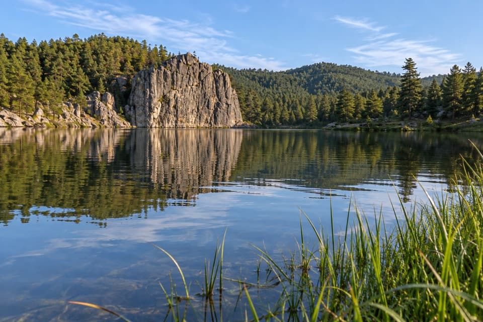
This is a straightforward connector rather than a loop: one paved path links Custer with the Stockade Lake area. The mapped route has short wooden bridge sections and brief concrete-panel transitions between the asphalt stretches. The gentle grade is the main effort; there’s no steep climb on the town-to-park direction. At the east end, give yourself time to look around Gordon Stockade before heading back or meeting your ride.

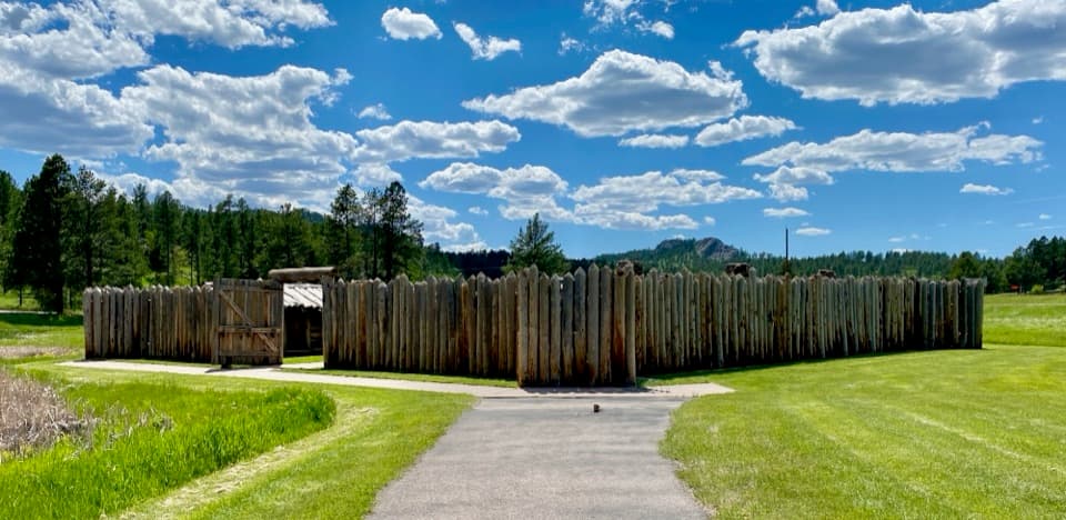
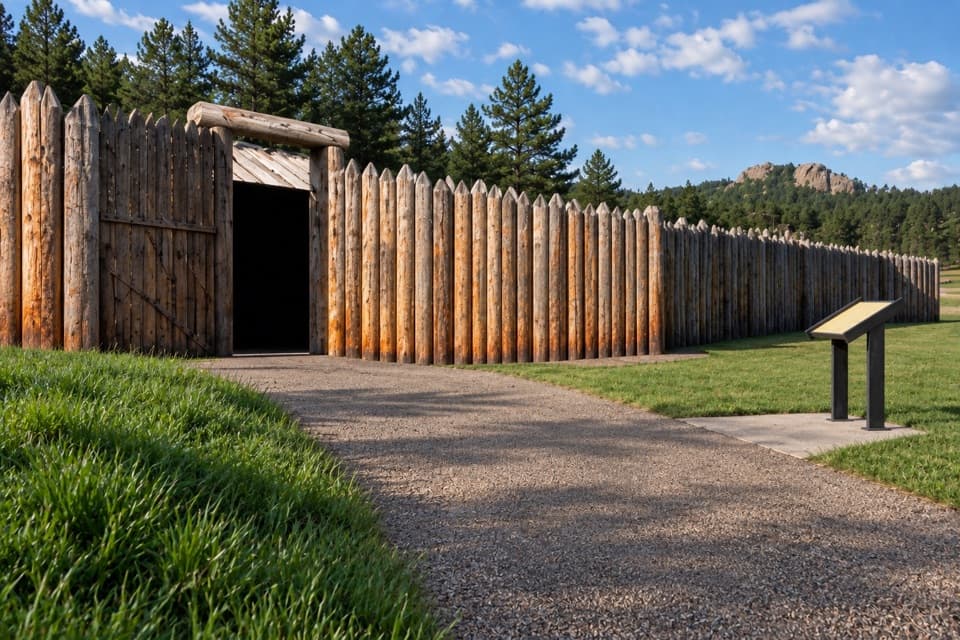
At Gordon StockadeThe trail’s payoff is a reconstructed timber fort with interpretive signs.

The trail’s payoff is a reconstructed timber fort with interpretive signs. The original Gordon Party built a stockade here in winter 1874–75 after gold seekers entered the Black Hills, then part of the Great Sioux Reservation under the 1868 Fort Laramie Treaty. U.S. Cavalry removed the party within five months. The fort you see now is the third replica: Custer residents built the first in 1925, the Civilian Conservation Corps rebuilt it in 1941, and a later reconstruction followed a safety closure. Take a few minutes to look through the fort before turning around or arranging your ride.

Wildlife

Wildlife in Custer

All Custer wildlife maps

Sighting maps show where each species has been reported across Custer. Wildlife moves, so no sighting is guaranteed.

Keep exploring

Near Custer Connector Trail

See it all on the map

Trails that start nearby

Places near the trailhead

Parkwolf’s Custer ranking

Top-rated trails in Custer

All 40 trails
  1. 1Black Elk Peak Trail #9 SouthChallenging · 6.6 mi
  2. 2Cathedral Spires TrailChallenging · 1.2 mi
  3. 3Sunday Gulch TrailChallenging · 3 mi
  4. 4Little Devils Tower TrailChallenging · 3 mi
  5. 5Sylvan Lake Shore TrailModerate · 1 mi
  6. 6Black Elk Peak LoopChallenging · 7.1 mi

Take Parkwolf to Custer.

The audio tour guide for the drive, plus offline maps, trails, and wildlife heatmaps for when the signal drops.

4.7 from 8,600+ ratings

Download Parkwolf on the App StoreGet Parkwolf on Google Play