Parking
Park at the Mossman Gorge Cultural Centre, where onsite parking and the shuttle service are available. The mapped walk starts at the gorge shuttle stop; Mayi Café is at the centre before the ride.

#1 of 22 trails in Daintree
Daintree National Park, QLD
A swaying bridge opens into dense tropical rainforest.
Overview
Map & elevation
Plan your hike

The highest, rockiest slopes around here are a summer buffet for grizzly bears.
Daintree Tour Guide
Parkwolf is a GPS audio tour guide for Daintree National Park. As you drive, it chimes in with what’s ahead: hidden gems, upcoming stops, history, geology, and wildlife, right through your car’s speakers.
See the Daintree audio tourRecorded for this trailhead
Mossman Gorge and Cultural Centre“Mossman Gorge Cultural Centre is coming up, the gateway to the river and its huge granite boulders. Park here and take the paid shuttle; the gorge walks start about two kilometres farther along.”
Plays as you drive up to this trailhead in the Parkwolf Daintree Tour Guide.
More stories near here in the app
“Fantastic app with many points of information… It’s great to just turn on while you’re driving and it gives you an audio tour of the national Park. We love it!!!!”


Trail guide
The Mossman Gorge Rainforest Circuit is a 3.4 km circuit from the gorge shuttle stop. Follow Baral Marrjanga to the Mossman River lookout, branch to Rex Creek bridge, cross it, walk the rainforest loop, and return by the same approach. Allow about two hours. A shorter 2.4 km figure describes the circuit from the far side of the bridge; that omits the access walk from the shuttle stop, so the distance depends on where you start. I’d make the extra time if you want more than a quick riverside stop: the bridge, lookout and deeper forest make this the most rounded walk in the gorge. It is Grade 3, moderately easy by the park’s description, but the circuit has rough, uneven ground and steps.
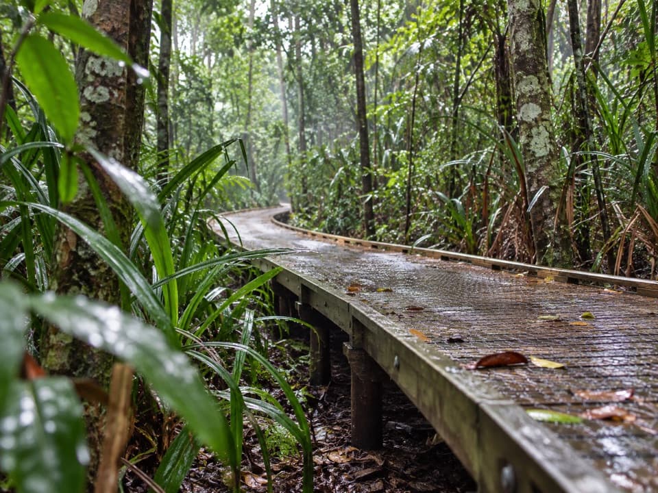
The first leg is part of the walk, not dead mileage. Baral Marrjanga follows elevated boardwalk through vines, epiphytes and ferns in the lower rainforest canopy to a Mossman River lookout. The boardwalk is suitable for wheelchairs and strollers (some visitors may need help), but the circuit beyond the bridge is not. If smooth access is your priority, the boardwalk and lookout make a worthwhile shorter outing; turn around there rather than carrying on to the rougher loop. Baral Marrjanga is an Eastern Kuku Yalanji name: Baral means track, and Marrjanga refers to a group of Elders or bosses. The name reflects the rainforest as a respected Elder or boss.
At the lookout, follow the short signed path to the left for Rex Creek bridge. The suspension bridge gently sways over cascading water; the circuit begins on its far side. About 80 m beyond the bridge, a small lookout faces Manjal Dimbi (Mount Demi). It is a quick view, not a summit walk, and the track splits into the rainforest loop shortly after it.
Once the circuit branches off, expect a rough, uneven track with sections of steps. The reward is close-up forest rather than a big open vista: tall, dense lowland rainforest, strangler figs, ribbon-like buttress roots and climbing vines reaching for light. Epiphytes grow on trunks and branches, and the steep ranges behind the gorge trap moist air from the ocean, keeping this forest cool and wet. The park asks walkers to be reasonably fit, carry drinking water and wear sturdy closed shoes; that advice matters more than the short distance suggests.
Keep an eye out for metallic-blue Ulysses butterflies flicking through the canopy and listen for the distinctive call of the wompoo fruit-dove. You may catch a view of the Mossman River from the approach and Manjal Dimbi from the bridge-side lookout; most of the circuit stays under trees. Mayi Café at the Cultural Centre sells grab-and-go snacks before you board the shuttle, and toilets are at the access area rather than out on the circuit. Stay out of the river: the gorge is unsupervised, and water conditions can change quickly after rain.
Wildlife
 688 sightingsSouthern CassowaryMost seen around 5 PMSighting map
 1,788 sightingsSaltwater CrocodileMost seen around 4 PMSighting map
 242 sightingsSpectacled Flying-foxMost seen around 6 PMSighting map
 332 sightingsBoyd's Forest DragonMost seen around 10 AMSighting map
 46 sightingsVictoria's RiflebirdMost seen around 7 AMSighting map
 188 sightingsLace MonitorMost seen around 10 AMSighting map
Sighting maps show where each species has been reported across Daintree. Wildlife moves, so no sighting is guaranteed.
Keep exploring
 EasyBaral Marrjanga Track0.7 km · 30 min · At the trailheadA short rainforest boardwalk to a Mossman River lookout.
 EasyRex Creek Bridge Track1.4 km · 1 hr · At the trailheadA short rainforest walk to a high, gently swaying creek bridge.
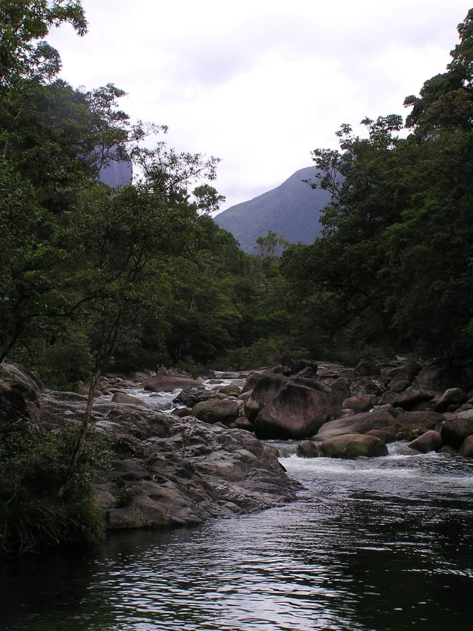 EasyLower Mossman River Track0.6 km · 40 min · At the trailheadQuick river lookouts over granite boulders and fast water.
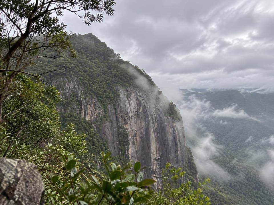 ChallengingMossman Bluff Walking Track13.4 km · 8.5 hr · 0.8 km awayA steep, remote climb toward the sheer Bluff above Mossman Gorge.
 ChallengingManjal Jimalji (Devils Thumb) Trail12 km · 10 hr · 8.9 km awayA hard rainforest climb to coral fern and a boulder lookout.
 Picnic area · At the trailheadMossman Gorge Day-use AreaA short, accessible rainforest boardwalk leads to Mossman River views.
 Sight · 0.3 km awayMossman River Lookout (Baral Marrjanga)A short boardwalk to a boulder-filled river and mountain view.
 Sight · 0.4 km awayRex Creek Suspension BridgeA swaying bridge hangs above clear, cascading creek water.
 Visitor center · 1.8 km awayMossman Gorge Cultural CentreStart here for Kuku Yalanji culture and the Mossman Gorge shuttle.
Parkwolf’s Daintree ranking

The audio tour guide for the drive, plus offline maps, trails, and wildlife heatmaps for when the signal drops.