
Place · 9.5 mi away
Challenging
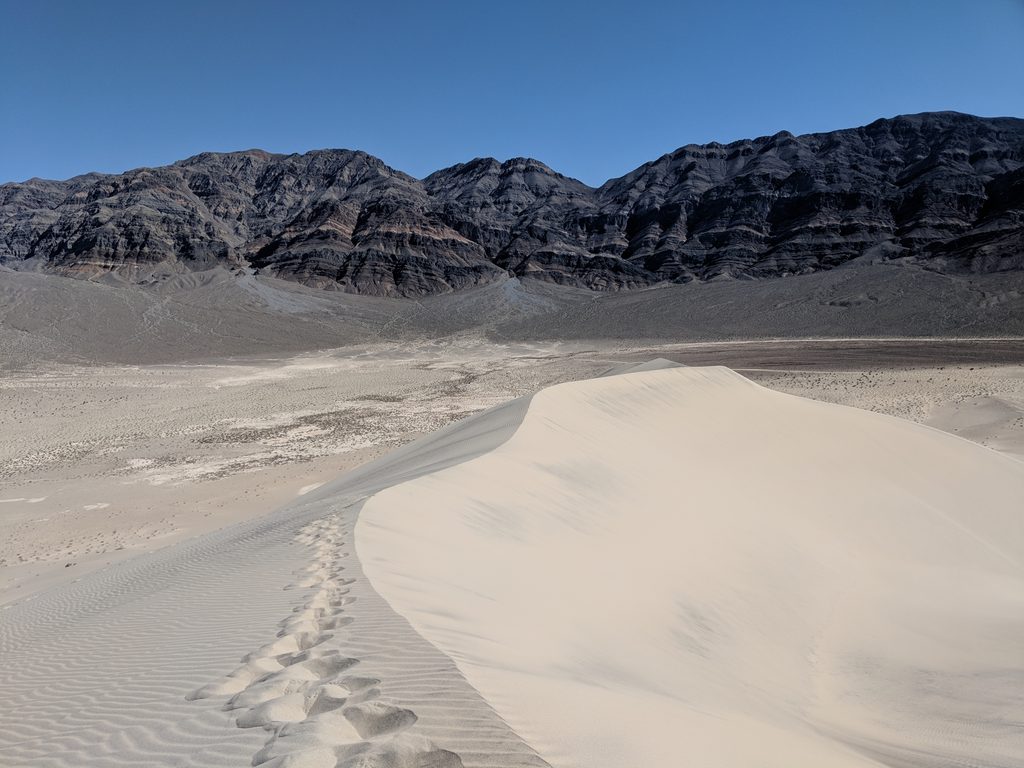
Eureka Dunes are the tallest sand dunes in California—rising roughly 680 feet above the valley floor—and they feel every bit as wild and remote as they sound. Set against the stark Last Chance Mountains, the dune field covers about 3 miles by 1 mile and delivers sweeping panoramas, profound silence, and a real leg-burner of a climb. On the right day, the sand itself can emit a low, resonant “booming” that you feel as much as hear—one of the park’s most unusual natural phenomena.
There is no marked trail here. You’ll choose your own line from the base near the campground up wind-sculpted ridges toward the highest crest. Expect steep slopes and deep, shifting sand—two steps up, one sliding back. A typical out-and-back to the high ridge is about 3.0 miles total, with up to ~680 feet of gain on loose sand, and usually takes 2–3 hours depending on conditions and how high you go. It’s strenuous, exposed, and entirely on sand.
Go in the cooler months (October through May). Summer heat can be dangerous; winter nights can be very cold. Spring can be windier—which can both help with comfort and add challenge underfoot. For light and photography, aim for sunrise or sunset when shadows carve texture into the ridgelines and the dunes glow. If you’re hoping to hear the dunes “boom,” calmer, dry conditions after sand movement can help, but it’s never guaranteed.
The approach is part of the adventure: the last stretch of road is rough gravel, slow-going, and can become impassable after rain. There are no services and often no cell reception. At the base, you’ll find primitive camping and a single pit toilet—bring your own toilet paper and plenty of water, food, and sun protection. Some hikers go barefoot when the sand is cool, but only do so when temperatures are low.
These dunes formed where wind and topography trap sand in the enclosed Eureka Valley. Look for hardy, rare plants and specialized desert wildlife adapted to this fragile environment, including the Mojave fringe‑toed lizard. Please avoid vegetated areas at the base of the dunes; stick to durable sand.
Sandboarding and off‑road vehicle use are not allowed—both to protect the dunes and the endemic species that live here. If camping, use the designated area and camp away from the base of the dunes to protect sensitive habitat.
Park at the base of the dunes near the primitive campground along South Eureka Valley Road; rough gravel access, no services, single pit toilet (bring TP).
Remote, no water or services, extreme heat risk, no cell reception; steep, loose sand; approach roads can be impassable after rain; protect sensitive vegetation and endemic species; no sandboarding.
Place · 9.5 mi away
Place · 9.7 mi away
Place · 14.5 mi away
Place · 14.7 mi away
Moderate · 14.3 mi away
Moderate · 14.5 mi away
Easy · 30.5 mi away
Moderate · 39.1 mi away

Parkwolf Tour Guide
