Badwater Salt Flat in Death Valley National Park

#1 of 57 trails in Death Valley

Death Valley National Park, CA · NV

Badwater Salt Flat

Walk out to Badwater’s salt polygons below sea level.

Photo: Mikenorton, CC BY-SA 4.0, via Wikimedia Commons

Length
1.9mi
Time
1.3hr
Elevation
Flat
Difficulty
Easy
  • No dogs
  • High point -279 ft

Hear the audio tour

Badwater Basin: Below Sea Level

Overview

About Badwater Salt Flat

Why go

  • Distinctive salt polygons and mountain-scale views in a short, flat walk
  • Paved parking, an access ramp and a boardwalk approach

Heads up

  • The unmarked salt surface is fully exposed, with no water on route

Map & elevation

The route

Loading the Death Valley map
Full map
Elevation-282–-279 ft
TrailheadBadwater Basin parking area36.22982, -116.76752
Keep this map with you offline in the Parkwolf app

Plan your hike

Before you go

Parking

Use the paved Badwater Basin parking area on Badwater Road, about 17 miles south of Furnace Creek. The lot has large spaces for RVs and buses and a vault toilet; an accessible ramp leads to the boardwalk. Continue beyond the boardwalk onto the flats for this hike.

Safety

The walk leaves the boardwalk for fragile, unmarked salt crust; the thin surface can break through to mud, and rain can leave temporary water. There is no shade or water on route. Avoid hot-weather hiking; the park specifically advises against summer hiking after 10 a.m. Pets are not allowed on the trail.

4 active Death Valley alerts

  • ClosureRoad closures and hazardous conditionsSeveral park roads are closed or hazardous; follow closures and vehicle restrictions.Official details
  • ClosureSaline Valley Lower Springs closed after wildfireLower Springs pools at Saline Valley Warm Springs remain closed because the September 15 wildfire left safety hazards, including potential hazardous chemicals; do not enter the closed area.Official details
See all 4 alerts
A park ranger sits on a dash-mounted phone, talking, as Parkwolf’s Tour Guide plays “Army Cutworm Moths: A Grizzly Bear Buffet” on Grand Loop Road below Dunraven Pass in Yellowstone
Parkwolf Tour GuideThe highest, rockiest slopes around here are a summer buffet for grizzly bears.

Death Valley Tour Guide

Your drive to Badwater Salt Flat, narrated.

Parkwolf is a GPS audio tour guide for Death Valley National Park. As you drive, it chimes in with what’s ahead: hidden gems, upcoming stops, history, geology, and wildlife, right through your car’s speakers.

See the Death Valley audio tour

Recorded for this trailhead

Badwater Basin: Below Sea Level
0:00 / 0:34
“You're coming up on Badwater Basin, North America's lowest point at two hundred eighty-two feet below sea level. I'd stop even if you only have time for the boardwalk beside the salty pool.”

Plays as you drive up to this trailhead in the Parkwolf Death Valley Tour Guide.

More stories near here in the app

  • The Kangaroo Rat's Midair Kick
  • The River With Gaps
  • The Baby Gauge Ore Trains
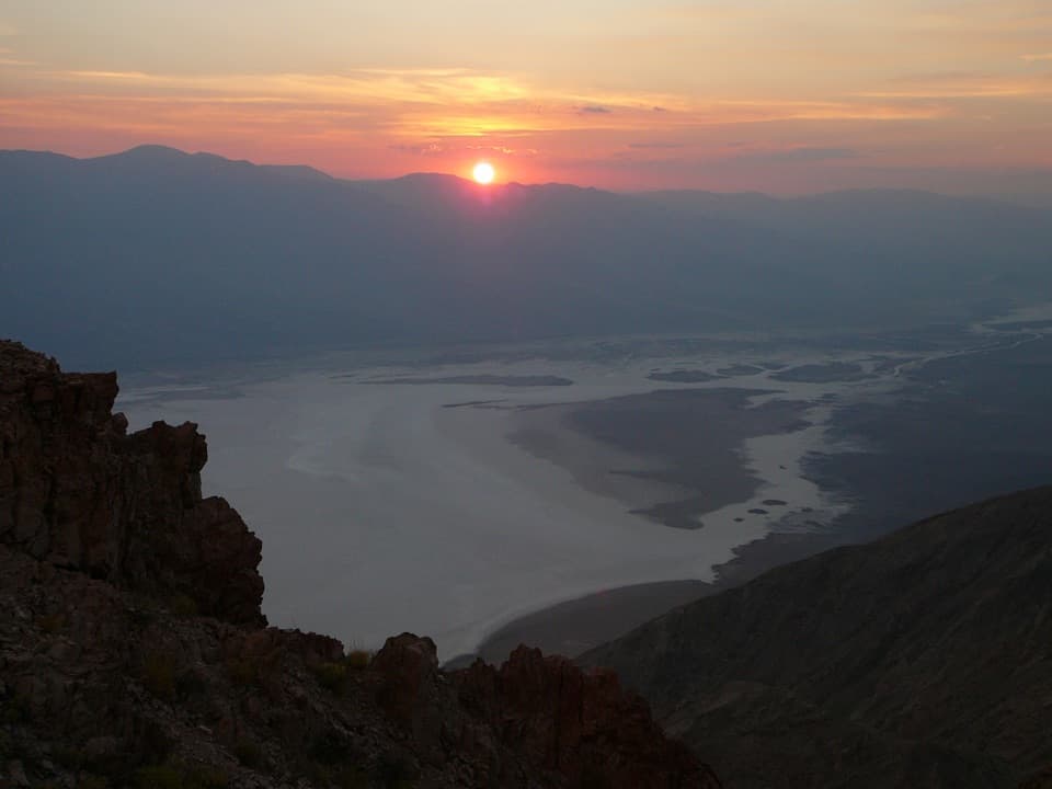
  • Dantes View: Above the Basin
  • 228 audio storiesacross Death Valley’s roads, triggered by GPS as you drive
  • Wildlife heatmapsfor Bighorn Sheep, Desert Tortoise, Coyote, and 13 more
  • Works offlinemaps, 57 trails, 81 places, and audio download before you lose signal
  • CarPlay readysimple controls built for the drive
★★★★★
“Fantastic app with many points of information… It’s great to just turn on while you’re driving and it gives you an audio tour of the national Park. We love it!!!!”
JMJamesApp Store review
Download Parkwolf on the App StoreGet Parkwolf on Google Play

4.7 from 8,600+ ratings

Trail guide

Hiking Badwater Salt Flat

Take the full walkBadwater Salt Flat is an out-and-back from the paved Badwater Basin parking area onto Death…

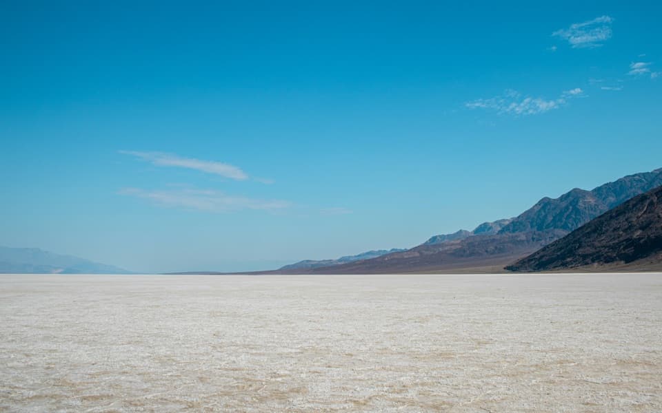
Badwater Salt Flat is an out-and-back from the paved Badwater Basin parking area onto Death Valley’s salt crust. The stored route follows the wooden boardwalk approach, then a mapped salt-surface track west across the flats to the polygon field and back: about 1.9 miles round trip, usually an hour to 75 minutes. It is flat and easy, but the latter part has no marked tread. The shorter one-mile round trip reaches the edge of the flats; continuing farther brings you to the stronger polygon patterns. Crossing the basin to its far side is a separate, much longer outing, about five miles each way.

Leaving the boardwalkThe ramp and boardwalk are the approach to the pool, not the whole salt-flat walk.

The ramp and boardwalk are the approach to the pool, not the whole salt-flat walk. Beyond them, the route opens onto a wide, almost featureless white plain. The actual walking line can shift with the surface, so the map represents a customary corridor rather than a fenced path. Keep track of the boardwalk and parking area behind you; the return uses the same ground. There is no water or food on the walk, and the lot’s vault toilet is the last restroom.

The flats are fully exposed. The park advises against hiking when it is hot and specifically warns against starting after 10 a.m. in summer. Thin salt crust can break through to mud, and rain can leave temporary water that changes the route. Salt crystals are fragile and footprints can last, so stay on the established access and avoid widening the worn line. Pets are not allowed on this trail.


How the polygons formThe crust is the surface of a closed basin.

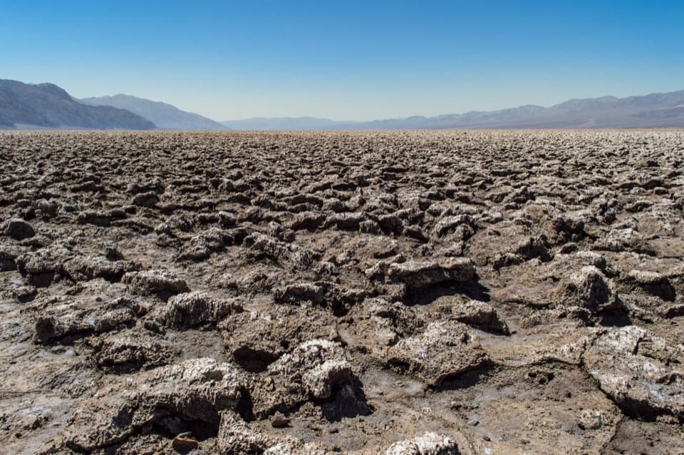
The crust is the surface of a closed basin. Ancient Lake Manly evaporated tens of thousands of years ago, leaving salts behind; water from Death Valley’s broad drainage still carries dissolved minerals into the basin. As groundwater evaporates, salt crystals build raised ridges around polygon-shaped patches. Rain and floods dissolve and redeposit the minerals, so the pattern keeps changing rather than acting like a permanent pavement. Sodium chloride dominates, with calcite, gypsum and borax also present.

The basin’s scaleBadwater Basin sits 282 feet below sea level, the lowest point in North America.

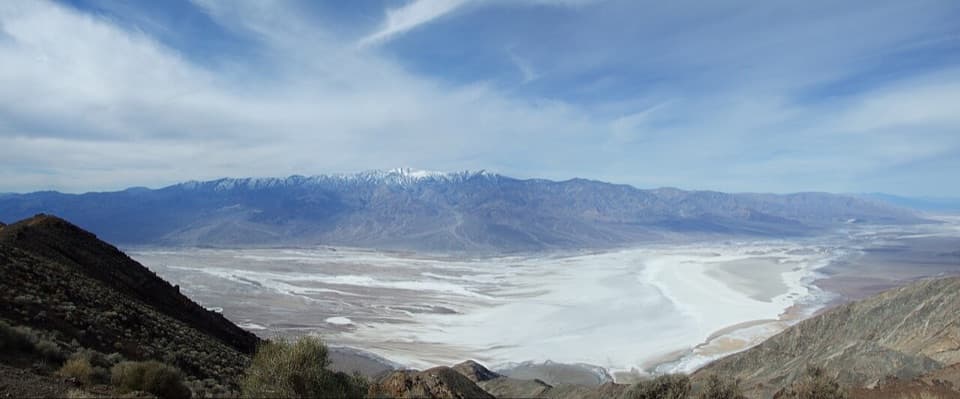
Badwater Basin sits 282 feet below sea level, the lowest point in North America. From the flats, the sea-level marker is visible high on the Black Mountains to the east; Telescope Peak rises across the valley to the west. The white floor is part of a salt flat covering nearly 200 square miles, so even this short walk sits inside a much larger landscape. For a photo, get beyond the boardwalk and put the polygon ridges in the foreground with the basin walls behind them.

At the start, the shallow saline pool is ringed with pickleweed and supports a snail found only here. The name has its own story: an early surveyor’s mule reportedly refused the salty water. The pool is briny, not “bad” in the sense of being contaminated.

Wildlife

Wildlife in Death Valley

All Death Valley wildlife maps

Sighting maps show where each species has been reported across Death Valley. Wildlife moves, so no sighting is guaranteed.

Parkwolf’s Death Valley ranking

Top-rated trails in Death Valley

All 57 trails
  1. 2Mosaic CanyonModerate · 4 mi
  2. 3Golden Canyon to Red CathedralModerate · 3 mi
  3. 4Telescope Peak TrailChallenging · 12.2 mi
  4. 5Golden Canyon Complete CircuitChallenging · 7.8 mi
  5. 6Gower Gulch LoopModerate · 4.3 mi
  6. 7Dantes Ridge to Mount PerryChallenging · 9 mi

Take Parkwolf to Death Valley.

The audio tour guide for the drive, plus offline maps, trails, and wildlife heatmaps for when the signal drops.

4.7 from 8,600+ ratings

Download Parkwolf on the App StoreGet Parkwolf on Google Play