Pros & cons
PROS
- Short, well-graded rainforest walk to a 275 m three-tiered waterfall
- Car park with toilets at the trailhead
- Quieter detour off the Milford Road corridor
CONS
- Reached via a long unsealed gravel road
- View is from a distant lookout with no access to the base
Overview
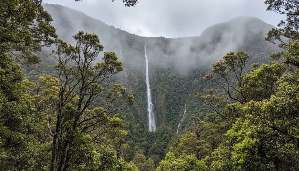
Humboldt Falls is Fiordland in a nutshell: big, wild, and wrapped in lush rainforest. The waterfall drops a dramatic 275 meters in three tiers into the head of the Hollyford Valley. It’s a worthy detour off the Milford Road if you want a grand waterfall without the tour-bus crowd.
The Walk
From the car park at the end of Hollyford (Lower Hollyford) Road, it’s an easy, well-graded 1.2 km return track through beech and tree fern forest. Expect 20–30 minutes round trip with about 42 m of gentle climbing—the first hundred meters are the steepest, then it eases off. The track is well maintained and family friendly.
The View & What Makes It Special
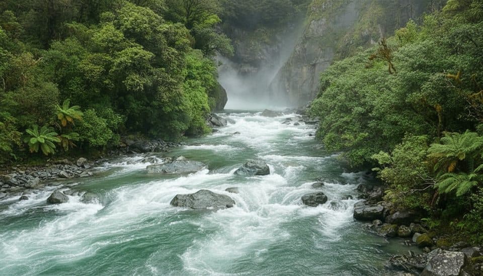
You’ll end at a designated lookout across the valley from the falls—no scrambling to the base here. In full flow, the water fans down three distinct drops against a sheer, mossy cliff. It’s one of the highest waterfalls in Fiordland and feels wonderfully tucked away compared to the marquee stops closer to Milford Sound.
Getting There & Logistics
Turn off SH94 at Marian Corner and follow the unsealed Hollyford Road to the car park at the end. The road is gravel—conditions vary—so allow extra time. Facilities are basic: parking, a signed trailhead, and a toilet. There are no food or fuel services out here; bring what you need. The area is managed by New Zealand’s Department of Conservation and is free to visit.
Wildlife
The rainforest here is alive with native birdlife—keep an ear out for fantails, bellbirds, and tui flitting through the canopy. The forest floor is rich with mosses and fungi, especially after rain.
Best Time to Visit
Humboldt roars after rain, and the wettest months (December–January) usually deliver the biggest show. In winter, ice or snow and occasional road closures are possible—check Milford Road (SH94) status before you go. It’s generally a quieter stop year-round, and the track is open 24 hours.

Practical Tips
- The viewpoint is the end of the line—plan on a lookout-only experience.
- Sandflies can be relentless; bring repellent.
- Combine with nearby Lake Marian or a taste of the Hollyford Track to round out the detour.
Where it is
-44.6959, 168.1338Tips for Humboldt Falls
- 01Visit after rain for the most dramatic flow.
- 02Allow extra time for the unsealed Lower Hollyford Road.
- 03Bring insect repellent—sandflies are common.
- 04In winter, check SH94 and Hollyford Road status before you go.
- 05Don’t expect access to the base; the lookout is the endpoint.
Amenities
Near Humboldt Falls
All places →All trails →
0.4 mi awayHumboldt Falls TrackShort rainforest stroll to a big, distant waterfall viewpointEasy · 0.8 mi · 30 min
0.4 mi awayHollyford TrackA mountains-to-sea tramp through river flats, lakes, and wild coast.Moderate · 35 mi · 36 hr
0.4 mi awayHidden Falls TrackFlat rainforest walk to a thunderous, tucked-away waterfallModerate · 11.2 mi · 5.5 hr
0.6 mi awayMoraine Creek RouteRugged bush-to-basin slog to lonely Lake Adelaide and rock bivviesChallenging · 3.4 mi · 6 hr
2.7 mi awayConical HillShort, steep spur to sweeping alpine views over Lake HarrisScenic Viewpoint
2.8 mi awayHarris Saddle ShelterHigh-alpine refuge and Conical Hill kickoff with Lake Harris viewsRestroom · Scenic Viewpoint
4.5 mi awayGunn’s CampHistoric Hollyford camp ruined by landslide, story still lingersCampground · Restroom
4.6 mi awayHidden FallsPowerful rainforest waterfall on a quiet Hollyford Track day walkRestroom · Scenic Viewpoint