Best time to visit
If you’re exploring the valley or nearby tracks, go on a clear break in the weather—mornings often have softer light and fewer people. Avoid heavy‑rain periods; Fiordland downpours are no joke and can trigger closures or hazards.
Campground · Fiordland National Park
Historic Hollyford camp ruined by landslide, story still lingers
Overview
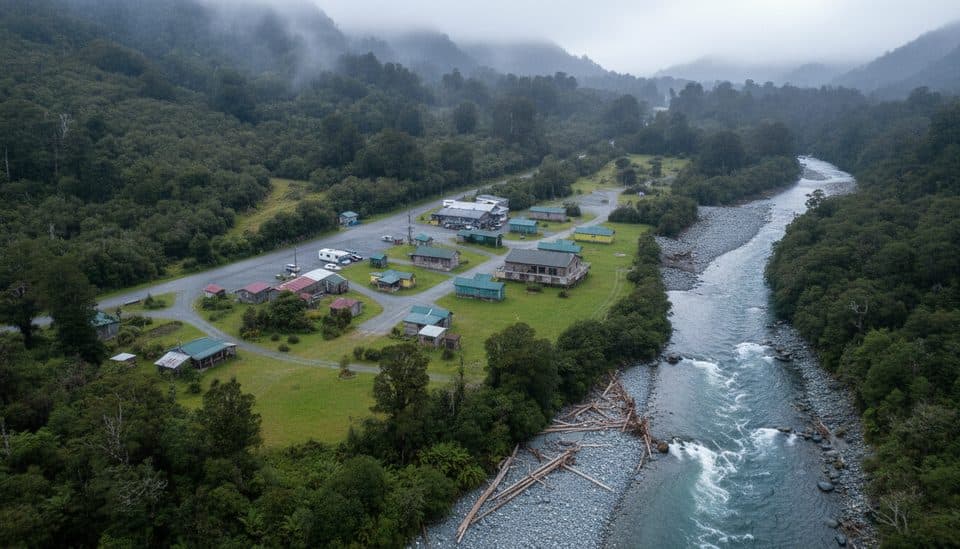
Gunn's Camp sits deep in the mid‑Hollyford Valley beneath the Darran Mountains—about as wild as Fiordland feels from the road. It began life as workers’ quarters for the Milford Road project in the 1920s–30s and evolved into a quirky, much‑loved camp of historic cabins and huts.
People came for the character: rustic huts, hot showers, a communal kitchen, and a tiny museum/store that made this remote corner feel welcoming after a wet Fiordland day. The setting—towering peaks, dense rainforest, and the Hollyford River—did the rest.
 Parkwolf’s verdictWhy It Was Special
Map
Local know-how
Don’t plan to stay—the camp remains closed after the 2020 landslide.
Confirm current road and track conditions with the visitor centre in Te Anau.
There’s no mobile service; download maps and details before you drive in.
Fuel up and bring food—there are no services in the Hollyford Valley.
Pack serious rain gear; Fiordland weather turns quickly and often.
Plan your stop

The highest, rockiest slopes around here are a summer buffet for grizzly bears.
Fiordland Tour Guide
Parkwolf is a GPS audio tour guide for Fiordland National Park. As you drive, it chimes in with what’s ahead: hidden gems, upcoming stops, history, geology, and wildlife, right through your car’s speakers.
See the Fiordland audio tourRecorded for this place
The Story of Gunn's Camp“You're approaching the site of what was once Gunn's Camp, a beloved and historic camp originally built for workers on the Milford Road.”
Plays as you drive up to Gunn’s Camp in the Parkwolf Fiordland Tour Guide.
More stories near here in the app
“Fantastic app with many points of information… It’s great to just turn on while you’re driving and it gives you an audio tour of the national Park. We love it!!!!”


Guide
A massive landslide in early 2020 swept through the site and devastated many of the buildings and infrastructure. The camp has been closed since, with its future unclear. Don’t plan on staying here; treat it as a historical waypoint in the valley’s story and confirm any updates before you go.
This is a prime launch area for valley highlights: the Lake Marian Track, Humboldt Falls, Pops View Lookout, and access toward the Hollyford Track. Even with the camp closed, these spots remain well worth your time.
The surrounding forests are good for native birdlife—listen for tui and bellbirds, and keep an eye out for cheeky kea. Kiwi live in the wider region, but sightings are rare.
Gunn’s began during the Great Depression to house Milford Road workers and later welcomed trampers as a humble, community‑minded camp. It’s now managed by a local trust, and the 2020 landslide is a stark reminder of Fiordland’s powerful geology.
Wildlife
 1,181 sightingsKeaMost seen around 10 AMSighting map
 199 sightingsFiordland PenguinMost seen around 7 PMSighting map
 228 sightingsBlue DuckMost seen around 5 PMSighting map
 32 sightingsBottlenose DolphinMost seen around 5 PMSighting map
 247 sightingsNew Zealand Fur SealMost seen around 6 PMSighting map
 58 sightingsKākāMost seen around 6 PMSighting map
Sighting maps show where each species has been reported across Fiordland. Wildlife moves, so no sighting is guaranteed.
Keep exploring
 EasyPop's View Lookout Walk0.2 km · 15 min · 6 km awayRoadside panorama over the Hollyford Valley with kea and a memorial
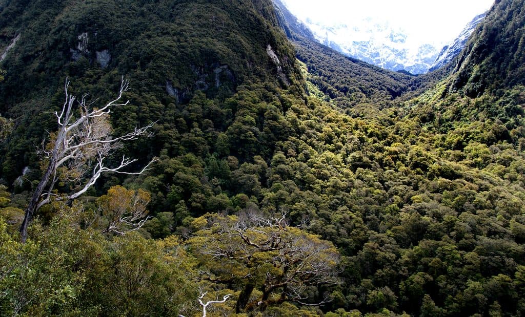 ChallengingLake Marian Track6.3 km · 3 hr · 6.1 km awayShort, rough climb to a mirror-still alpine lake in a hanging valley
 EasyMarian Falls Track1.3 km · 20 min · 6.1 km awayA quick rainforest stroll to photogenic cascades and a swing bridge
 ChallengingRouteburn Track33 km · 14 hr · 7.4 km awayA 20.5-mile alpine point-to-point Great Walk from The Divide to Routeburn Shelter
 ModerateRouteburn Track to Lake Mackenzie11.3 km · 5.5 hr · 7.4 km awayBeech forest, Earland Falls, and a glassy alpine lake
 ModerateRouteburn Track to Earland Falls13.4 km · 6 hr · 7.4 km awayA full-day walk to Fiordland's 174 m waterfall
 EasyLake Howden Track6.8 km · 3 hr · 7.4 km awayA short beech-forest walk from The Divide to Lake Howden.
 ModerateCaples Track33.5 km · 15 hr · 7.4 km awayPoint-to-point tramp through the Caples valley to The Divide Shelter
 Lodging · 2.8 km awayLake Mackenzie HutGreat Walk hut on a turquoise alpine lake with big-mountain views
 Sight · 3 km awayLake MackenzieSub‑alpine jewel on the Routeburn with a hut and campsite
 Sight · 4.4 km awayHarris Saddle ShelterHigh-alpine refuge and Conical Hill kickoff with Lake Harris views
 Sight · 4.5 km awayConical HillShort, steep spur to sweeping alpine views over Lake Harris
 Sight · 5 km awayEarland Falls174 m Routeburn waterfall that drenches the track after rain
 Sight · 5.7 km awayLake Marian LookoutShort walk to a gantry over thundering Marian Falls
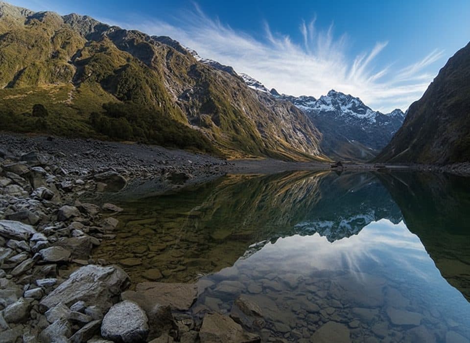
 Sight · 5.8 km awayHinepipiwai / Lake MarianMirror-still alpine lake in a dramatic hanging valley
 Sight · 5.8 km awayMarian CascadeQuick, roaring cascades a short stroll from the Lake Marian track
Parkwolf’s Fiordland ranking
The audio tour guide for the drive, plus offline maps, trails, and wildlife heatmaps for when the signal drops.