Fiordland National Park, SL

Greenstone Track

Quiet point-to-point Fiordland tramp through beech forest, tussock, and river valleys

Length
30.8km
Time
12hr
Elev. change
303m
Difficulty
Moderate
  • No dogs
  • High point 665 m
  • #27 of 68 in Fiordland
Parkwolf audio tour126 stories across Fiordland’s roads

Overview

About Greenstone Track

Why go

  • Quieter multi-day alternative to the nearby Great Walks
  • Serviced Greenstone and McKellar huts with a strong valley-to-lake progression
  • Swing bridges and a clear route through beech forest, tussock, and river flats

Heads up

  • Point-to-point logistics require a shuttle or linked-route transport plan
  • Gravel-road approach and fords can become impassable after heavy rain
  • Huts have untreated water and no supplied cooking stoves; carry your own gear
The Greenstone Track is a quieter multi-day Fiordland tramp through beech forest, open tussock flats, river scenery, and the Greenstone and McKellar valleys. It offers a backcountry alternative to the busier Great Walks, with serviced huts and several swing bridges along the way.
Parkwolf’s verdictWhy go

Map & elevation

The route

Loading the Fiordland map
Full map
Elevation362–665 m
TrailheadGreenstone Road End / Greenstone Shelter-44.92877, 168.34607
Keep this map with you offline in the Parkwolf app

Plan your hike

Before you go

Parking

Use the Greenstone and Caples Tracks car park / Greenstone Shelter at the end of Greenstone Station Road. The approach from Glenorchy is gravel; fords between Kinloch and the road end can flood and become impassable in heavy rain. Arrange a shuttle or other transport for the point-to-point finish.

Best time to go

The trailhead is at the end of Greenstone Station Road, reached from Glenorchy. The approach is gravel, and the fords between Kinloch and the road end can flood and become impassable after heavy rain. Fiordland weather changes quickly; late spring through autumn is generally more settled, while winter brings shorter days, cold, snow or ice, and higher-water risks. Dogs are not allowed on this track.

Safety

Fiordland weather changes quickly. Expect wet ground, slips, side streams, and high water after heavy rain; the road approach includes fords that may become impassable. Treat all hut water before drinking, stay on the marked route across private or grazed land, and note that dogs are not allowed.

A park ranger sits on a dash-mounted phone, talking, as Parkwolf’s Tour Guide plays “Army Cutworm Moths: A Grizzly Bear Buffet” on Grand Loop Road below Dunraven Pass in Yellowstone
Parkwolf Tour GuideThe highest, rockiest slopes around here are a summer buffet for grizzly bears.

Fiordland Tour Guide

Your drive to Greenstone Track, narrated.

Parkwolf is a GPS audio tour guide for Fiordland National Park. As you drive, it chimes in with what’s ahead: hidden gems, upcoming stops, history, geology, and wildlife, right through your car’s speakers.

See the Fiordland audio tour
  • 126 audio storiesacross Fiordland’s roads, triggered by GPS as you drive
  • Wildlife heatmapsfor Kea, Fiordland Penguin, Blue Duck, and 13 more
  • Works offlinemaps, 68 trails, 124 places, and audio download before you lose signal
  • CarPlay readysimple controls built for the drive
★★★★★
“Fantastic app with many points of information… It’s great to just turn on while you’re driving and it gives you an audio tour of the national Park. We love it!!!!”
JMJamesApp Store review
Download Parkwolf on the App StoreGet Parkwolf on Google Play

4.7 from 8,600+ ratings

Trail guide

Hiking Greenstone Track

Route and distanceThis is a point-to-point route from Greenstone Road End (Greenstone Shelter) to the…

This is a point-to-point route from Greenstone Road End (Greenstone Shelter) to the Greenstone–Caples/Routeburn junction north of Lake McKellar. The verified mapped corridor is about 30.8 km/19.1 miles one way; allow roughly 2–3 days for a pack-carrying trip. The core line passes Greenstone Hut and McKellar Hut and finishes at the junction toward the Greenstone Saddle and Lake Howden. The optional continuation to Lake Howden and The Divide, and the Caples Track over McKellar Saddle, are linked routes rather than part of this stored line.

What it’s like out thereThe lower valley alternates between river flats, grassy clearings, and mossy beech forest.

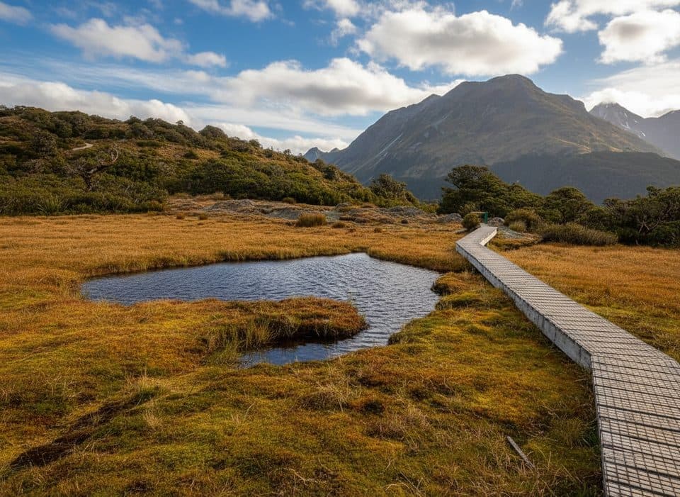
The lower valley alternates between river flats, grassy clearings, and mossy beech forest. Farther up, the route becomes more open around Lake McKellar and the Greenstone Saddle area. Expect a well-marked tramping track, swing bridges, occasional slips, wet ground, and side streams that can be troublesome after heavy rain. The line reaches roughly 698 m near Greenstone Saddle but does not cross the 945 m McKellar Saddle on the Caples variant.

Huts and logisticsGreenstone Hut and McKellar Hut are serviced DOC huts with mattresses, toilets, heating, and…

Greenstone Hut and McKellar Hut are serviced DOC huts with mattresses, toilets, heating, and untreated tap water—boil or otherwise treat water before drinking. Book hut or campsite stays ahead of time and carry your own stove and food; these are not Great Walk huts with cooking equipment provided. Arrange a shuttle or other transport for this point-to-point route if you are not returning by the linked network.

Is it for you?Choose this tramp for a quieter multi-day valley journey with huts, forests, tussock, and big…

Choose this tramp for a quieter multi-day valley journey with huts, forests, tussock, and big surrounding mountains. Link it with the Caples Track for the approximately 61 km circuit, or use the route toward Lake Howden and The Divide only if you have arranged the appropriate transport and itinerary.

Wildlife

Wildlife in Fiordland

All Fiordland wildlife maps

Sighting maps show where each species has been reported across Fiordland. Wildlife moves, so no sighting is guaranteed.

Parkwolf’s Fiordland ranking

Top-rated trails in Fiordland

All 68 trails
  1. 1Milford TrackChallenging · 53.4 km
  2. 2Routeburn TrackChallenging · 33 km
  3. 3Kepler TrackChallenging · 60 km
  4. 4Luxmore Summit TrackChallenging · 33.5 km
  5. 5Kepler Track to Mount LuxmoreChallenging · 37 km
  6. 6Sutherland Falls TrackModerate · 4.7 km

Take Parkwolf to Fiordland.

The audio tour guide for the drive, plus offline maps, trails, and wildlife heatmaps for when the signal drops.

4.7 from 8,600+ ratings

Download Parkwolf on the App StoreGet Parkwolf on Google Play