Parking
No road access. Arrange boat transport across Lake Hauroko to the Hauroko Burn Hut drop-off, typically from the southern lake ramp.

Fiordland National Park, SL
A remote, boat-accessed Dusky Track leg from Hauroko Burn to Lake Roe
Overview
Map & elevation
Plan your hike

The highest, rockiest slopes around here are a summer buffet for grizzly bears.
Fiordland Tour Guide
Parkwolf is a GPS audio tour guide for Fiordland National Park. As you drive, it chimes in with what’s ahead: hidden gems, upcoming stops, history, geology, and wildlife, right through your car’s speakers.
See the Fiordland audio tour“Fantastic app with many points of information… It’s great to just turn on while you’re driving and it gives you an audio tour of the national Park. We love it!!!!”


Trail guide
This is the southern, one-way Hauroko Burn section of the Dusky Track, linking a boat-accessed start at Hauroko Burn Hut with Lake Roe Hut via Halfway Hut. Expect remote Fiordland beech forest, river valleys, mud, treefall and steep, rough ground above the Hauroko Burn. It is an advanced backcountry route with no road access or cell service.
The verified route line is about 11.7 miles (18.8 km) one way, with no return corridor stored. DOC's section listings headline the same itinerary as 10.5 km from Lake Hauroko to Halfway Hut and 7 km from Halfway Hut to Lake Roe Hut; the app length follows the more detailed mapped line. Allow a full day in good conditions and more time if rain raises the rivers; Parkwolf's planning time is 9 hours.
This is for experienced trampers only. Fiordland rain can raise rivers quickly, while deep mud, fallen trees, indistinct marking, steep terrain and three-wire bridges can slow progress. Carry a personal locator beacon, robust wet-weather gear, spare food and a map; be ready to wait out unsafe crossings.
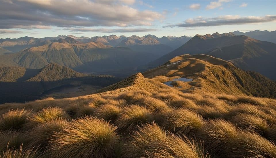
The route moves from Lake Hauroko's forested shore into the Hauroko Burn valley, then climbs toward the open, tarn-studded country around Lake Roe. Silver beech and podocarp forest, mossy river corridors and remote mountain views define the journey. Native robins, tomtits, bellbirds and kiwi may be encountered, though sightings are never guaranteed.
There is no road access to Hauroko Burn Hut. Arrange a boat across Lake Hauroko, usually from the southern boat ramp, and plan transport from Lake Roe onward as part of the wider Dusky Track itinerary. DOC huts are basic and first-come, first-served; carry water-treatment supplies and build in weather contingency.
Wildlife
 1,181 sightingsKeaMost seen around 10 AMSighting map
 199 sightingsFiordland PenguinMost seen around 7 PMSighting map
 228 sightingsBlue DuckMost seen around 5 PMSighting map
 32 sightingsBottlenose DolphinMost seen around 5 PMSighting map
 247 sightingsNew Zealand Fur SealMost seen around 6 PMSighting map
 58 sightingsKākāMost seen around 6 PMSighting map
Sighting maps show where each species has been reported across Fiordland. Wildlife moves, so no sighting is guaranteed.
Keep exploring
 ChallengingDusky Track57.1 km · 9 days · At the trailheadA remote hut trek through Fiordland's mud, mountains and wild water.ChallengingGrebe Valley Track18 km · 9 hr · 20.3 km awayRemote Borland Road-to-Lake Monowai traverse via Green Lake Hut
 ModerateMount Burns Tarns Track1.4 km · 45 min · 20.5 km awayShort, punchy climb to alpine tarns above Borland Saddle
Parkwolf’s Fiordland ranking

The audio tour guide for the drive, plus offline maps, trails, and wildlife heatmaps for when the signal drops.


