Parking
Use the Walhalla Overlook parking area on Cape Royal Road. The short Pueblo path begins at the north end of the lot.

Grand Canyon National Park, AZ
A short pine walk reveals a 900-year-old settlement.
Overview
Map & elevation
Plan your hike

The highest, rockiest slopes around here are a summer buffet for grizzly bears.
Grand Canyon Tour Guide
Parkwolf is a GPS audio tour guide for Grand Canyon National Park. As you drive, it chimes in with what’s ahead: hidden gems, upcoming stops, history, geology, and wildlife, right through your car’s speakers.
See the Grand Canyon audio tourRecorded for this trailhead
Walhalla Overlook and Pueblo“Walhalla Overlook is coming up, with a canyon view and a pueblo just across the road.”
Plays as you drive up to this trailhead in the Parkwolf Grand Canyon Tour Guide.
More stories near here in the app
“Fantastic app with many points of information… It’s great to just turn on while you’re driving and it gives you an audio tour of the national Park. We love it!!!!”


Trail guide
Walhalla Glades Pueblo Trail is an easy out-and-back of about 0.16 mile from the Walhalla Overlook parking area to the low stone foundations of an Ancestral Puebloan home in a ponderosa-pine clearing. The mapped path is about 0.08 mile each way; allow around 15 minutes if you pause at the interpretive stops. The nearby overlook is for the canyon view; this stop is for the rooms and the story behind them.
The building outlines are low foundations rather than standing rooms. The walking tour points out six rooms; look for a small slab-lined hearth in one and a large limestone slab set upright in another. Some of the smaller rooms may have been used for storage. Stay on the designated path and keep off the walls: these fragile places are protected and sacred to regional tribes.
This pueblo belonged to a broader farming landscape: more than 100 Walhalla Plateau farm sites date to 1050–1150 CE. People grew corn, beans and squash in small fields and terraces. The plateau's meadows, seasonal moisture and nearby water sources helped make a summer home possible; people likely moved to lower country in winter. It's a worthwhile short stop if you want human history on a North Rim drive, rather than a longer hike. Dogs aren't allowed on this North Rim trail.
Wildlife
 718 sightingsCalifornia CondorMost seen around 5 PMSighting map
 533 sightingsBighorn SheepMost seen around 7 AMSighting map
 169 sightingsAmerican BisonMost seen around 7 PMSighting map
 1,891 sightingsElkMost seen around 6 AMSighting map
 59 sightingsCoyoteMost seen around 6 PMSighting map
 27 sightingsGray FoxMost seen around 6 AMSighting map
Sighting maps show where each species has been reported across Grand Canyon. Wildlife moves, so no sighting is guaranteed.
Keep exploring
 ModerateCliff Springs Trail0.8 mi · 1.5 hr · 0.7 mi awayA short, steep walk to a spring beneath a red rock overhang.
 EasyCape Royal Trail0.8 mi · 1 hr · 0.9 mi awayAn easy paved walk to a natural arch and wide canyon views.
 ModerateCape Final Trail4.2 mi · 3 hr · 0.9 mi awayA pine walk ends at an open rocky point above the canyon.
 ModerateWalhalla Spur Trail5.4 mi · 3 hr · 3.1 mi awayA remote, rough forest track across the Walhalla Plateau.
 EasyUnkar Delta Loop0.9 mi · 45 min · 5.3 mi awayA short river loop passes ten ancestral Puebloan sites.
 EasyRoosevelt Point Trail0.3 mi · 24 min · 5.9 mi awayA woodland loop opens to the Painted Desert and canyon views.
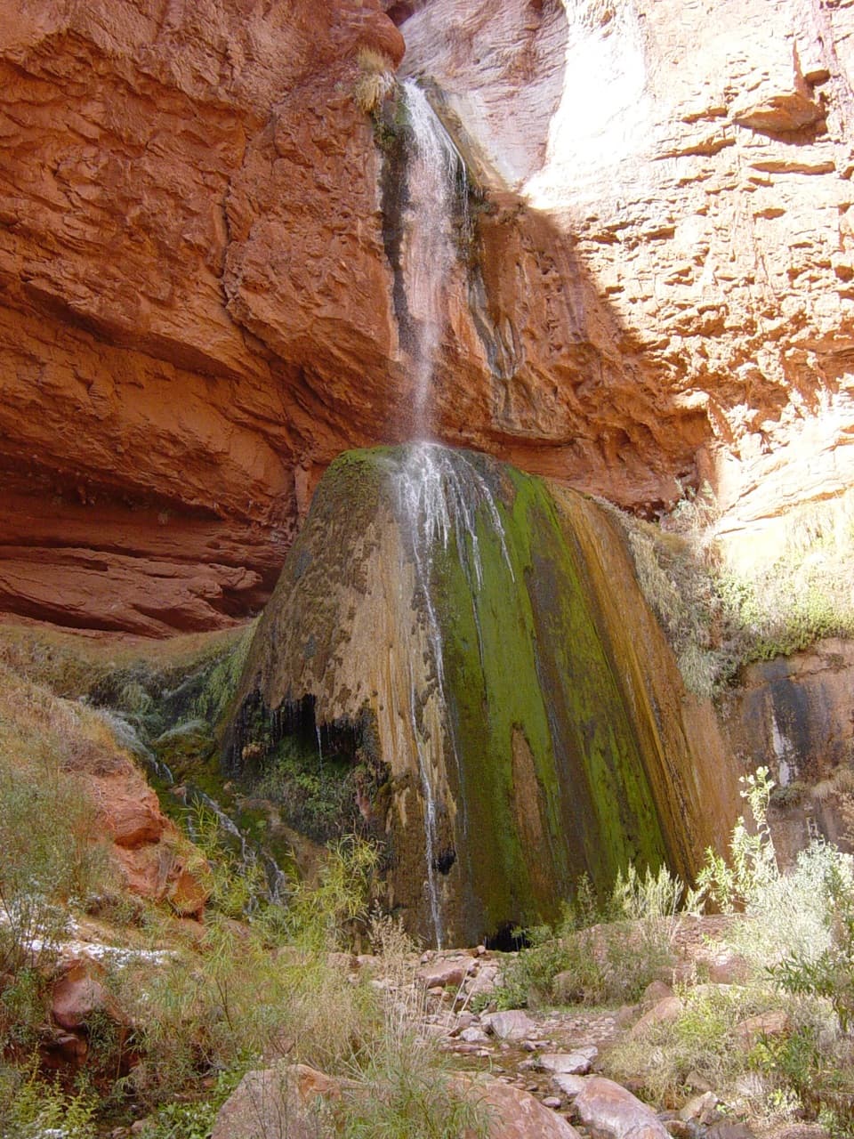 ModerateRibbon Falls Trail from Cottonwood Campground3.2 mi · 2.3 hr · 6.1 mi awayA short inner-canyon walk to a spring-fed travertine waterfall
 ChallengingTonto Trail95 mi · 3.7 days · 6.2 mi awayA 95-mile traverse along the canyon’s dry middle bench.
 Sight · 0.1 mi awayWalhalla Glades PuebloA short walk to a 900-year-old pueblo home site.
 Sight · 0.1 mi awayWalhalla OverlookA broad Unkar Delta view, with a pueblo across the road.
 Sight · 1 mi awayAngels WindowThe Colorado River framed through a natural arch.
 Sight · 1.2 mi awayCape RoyalA 23-mile North Rim drive opens onto a 270-degree canyon view.Sight · 2 mi awayCape FinalA 4.2-mile forest hike ends with a wide canyon panorama.
 Sight · 5.9 mi awayRoosevelt PointA short walk finishes at an east-facing canyon panorama.
 Campground · 6.1 mi awayCottonwood CampgroundSleep beneath the canyon walls beside Bright Angel Creek.
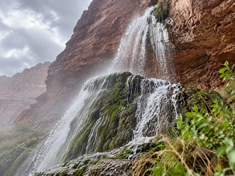 Sight · 6.6 mi awayRibbon FallsA shaded waterfall and pool deep in the inner canyon.
Parkwolf’s Grand Canyon ranking

The audio tour guide for the drive, plus offline maps, trails, and wildlife heatmaps for when the signal drops.




