Schmutz Spring Trail in Grand Canyon National Park

Grand Canyon National Park, AZ

Schmutz Spring Trail

A steep 1,300-foot descent into Tuckup, with a long dirt-road drive.

Length
4.2mi
Time
4hr
Elev. change
1,371ft
Difficulty
Challenging
  • No dogs
  • High point 5,823 ft
Parkwolf audio tour79 stories across Grand Canyon’s roads

Overview

About Schmutz Spring Trail

Why go

  • A direct route into a little-visited Esplanade bench
  • Established path with a clear descent to Tuckup

Heads up

  • About 1,300 feet of climbing on the return
  • Very remote dirt-road access and no dependable water

Map & elevation

The route

Loading the Grand Canyon map
Full map
Elevation4,452–5,823 ft
TrailheadSchmutz Spring Trailhead36.33926, -112.92715
Keep this map with you offline in the Parkwolf app

Plan your hike

Before you go

Parking

Use the Schmutz Spring Trailhead near the head of Tuckup Canyon. It takes a long dirt-road drive to reach; trip accounts describe more than one approach, including from AZ 389 and Mount Trumbull Road. Confirm the exact current route and vehicle requirements with the land managers before departure. No services are documented at the trailhead.

Safety

The route drops about 1,300 feet and requires the same climb back. Shade and dependable water are scarce; heat and monsoon storms are serious hazards. The spring is off trail and its flow is unreliable. Pets are prohibited below the rim. Day-use access permits may apply if entering through Tuweep; overnight backcountry camping requires a permit.

4 active Grand Canyon alerts

  • ClosureInner Canyon and North Rim trail closuresDo not enter the closed trails, bridges, campgrounds, and inner-canyon areas.Official details
  • ClosureNorth Rim scenic roads closed for repairsCape Royal Road and Point Imperial Road are closed from sunset October 15 through sunrise November 3, 2026. - The roads are closed to accommodate critical road repair and rehabilitation work.Official details
See all 4 alerts
A park ranger sits on a dash-mounted phone, talking, as Parkwolf’s Tour Guide plays “Army Cutworm Moths: A Grizzly Bear Buffet” on Grand Loop Road below Dunraven Pass in Yellowstone
Parkwolf Tour GuideThe highest, rockiest slopes around here are a summer buffet for grizzly bears.

Grand Canyon Tour Guide

Your drive to Schmutz Spring Trail, narrated.

Parkwolf is a GPS audio tour guide for Grand Canyon National Park. As you drive, it chimes in with what’s ahead: hidden gems, upcoming stops, history, geology, and wildlife, right through your car’s speakers.

See the Grand Canyon audio tour
  • 79 audio storiesacross Grand Canyon’s roads, triggered by GPS as you drive
  • Wildlife heatmapsfor California Condor, Bighorn Sheep, American Bison, and 13 more
  • Works offlinemaps, 73 trails, 96 places, and audio download before you lose signal
  • CarPlay readysimple controls built for the drive
★★★★★
“Fantastic app with many points of information… It’s great to just turn on while you’re driving and it gives you an audio tour of the national Park. We love it!!!!”
JMJamesApp Store review
Download Parkwolf on the App StoreGet Parkwolf on Google Play

4.7 from 8,600+ ratings

Trail guide

Hiking Schmutz Spring Trail

The hikeSchmutz Spring Trail follows a named path from the Schmutz Spring Trailhead down to the…

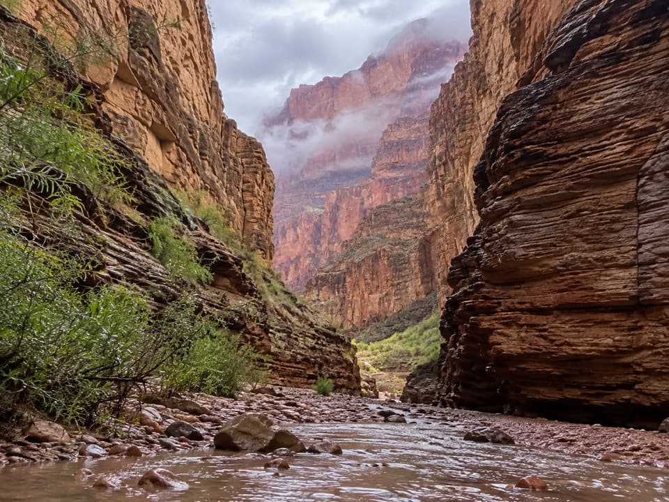
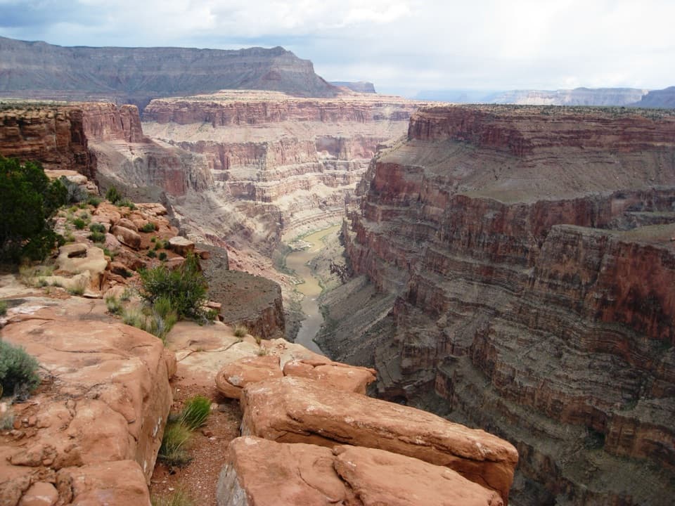
Schmutz Spring Trail follows a named path from the Schmutz Spring Trailhead down to the Esplanade, where it meets the Tuckup Trail. The descent is about 2.1 miles one way; retrace it for a 4.2-mile out-and-back and allow around four hours. It drops about 1,300 feet, all of which you climb back. Choose it for a remote walk into the quieter Esplanade country, not as a quick roadside stop.

Down to the EsplanadeThe trail is established on the descent, but this is rugged canyon country rather than a…

The trail is established on the descent, but this is rugged canyon country rather than a maintained park stroll. Near the bottom, the path crosses the debris-covered Esplanade bench before reaching the Tuckup junction. Turn around there for the mapped Schmutz route. Continuing on Tuckup is a separate, longer backcountry itinerary that needs its own planning.

The spring and dry countrySchmutz Spring is off the mapped trail near Steck’s Rock.

Schmutz Spring is off the mapped trail near Steck’s Rock. It has been a hidden pool on some visits and only wet ground or a few drips on others, so do not count on it for water. Shade is scarce and the open canyon is unforgiving in heat; carry all the water you need and avoid setting out when storms threaten.

Getting thereThe trailhead is reached by a long dirt-road approach, and trip accounts describe more than one…

The trailhead is reached by a long dirt-road approach, and trip accounts describe more than one route in. Confirm the current road, vehicle, and access-permit requirements with the land managers before driving; there are no services at the trailhead. Pets are not allowed below the canyon rim. Day hikes do not require a backcountry permit, but overnight camping does; if your approach enters the Tuweep area, its separate advance day-use permit applies.

Wildlife

Wildlife in Grand Canyon

All Grand Canyon wildlife maps

Sighting maps show where each species has been reported across Grand Canyon. Wildlife moves, so no sighting is guaranteed.

Parkwolf’s Grand Canyon ranking

Top-rated trails in Grand Canyon

All 73 trails
  1. 1Rim-to-Rim: North Kaibab to Bright AngelChallenging · 23.5 mi
  2. 2South Kaibab TrailChallenging · 6.3 mi
  3. 3Bright Angel TrailChallenging · 7.8 mi
  4. 4Rim TrailModerate · 12.8 mi
  5. 5Rim-to-Rim: South Kaibab to North KaibabChallenging · 21 mi
  6. 6Cape Royal TrailEasy · 0.8 mi

Take Parkwolf to Grand Canyon.

The audio tour guide for the drive, plus offline maps, trails, and wildlife heatmaps for when the signal drops.

4.7 from 8,600+ ratings

Download Parkwolf on the App StoreGet Parkwolf on Google Play