Poorpa Yanyeen Meerreeng Timboon–Port Campbell Trail in Great Ocean Road

Great Ocean Road, VIC

Poorpa Yanyeen Meerreeng Timboon–Port Campbell Trail

A 19.3 km crossing from dairy country to the Southern Ocean.

Length
19.3km
Time
4.8hr
Elev. change
122m
Difficulty
Moderate
  • Dogs allowed
  • High point 127 m
Parkwolf audio tour181 stories across Great Ocean Road’s roads

Overview

About Poorpa Yanyeen Meerreeng Timboon–Port Campbell Trail

Why go

  • Wet forest, dairy country and coastal scenery make the long walk varied.
  • Paaratte and the on-route café break up the crossing.

Heads up

  • The 19.3 km one-way distance needs transport at both ends.

Map & elevation

The route

Loading the Great Ocean Road map
Full map
Elevation5–127 m
TrailheadTimboon Trailhead, Lambert Street by the swimming pool-38.48576, 142.98094
Keep this map with you offline in the Parkwolf app

Plan your hike

Before you go

Parking

Start beside the Timboon swimming pool on Lambert Street. At the Port Campbell end, use the Desaily Street trailhead; parking is listed at the Recreation Reserve. Water is listed at the Timboon station and Port Campbell BBQ area, with toilets near Timboon Ice Creamery and at the Port Campbell end.

Safety

This is a 19.3 km one-way commitment, not a loop; arrange transport between Timboon and Port Campbell. The wide trail is shared with cyclists, and most of its surface is crushed gravel.

7 active Great Ocean Road alerts

  • ClosureLorne-area walking trails closed after flood and storm damageSeveral walking trails near Lorne remain closed; do not enter closed tracks. - Phantom Falls Walk is temporarily closed because flood and storm damage affected the trail and structures.Official details
  • ClosureWye Road closed after storm and flood damageWye Road is closed until further notice for road maintenance and repairs following storm and flood damage; do not use the road. Check current Great Otway National Park conditions before travelling.Official details
See all 7 alerts
A park ranger sits on a dash-mounted phone, talking, as Parkwolf’s Tour Guide plays “Army Cutworm Moths: A Grizzly Bear Buffet” on Grand Loop Road below Dunraven Pass in Yellowstone
Parkwolf Tour GuideThe highest, rockiest slopes around here are a summer buffet for grizzly bears.

Great Ocean Road Tour Guide

Your drive to Poorpa Yanyeen Meerreeng Timboon–Port Campbell Trail, narrated.

Parkwolf is a GPS audio tour guide for Great Ocean Road. As you drive, it chimes in with what’s ahead: hidden gems, upcoming stops, history, geology, and wildlife, right through your car’s speakers.

See the Great Ocean Road audio tour
  • 181 audio storiesacross Great Ocean Road’s roads, triggered by GPS as you drive
  • Wildlife heatmapsfor Koala, Kangaroo, Little Penguin, and 13 more
  • Works offlinemaps, 109 trails, 99 places, and audio download before you lose signal
  • CarPlay readysimple controls built for the drive
★★★★★
“Fantastic app with many points of information… It’s great to just turn on while you’re driving and it gives you an audio tour of the national Park. We love it!!!!”
JMJamesApp Store review
Download Parkwolf on the App StoreGet Parkwolf on Google Play

4.7 from 8,600+ ratings

Trail guide

Hiking Poorpa Yanyeen Meerreeng Timboon–Port Campbell Trail

The full crossingPoorpa Yanyeen Meerreeng is a 19.

Poorpa Yanyeen Meerreeng is a 19.3 km one-way, shared-use trail from Lambert Street in Timboon to Desaily Street at Port Campbell. It moves from wet forest and rolling dairy country through coastal heath and wetland, finishing above Port Campbell Bay and the Southern Ocean. The grade is gentle, but the distance makes this a full-day walk: allow about five hours, within the published 3.5-to-6-hour range. Start in Timboon if you want the coast to arrive as the payoff rather than walking away from it.

Set up the one-way walkThere is no loop, so arrange a pickup or other transport between the towns before you start.

There is no loop, so arrange a pickup or other transport between the towns before you start. The Timboon trailhead is beside the swimming pool on Lambert Street; at the Port Campbell end, the trail starts by Desaily Street, with parking at the Recreation Reserve. Water is available at the Timboon station and Paaratte, and toilets are listed near the Timboon Ice Creamery and at Paaratte. Dogs are allowed on lead. The route is also used by cyclists, so expect to share the wide track.

If you want a shorter version, walk about 12 km return from Timboon to Schulz Organic Creamery & Café. It is on the route and makes a natural halfway turn-around for a shorter day.

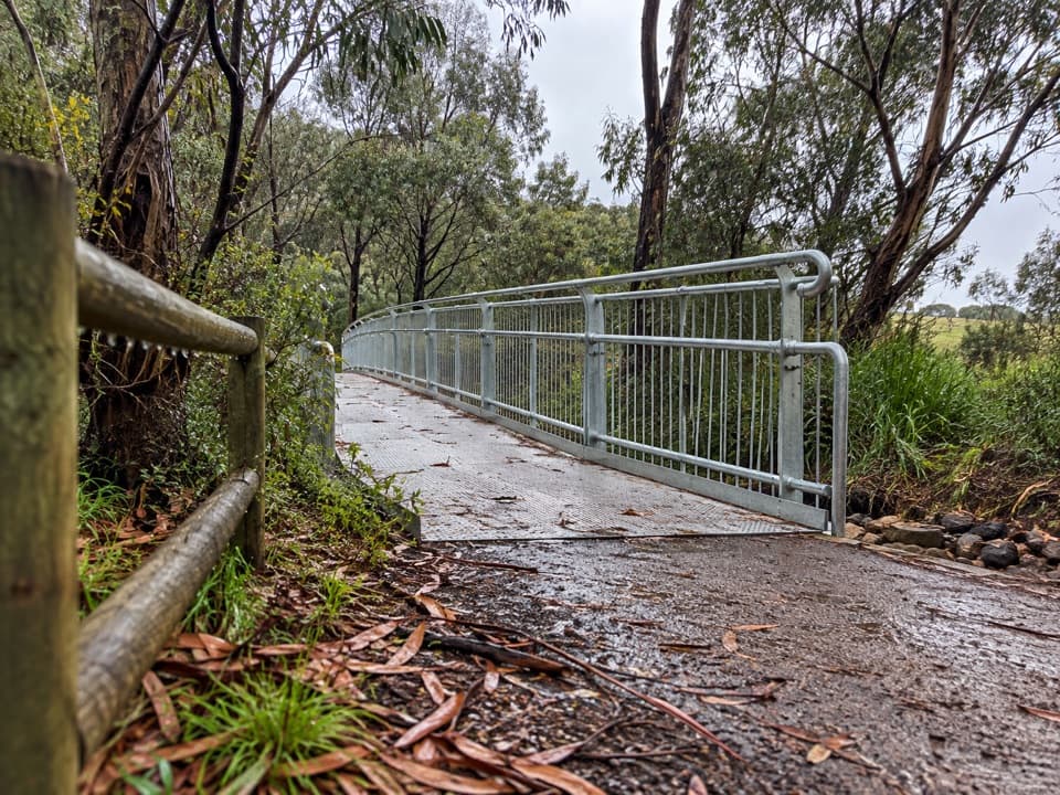
Timboon to PaaratteFrom Power Creek Reserve, the first 8 km pass through tall wet forest and along the edge of…

From Power Creek Reserve, the first 8 km pass through tall wet forest and along the edge of farms. Most of the trail is crushed gravel, with boardwalks and bridges across wet ground and underpasses where the path goes beneath farm access. Short informal creekside tracks branch away and rejoin; keep to the signed main route. Koalas are sometimes seen near Power Creek, though a sighting is never guaranteed. Schulz Organic Creamery & Café is an on-route stop for coffee and house-made treats.

Paaratte toward the coastPaaratte Recreation Reserve is a useful rest stop with water, toilets, picnic facilities and a…

Paaratte Recreation Reserve is a useful rest stop with water, toilets, picnic facilities and a toolkit. The trail then undulates along the forest edge through farmland. Cattle overpasses mark changes in the view as the route moves into lower coastal forest and heath. The ocean first comes into view around North South Road, then opens out as taller trees give way to coastal plants. Paaratte’s shelter shed and remnant tennis courts belonged to a larger local precinct that once included Paaratte School.

The Port Campbell finishThe final 1.

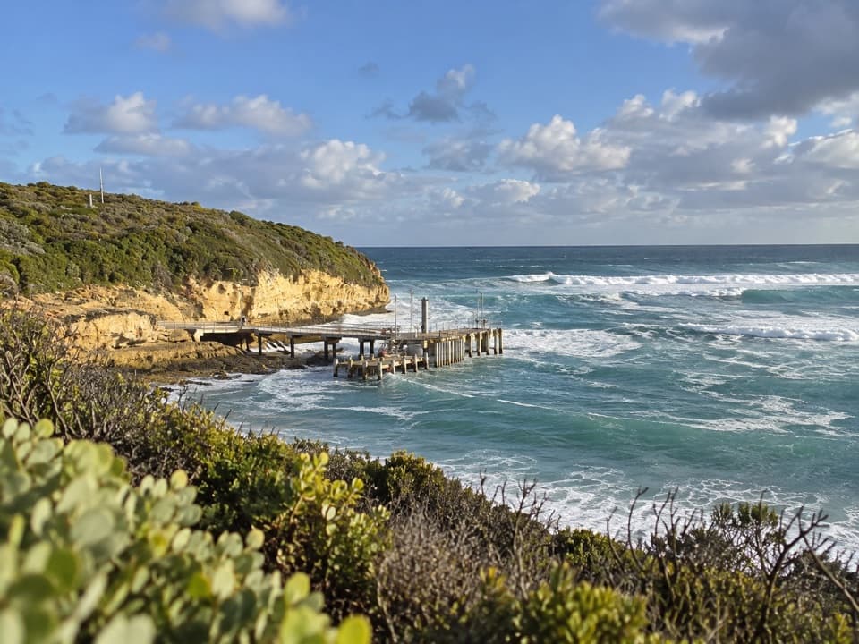
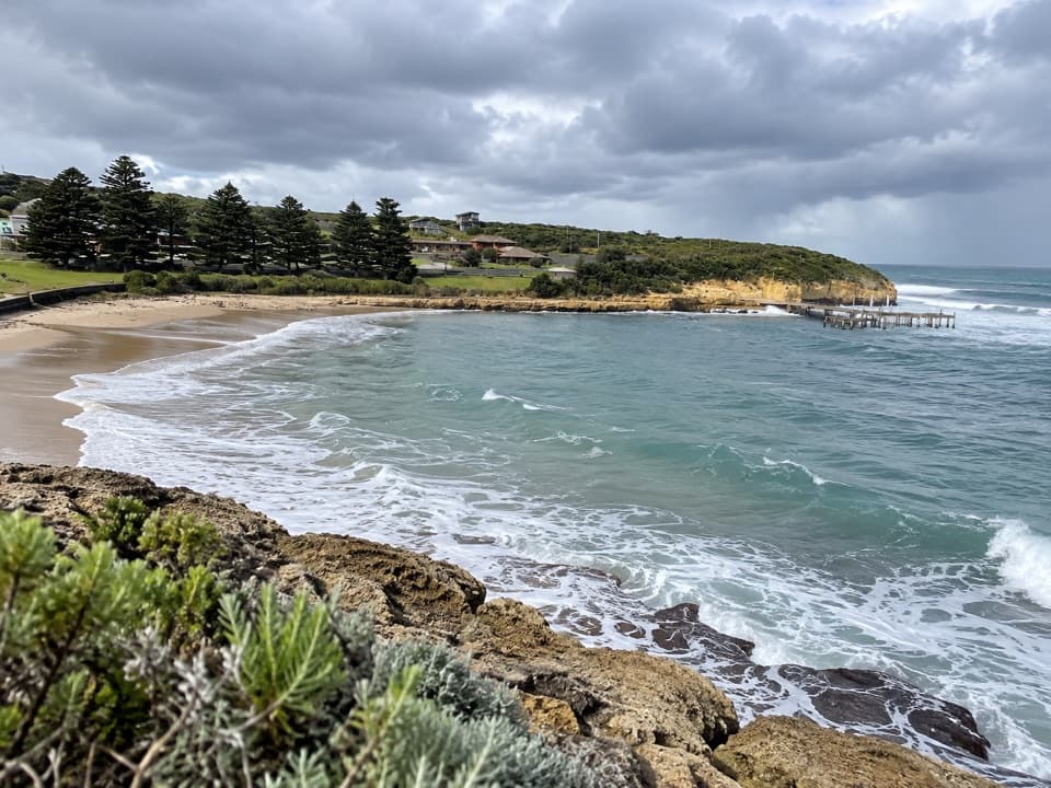
The final 1.5 km changes to paved path and boardwalk through wetland toward town, with elevated sections above the coastal landscape. A short spur near the bike rack looks over sheltered Port Campbell Bay and the Southern Ocean. About 300 m along the track, a left turn leads down steps and across a suspension bridge as a shortcut into town. The 4 km Port Campbell Discovery Walk follows the eastern headland separately; it is an optional add-on, not part of this 19.3 km crossing.

A name for travelling through CountryThe trail crosses Keerray Wooroong Country.

The trail crosses Keerray Wooroong Country. Eastern Maar Aboriginal Corporation chose Poorpa Yanyeen Meerreeng, a Kirrae Whurrong name meaning “travel through Country.” The route was first known as the Twelve Apostles Trail during the project, but its current endpoint is Port Campbell; it does not continue to the Twelve Apostles. Carry that distinction into your plans, especially if you are looking for a way to walk the coast farther west.

Wildlife

Wildlife in Great Ocean Road

All Great Ocean Road wildlife maps

Sighting maps show where each species has been reported across Great Ocean Road. Wildlife moves, so no sighting is guaranteed.

Keep exploring

Near Poorpa Yanyeen Meerreeng Timboon–Port Campbell Trail

See it all on the map

Trails that start nearby

Places near the trailhead

Parkwolf’s Great Ocean Road ranking

Top-rated trails in Great Ocean Road

All 109 trails
  1. 1Great Ocean WalkChallenging · 100 km
  2. 2Maits Rest Rainforest WalkEasy · 0.8 km
  3. 3Triplet Falls WalkModerate · 2 km
  4. 4Hopetoun Falls WalkModerate · 0.8 km
  5. 5Erskine Falls WalkModerate · 0.7 km
  6. 6Surf Coast WalkChallenging · 41.5 km

Take Parkwolf to Great Ocean Road.

The audio tour guide for the drive, plus offline maps, trails, and wildlife heatmaps for when the signal drops.

4.7 from 8,600+ ratings

Download Parkwolf on the App StoreGet Parkwolf on Google Play