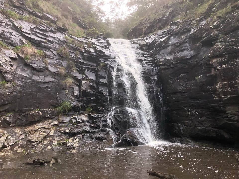
Parking
Use the signed Falls Carpark on Phillips Track, reached via C155 from Gellibrand. The shared Triplet Falls Picnic Area has toilets and picnic tables.

#3 of 109 trails in Great Ocean Road
Great Ocean Road, VIC
Three cascades, old sawmill relics and a stair-heavy rainforest loop.
Overview
Map & elevation
Plan your hike

The highest, rockiest slopes around here are a summer buffet for grizzly bears.
Great Ocean Road Tour Guide
Parkwolf is a GPS audio tour guide for Great Ocean Road. As you drive, it chimes in with what’s ahead: hidden gems, upcoming stops, history, geology, and wildlife, right through your car’s speakers.
See the Great Ocean Road audio tourRecorded for this trailhead
Triplet Falls“You're approaching Triplet Falls, where a rainforest loop leads to three cascades among tree ferns. Allow about an hour for the two-kilometre circuit, with plenty of stairs and a climb back out.”
Plays as you drive up to this trailhead in the Parkwolf Great Ocean Road Tour Guide.
More stories near here in the app
“Fantastic app with many points of information… It’s great to just turn on while you’re driving and it gives you an audio tour of the national Park. We love it!!!!”


Trail guide
Triplet Falls Walk is a 2 km (1.24 mi) rainforest circuit, officially about an hour, from the signed Falls Carpark on Phillips Track. A short shared approach takes you to the loop and is retraced at the end. The trail winds through tall Mountain Ash and tree ferns on steps and elevated walkways, then brings you to platforms above Youngs Creek for views of the lower and upper cascades. I’d choose it for a short waterfall walk with a real forest story; just don’t mistake the distance for an easy stroll.
This is a stair-heavy walk. The steps descend through wet ferny gullies, then climb back out; repeated flights make the return feel harder than the 2 km suggests. Visitors often mention the stair climb, and several say the steps can be slippery when wet. Allow the full hour if you stop at the platforms, and more if stairs usually slow you down. Elevated walkways carry you over parts of the forest floor, where mosses and fungi help maintain the rainforest. Stay on the track rather than stepping down to look closely.
Listen for water as you circle toward the falls. The viewing platforms show different parts of Triplet Falls, including the upper and lower cascades; keep going past the first deck instead of turning around there. The walk stays above and back from the creek, so this isn’t a water-level visit. Ferns and other vegetation frame parts of the view, which can feel more distant than the name suggests. After rain, Youngs Creek runs more strongly and the falls are more impressive, but flow varies with conditions.
The waterfall isn’t the only reason to take this loop. It passes the site of a former timber mill, with log carts and other mill artefacts still beside the track. Interpretation signs tell the story as you walk, and the contrast is striking: the forest has reclaimed a working site, while the Mountain Ash overhead can be more than 200 years old. Their seeds are about the size of a grain of sand. Tree ferns, moss and fungi fill the understory; take in the detail from the track so the fragile forest floor stays intact.
Youngs Creek feeds the falls from Weeaproinah, which receives almost two metres of rain in an average year, the highest average in Victoria. That wet climate helps explain the damp rainforest and why the sound of the falls reaches you before the viewing decks open up. If the creek is running hard after rain, the cascades stand out more clearly among the trees; a dry spell can make them less dramatic.
The Triplet Falls Picnic Area has parking, toilets and picnic tables. Dogs are not allowed in the national park. Little Aire Falls shares the access but is a separate 2.5 km return walk, estimated at 2.5 hours, following an old logging winch line to an 8 m viewing platform. Add it only if you want another rainforest walk; keep its extra distance and time separate from the Triplet Falls circuit.
Wildlife
 900 sightingsKoalaMost seen around 5 PMSighting map
 358 sightingsKangarooMost seen around 6 PMSighting map
 49 sightingsLittle PenguinMost seen around 8 PMSighting map
 155 sightingsEchidnaMost seen around 6 PMSighting map
 33 sightingsFur SealMost seen around 6 PMSighting map
 59 sightingsRed-necked WallabyMost seen around 6 AMSighting map
Sighting maps show where each species has been reported across Great Ocean Road. Wildlife moves, so no sighting is guaranteed.
Keep exploring
 ModerateLittle Aire Falls Walk2.5 km · 2.5 hr · 1.1 km awayA fern-lined climb to an elevated waterfall platform.
 ModerateOtway Fly Treetop Walk2.4 km · 1 hr · 2.5 km awayA gently swaying steel walkway climbs into the rainforest canopy.
 ModerateHopetoun Falls Walk0.8 km · 36 min · 6.3 km awayA short descent through tree ferns reaches a 30-metre waterfall.
 ModerateBeauchamp Falls Walk3 km · 1.3 hr · 9.9 km awayA ferny descent to a 20-metre falls, with a steep climb back.
 EasyMaits Rest Rainforest Walk0.8 km · 30 min · 10.8 km awayA quick boardwalk loop through giant fern gullies and old rainforest.
 ModerateMadsen’s Track Nature Walk1.4 km · 42 min · 11.3 km awayA shaded river loop through rainforest to Anne’s Cascades.
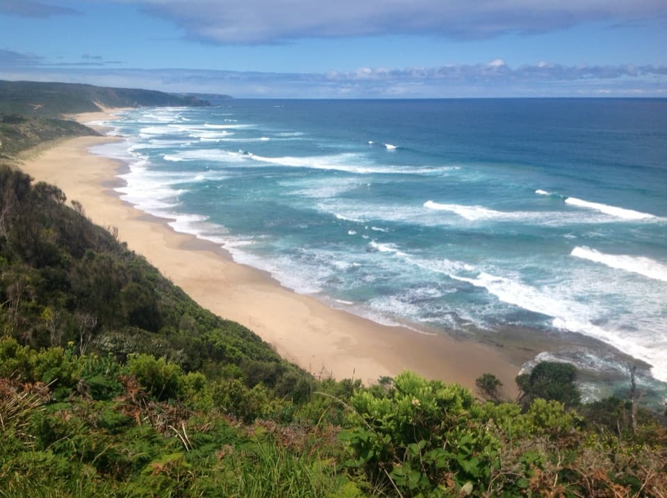 ModerateCastle Cove to Johanna Beach Walk7 km · 2.5 hr · 13.7 km awayFrom clifftop bush to Johanna’s beach and river crossing.
 ModerateAire River to Johanna Beach Walk13.8 km · 5.3 hr · 14.7 km awayCoastal heath, Castle Cove, and a long beach finish.Sight · At the trailheadTriplet FallsRainforest boardwalks and three cascades at a former mill site.
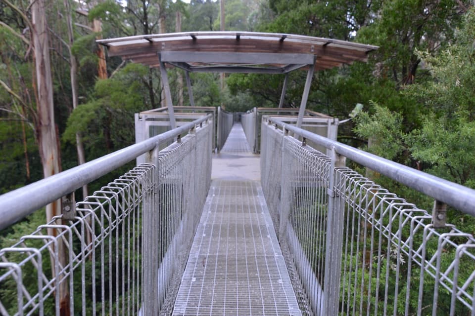 Sight · 2.5 km awayOtway Fly Treetop AdventuresWalk above the canopy, then climb the Spiral Tower.
 Sight · 6.4 km awayHopetoun FallsTree ferns frame a waterfall; the lower view takes 200 stairs.
 Sight · 7.4 km awayThe RedwoodsA tall, quiet redwood grove beside the Aire River.Sight · 10.4 km awayBeauchamp FallsA bright, fern-framed cascade reached by a forest walk
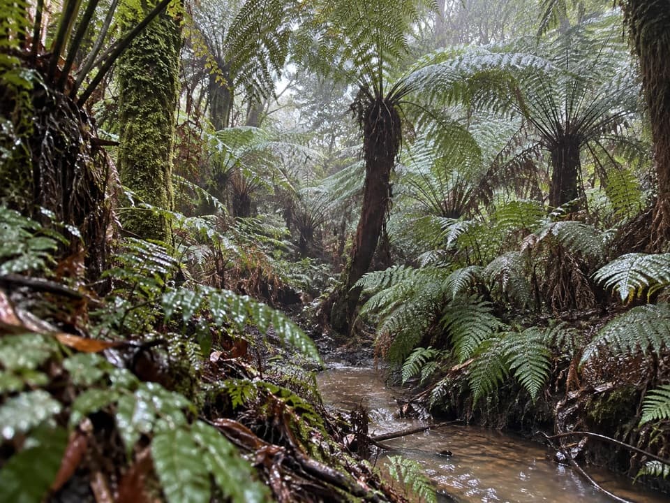 Sight · 10.8 km awayMaits Rest Rainforest WalkA shady boardwalk loop through fern gullies and giant old trees.Sight · 11.3 km awayMelba Gully Day Visitor AreaA short rainforest loop; glow worms may show after dark.
 Campground · 14.2 km awayJohanna Beach CampgroundA grassy coastal base a short walk from Johanna Beach.
Parkwolf’s Great Ocean Road ranking

The audio tour guide for the drive, plus offline maps, trails, and wildlife heatmaps for when the signal drops.