Parking
Start at the signed Nature Walk / The Canyon Walk beside the information board at Sheoak Picnic Ground. For the shorter point-to-point option, stage a pickup car at Allenvale Mill Car Park beside the camping area on Allenvale Road.
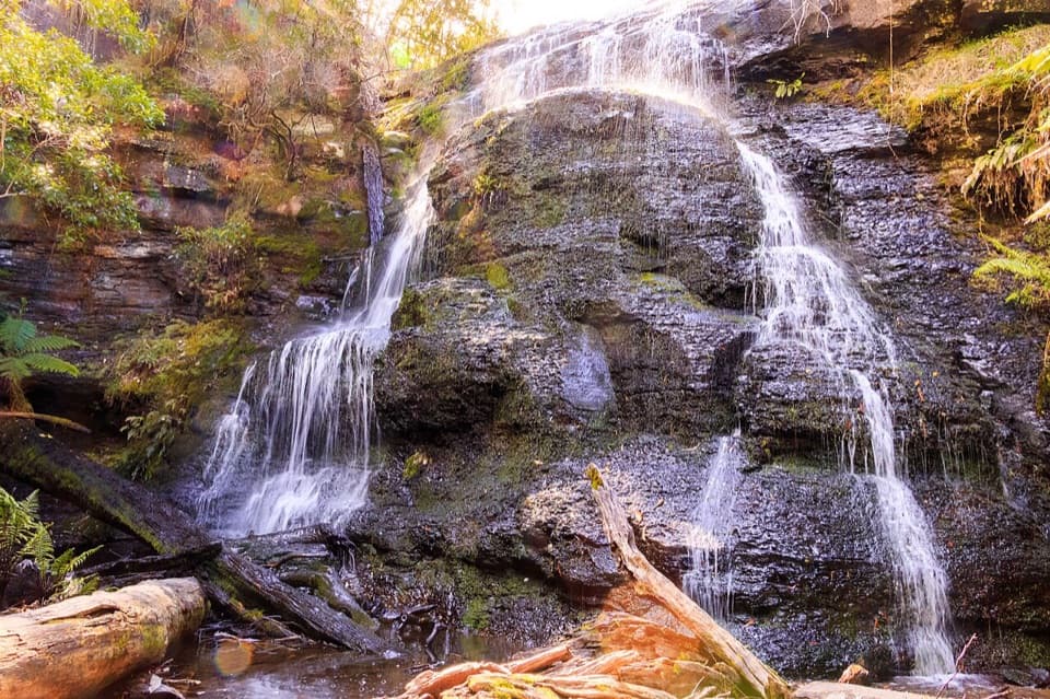
Great Ocean Road, VIC
Three waterfalls and a mossy rock cleft, linked in one rugged loop.
Overview
Map & elevation
Plan your hike

The highest, rockiest slopes around here are a summer buffet for grizzly bears.
Great Ocean Road Tour Guide
Parkwolf is a GPS audio tour guide for Great Ocean Road. As you drive, it chimes in with what’s ahead: hidden gems, upcoming stops, history, geology, and wildlife, right through your car’s speakers.
See the Great Ocean Road audio tourRecorded for this trailhead
Sheoak Picnic Area“You're nearing Sheoak Picnic Area, a shaded clearing among tall eucalypts where you can stop for lunch without committing to a waterfall hike. Bring your own picnic and use the tables or roofed barbecue shelter.”
Plays as you drive up to this trailhead in the Parkwolf Great Ocean Road Tour Guide.
More stories near here in the app
“Fantastic app with many points of information… It’s great to just turn on while you’re driving and it gives you an audio tour of the national Park. We love it!!!!”


Trail guide
The Canyon Circuit is an 8.5 km (5.3 mi) loop from Sheoak Picnic Ground, usually allowed about three hours. It links Won Wondah Falls, Henderson Falls, The Canyon and Phantom Falls, then returns from Allenvale along Garvey Track. The route is a worthwhile half-day for the mix of waterfalls, ferny forest and a narrow rocky passage, but expect a demanding walk rather than a gentle picnic stroll. The full loop length includes the return to Sheoak; a second car at Allenvale makes a shorter point-to-point finish.
Begin by the information board and follow the signed Nature Walk through a ferny glade and across Sheoak Creek. The path joins Garvey Track, crosses it and Sharps Track, then follows the Henderson Creek valley. A short right-hand spur reaches the Won Wondah Falls lookout; the cascade can be partly screened by overhanging plants. Return to the main path and continue about 500 m to Henderson Falls, where water runs across a dark, mossy rock wall. Look for the Mountain Ash near the second bridge.
Follow the signs from the falls junction toward The Canyon. The track climbs and crosses a small creek before entering a rocky cleft with walls about 10 m high. This is the most uneven part: the passage winds around moss-covered boulders and the rock underfoot can make progress slower. Take time to look up through the cleft; its close walls make the route feel very different from the open creekside sections. The high rock walls also make a strong frame for a photograph, while the Won Wondah lookout gives a view through the foliage.
After The Canyon, the path eases for roughly 2 km toward Phantom Falls, then descends about 1.5 km to Allenvale Mill Car Park. Water flow varies at the falls, so the rock amphitheatre is part of the payoff even when the cascade is slight. If you have left a pickup car at Allenvale, the walk can finish there. Without a shuttle, follow Garvey Track for about 2 km back to Sheoak to complete the circuit represented by this distance.
The route is rated moderate to difficult, with steep, rocky stretches; mud is possible and walking poles can help. Allow time for the uneven ground and the waterfall detours rather than treating three hours as a sightseeing allowance. Sheoak Picnic Ground has toilets, an information board, picnic tables and gas barbecues. Dogs are not permitted on roads, tracks or trails in the Lorne area of the national park. The forest's water and vegetation often bring bird calls; Pied Currawong, New Holland Honeyeater and White-throated Treecreeper are among the species noted along this route.
Wildlife
 900 sightingsKoalaMost seen around 5 PMSighting map
 358 sightingsKangarooMost seen around 6 PMSighting map
 49 sightingsLittle PenguinMost seen around 8 PMSighting map
 155 sightingsEchidnaMost seen around 6 PMSighting map
 33 sightingsFur SealMost seen around 6 PMSighting map
 59 sightingsRed-necked WallabyMost seen around 6 AMSighting map
Sighting maps show where each species has been reported across Great Ocean Road. Wildlife moves, so no sighting is guaranteed.
Keep exploring
 EasyLower Kalimna Falls Walk6.5 km · 2.5 hr · At the trailheadA ferny creek walk to a waterfall with a cave-like overhang.
 ModerateSheoak Falls–Castle Rock Circuit9.4 km · 3.5 hr · At the trailheadCreekside forest, Swallow Cave, Sheoak Falls and a coastal lookout.EasyWon Wondah and Henderson Falls Walk3.6 km · 1.5 hr · At the trailheadTwo waterfalls, a giant eucalypt, and a ferny gully at the end.
 ModerateCastle Rock Walk7 km · 3 hr · At the trailheadSteep forest climb to a rugged coastal lookout above Cumberland River.
 EasySheoak Picnic Ground Nature Walk1.3 km · 30 min · At the trailheadA fern-gully loop with tall gums and a suspension bridge
 ModerateAllenvale Mill to Phantom Falls Walk3.5 km · 1.5 hr · 1.5 km awayA riverside climb to falls framed by tree ferns.
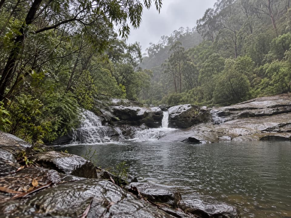 ModerateCumberland River Trail6 km · 4 hr · 2.3 km awayA waterfall walk that turns into a rocky scramble above Jebb’s Pool.
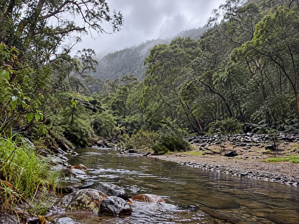 ModerateCumberland River–Jebbs Pool Walk3 km · 1.5 hr · 2.3 km awayA short gorge walk with rock pools and a river crossing.
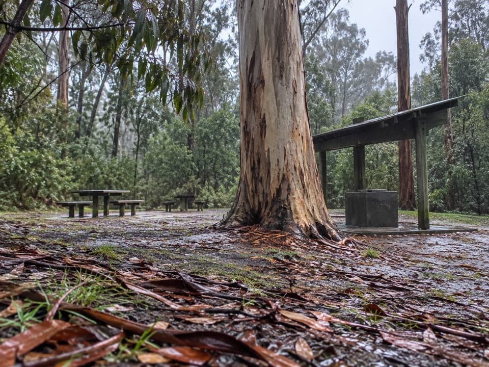 Picnic area · At the trailheadSheoak Picnic AreaA shaded eucalypt picnic stop and base for waterfall walks.
 Sight · 0.6 km awayWon Wondah FallsA small, often screened cascade on the walk to Henderson Falls.Sight · 1 km awayHenderson FallsA fern-framed waterfall reached by a forest walk from Sheoak.
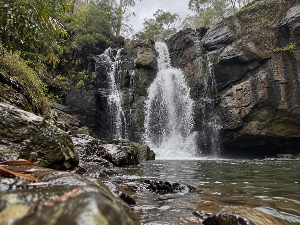 Sight · 1.4 km awayPhantom FallsA forest walk to a waterfall that runs strongest after rain.
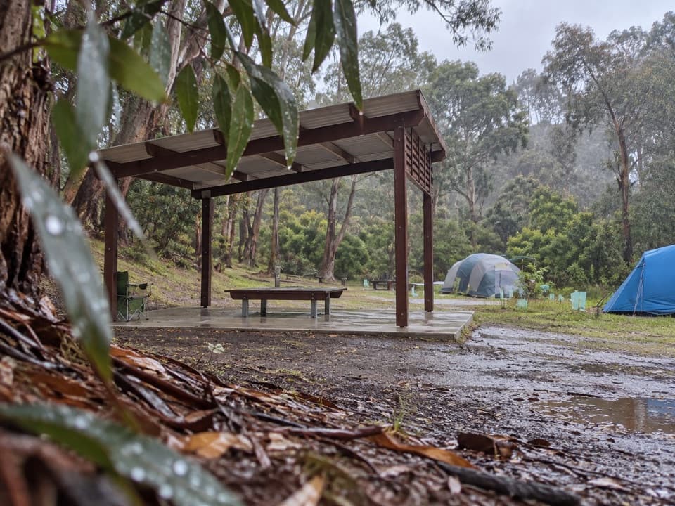 Campground · 1.5 km awayAllenvale CampgroundTwenty tent sites beside the St George River; carry your gear in.
 Sight · 2.1 km awaySheoak FallsA short walk leads to a waterfall whose flow follows the rain.
 Campground · 2.2 km awayCumberland River Holiday ParkRiverside camping and cabins under a wooded cliff escarpment.Sight · 2.3 km awayLower Kalimna FallsA ferny creek waterfall where you can stand behind the falling water.
Parkwolf’s Great Ocean Road ranking

The audio tour guide for the drive, plus offline maps, trails, and wildlife heatmaps for when the signal drops.





