Medano Lake Trail in Great Sand Dunes National Park

#2 of 17 trails in Great Sand Dunes

Great Sand Dunes National Park, CO

Medano Lake Trail

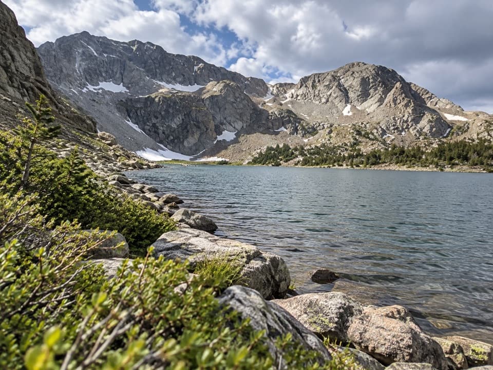
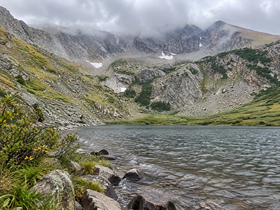
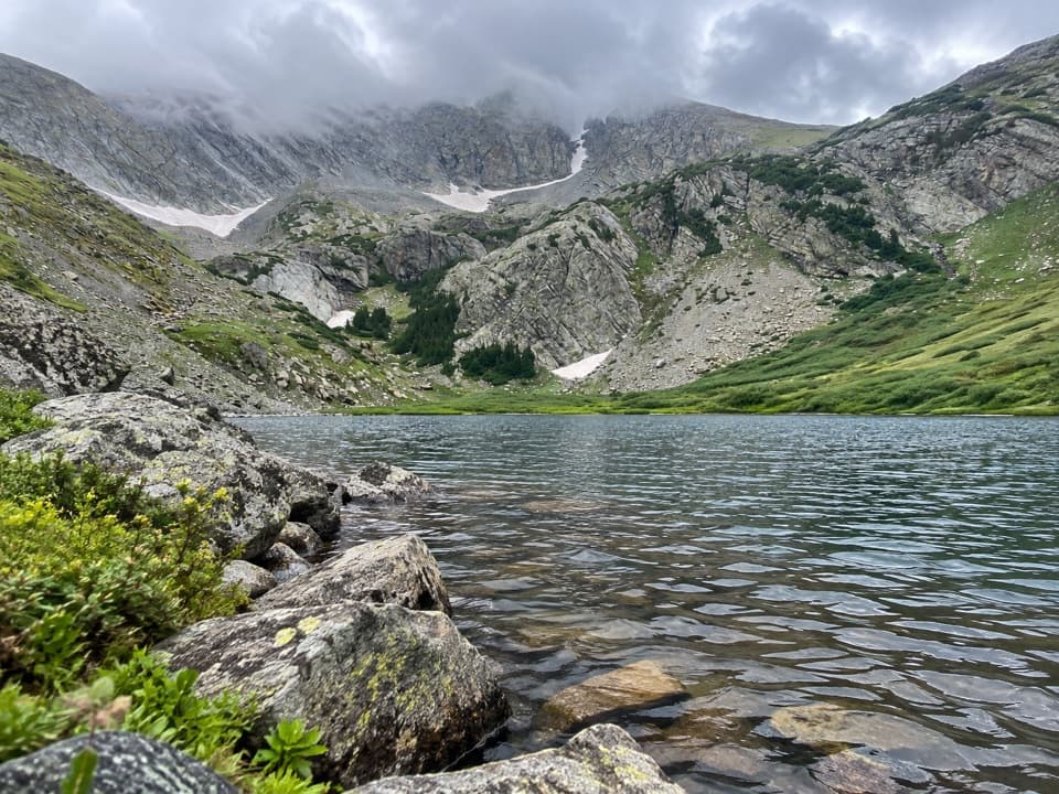
Creekside forest climbs to an alpine lake beneath Mount Herard.

Length
7.4mi
Time
5.5hr
Elev. change
1,952ft
Difficulty
Challenging
  • Dogs allowed
  • High point 11,627 ft

Hear the audio tour

Medano Lake Trailhead

Overview

About Medano Lake Trail

Why go

  • A creek valley, meadows, and a high alpine lake make a varied climb.
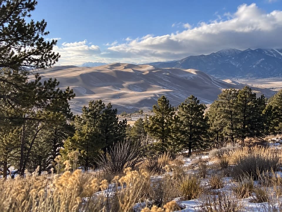
  • The optional ridge above the lake looks back toward the Sand Dunes.

Heads up

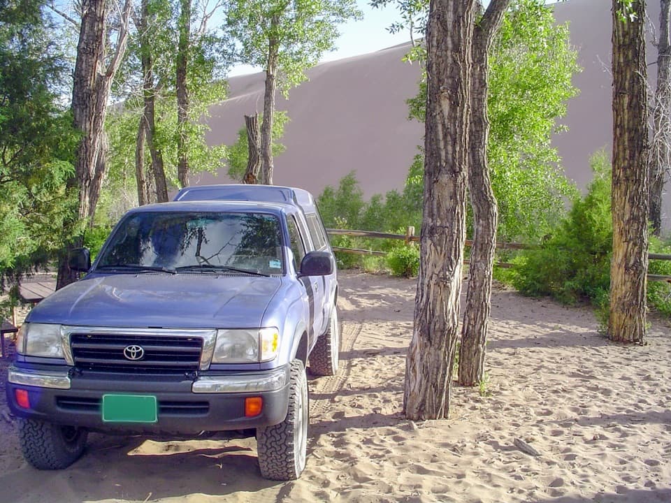
  • Access requires a high-clearance 4WD vehicle with 4-low.
  • The long climb starts near 10,000 feet and reaches exposed high country.
Medano Lake is the natural turnaround: an alpine lake at timberline with Mount Herard’s steep cliffs over the shore. The creek connects this high basin to the dunes below. It begins in snowfields on Herard and is part of the water system that feeds the dunefield. Fishing is permitted in both the creek and the lake. A short climb to the ridge above the lake opens a view back toward the Sand Dunes; that’s an optional side trip, not part of the mapped 7.4-mile route. Add it only if you still have the time and energy for more climbing.
Parkwolf’s verdictThe lake is the payoff

Map & elevation

The route

Loading the Great Sand Dunes map
Full map
Elevation9,675–11,627 ft
TrailheadMedano Lake Trailhead37.85202, -105.43727
Keep this map with you offline in the Parkwolf app

Plan your hike

Before you go

Parking

Follow Medano Pass Primitive Road to mile 10.7 and take the short spur to Medano Lake Trailhead, about half a mile west of Medano Pass. The drive from the visitor center takes about 1.5 hours and requires high-clearance 4WD with 4-low. The road is seasonal. Confirm the visitor-center permit instruction before setting out.

Safety

High elevation and about 2,000 feet of climbing lead to an exposed alpine basin where afternoon lightning and lingering snow are seasonal hazards. The access road requires high-clearance 4WD with 4-low, has deep sand and multiple creek crossings, and has no cell coverage. The Forest Service’s access instructions say to obtain a permit at the visitor center; the National Park Service’s hike guidance does not list a separate day-hiking permit, so confirm before driving in.

2 active Great Sand Dunes alerts

  • CautionSwift, deep water on Medano Pass Primitive RoadMentions Medano Pass Primitive Road, referenced in this guideMedano Pass Primitive Road is open, but heavy rain has created swift water up to 3 feet deep, especially at creek crossings 3, 4, and 5.Official details
  • CautionStage 1 fire restrictionsStage 1 fire restrictions are active throughout Great Sand Dunes; use fires only in designated steel fire rings or picnic-site barbecues.Official details
Great Sand Dunes alerts
A park ranger sits on a dash-mounted phone, talking, as Parkwolf’s Tour Guide plays “Army Cutworm Moths: A Grizzly Bear Buffet” on Grand Loop Road below Dunraven Pass in Yellowstone
Parkwolf Tour GuideThe highest, rockiest slopes around here are a summer buffet for grizzly bears.

Great Sand Dunes Tour Guide

Your drive to Medano Lake Trail, narrated.

Parkwolf is a GPS audio tour guide for Great Sand Dunes National Park. As you drive, it chimes in with what’s ahead: hidden gems, upcoming stops, history, geology, and wildlife, right through your car’s speakers.

Recorded for this trailhead

Medano Lake Trailhead
0:00 / 0:23
“You're approaching the spur to Medano Lake Trailhead, where a long forest climb leads to a lake at timberline beneath Mount Herard.”

Plays as you drive up to this trailhead in the Parkwolf Great Sand Dunes Tour Guide.

More stories near here in the app

  • Medano Pass
  • The Valley's Lost Lake
  • A Creek That Protects Its Trout
  • When the Sand Hums
  • 31 audio storiesacross Great Sand Dunes’s roads, triggered by GPS as you drive
  • Wildlife heatmapsfor Elk, Pronghorn, Wild Turkey, and 13 more
  • Works offlinemaps, 17 trails, 29 places, and audio download before you lose signal
  • CarPlay readysimple controls built for the drive
★★★★★
“Fantastic app with many points of information… It’s great to just turn on while you’re driving and it gives you an audio tour of the national Park. We love it!!!!”
JMJamesApp Store review
Download Parkwolf on the App StoreGet Parkwolf on Google Play

4.7 from 8,600+ ratings

Trail guide

Hiking Medano Lake Trail

The whole climbMedano Lake Trail is an out-and-back to a small alpine lake below Mount Herard, following…

Medano Lake Trail is an out-and-back to a small alpine lake below Mount Herard, following Medano Creek through spruce-fir forest and open meadows. The trailhead-to-lake distance is 3.7 miles each way, so plan on 7.4 miles round trip and about 2,000 feet of climbing for the complete walk. Give it five to six hours; the trail starts near 10,000 feet, so the altitude adds up as much as the mileage. This is the hike to choose if you want a long climb with a lake as the payoff. The mapped route stops at the lake. Mount Herard’s steep summit is a separate continuation beyond it, not part of this distance.

Get to the trailhead firstMedano Lake Trailhead is at the end of a short spur about half a mile west of Medano Pass, at…

Medano Lake Trailhead is at the end of a short spur about half a mile west of Medano Pass, at road mile 10.7. From the visitor center, allow about an hour and a half on Medano Pass Primitive Road. The road is seasonal, typically opening around late May and closing by November as snow and creek levels allow. A high-clearance 4WD vehicle with a 4-low transfer case is required by law; all-wheel drive is not enough. The access road has deep sand and multiple creek crossings, and there’s no cell signal along it. The Forest Service says visitors must get a permit at the visitor center; the National Park Service’s hike guidance doesn’t list a separate day-hiking permit, so confirm the requirement before you head in. There’s no potable water at the trailhead.

Follow Medano Creek uphillFrom the trailhead, the path climbs at a moderate, fairly steady rate beside Medano Creek…

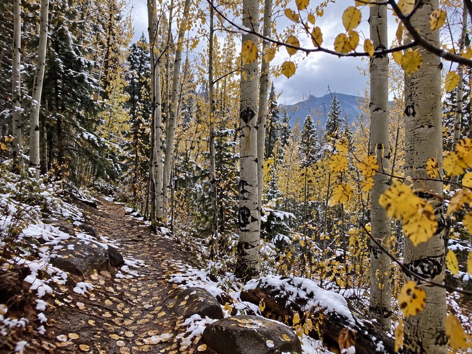
From the trailhead, the path climbs at a moderate, fairly steady rate beside Medano Creek through spruce-fir forest and patches of aspen. The creek valley is shaded and greener than the exposed country around the dunes. Farther up, meadows and thinner trees open the view as you gain elevation, and the route reaches timberline in a basin below Mount Herard. Snowdrifts can linger on the upper trail into June and sometimes July. Summer storms are a real concern once you reach open ground, so start early and set a turnaround time if the weather is building.

Make the return part of the planYou retrace the same creekside trail, so keep enough energy for the second 3.7 miles.

You retrace the same creekside trail, so keep enough energy for the second 3.7 miles. The elevation is high from the start and the upper basin is exposed; the park advises an early summer start to reduce the risk of afternoon lightning, especially for hikers continuing toward Herard. The lake trail and the summit route are different outings: stop at the lake unless you have planned specifically for the much steeper Mount Herard ascent. Dogs are allowed in the Preserve on leash, and the trail stays in the Preserve, so keep them leashed throughout. Road and trail access can be limited by snow and runoff even after summer begins; check with the visitor center before committing to the long drive.

Wildlife

Wildlife in Great Sand Dunes

All Great Sand Dunes wildlife maps

Sighting maps show where each species has been reported across Great Sand Dunes. Wildlife moves, so no sighting is guaranteed.

Keep exploring

Near Medano Lake Trail

See it all on the map

Trails that start nearby

Places near the trailhead

Parkwolf’s Great Sand Dunes ranking

Top-rated trails in Great Sand Dunes

All 17 trails
  1. 1Dunes Overlook TrailModerate · 2 mi
  2. 3Upper Sand Creek Lake TrailChallenging · 7.7 mi
  3. 4Lower Sand Creek Lake TrailChallenging · 8 mi
  4. 5Upper and Lower Sand Creek Lakes HikeChallenging · 9.9 mi
  5. 6Music Pass TrailModerate · 2.2 mi
  6. 7Zapata Falls TrailModerate · 1 mi

Take Parkwolf to Great Sand Dunes.

The audio tour guide for the drive, plus offline maps, trails, and wildlife heatmaps for when the signal drops.

4.7 from 8,600+ ratings

Download Parkwolf on the App StoreGet Parkwolf on Google Play