Upper and Lower Sand Creek Lakes Hike in Great Sand Dunes National Park

#5 of 17 trails in Great Sand Dunes

Great Sand Dunes National Park, CO

Upper and Lower Sand Creek Lakes Hike

Two lakes beyond Music Pass, with hard miles in between.

Photo: Wikimedia Commons
Length
9.9mi
Time
6.5hr
Elev. change
988ft
Difficulty
Challenging
  • Loop
  • Dogs allowed
  • High point 11,673 ft
Parkwolf audio tour31 stories across Great Sand Dunes’s roads

Overview

About Upper and Lower Sand Creek Lakes Hike

Why go

  • Two alpine lakes in one high-country outing.
  • A dramatic view opens at Music Pass.

Heads up

  • The steep, loose terrain makes the return climb demanding.
  • The upper trailhead road requires high-clearance 4WD.

Map & elevation

The route

Loading the Great Sand Dunes map
Full map
Elevation10,686–11,673 ft
TrailheadMusic Pass Trailhead (upper trailhead at end of Music Pass Road)37.92472, -105.48759
Keep this map with you offline in the Parkwolf app

Plan your hike

Before you go

Parking

From Highway 69 south of Westcliffe, follow the Music Pass signs and turn left at the T onto South Colony Road. The upper trailhead is at the end of Music Pass Road. The National Park Service directs 2WD vehicles to park where the Rainbow Trail crosses Music Pass Road; walking from there adds 2.5 miles each way. The upper trailhead requires high-clearance 4WD.

Best time to go

This route spends a long time above 10,000 feet and reaches alpine terrain around 11,700 feet. The combination of altitude, steep climbs and loose footing makes the outing harder than its mileage alone suggests. There’s no potable water service on the route, and water is scarce early in the approach; treat any creek or lake water before drinking. Snow can block the trail from November into June, and drifts often linger into June. Summer and fall are the more dependable seasons, but ask a ranger about conditions before you commit to the drive and hike.

Safety

Steep climbing to Music Pass and loose footing on the descent into the basin; the route reaches about 11,700 feet and includes a Sand Creek crossing. Snow can block the trail from November into June, with drifts often lingering into June. There is no potable water service; treat natural water. The upper trailhead requires high-clearance 4WD; 2WD access adds 5 miles to the round trip.

2 active Great Sand Dunes alerts

  • CautionStage 1 fire restrictionsStage 1 fire restrictions are active throughout Great Sand Dunes; use fires only in designated steel fire rings or picnic-site barbecues.Official details
  • CautionSwift, deep water on Medano Pass Primitive RoadMedano Pass Primitive Road is open, but heavy rain has created swift water up to 3 feet deep, especially at creek crossings 3, 4, and 5.Official details
Great Sand Dunes alerts
A park ranger sits on a dash-mounted phone, talking, as Parkwolf’s Tour Guide plays “Army Cutworm Moths: A Grizzly Bear Buffet” on Grand Loop Road below Dunraven Pass in Yellowstone
Parkwolf Tour GuideThe highest, rockiest slopes around here are a summer buffet for grizzly bears.

Great Sand Dunes Tour Guide

Your drive to Upper and Lower Sand Creek Lakes Hike, narrated.

Parkwolf is a GPS audio tour guide for Great Sand Dunes National Park. As you drive, it chimes in with what’s ahead: hidden gems, upcoming stops, history, geology, and wildlife, right through your car’s speakers.

More stories near here in the app

  • Medano Pass
  • Medano Lake Trailhead
  • 31 audio storiesacross Great Sand Dunes’s roads, triggered by GPS as you drive
  • Wildlife heatmapsfor Elk, Pronghorn, Wild Turkey, and 13 more
  • Works offlinemaps, 17 trails, 29 places, and audio download before you lose signal
  • CarPlay readysimple controls built for the drive
★★★★★
“Fantastic app with many points of information… It’s great to just turn on while you’re driving and it gives you an audio tour of the national Park. We love it!!!!”
JMJamesApp Store review
Download Parkwolf on the App StoreGet Parkwolf on Google Play

4.7 from 8,600+ ratings

Trail guide

Hiking Upper and Lower Sand Creek Lakes Hike

The whole hikeUpper and Lower Sand Creek Lakes is a 9.9-mile branched out-and-back from Music Pass Trailhead.

Upper and Lower Sand Creek Lakes is a 9.9-mile branched out-and-back from Music Pass Trailhead. Climb to Music Pass, drop into the Sand Creek basin, take the Upper Lake branch first, return to its fork, then visit Lower Lake before retracing the approach. Budget about 6–7 hours on foot; this is a hard, high-country day with roughly 2,400 feet of cumulative climbing, not a quick lake stroll. It’s a good choice if you want two alpine lakes and a dramatic pass in one outing. If that sounds like too much, choose one lake branch and leave the other for another day.

Music Pass and the basinThe trail climbs steeply for about a mile from the upper trailhead to Music Pass at treeline.

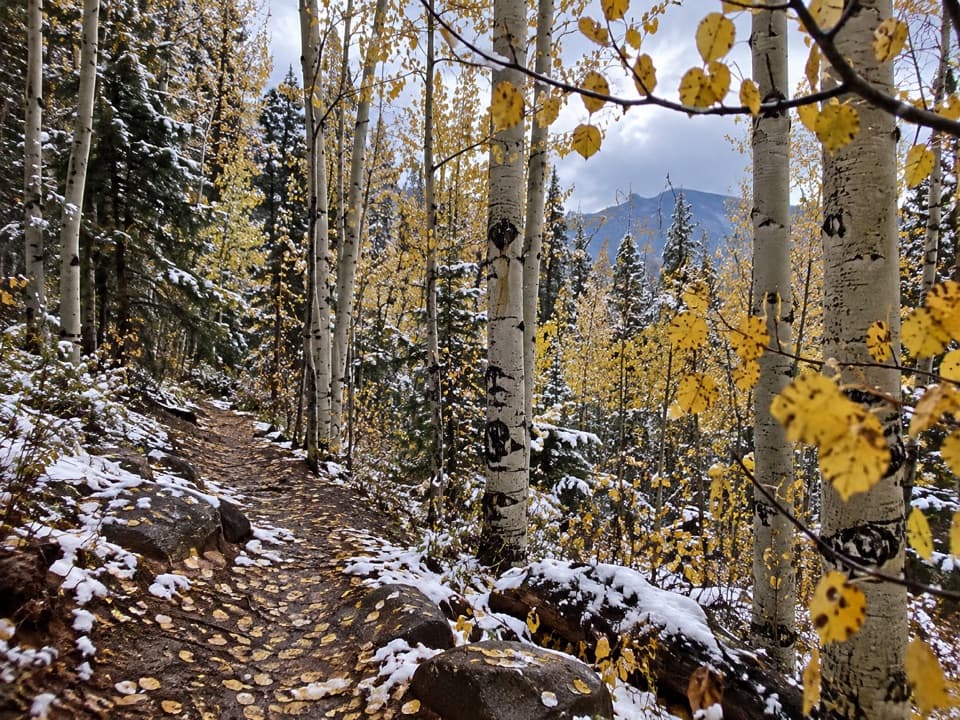
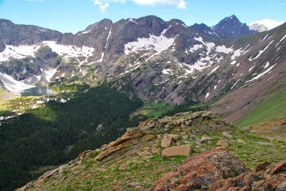
The trail climbs steeply for about a mile from the upper trailhead to Music Pass at treeline. The first stretch is forested; the view opens near the crest, where a rocky outcrop looks down into the Sand Creek basin. Take a moment there: it’s a rewarding view before the route drops steeply onto loose ground. That descent becomes a climb on the return, so expect the pass to feel harder on the way out. The line crosses into the Great Sand Dunes National Preserve’s high country, well beyond the dune-field walks most visitors come for.

The two lake branchesVisit Upper Sand Creek Lake first, then retrace the path to the fork before heading to Lower…

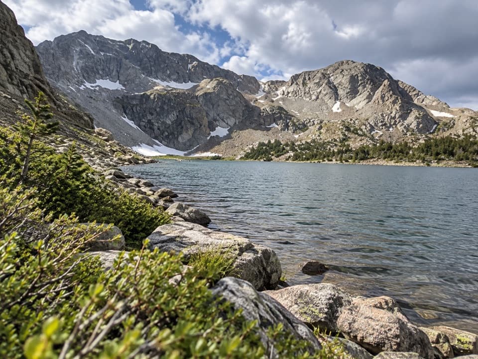
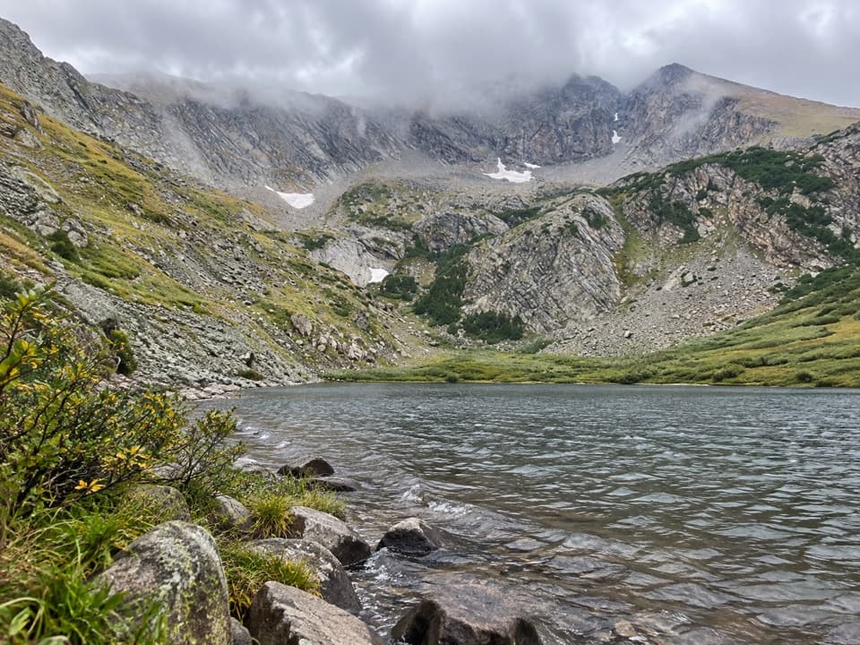
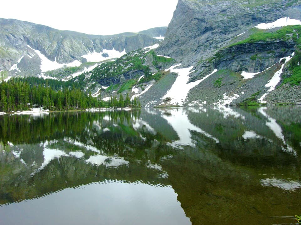
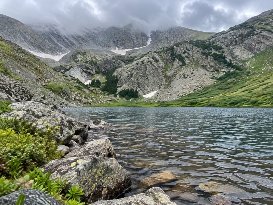
Visit Upper Sand Creek Lake first, then retrace the path to the fork before heading to Lower Lake. The upper branch climbs into a mountain bowl below Music Mountain, Milwaukee Peak and Marble Mountain; the lake sits near 11,700 feet. From its shore, turn back rather than trying to cut across the basin to the other lake. The lower branch crosses Sand Creek and climbs to the smaller lake beneath a steep mountain wall. The crossing and the approach make Lower Lake feel like a separate destination, not a quick add-on from the upper shore.

Getting to the upper trailheadFrom Highway 69 south of Westcliffe, follow the Music Pass signs and turn left at the T onto…

From Highway 69 south of Westcliffe, follow the Music Pass signs and turn left at the T onto South Colony Road. The upper trailhead is another 2.5 miles up Music Pass Road and requires a high-clearance four-wheel-drive vehicle. If you’re in a two-wheel-drive car, park where the Rainbow Trail crosses Music Pass Road; the walk from there adds 2.5 miles each way, making this roughly a 14.9-mile outing rather than the 9.9 miles above. Keep dogs leashed in the preserve.

Staying overnightA backpacking trip can break up the long day.

A backpacking trip can break up the long day. Marked backcountry campsites sit back from the lakes, and camping in the preserve does not require a backcountry permit. Keep the lake shore itself clear and use the designated sites.

Wildlife

Wildlife in Great Sand Dunes

All Great Sand Dunes wildlife maps

Sighting maps show where each species has been reported across Great Sand Dunes. Wildlife moves, so no sighting is guaranteed.

Keep exploring

Near Upper and Lower Sand Creek Lakes Hike

See it all on the map

Trails that start nearby

Places near the trailhead

Parkwolf’s Great Sand Dunes ranking

Top-rated trails in Great Sand Dunes

All 17 trails
  1. 1Dunes Overlook TrailModerate · 2 mi
  2. 2Medano Lake TrailChallenging · 7.4 mi
  3. 3Upper Sand Creek Lake TrailChallenging · 7.7 mi
  4. 4Lower Sand Creek Lake TrailChallenging · 8 mi
  5. 6Music Pass TrailModerate · 2.2 mi
  6. 7Zapata Falls TrailModerate · 1 mi

Take Parkwolf to Great Sand Dunes.

The audio tour guide for the drive, plus offline maps, trails, and wildlife heatmaps for when the signal drops.

4.7 from 8,600+ ratings

Download Parkwolf on the App StoreGet Parkwolf on Google Play