Upper Sand Creek Lake Trail in Great Sand Dunes National Park

#3 of 17 trails in Great Sand Dunes

Great Sand Dunes National Park, CO

Upper Sand Creek Lake Trail

High alpine lake after a steep pass and loose basin descent.

Length
7.7mi
Time
7.5hr
Elev. change
1,073ft
Difficulty
Challenging
  • Dogs allowed
  • High point 11,759 ft
Parkwolf audio tour31 stories across Great Sand Dunes’s roads

Overview

About Upper Sand Creek Lake Trail

Why go

  • A high lake basin beneath Music Mountain, Milwaukee Peak and Marble Mountain.
  • Two distinct mountain views: the open pass and the lake cirque.

Heads up

  • A steep pass climb, loose descent and another climb to the lake.
  • High elevation and the 4WD approach make this a full-day commitment.

Map & elevation

The route

Loading the Great Sand Dunes map
Full map
Elevation10,686–11,759 ft
TrailheadMusic Pass Trailhead37.92477, -105.48769
Keep this map with you offline in the Parkwolf app

Plan your hike

Before you go

Parking

Music Pass Trailhead is at the end of Music Pass Road. High-clearance 4WD vehicles may continue the final 2.5 miles to it. 2WD vehicles should park where the Rainbow Trail crosses Music Pass Road; walking from there adds 2.5 miles each way (5 miles round trip). Check current road conditions before driving in.

Best time to go

Treat this as a summer or fall route. Snow can block the high trail from late fall into June, and drifts may remain through June; in mid-summer, the grass greens up, wildflowers bloom and snowfields still stripe the peaks. Start early because the pass and upper basin are exposed to afternoon thunderstorms and lightning. The preserve's alpine tundra begins around the lake's elevation and is habitat for pikas, marmots, ptarmigans and bighorn sheep, along with summer wildflowers. Those are possibilities across the high country, not guaranteed sightings on this route.

Safety

The trail climbs above treeline to high alpine elevations; expect a steep, rocky approach, loose footing on the descent and afternoon lightning exposure. Snow can linger into June. Carry all drinking water from the trailhead; no potable source is documented. Dogs must be leashed in the preserve.

2 active Great Sand Dunes alerts

  • CautionStage 1 fire restrictionsStage 1 fire restrictions are active throughout Great Sand Dunes; use fires only in designated steel fire rings or picnic-site barbecues.Official details
  • CautionSwift, deep water on Medano Pass Primitive RoadMedano Pass Primitive Road is open, but heavy rain has created swift water up to 3 feet deep, especially at creek crossings 3, 4, and 5.Official details
Great Sand Dunes alerts
A park ranger sits on a dash-mounted phone, talking, as Parkwolf’s Tour Guide plays “Army Cutworm Moths: A Grizzly Bear Buffet” on Grand Loop Road below Dunraven Pass in Yellowstone
Parkwolf Tour GuideThe highest, rockiest slopes around here are a summer buffet for grizzly bears.

Great Sand Dunes Tour Guide

Your drive to Upper Sand Creek Lake Trail, narrated.

Parkwolf is a GPS audio tour guide for Great Sand Dunes National Park. As you drive, it chimes in with what’s ahead: hidden gems, upcoming stops, history, geology, and wildlife, right through your car’s speakers.

More stories near here in the app

  • Medano Pass
  • Medano Lake Trailhead
  • 31 audio storiesacross Great Sand Dunes’s roads, triggered by GPS as you drive
  • Wildlife heatmapsfor Elk, Pronghorn, Wild Turkey, and 13 more
  • Works offlinemaps, 17 trails, 29 places, and audio download before you lose signal
  • CarPlay readysimple controls built for the drive
★★★★★
“Fantastic app with many points of information… It’s great to just turn on while you’re driving and it gives you an audio tour of the national Park. We love it!!!!”
JMJamesApp Store review
Download Parkwolf on the App StoreGet Parkwolf on Google Play

4.7 from 8,600+ ratings

Trail guide

Hiking Upper Sand Creek Lake Trail

Is this your kind of day?Upper Sand Creek Lake Trail is a 7.

Upper Sand Creek Lake Trail is a 7.7-mile out-and-back from Music Pass Trailhead: climb through forest to Music Pass, descend into the Sand Creek basin, then climb again to an alpine lake under a wall of high peaks. It is a hard, high-altitude day for hikers comfortable with steep grades and loose ground. The mapped corridor is about 3.8 miles one way; published round-trip figures range as high as 9 miles, so leave room in your schedule. Plan on about 7–8 hours on the trail, plus the drive to the remote access road. A reported 2,000 feet of climbing is a serious amount at this elevation.

Start at the right accessThe distance above starts at Music Pass Trailhead, at the end of Music Pass Road.

The distance above starts at Music Pass Trailhead, at the end of Music Pass Road. High-clearance 4WD vehicles may continue the last 2.5 miles to it. The 2WD parking point is where the Rainbow Trail crosses Music Pass Road; walking from there adds 2.5 miles each way, making the full day about five miles longer than the trail distance above. Check road conditions before driving in. No potable water or food service is documented on the route, so carry your drinking water from the start. Dogs are allowed in the preserve but must stay leashed.

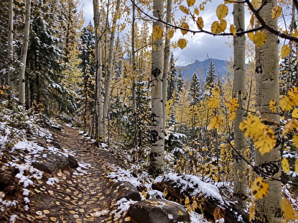
Climb to Music PassThe first mile is a steep climb through forest to treeline.

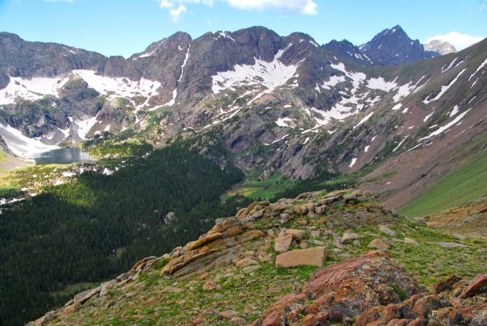
The first mile is a steep climb through forest to treeline. At Music Pass the forest gives way to exposed mountain ground, with the Upper Sand Creek basin opening below. A rocky outcrop just under the crest gives the broadest view: Tijeras Peak, Music Mountain, Pico Aislado and Marble Mountain frame the basin. It is a good place for a wide photo with some of the trail or a hiker in the foreground to show the scale.

Take the upper-lake branchFrom the pass, the path drops relatively steeply into the basin on loose footing.

From the pass, the path drops relatively steeply into the basin on loose footing. At the first junction, turn right for Upper Sand Creek Lake. After roughly 0.4 mile, keep right again to climb toward the lake. The left branch goes to Lower Sand Creek Lake, a different hike; don't follow a combined-lakes route if Upper Lake is your destination. Save some energy for the return: you climb back out of the basin and over the pass to reach the trailhead.

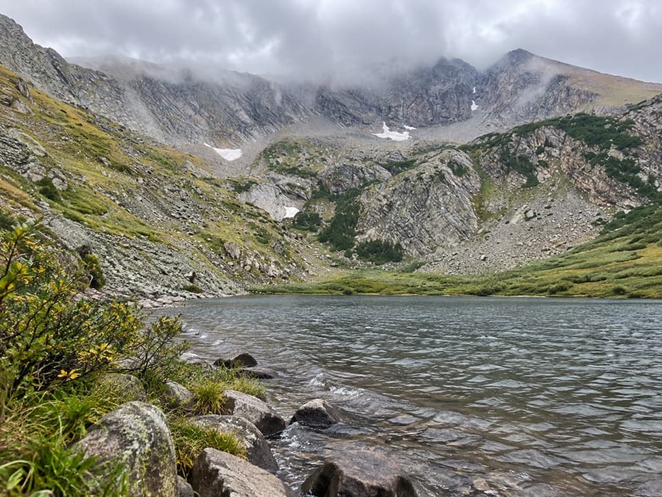
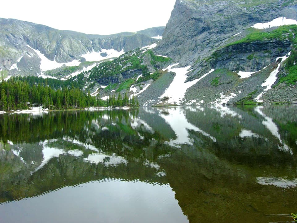
The high basinUpper Sand Creek Lake sits around 11,700 feet, in a rocky cirque beneath Music Mountain,…

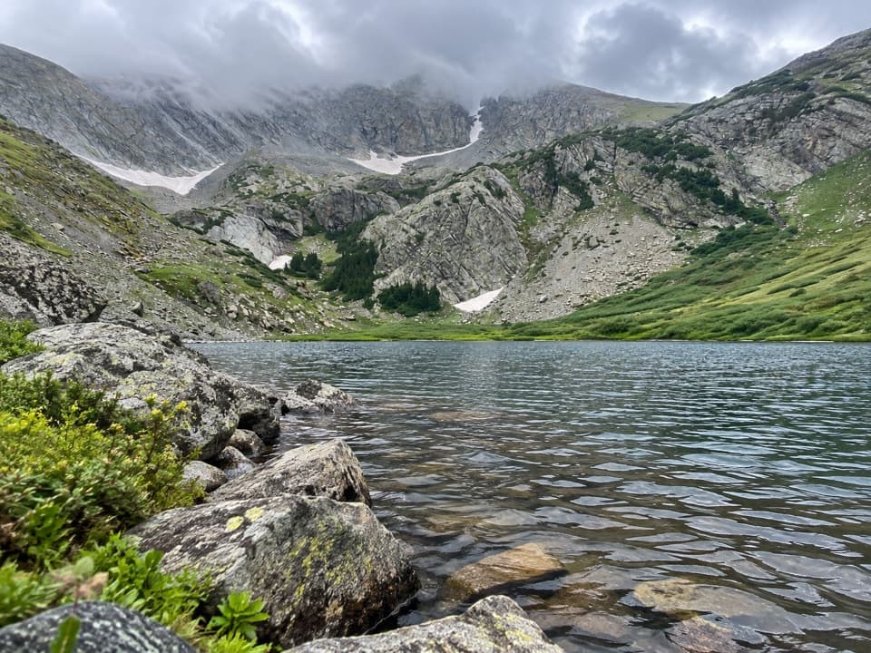
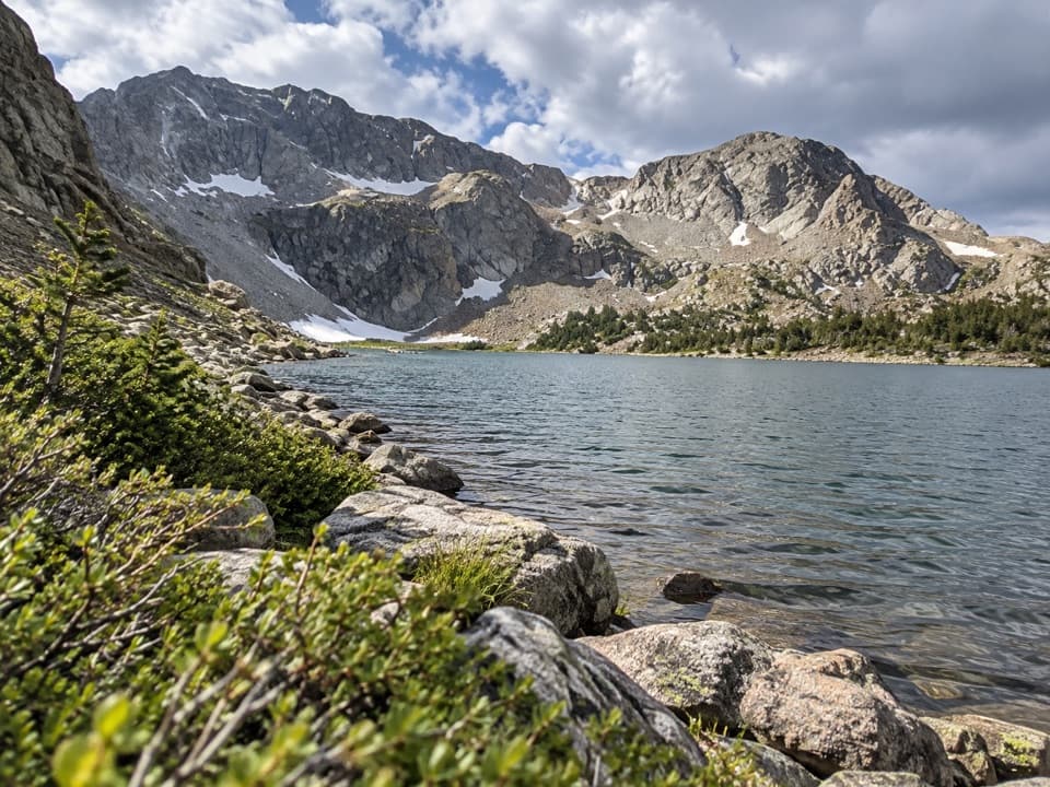
Upper Sand Creek Lake sits around 11,700 feet, in a rocky cirque beneath Music Mountain, Milwaukee Peak and Marble Mountain. The exposed lake shore is the destination, not a summit; spend time looking back across the water at the steep basin walls before turning around. A grounded photo of the shoreline shows the lake, angular gray rock and sparse alpine shrubs; there is no food or visitor facility at the lake.

Wildlife

Wildlife in Great Sand Dunes

All Great Sand Dunes wildlife maps

Sighting maps show where each species has been reported across Great Sand Dunes. Wildlife moves, so no sighting is guaranteed.

Keep exploring

Near Upper Sand Creek Lake Trail

See it all on the map

Trails that start nearby

Places near the trailhead

Parkwolf’s Great Sand Dunes ranking

Top-rated trails in Great Sand Dunes

All 17 trails
  1. 1Dunes Overlook TrailModerate · 2 mi
  2. 2Medano Lake TrailChallenging · 7.4 mi
  3. 4Lower Sand Creek Lake TrailChallenging · 8 mi
  4. 5Upper and Lower Sand Creek Lakes HikeChallenging · 9.9 mi
  5. 6Music Pass TrailModerate · 2.2 mi
  6. 7Zapata Falls TrailModerate · 1 mi

Take Parkwolf to Great Sand Dunes.

The audio tour guide for the drive, plus offline maps, trails, and wildlife heatmaps for when the signal drops.

4.7 from 8,600+ ratings

Download Parkwolf on the App StoreGet Parkwolf on Google Play