Mau Loa o Maunaulu in Hawaiʻi Volcanoes National Park

Scenic pullout · Hawaiʻi Volcanoes National Park

Mau Loa o Maunaulu

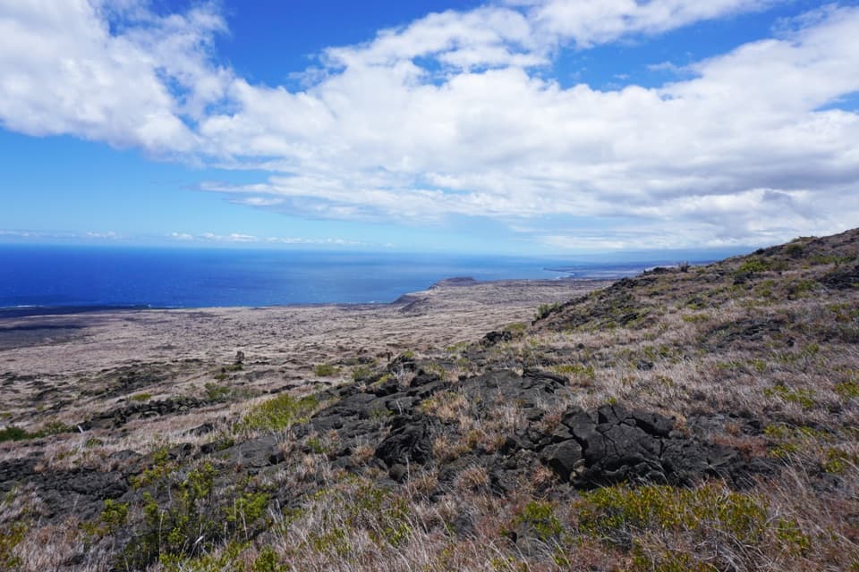
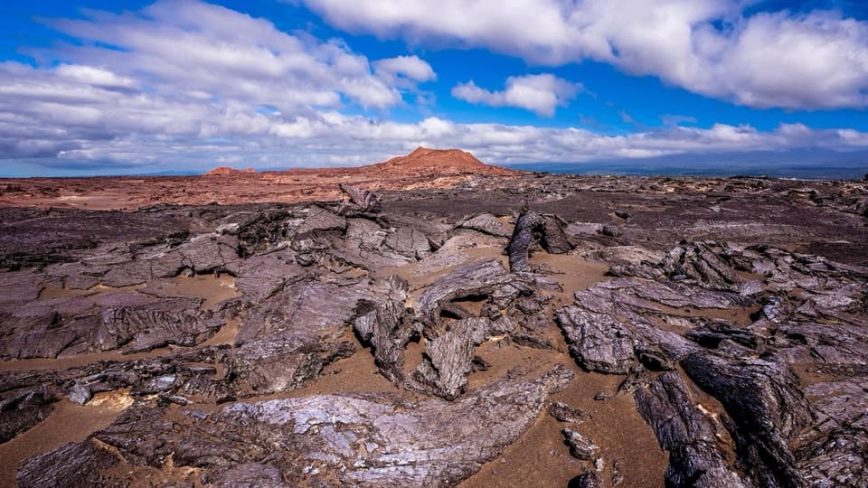
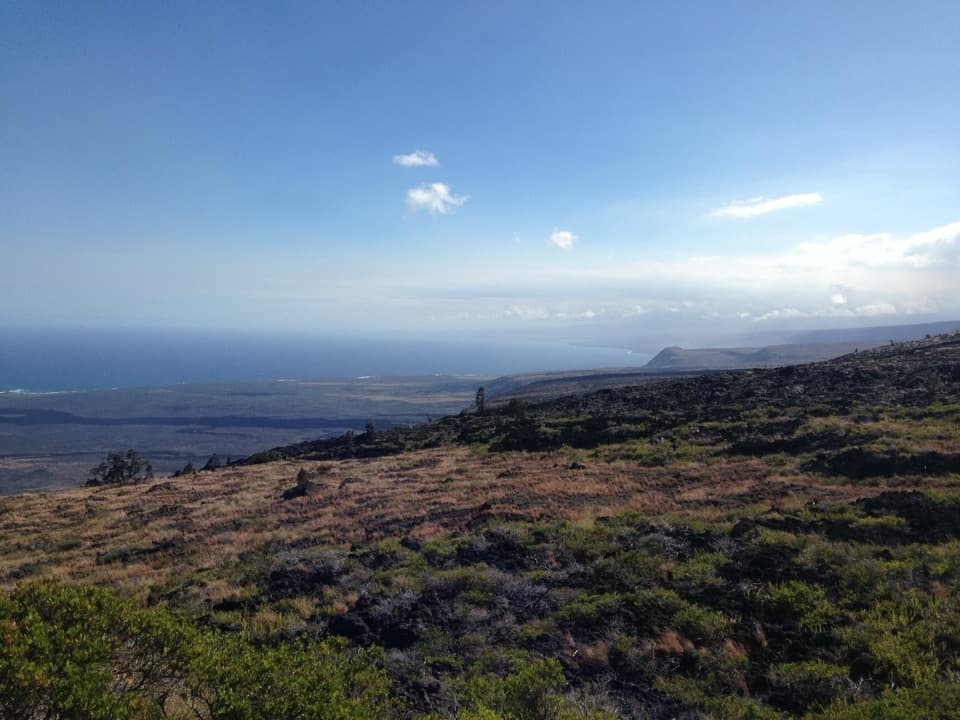
See Maunaulu's glassy 1969–74 lava field from the road.

Photo: National Park Service
Type
Scenic pullout
Nearest trail
Right here
Audio stories
4 nearby
  • Pullout
  • Parking
  • Scenic viewpoint
  • Trailhead

Hear the audio tour

Mau Loa o Maunaulu: Glassy Lava and a Long Trail

Overview

About Mau Loa o Maunaulu

Why stop

  • An expansive view across flows from Maunaulu’s nearly five-year eruption.

Map

Where it is

Loading the Hawaiʻi Volcanoes map
Full map
Scenic pulloutMau Loa o Maunaulu19.33666, -155.20386
Keep this map with you offline in the Parkwolf app

Plan your stop

Before you go

5 active Hawaiʻi Volcanoes alerts

  • ClosureStorm-damage closures at Kahuku, Kīpukapuaulu, and Sulphur BanksStorm damage and hazardous trees continue to restrict access at Kahuku and Kīpukapuaulu; the damaged Sulphur Banks Bridge is closed.Official details
  • ClosureWork closures on Hilina Pali and Mauna Loa roadsRoad work is restricting motorized and all-use access on portions of Hilina Pali Road and Mauna Loa Road.Official details

See all 5 alerts
A park ranger sits on a dash-mounted phone, talking, as Parkwolf’s Tour Guide plays “Army Cutworm Moths: A Grizzly Bear Buffet” on Grand Loop Road below Dunraven Pass in Yellowstone
Parkwolf Tour GuideThe highest, rockiest slopes around here are a summer buffet for grizzly bears.

Hawaiʻi Volcanoes Tour Guide

Your drive to Mau Loa o Maunaulu, narrated.

Parkwolf is a GPS audio tour guide for Hawaiʻi Volcanoes National Park. As you drive, it chimes in with what’s ahead: hidden gems, upcoming stops, history, geology, and wildlife, right through your car’s speakers.

See the Hawaiʻi Volcanoes audio tour

Recorded for this place

Mau Loa o Maunaulu: Glassy Lava and a Long Trail
0:00 / 0:28
“You're nearing Mau Loa o Maunaulu, where you can look across the lava field straight from the pullout. Look uphill for Maunaulu's broad shield, the source of these flows.”

Plays as you drive up to Mau Loa o Maunaulu in the Parkwolf Hawaiʻi Volcanoes Tour Guide.

More stories near here in the app

  • Muliwai a Pele: A Three-Day Lava River
  • ʻŌhiʻa: A Tree Starts in a Crack
  • One Park, Different Weather
  • Maunaulu: Walk to Puʻuhuluhulu
  • 58 audio storiesacross Hawaiʻi Volcanoes’s roads, triggered by GPS as you drive
  • Wildlife heatmapsfor Hawaiian Goose (Nēnē), Green Sea Turtle, Hawaiian Hawk ('Io), and 13 more
  • Works offlinemaps, 33 trails, 53 places, and audio download before you lose signal
  • CarPlay readysimple controls built for the drive
★★★★★
“Fantastic app with many points of information… It’s great to just turn on while you’re driving and it gives you an audio tour of the national Park. We love it!!!!”
JMJamesApp Store review
Download Parkwolf on the App StoreGet Parkwolf on Google Play

4.7 from 8,600+ ratings

Guide

More about Mau Loa o Maunaulu

A quick stop on Chain of Craters RoadMau Loa o Maunaulu is a roadside pullout with a broad view across the Maunaulu lava field.

Mau Loa o Maunaulu is a roadside pullout with a broad view across the Maunaulu lava field. It’s a good short stop if you want to see the scale of the eruption from the drive; the view is right at the pullout. The Keauhou Trail also starts here and heads toward coastal backcountry campsites, so treat that as a separate hike rather than part of the quick lookout.

Look uphillOn the mauka, or uphill, side of the road, the Maunaulu lava shield sits in the distance.

On the mauka, or uphill, side of the road, the Maunaulu lava shield sits in the distance. It’s the source of the broad field below. For a photo, include some of the textured lava in front and the shield beyond it; that gives the scene both its close detail and its scale.

When lava crossed the roadMaunaulu’s flows repeatedly crossed the road between 1969 and 1974, during an eruption that…

Maunaulu’s flows repeatedly crossed the road between 1969 and 1974, during an eruption that lasted nearly five years. The broad, dark field you see from this pullout is part of that long eruptive episode.

The shine on the pāhoehoeSome pāhoehoe flows have a shiny glaze because light reflects off a thin, silica-rich layer of…

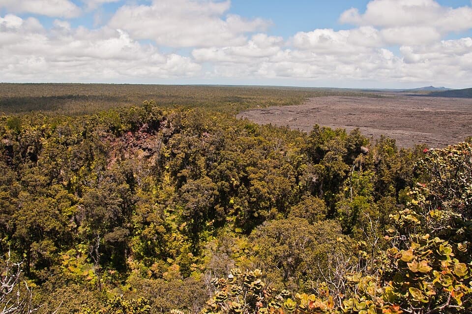
Some pāhoehoe flows have a shiny glaze because light reflects off a thin, silica-rich layer of surface glass. Vegetation is sparse here, where hard lava and harsh winds make it difficult for plants to take hold.

What the name meansThe name is translated as “the long continuous growing mountain,” or “forever-growing mountain.”

The name is translated as “the long continuous growing mountain,” or “forever-growing mountain.” It fits a place shaped by repeated additions of lava.

Wildlife

Wildlife in Hawaiʻi Volcanoes

All Hawaiʻi Volcanoes wildlife maps

Sighting maps show where each species has been reported across Hawaiʻi Volcanoes. Wildlife moves, so no sighting is guaranteed.

Keep exploring

Near Mau Loa o Maunaulu

See it all on the map

Trails nearby

More stops nearby

Parkwolf’s Hawaiʻi Volcanoes ranking

Top sights in Hawaiʻi Volcanoes

All 53 places
  1. 1UēkahunaSight
  2. 2Nāhuku Lava TubeSight
  3. 3Kīlauea OverlookSight
  4. 4Puʻuloa PetroglyphsSight
  5. 5Hōlei Sea ArchSight
  6. 6Kīlauea Iki OverlookSight

Take Parkwolf to Hawaiʻi Volcanoes.

The audio tour guide for the drive, plus offline maps, trails, and wildlife heatmaps for when the signal drops.

4.7 from 8,600+ ratings

Download Parkwolf on the App StoreGet Parkwolf on Google Play