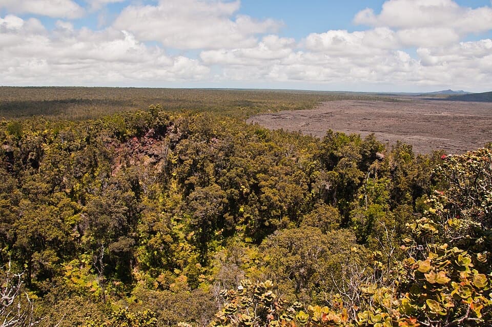
Puʻuhuluhulu Overlook in Hawaiʻi Volcanoes National Park

Sight · Hawaiʻi Volcanoes National Park

Puʻuhuluhulu Overlook

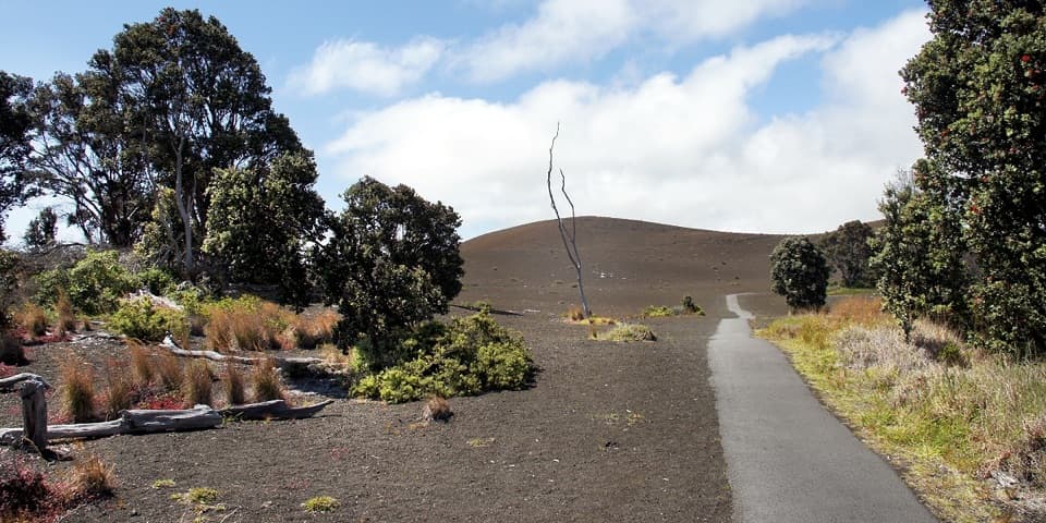
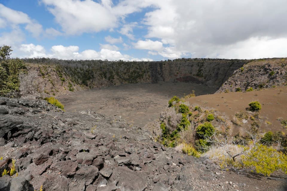
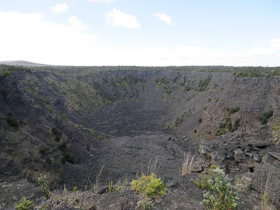
A forested cone gives a close view of Maunaulu’s lava shield.

Photo: Wikimedia Commons
Type
Sight
Nearest trail
0.8 mi
Audio stories
3 nearby
  • Trailhead
  • Parking
  • Restrooms
  • Scenic viewpoint
  • #13 of 35 sights

Hear the audio tour

Maunaulu: Walk to Puʻuhuluhulu

Overview

About Puʻuhuluhulu Overlook

Puʻuhuluhulu Overlook is a summit deck on a forested cinder cone above Maunaulu’s broad lava shield. It’s a rewarding half-day if you want a close look at Kīlauea’s 1969–74 eruption landscape, but reaching the view takes a 2.5-mile walk over rough lava.

Why stop

  • The view pairs an older forested cone with younger lava fields.

Heads up

  • The 2.5-mile hike crosses uneven lava and ends with a steep climb.

Map

Where it is

Loading the Hawaiʻi Volcanoes map
Full map
SightPuʻuhuluhulu Overlook19.37120, -155.20516
Keep this map with you offline in the Parkwolf app

Plan your stop

Before you go

5 active Hawaiʻi Volcanoes alerts

  • ClosureWork closures on Hilina Pali and Mauna Loa roadsMentions Mauna Loa, referenced in this guideRoad work is restricting motorized and all-use access on portions of Hilina Pali Road and Mauna Loa Road.Official details
  • ClosureStorm-damage closures at Kahuku, Kīpukapuaulu, and Sulphur BanksStorm damage and hazardous trees continue to restrict access at Kahuku and Kīpukapuaulu; the damaged Sulphur Banks Bridge is closed.Official details

See all 5 alerts
A park ranger sits on a dash-mounted phone, talking, as Parkwolf’s Tour Guide plays “Army Cutworm Moths: A Grizzly Bear Buffet” on Grand Loop Road below Dunraven Pass in Yellowstone
Parkwolf Tour GuideThe highest, rockiest slopes around here are a summer buffet for grizzly bears.

Hawaiʻi Volcanoes Tour Guide

Your drive to Puʻuhuluhulu Overlook, narrated.

Parkwolf is a GPS audio tour guide for Hawaiʻi Volcanoes National Park. As you drive, it chimes in with what’s ahead: hidden gems, upcoming stops, history, geology, and wildlife, right through your car’s speakers.

See the Hawaiʻi Volcanoes audio tour

Recorded for this place

Maunaulu: Walk to Puʻuhuluhulu
0:00 / 0:28
“You're approaching the Maunaulu trailhead, where a walk to Puʻuhuluhulu gives you a view across the lava landscape from a wooded cone.”

Plays as you drive up to Puʻuhuluhulu Overlook in the Parkwolf Hawaiʻi Volcanoes Tour Guide.

More stories near here in the app

  • Pauahi Crater: A Lava Whirlpool
  • ʻŌhiʻa: A Tree Starts in a Crack
  • The Crater That Collapsed in 1924
  • Mau Loa o Maunaulu: Glassy Lava and a Long Trail
  • 58 audio storiesacross Hawaiʻi Volcanoes’s roads, triggered by GPS as you drive
  • Wildlife heatmapsfor Hawaiian Goose (Nēnē), Green Sea Turtle, Hawaiian Hawk ('Io), and 13 more
  • Works offlinemaps, 33 trails, 53 places, and audio download before you lose signal
  • CarPlay readysimple controls built for the drive
★★★★★
“Fantastic app with many points of information… It’s great to just turn on while you’re driving and it gives you an audio tour of the national Park. We love it!!!!”
JMJamesApp Store review
Download Parkwolf on the App StoreGet Parkwolf on Google Play

4.7 from 8,600+ ratings

Guide

More about Puʻuhuluhulu Overlook

Plan for the climbThe route starts about 100 yards from the Maunaulu parking area, follows ahu across lava flows,…

The route starts about 100 yards from the Maunaulu parking area, follows ahu across lava flows, then climbs 210 feet. The hike is moderate overall, with a steep final quarter-mile; the lava is uneven, unstable and cut by deep cracks. Allow 2–3 hours and bring food and water. There’s a restroom at the parking area. Stay on the marked route, don’t touch fragile lava tree molds, and don’t make new ahu.

Take in the viewFrom the summit deck, Maunaulu’s wide lava shield fills the foreground.

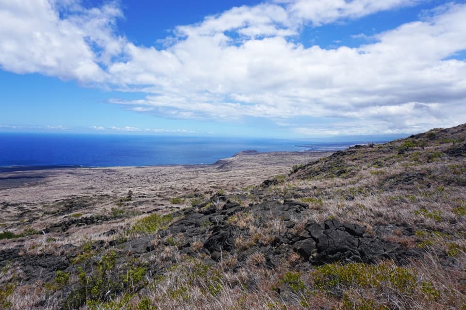
From the summit deck, Maunaulu’s wide lava shield fills the foreground. On clear days the view reaches Mauna Loa, Mauna Kea and the Pacific. For a photo, frame the open shield beyond the forested cone.

An older cone beside a new shieldPuʻuhuluhulu means “shaggy hill.”

Puʻuhuluhulu means “shaggy hill.” The volcanic cone predates Maunaulu by more than 500 years and once stood nearly 300 feet above its surroundings. Maunaulu formed in the 1969–74 eruption, dwarfing and nearly surrounding the older cone. Puʻuhuluhulu served as an observation point and fountain-measuring station; eruption fountains reached 1,770 feet.

A refuge in the craterCinder, spatter and ash from gas-rich fountains built the cone.

Cinder, spatter and ash from gas-rich fountains built the cone. Its old crater shelters rare native plants, including ʻōhā, from feral pigs, and has helped seed plants colonizing fresh lava.

Wildlife

Wildlife in Hawaiʻi Volcanoes

All Hawaiʻi Volcanoes wildlife maps

Sighting maps show where each species has been reported across Hawaiʻi Volcanoes. Wildlife moves, so no sighting is guaranteed.

Keep exploring

Near Puʻuhuluhulu Overlook

See it all on the map

Trails nearby

More stops nearby

Parkwolf’s Hawaiʻi Volcanoes ranking

Top sights in Hawaiʻi Volcanoes

All 53 places
  1. 1UēkahunaSight
  2. 2Nāhuku Lava TubeSight
  3. 3Kīlauea OverlookSight
  4. 4Puʻuloa PetroglyphsSight
  5. 5Hōlei Sea ArchSight
  6. 6Kīlauea Iki OverlookSight

Take Parkwolf to Hawaiʻi Volcanoes.

The audio tour guide for the drive, plus offline maps, trails, and wildlife heatmaps for when the signal drops.

4.7 from 8,600+ ratings

Download Parkwolf on the App StoreGet Parkwolf on Google Play