West Mountain Loop Overlook in Hot Springs National Park

#8 of 24 sights in Hot Springs

Sight · Hot Springs National Park

West Mountain Loop Overlook

A summit vista beside stone once shaped into tools.

Photo: National Park Service
Type
Sight
Nearest trail
Right here
Audio stories
14 nearby
  • Parking
  • Scenic viewpoint
  • Trailhead

Hear the audio tour

West Mountain Summit: The Southern View

Overview

About West Mountain Loop Overlook

Why stop

  • A southern mountain vista beside an exposed toolstone outcrop.

Heads up

  • Small summit parking area.

Map

Where it is

Loading the Hot Springs map
Full map
SightWest Mountain Loop Overlook34.50843, -93.06848
Keep this map with you offline in the Parkwolf app

Plan your stop

Before you go

2 active Hot Springs alerts

  • CautionPark-wide burn ban in effectA park-wide burn ban is in effect because of high fire danger. - The ban was enacted on August 15, 2026.Official details
  • ClosureMaurice Bathhouse closed for renovationsThe Maurice Bathhouse is currently closed for renovations. - Do not plan to use the building during your visit. Check current Bathhouse Row status before visiting.Official details

Hot Springs alerts
A park ranger sits on a dash-mounted phone, talking, as Parkwolf’s Tour Guide plays “Army Cutworm Moths: A Grizzly Bear Buffet” on Grand Loop Road below Dunraven Pass in Yellowstone
Parkwolf Tour GuideThe highest, rockiest slopes around here are a summer buffet for grizzly bears.

Hot Springs Tour Guide

Your drive to West Mountain Loop Overlook, narrated.

Parkwolf is a GPS audio tour guide for Hot Springs National Park. As you drive, it chimes in with what’s ahead: hidden gems, upcoming stops, history, geology, and wildlife, right through your car’s speakers.

Recorded for this place

West Mountain Summit: The Southern View
0:00 / 0:30
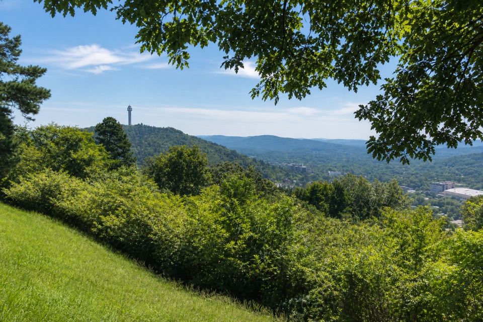
“You're approaching West Mountain's summit overlook, with a southern view toward the Trap Mountains and distant Lake Hamilton. Stop here for the mountains rather than the downtown view.”

Plays as you drive up to West Mountain Loop Overlook in the Parkwolf Hot Springs Tour Guide.

More stories near here in the app

  • The People Behind the Baths
  • Whittington Park: Old Bridges and Cold Spring Water
  • West Mountain: Town Views and a Stone Shelter
  • Buckstaff and Quapaw: Choose Your Soak
  • 18 audio storiesacross Hot Springs’s roads, triggered by GPS as you drive
  • Wildlife heatmapsfor White-tailed Deer, Groundhog, Mexican Long-nosed Armadillo, and 13 more
  • Works offlinemaps, 19 trails, 33 places, and audio download before you lose signal
  • CarPlay readysimple controls built for the drive
★★★★★
“Fantastic app with many points of information… It’s great to just turn on while you’re driving and it gives you an audio tour of the national Park. We love it!!!!”
JMJamesApp Store review
Download Parkwolf on the App StoreGet Parkwolf on Google Play

4.7 from 8,600+ ratings

Guide

More about West Mountain Loop Overlook

The southern viewThis is a drive-up scenic overlook at the summit of West Mountain, one of three stops on the…

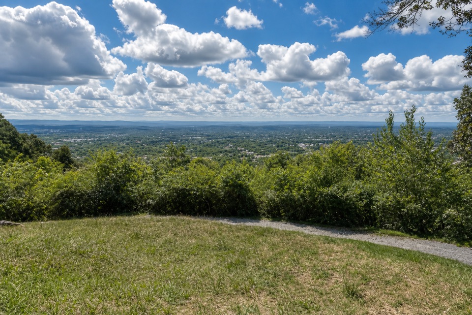
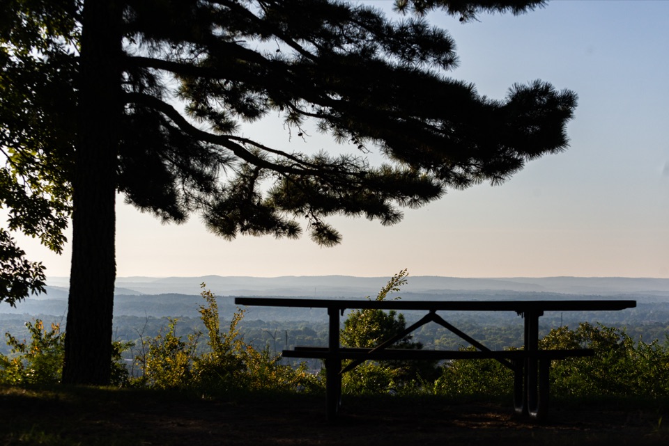
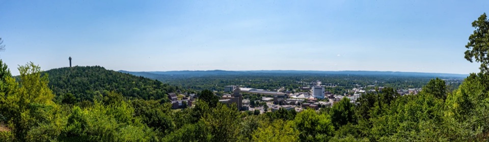
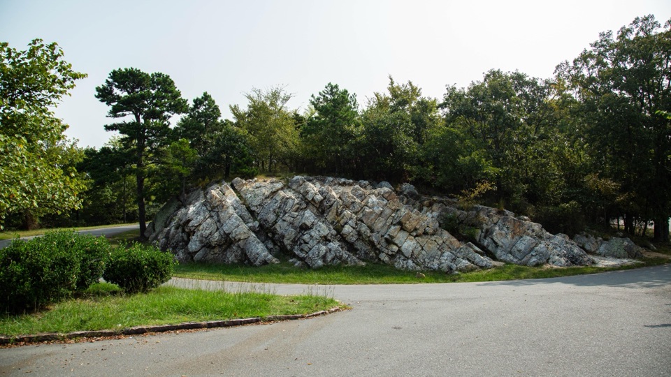
This is a drive-up scenic overlook at the summit of West Mountain, one of three stops on the Summit Loop. It looks south toward the Trap Mountains, with Lake Hamilton far in the distance. The lower stops look back over Bathhouse Row and downtown, so the summit gives you a different angle rather than a repeat. Come for the layered southern view and the large novaculite outcrop beside the road.

Getting up to the summitWest Mountain Drive is a two-way road with entrances from Prospect Avenue and Whittington…

West Mountain Drive is a two-way road with entrances from Prospect Avenue and Whittington Avenue; it leads to the Summit Loop. There is auto parking, but the summit lot is small. Sunset Trail access is available at the summit if you want to continue on foot. No restroom or potable water is listed for the outcrop, so plan ahead and treat this as a scenic stop.

A stone shaped for toolsThe exposed Arkansas novaculite is part of the visit.

The exposed Arkansas novaculite is part of the visit. Caddo people shaped the stone into tools and weapons; European settlers later used it for whetstones. It was useful because it could be worked into a form and hold a sharp edge. Look closely at the broken texture and ridges to see why it mattered as both a landscape feature and a tool material.

How the ridge survivedArkansas novaculite belongs to a silica-rich rock formation laid down roughly 318 to 416…

Arkansas novaculite belongs to a silica-rich rock formation laid down roughly 318 to 416 million years ago. As the Ouachita Mountains formed, folding and faulting exposed tougher beds on ridges while softer rock eroded away. The outcrop connects the mountain view to a much older story underfoot.

Photograph the outcrop in contextStep back and include the road edge and surrounding trees with the outcrop; that setting gives…

Step back and include the road edge and surrounding trees with the outcrop; that setting gives the pale rock scale and shape better than a tight close-up.

Wildlife

Wildlife in Hot Springs

All Hot Springs wildlife maps

Sighting maps show where each species has been reported across Hot Springs. Wildlife moves, so no sighting is guaranteed.

Keep exploring

Near West Mountain Loop Overlook

See it all on the map

Trails nearby

More stops nearby

Parkwolf’s Hot Springs ranking

Top sights in Hot Springs

All 33 places
  1. 1Fordyce Bathhouse Visitor Center and MuseumSight
  2. 2Buckstaff BathhouseSight
  3. 3Quapaw Baths & SpaSight
  4. 4Hot Springs Mountain TowerSight
  5. 5Hot Water CascadeSight
  6. 6Display SpringSight

Take Parkwolf to Hot Springs.

The audio tour guide for the drive, plus offline maps, trails, and wildlife heatmaps for when the signal drops.

4.7 from 8,600+ ratings

Download Parkwolf on the App StoreGet Parkwolf on Google Play