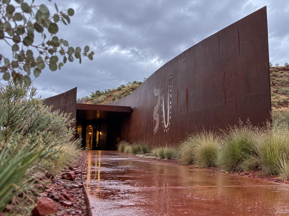
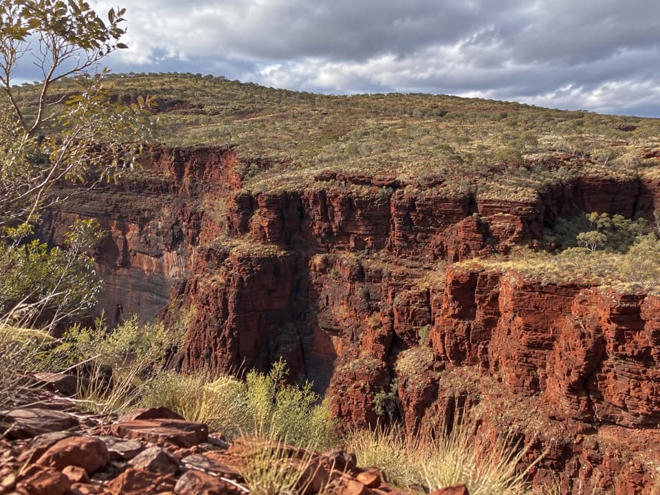
Nhamarrunha (Kalamina Gorge) in Karijini National Park

#8 of 22 trails in Karijini

Karijini National Park, WA

Nhamarrunha (Kalamina Gorge)

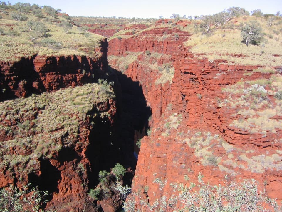
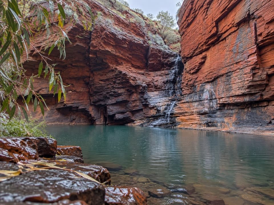
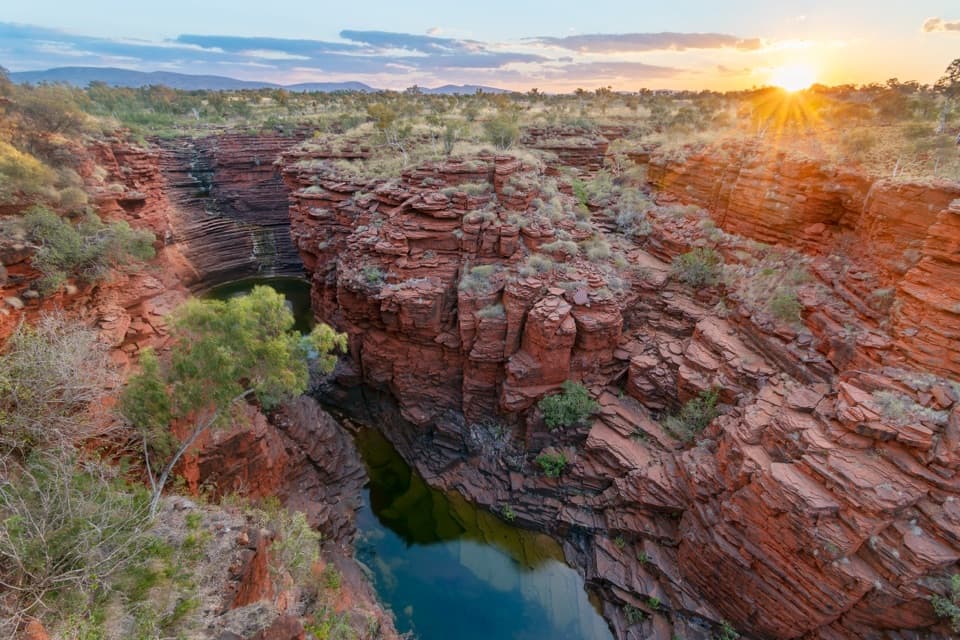
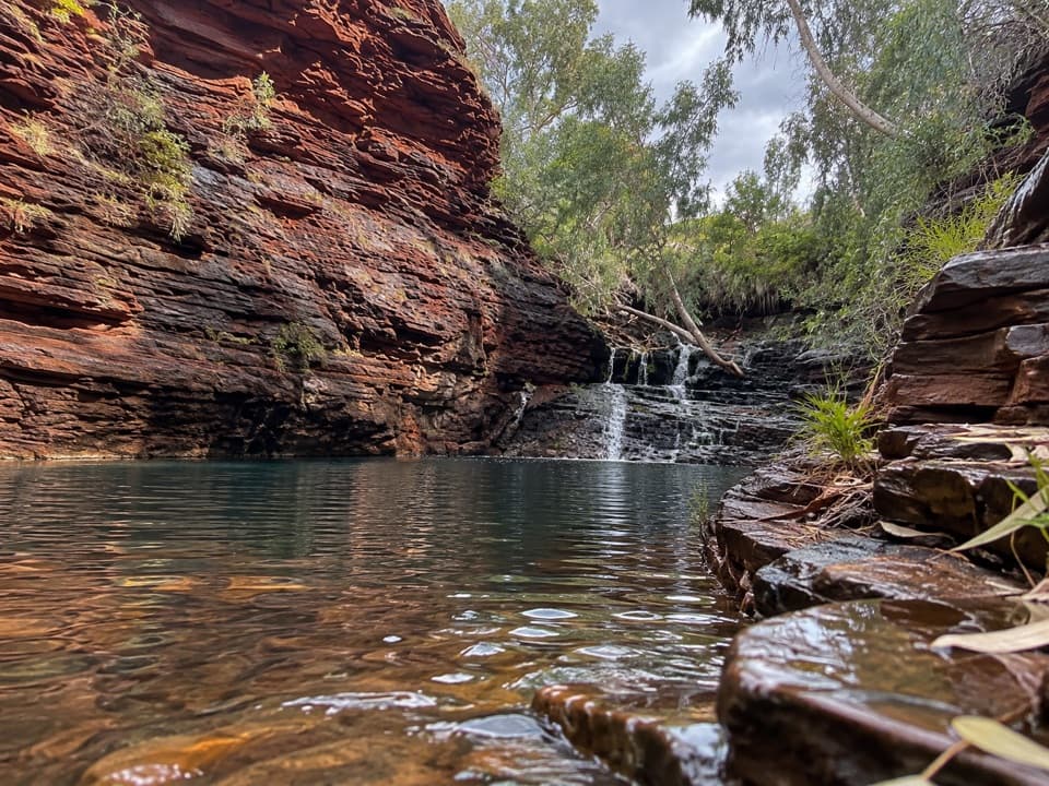
Red walls, a tucked-away pool, and a rocky ledge walk.

Photo: Wikimedia Commons
Length
3km
Time
3hr
Elev. change
38m
Difficulty
Moderate
  • No dogs
  • High point 683 m

Hear the audio tour

Kalamina Gorge and Rock Arch Pool

Overview

About Nhamarrunha (Kalamina Gorge)

Why go

  • Rock Arch Pool and a natural arch cap a varied short gorge walk
  • Open streamside walking gives way to close red-rock ledges

Heads up

  • Steep access descent and slippery creek crossings
  • Narrow ledges can make passing other walkers awkward

Map & elevation

The route

Loading the Karijini map
Full map
Elevation645–683 m
TrailheadKalamina Gorge access, Kalamina Road-22.41691, 118.40158
Keep this map with you offline in the Parkwolf app

Plan your hike

Before you go

Parking

Start from the Kalamina Gorge access car park on Kalamina Road. The approach is unsealed; recent visitors report rough or corrugated sections, so check current access. Lot capacity and overflow arrangements were not verified. Park entry fees apply.

Safety

The descent is steep, and wet ledges and creek crossings can be slippery. Flash flooding is a serious gorge hazard: do not enter if rain is in the area, and leave immediately if it starts. Summer heat often exceeds 40°C; gorge pools can be extremely cold from April through September. Do not jump or dive into the water.

A park ranger sits on a dash-mounted phone, talking, as Parkwolf’s Tour Guide plays “Army Cutworm Moths: A Grizzly Bear Buffet” on Grand Loop Road below Dunraven Pass in Yellowstone
Parkwolf Tour GuideThe highest, rockiest slopes around here are a summer buffet for grizzly bears.

Karijini Tour Guide

Your drive to Nhamarrunha (Kalamina Gorge), narrated.

Parkwolf is a GPS audio tour guide for Karijini National Park. As you drive, it chimes in with what’s ahead: hidden gems, upcoming stops, history, geology, and wildlife, right through your car’s speakers.

See the Karijini audio tour

Recorded for this trailhead

Kalamina Gorge and Rock Arch Pool
0:00 / 0:29
“Kalamina Gorge is coming up, with a short, steep descent to a small waterfall and permanent pool. For a quick visit, allow about half an hour, including the climb back out. Look for fish in the rock pools.”

Plays as you drive up to this trailhead in the Parkwolf Karijini Tour Guide.

More stories near here in the app

  • Sorting Rock with a Magnet
  • Wittenoom's Lasting Legacy
  • The Pigeon with a Long Crest
  • Hematite's Two Faces
  • 141 audio storiesacross Karijini’s roads, triggered by GPS as you drive
  • Wildlife heatmapsfor Dingo, Rock Wallaby, Mulga Snake, and 13 more
  • Works offlinemaps, 22 trails, 30 places, and audio download before you lose signal
  • CarPlay readysimple controls built for the drive
★★★★★
“Fantastic app with many points of information… It’s great to just turn on while you’re driving and it gives you an audio tour of the national Park. We love it!!!!”
JMJamesApp Store review
Download Parkwolf on the App StoreGet Parkwolf on Google Play

4.7 from 8,600+ ratings

Trail guide

Hiking Nhamarrunha (Kalamina Gorge)

The full walkNhamarrunha (Kalamina Gorge) is a 3 km (1.

Nhamarrunha (Kalamina Gorge) is a 3 km (1.9-mile) out-and-back from Kalamina Road down to the gorge floor and on to Rock Arch Pool, then back the same way. Allow about three hours. It is a Class 4, difficult walk: the mileage is short, but the access drops steeply and later stretches cross water and squeeze onto ledges. If you only want a quick waterfall stop, the five-minute descent to the first pool is a much shorter outing. The main walk continues downstream to Rock Arch Pool; Kalamina Falls is a short upstream side trip near the entrance and adds some backtracking.

Down to the streamThe route starts on steps and a steep track to a small permanent pool and waterfall at the…

The route starts on steps and a steep track to a small permanent pool and waterfall at the bottom. For Rock Arch Pool, head downstream along the stream. This first stretch is relatively open, with a broad channel, mature snappy gums and grasses along the banks. The park says lemon-scented grass grows here and that fish may be visible in the rock pools. Those are things to look and smell for, not a guarantee on a particular day.

Finding the routeThe track crosses the stream and alternates between the wider gorge floor, rocky banks and…

The track crosses the stream and alternates between the wider gorge floor, rocky banks and ledges beside pools. Circular markers on rocks show which side to follow, especially where the walking line changes banks. Keep looking for them at crossings; it is easy to keep following a tempting ledge after the marked route has moved across. Some patches are wet or muddy, and water-smoothed rock can be slippery. Where the ledges narrow, there is little room to pass someone coming the other way, so wait for a wider section.

The walls and poolsFarther in, the gorge closes around you.

Farther in, the gorge closes around you. Layered red walls rise beside the stream, and smooth ledges run past broader pools. The contrast is the walk's appeal: you start in an open, grassy channel, then spend parts of the route close against the rock before the gorge opens again. There are no long climbs once you are on the floor, but the repeated uneven footholds and crossings make the walk slower than its distance suggests.

Rock Arch PoolRock Arch Pool is the natural turnaround, where the ledge runs out beside reflective water and…

Rock Arch Pool is the natural turnaround, where the ledge runs out beside reflective water and a natural arch spans the end of the gorge. Take a moment before turning back; the pool and arch make the clearest sense of the walk's destination. This is the route's signature view: frame the arch above the water with some of the red gorge wall in the picture. Return the same way rather than treating the pool as a through-route.

Access and facilitiesStart from the Kalamina Gorge access car park on Kalamina Road.

Start from the Kalamina Gorge access car park on Kalamina Road. The approach is unsealed, and visitors have reported rough or corrugated sections; conditions vary, so check current road access before the drive. A toilet and picnic area are at the access. Park entry fees apply. No food service or drinking-water source was verified at the gorge, so plan those before you set out. Pets are not allowed in the national park, apart from certified assistance animals.

Weather and footingFlash flooding is a serious gorge hazard.

Flash flooding is a serious gorge hazard. Do not enter a gorge when rain is in the area, and leave immediately if rain starts. Karijini summer temperatures often exceed 40°C, while gorge pools can be extremely cold, especially from April through September. The pool is listed for swimming, but do not jump or dive into gorge water.

Wildlife

Wildlife in Karijini

All Karijini wildlife maps

Sighting maps show where each species has been reported across Karijini. Wildlife moves, so no sighting is guaranteed.

Keep exploring

Near Nhamarrunha (Kalamina Gorge)

See it all on the map

Trails that start nearby

Places near the trailhead

Parkwolf’s Karijini ranking

Top-rated trails in Karijini

All 22 trails
  1. 1Bilungunha (Hancock Gorge), Kermits PoolChallenging · 1.5 km
  2. 2Punurrunha Summit (Mount Bruce)Challenging · 9 km
  3. 3Lower Weano Gorge, Handrail PoolChallenging · 1.2 km
  4. 4Dales Gorge LoopModerate · 2.8 km
  5. 5Jubula (Fortescue Falls)Moderate · 0.8 km
  6. 6Jubura (Fern Pool)Moderate · 1.4 km

Take Parkwolf to Karijini.

The audio tour guide for the drive, plus offline maps, trails, and wildlife heatmaps for when the signal drops.

4.7 from 8,600+ ratings

Download Parkwolf on the App StoreGet Parkwolf on Google Play