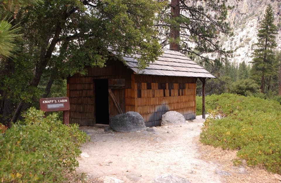
Simpson Meadow Trail in Kings Canyon National Park

Kings Canyon National Park, CA

Simpson Meadow Trail

A steep Copper Creek climb gives way to a rough river descent.

Photo: Flickr
Length
22.9mi
Time
20hr
Elev. change
5,387ft
Difficulty
Challenging
  • No dogs
  • High point 10,466 ft

Hear the audio tour

Road's End and Muir Rock

Overview

About Simpson Meadow Trail

Why go

  • High views from Granite Pass and a distinctive, remote high-country traverse.
  • Shorty’s Meadow cabin remnant and the Drift Fence view add specific stops along a long route.

Heads up

  • The route is almost 23 miles one way, with a hot climb and a very steep, loose descent.
  • The far end has no road access, and the nearby river crossing is not verified for use.

Map & elevation

The route

Loading the Kings Canyon map
Full map
Elevation5,079–10,466 ft
TrailheadCopper Creek Trailhead, Road’s End parking area36.79649, -118.58355
Keep this map with you offline in the Parkwolf app

Plan your hike

Before you go

Parking

Start at Copper Creek Trailhead in the Road’s End parking area. The trailhead has auto and bus/RV parking, an information kiosk and animal-safe food storage. The far end has no road access; plan an onward wilderness route or return before starting.

Safety

This is a remote, high-altitude point-to-point route, with a hot exposed climb and a final five-mile descent of about 4,000 feet on steep, loose tread. Water and creek crossings are seasonal; the East Fork of Dougherty Creek is the last source identified for northbound travel. Overnight trips require a wilderness permit and animal-resistant food storage. Pets are prohibited on park trails. The mapped finish has no road access; a separate crossing nearby is marked disused.

8 active Kings Canyon alerts

  • CautionStage 1 fire restrictionsStage 1 fire restrictions are active because high fire danger raises the risk of accidental human-caused fires that could threaten visitors and employees.Official details
  • ClosureGrant Grove trails and areas closed for prescribed fireSome trails and areas around Grant Grove and the General Grant Tree are closed during an active prescribed burn; stay out until crews clear hazards and reopen them.Official details
See all 8 alerts
A park ranger sits on a dash-mounted phone, talking, as Parkwolf’s Tour Guide plays “Army Cutworm Moths: A Grizzly Bear Buffet” on Grand Loop Road below Dunraven Pass in Yellowstone
Parkwolf Tour GuideThe highest, rockiest slopes around here are a summer buffet for grizzly bears.

Kings Canyon Tour Guide

Your drive to Simpson Meadow Trail, narrated.

Parkwolf is a GPS audio tour guide for Kings Canyon National Park. As you drive, it chimes in with what’s ahead: hidden gems, upcoming stops, history, geology, and wildlife, right through your car’s speakers.

See the Kings Canyon audio tour

Recorded for this trailhead

Road's End and Muir Rock
0:00 / 0:29
“You're nearing Road's End, where Highway one eighty finishes and a short dirt path leads to Muir Rock beside the Kings River.”

Plays as you drive up to this trailhead in the Parkwolf Kings Canyon Tour Guide.

More stories near here in the app

  • Zumwalt Meadow
  • Roaring River Falls
  • Knapp’s Cabin
  • Cedar Grove's Flat Green Sprays
  • 55 audio storiesacross Kings Canyon’s roads, triggered by GPS as you drive
  • Wildlife heatmapsfor Black Bear, Mule Deer, Marmot, and 13 more
  • Works offlinemaps, 77 trails, 61 places, and audio download before you lose signal
  • CarPlay readysimple controls built for the drive
★★★★★
“…The kids and my husband and I all agree that the narration really added to our experience driving through the parks. We learned so much about the history and the flora & fauna.”
JessestblondeApp Store review
Download Parkwolf on the App StoreGet Parkwolf on Google Play

4.7 from 8,600+ ratings

Trail guide

Hiking Simpson Meadow Trail

A remote point-to-point routeSimpson Meadow Trail is a 22.

Simpson Meadow Trail is a 22.9-mile, one-way wilderness traverse from the Copper Creek Trailhead at Road’s End to the junction with Upper Middle Fork Kings Trail near Simpson Meadow. That total includes the 10.9-mile approach to Granite Pass and about 12 miles of trail north of the pass. The route climbs above 10,600 feet, then drops through high meadows and steep, loose tread toward the Middle Fork. This isn’t a loop or a day hike: allow about two days of walking, plus camp time. Overnight trips require a wilderness permit, and you’ll need a plan for animal-resistant food storage. There’s no road at the far end, so arrange an onward wilderness route or a return plan before setting out. The shorter 13-mile figure describes roughly the pass-to-river section and leaves out the Road’s End approach.

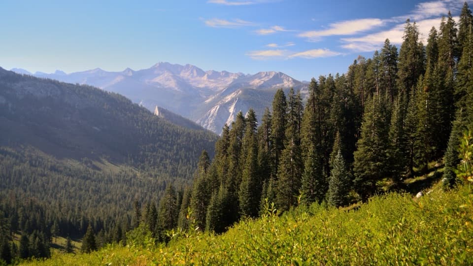
The Copper Creek climbFrom Road’s End, Copper Creek climbs steadily through a mix of open slope and forest.

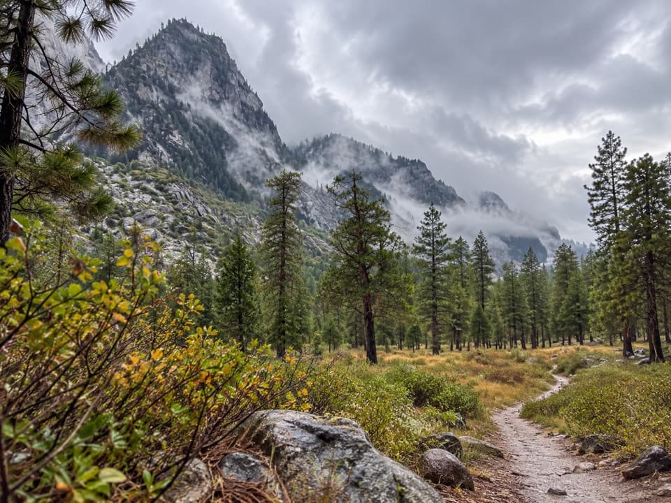
From Road’s End, Copper Creek climbs steadily through a mix of open slope and forest. The lower climb gets hot and has little shade, so an early start helps. Lower Tent Meadow, about four miles in, is the first allowed campsite; the trail continues past Upper Tent Meadow toward the Granite Lip. Upper Tent can be difficult to spot, and the Lip itself has no water. Water sources on this ascent are limited and seasonal, so don’t plan on every small stream being dependable.

Granite Basin and Granite PassPast the Lip, the route drops into Granite Basin, where open granite, green meadows and small…

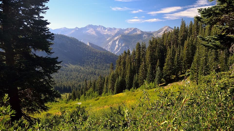
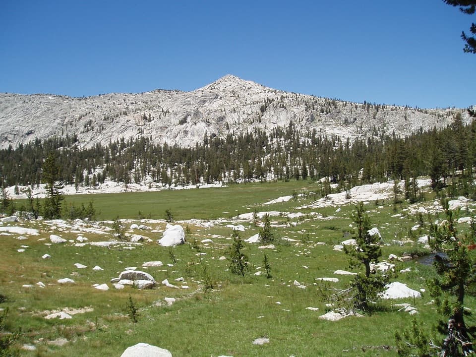
Past the Lip, the route drops into Granite Basin, where open granite, green meadows and small lakes break up the climb. The trail then rises again to Granite Pass, the high point at about 10,660 feet. Stop at the saddle and look both ways: south across the basin, then north toward the Middle Fork and LeConte Canyon. This is the view to linger over. Include a little of the trail or basin in a photo so the steep approach reads in the foreground; side trips to nearby lakes add mileage and aren’t part of this line.

Shorty’s Meadow and the creek crossingsNorth of the pass, the path descends through three meadows.

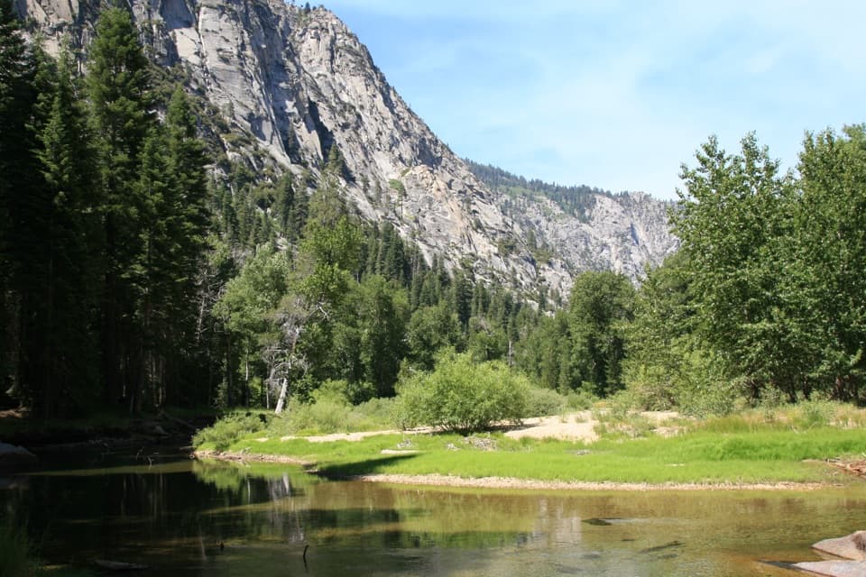
North of the pass, the path descends through three meadows. Shorty’s Meadow is the largest; look among the trees near its southeast end for a cabin remnant associated with Joseph Walter “Shorty” Lovelace, a winter trapper who built small shelters about a day’s walk apart. The cabin sites form part of a historic district listed in 1978. Farther on, the route crosses the forks of Dougherty Creek four times. After the third crossing, a drift fence opens a west-facing view toward the partly hidden Lake of the Fallen Moon. The lake is a viewpoint, not a separate trail destination; stay on the mapped route.

The steep descent and the far endAt the State Lakes junction, the final five miles drop about 4,000 feet.

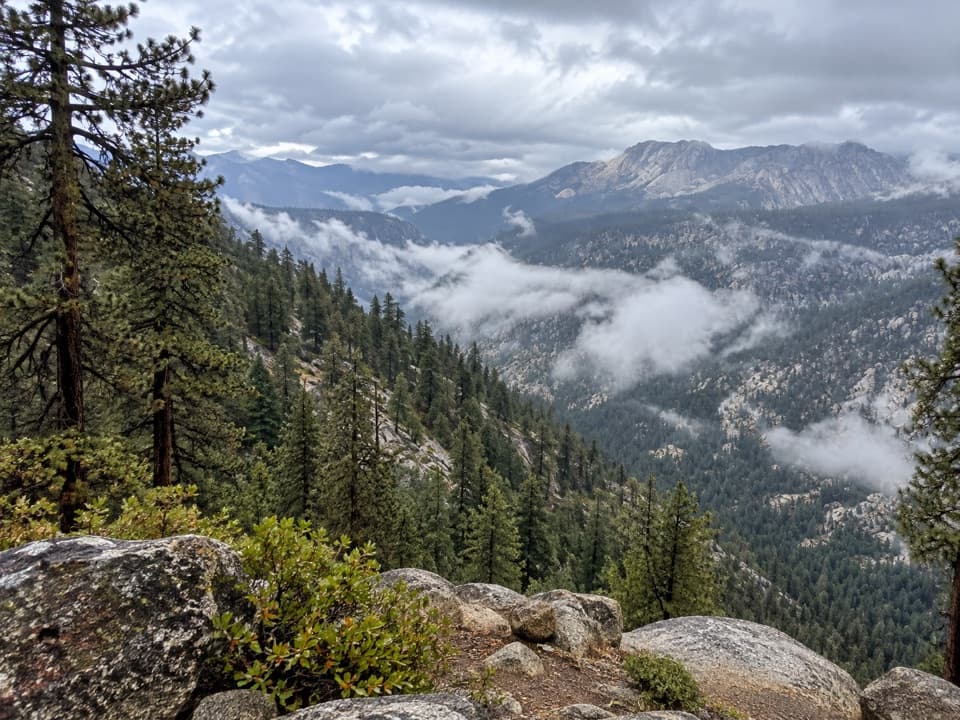
At the State Lakes junction, the final five miles drop about 4,000 feet. This loose, very steep, minimally maintained stretch is commonly called The Bitch Trail. Going north, the East Fork of Dougherty Creek is the last source the route description identifies; water can be seasonal. The mapped line ends at the Upper Middle Fork Kings Trail junction on the river’s east side. It does not cross the Middle Fork. A separate crossing nearby is marked disused, so don’t build an exit plan around it; continue on a verified backcountry route or retrace your steps. There is no vehicle access at this end.

If you need to finish at Road’s EndFor a same-start trip that returns to the car, the separate Copper Creek Trail to Granite Pass…

For a same-start trip that returns to the car, the separate Copper Creek Trail to Granite Pass is a 22-mile out-and-back. It shares the exposed climb and high-country scenery but stops at the pass and retraces the approach, avoiding a remote one-way finish. It’s still a strenuous backpacking objective, not a short substitute.

Wildlife

Wildlife in Kings Canyon

All Kings Canyon wildlife maps

Sighting maps show where each species has been reported across Kings Canyon. Wildlife moves, so no sighting is guaranteed.

Keep exploring

Near Simpson Meadow Trail

See it all on the map

Trails that start nearby

Places near the trailhead

Parkwolf’s Kings Canyon ranking

Top-rated trails in Kings Canyon

All 77 trails
  1. 1Rae Lakes LoopChallenging · 41.4 mi
  2. 2Mist Falls TrailModerate · 8 mi
  3. 3Zumwalt Meadow TrailEasy · 1.5 mi
  4. 4Roaring River Falls TrailEasy · 0.3 mi
  5. 5Panoramic Point TrailEasy · 0.5 mi
  6. 6Big Stump Loop TrailEasy · 1.6 mi

Take Parkwolf to Kings Canyon.

The audio tour guide for the drive, plus offline maps, trails, and wildlife heatmaps for when the signal drops.

4.7 from 8,600+ ratings

Download Parkwolf on the App StoreGet Parkwolf on Google Play