Zumwalt Meadow in Kings Canyon National Park

#2 of 31 sights in Kings Canyon

Sight · Kings Canyon National Park

Zumwalt Meadow

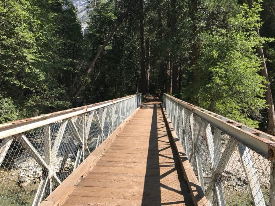
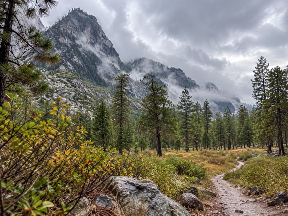
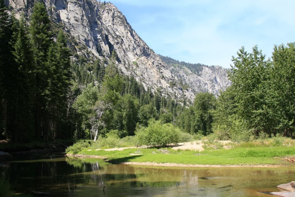
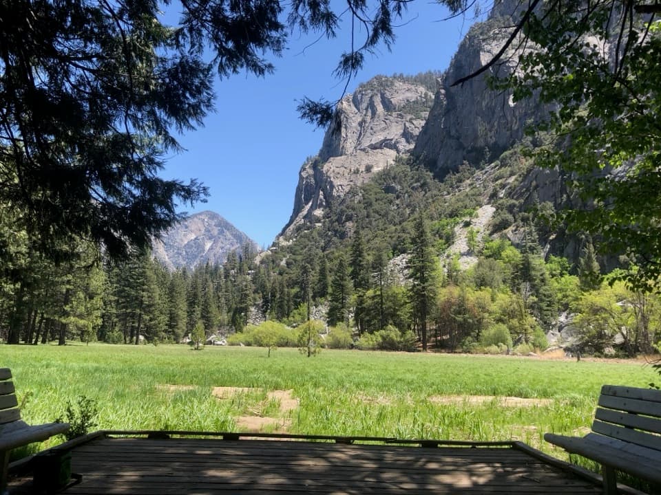
A short river crossing opens onto a green meadow beneath granite walls.

Photo: National Park Service
Type
Sight
Nearest trail
Right here
Audio stories
3 nearby
  • Trailhead
  • Parking
  • Scenic viewpoint

Hear the audio tour

Zumwalt Meadow

Overview

About Zumwalt Meadow

Why stop

  • A lush riverside meadow beneath steep granite walls.
  • A short bridge crossing gives the canyon floor a different scale.

Heads up

  • The former meadow loop was washed out; the current visit is not a loop through the meadow.
  • Trailhead parking is very limited.

Map

Where it is

Loading the Kings Canyon map
Full map
SightZumwalt Meadow36.79372, -118.59835
Keep this map with you offline in the Parkwolf app

Plan your stop

Before you go

Getting there

The trailhead is 4.5 miles east of Cedar Grove Village, at the end of a small lot with very limited parking. If it is full, come back later rather than counting on a nearby space. The path to the bridge is the gentlest part; talus beyond it is uneven. Pets are not allowed on park trails. Cedar Grove usually opens from May through early or mid-November, with dates varying by weather and some facilities keeping shorter seasons. Check road and trail conditions before making the drive, and bring food and water for the stop.

8 active Kings Canyon alerts

  • CautionStage 1 fire restrictionsStage 1 fire restrictions are active because high fire danger raises the risk of accidental human-caused fires that could threaten visitors and employees.Official details
  • ClosureGrant Grove trails and areas closed for prescribed fireSome trails and areas around Grant Grove and the General Grant Tree are closed during an active prescribed burn; stay out until crews clear hazards and reopen them.Official details
See all 8 alerts
A park ranger sits on a dash-mounted phone, talking, as Parkwolf’s Tour Guide plays “Army Cutworm Moths: A Grizzly Bear Buffet” on Grand Loop Road below Dunraven Pass in Yellowstone
Parkwolf Tour GuideThe highest, rockiest slopes around here are a summer buffet for grizzly bears.

Kings Canyon Tour Guide

Your drive to Zumwalt Meadow, narrated.

Parkwolf is a GPS audio tour guide for Kings Canyon National Park. As you drive, it chimes in with what’s ahead: hidden gems, upcoming stops, history, geology, and wildlife, right through your car’s speakers.

See the Kings Canyon audio tour

Recorded for this place

Zumwalt Meadow
0:00 / 0:24
“Zumwalt Meadow is coming up, and I'd stop here for a walk beside the Kings River, with green meadow below the granite walls.”

Plays as you drive up to Zumwalt Meadow in the Parkwolf Kings Canyon Tour Guide.

More stories near here in the app

  • Road's End and Muir Rock
  • Roaring River Falls
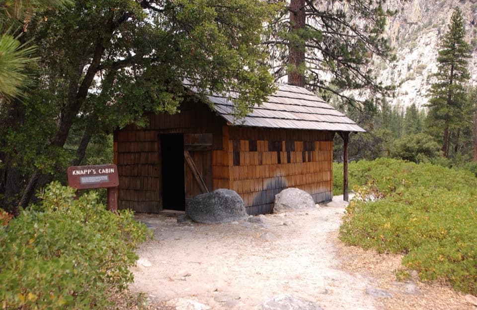
  • Knapp’s Cabin
  • Cedar Grove's Flat Green Sprays
  • 55 audio storiesacross Kings Canyon’s roads, triggered by GPS as you drive
  • Wildlife heatmapsfor Black Bear, Mule Deer, Marmot, and 13 more
  • Works offlinemaps, 77 trails, 61 places, and audio download before you lose signal
  • CarPlay readysimple controls built for the drive
★★★★★
“…The kids and my husband and I all agree that the narration really added to our experience driving through the parks. We learned so much about the history and the flora & fauna.”
JessestblondeApp Store review
Download Parkwolf on the App StoreGet Parkwolf on Google Play

4.7 from 8,600+ ratings

Guide

More about Zumwalt Meadow

Why make the stopZumwalt Meadow is a lush opening beside the Kings River in Cedar Grove, framed by steep granite…

Zumwalt Meadow is a lush opening beside the Kings River in Cedar Grove, framed by steep granite walls. The river crossing and meadow make it one of the canyon's signature short stops. Go for a compact walk and a close look at the canyon floor; this isn't a route through a complete meadow loop.

The route todayThe meadow trail is listed at 0.8 mile.

The meadow trail is listed at 0.8 mile. It crosses the river on an expansion bridge, then climbs through woods and talus to views across the meadow. Flooding in 2019 washed away sections of the old route through the meadow and beside the river, so treat the visit as an out-and-back unless you continue onto the Kanawyer Loop. Beyond the meadow, that trail continues another 0.8 mile toward Road's End and Muir Rock.

What the trail feels likeFrom the parking area to the expansion bridge, the path is relatively level, but it is unpaved,…

From the parking area to the expansion bridge, the path is relatively level, but it is unpaved, sandy and not firmly packed in places. That stretch may suit some wheelchair users; the full route is not described as accessible. Past the bridge, the woods and talus make for rougher walking. Spring snowmelt can flood the trail or nearby ground.

A green pocket in a granite canyonThe meadow sits below steep granite walls and broken rock slopes.

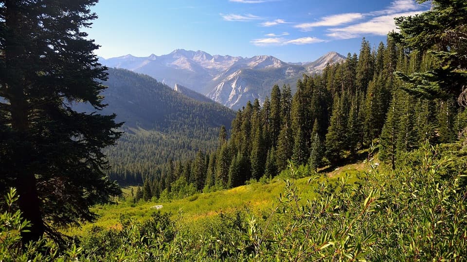
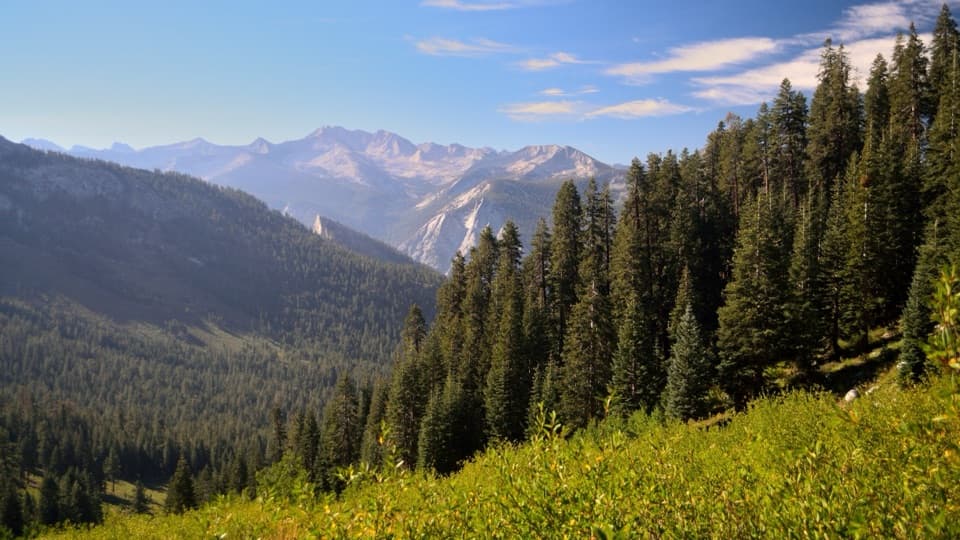
The meadow sits below steep granite walls and broken rock slopes. Sierra Nevada granite formed as molten rock cooled underground about 100 million years ago; glaciers later carved the deep valleys and jagged peaks around Cedar Grove. Here the contrast is easy to read: grass and river on the canyon floor, high bare rock above.

River, meadow and wildlifeFrom the bridge, look both ways along the Kings River; farther along, the trail rises to a view…

From the bridge, look both ways along the Kings River; farther along, the trail rises to a view back across the meadow. Meadows can attract bears, yellow-bellied marmots, deer, birds of prey and snakes, but sightings are never guaranteed. Take the river, green meadow and wall together in the view to show how the canyon fits around this small opening.

Wildlife

Wildlife in Kings Canyon

All Kings Canyon wildlife maps

Sighting maps show where each species has been reported across Kings Canyon. Wildlife moves, so no sighting is guaranteed.

Keep exploring

Near Zumwalt Meadow

See it all on the map

Trails nearby

More stops nearby

Parkwolf’s Kings Canyon ranking

Top sights in Kings Canyon

All 61 places
  1. 1General Grant TreeSight
  2. 3Roaring River FallsSight
  3. 4Panoramic Point OverlookSight
  4. 5Grizzly FallsSight
  5. 6Boyden CavernSight
  6. 7Junction ViewSight

Take Parkwolf to Kings Canyon.

The audio tour guide for the drive, plus offline maps, trails, and wildlife heatmaps for when the signal drops.

4.7 from 8,600+ ratings

Download Parkwolf on the App StoreGet Parkwolf on Google Play