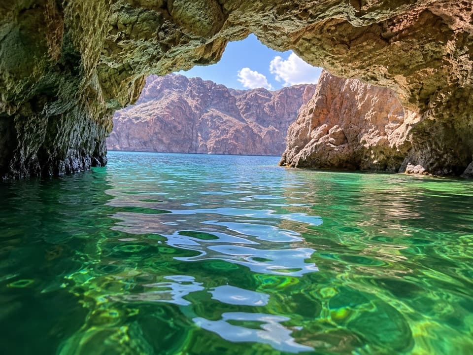
Arizona Hot Springs in Lake Mead National Recreation Area

#8 of 40 sights in Lake Mead

Sight · Lake Mead National Recreation Area

Arizona Hot Springs

A soak in canyon hot pools after a hard desert hike.

Type
Sight
Nearest trail
1.9 mi
Audio stories
1 nearby
  • Trailhead
  • Parking
  • Restrooms

Hear the audio tour

White Rock Canyon: The Hike to Arizona Hot Springs

Overview

About Arizona Hot Springs

Why stop

  • Natural hot pools in a narrow volcanic canyon beside the Colorado River.

Heads up

  • The unmaintained route is strenuous, sandy and exposed.
  • The loop includes a 20-foot ladder and steep scrambling.

Map

Where it is

Loading the Lake Mead map
Full map
SightArizona Hot Springs35.96054, -114.72573
Keep this map with you offline in the Parkwolf app

Plan your stop

Before you go

4 active Lake Mead alerts

  • CautionArizona Hot Springs bacteria advisoryMentions this placeLimit body contact with Arizona Hot Springs water: fecal bacteria in samples frequently reach high levels and can transmit human diseases.Official details
  • CautionHarmful algae bloom at Nelson’s Landing and Cottonwood CoveA harmful algae bloom has been confirmed in recent samples from Nelson’s Landing and Cottonwood Cove; avoid contact with water where algae is visible.Official details
See all 4 alerts
A park ranger sits on a dash-mounted phone, talking, as Parkwolf’s Tour Guide plays “Army Cutworm Moths: A Grizzly Bear Buffet” on Grand Loop Road below Dunraven Pass in Yellowstone
Parkwolf Tour GuideThe highest, rockiest slopes around here are a summer buffet for grizzly bears.

Lake Mead Tour Guide

Your drive to Arizona Hot Springs, narrated.

Parkwolf is a GPS audio tour guide for Lake Mead National Recreation Area. As you drive, it chimes in with what’s ahead: hidden gems, upcoming stops, history, geology, and wildlife, right through your car’s speakers.

See the Lake Mead audio tour

Recorded for this place

White Rock Canyon: The Hike to Arizona Hot Springs
0:00 / 0:26
“You're nearing the White Rock Canyon trailhead, with hiking access to Arizona Hot Springs.”

Plays as you drive up to Arizona Hot Springs in the Parkwolf Lake Mead Tour Guide.

More stories near here in the app

  • Sorting the Stones for Hoover Dam
  • Kingman Wash Beach and Fortification Hill
  • Hoover Dam's High Scalers
  • The Woodpecker Among the Thorns
  • 153 audio storiesacross Lake Mead’s roads, triggered by GPS as you drive
  • Wildlife heatmapsfor Bighorn Sheep, Burro, Bald Eagle, and 13 more
  • Works offlinemaps, 42 trails, 70 places, and audio download before you lose signal
  • CarPlay readysimple controls built for the drive
★★★★★
“Fantastic app with many points of information… It’s great to just turn on while you’re driving and it gives you an audio tour of the national Park. We love it!!!!”
JMJamesApp Store review
Download Parkwolf on the App StoreGet Parkwolf on Google Play

4.7 from 8,600+ ratings

Guide

More about Arizona Hot Springs

What you are hiking toArizona Hot Springs is a group of natural geothermal pools in a narrow, water-worn canyon…

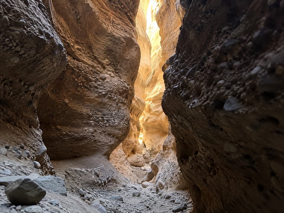
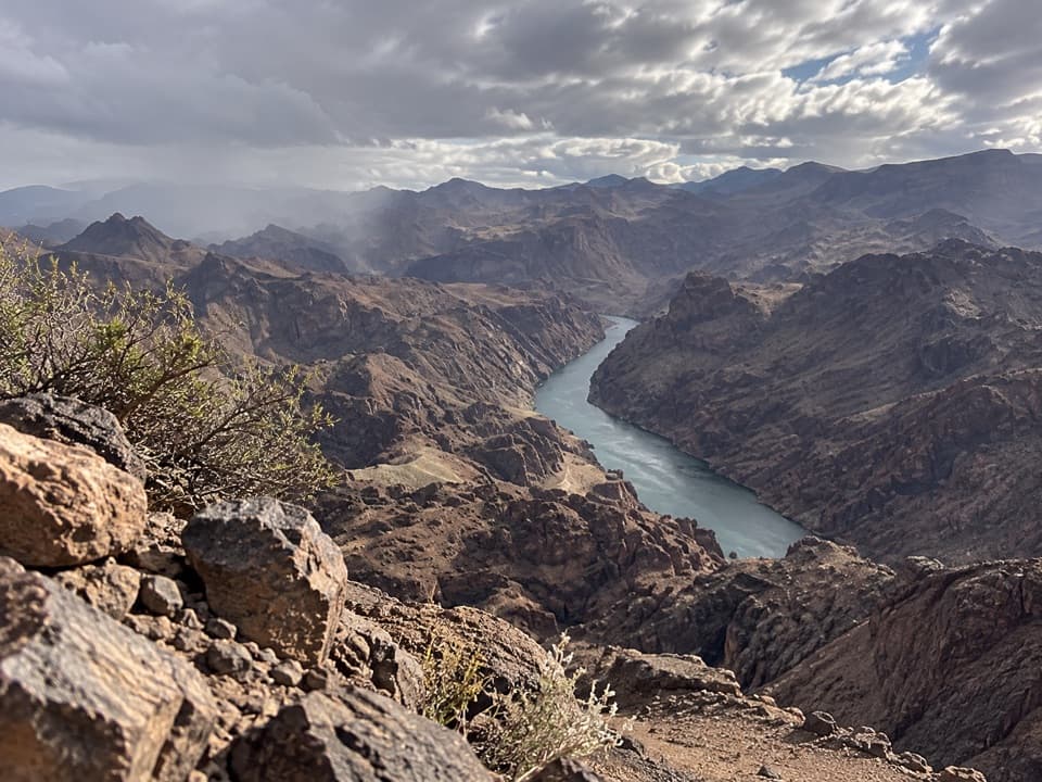
Arizona Hot Springs is a group of natural geothermal pools in a narrow, water-worn canyon beside the Colorado River. The land visit is a serious hike, not a quick pullout: the National Park Service lists 5 miles out and back or a 5.69-mile loop linking the Arizona Hot Springs and White Rock trails. It gives the route 750 feet of elevation change and 4 to 8 hours round trip. Go for the canyon walk as much as the soak; the sandy wash and steep scrambling make this a poor choice if you want an easy stop.

The trail and its ladderFrom the shared White Rock Canyon trailhead off U.S.

From the shared White Rock Canyon trailhead off U.S. 93, the unmaintained route descends through a normally dry wash of soft sand, gravel, rocks and boulders before reaching the Colorado River and Hot Spring Canyon. Footpaths braid together near the river, so keep track of your route. The loop descends a 20-foot ladder to White Rock Canyon Trail, with steep grades and ledges along the way.

Carry plenty of drinking water; none is available at the trailhead. Do not hike in a wash or canyon when thunderstorms threaten flash flooding. At the spring, stay on the established route and leave the flowing water and rocks as they are.

Hot water in a tight canyonGeothermal water rises through faults and fractures and flows at an estimated 30 to 50 gallons…

Geothermal water rises through faults and fractures and flows at an estimated 30 to 50 gallons per minute. NPS reports temperatures of 111 to 120°F. The pools sit among close, water-polished walls, with a waterfall and ladder giving the canyon its most recognizable view. Expect clothing-optional soaking. For a photo, include the ladder, falling water and the close rock walls together; that shows how narrow the canyon is.

Why it is also called RingboltRingbolt Hot Springs takes its alternate name from Ringbolt Rapids, just upstream from Hot…

Ringbolt Hot Springs takes its alternate name from Ringbolt Rapids, just upstream from Hot Spring Canyon. The pools are a natural, free-flowing spring system, not a built bathhouse. Blocking its flow with sandbags or other objects is prohibited because it alters the spring and creates health risks.

Volcanic rock and desert plantsThe canyon is mostly volcanic rock and volcanic ash.

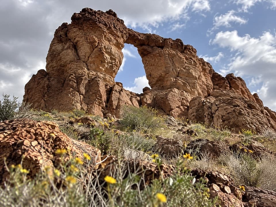
The canyon is mostly volcanic rock and volcanic ash. Granite boulders washed down from the Black Mountains add lighter blocks among the darker canyon walls. Look for desert plants such as indigo bush, rabbit brush, Mormon tea and globemallow along the route.

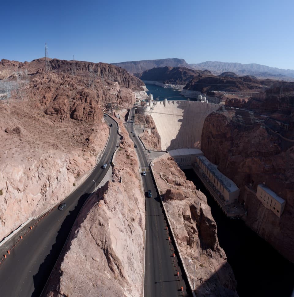
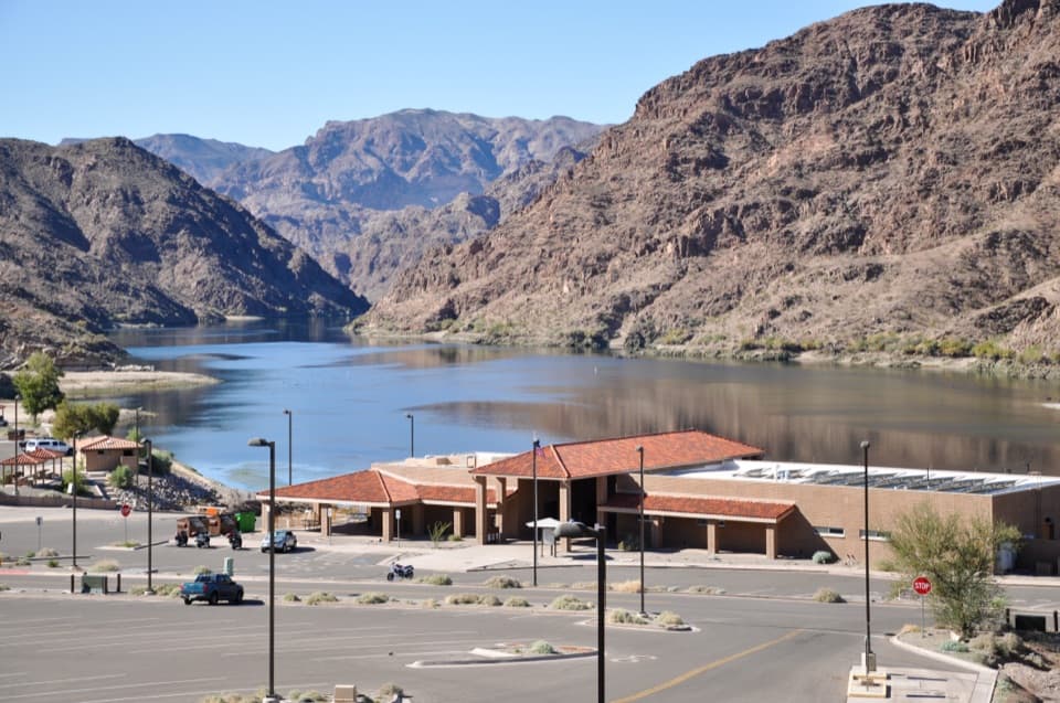
Before you set outParking is at the shared trailhead just off U.S. 93, south of Hoover Dam.

Parking is at the shared trailhead just off U.S. 93, south of Hoover Dam. Pit toilets are about 200 yards downstream of the springs along the Colorado River, not beside the pools; there is no food service at the spring. The trail is in a fee area, so keep your park pass or proof of admission in the vehicle. Pets are allowed on the trail on a leash no longer than six feet.

Land access closes annually May 15 through September 30. NPS may also close strenuous trails outside that window when the Willow Beach forecast reaches 95°F or flash flooding is possible. The springs remain accessible by water on Lake Mohave during trail closures.

Wildlife

Wildlife in Lake Mead

All Lake Mead wildlife maps

Sighting maps show where each species has been reported across Lake Mead. Wildlife moves, so no sighting is guaranteed.

Keep exploring

Near Arizona Hot Springs

See it all on the map

Trails nearby

More stops nearby

Parkwolf’s Lake Mead ranking

Top sights in Lake Mead

All 70 places
  1. 1Hoover DamSight
  2. 2Emerald CaveSight
  3. 3Willow BeachBeach
  4. 4Boulder BeachBeach
  5. 5St. Thomas TownsiteSight
  6. 6Mike O’Callaghan–Pat Tillman Memorial BridgeSight

Take Parkwolf to Lake Mead.

The audio tour guide for the drive, plus offline maps, trails, and wildlife heatmaps for when the signal drops.

4.7 from 8,600+ ratings

Download Parkwolf on the App StoreGet Parkwolf on Google Play