Rest and Be Thankful Viewpoint in Loch Lomond & The Trossachs National Park

Sight · Loch Lomond & The Trossachs National Park

Rest and Be Thankful Viewpoint

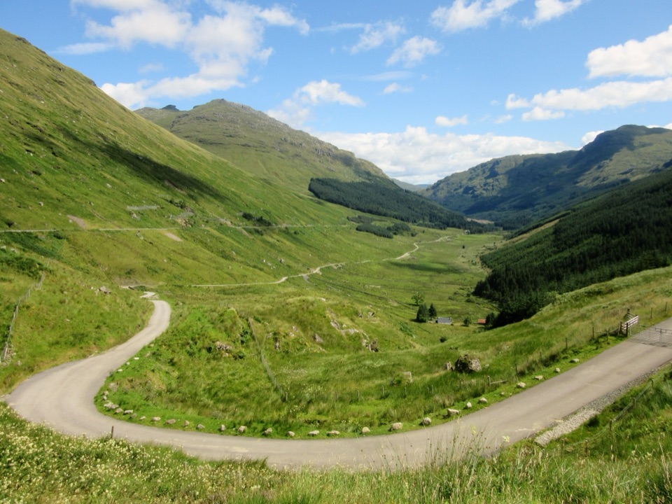
The famous top-of-the-pass view, a soldiers' stone and a burger van

Photo: Wikimedia Commons
Type
Sight
Nearest trail
1.5 km
Audio stories
5 nearby
  • Parking
  • Scenic viewpoint
  • Food
  • Picnic tables
  • #13 of 41 sights

Hear the audio tour

Rest and Be Thankful above Glen Croe

Overview

About Rest and Be Thankful Viewpoint

Why stop

  • Glen Croe view straight from the car park
  • Well-liked, fairly priced burger van

Heads up

  • Landslides can close the road at short notice

Map

Where it is

Loading the Loch Lomond & The Trossachs map
Full map
SightRest and Be Thankful Viewpoint56.22568, -4.85589
Keep this map with you offline in the Parkwolf app

Plan your stop

Before you go

4 active Loch Lomond & The Trossachs alerts

  • CautionA82 restriction near Kings House HotelThe A82 is restricted in both directions near Kings House Hotel, Glencoe, because of planned roadworks. - Temporary traffic lights are in place; follow the traffic management.Official details
  • ClosureDaytime A827 closure at KillinThe A827 at Killin is closed during the day for roadworks from 28 September through 9 October 2026. - Closure hours: 9:30am to 3:30pm; avoid the route during those hours.Official details
See all 4 alerts
A park ranger sits on a dash-mounted phone, talking, as Parkwolf’s Tour Guide plays “Army Cutworm Moths: A Grizzly Bear Buffet” on Grand Loop Road below Dunraven Pass in Yellowstone
Parkwolf Tour GuideThe highest, rockiest slopes around here are a summer buffet for grizzly bears.

Loch Lomond & The Trossachs Tour Guide

Your drive to Rest and Be Thankful Viewpoint, narrated.

Parkwolf is a GPS audio tour guide for Loch Lomond & The Trossachs National Park. As you drive, it chimes in with what’s ahead: hidden gems, upcoming stops, history, geology, and wildlife, right through your car’s speakers.

Recorded for this place

Rest and Be Thankful above Glen Croe
0:00 / 0:30
“You're coming up on Rest and Be Thankful, the A83 pass where Glen Croe opens below the car park.”

Plays as you drive up to Rest and Be Thankful Viewpoint in the Parkwolf Loch Lomond & The Trossachs Tour Guide.

More stories near here in the app

  • Beinn an Lochain from the A83
  • Keats and the Missing Inn
  • Why Soldiers Built This Road
  • Why the Cobbler Has Three Peaks
  • 196 audio storiesacross Loch Lomond & The Trossachs’s roads, triggered by GPS as you drive
  • Wildlife heatmapsfor Golden Eagle, Red Deer, Mute Swan, and 13 more
  • Works offlinemaps, 93 trails, 73 places, and audio download before you lose signal
  • CarPlay readysimple controls built for the drive
★★★★★
“Fantastic app with many points of information… It’s great to just turn on while you’re driving and it gives you an audio tour of the national Park. We love it!!!!”
JMJamesApp Store review
Download Parkwolf on the App StoreGet Parkwolf on Google Play

4.7 from 8,600+ ratings

Guide

More about Rest and Be Thankful Viewpoint

What you're stopping forRest and Be Thankful is the top of the A83 road pass between Loch Long and Loch Fyne, about 245…

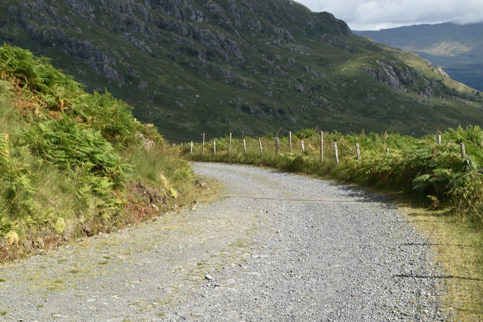
Rest and Be Thankful is the top of the A83 road pass between Loch Long and Loch Fyne, about 245 m up, with a big car park on the Glen Croe side and the whole glen laid out below it. It's the most famous road view in this corner of the park, and it's famous for a good reason: you've just come up a long, steep climb, and from the top you can see the old road looping down the valley floor that people used to have to walk. Stop here even if you're only passing through on the way to Inveraray or Oban. Ten to twenty minutes covers the view, the marker stone and a sit on a bench; add a bit longer if the food van's in and there's a queue.

The view and the story behind the nameWalk to the edge on the glen side and Glen Croe runs away south-east below you: steep grass on…

Walk to the edge on the glen side and Glen Croe runs away south-east below you: steep grass on the left, plantation forest on the right, and a narrow single-track road doing a hairpin right under the car park before wandering down the middle of the glen. That's the Old Military Road, pushed through here by soldiers in the middle of the eighteenth century, after the Jacobite risings, so troops could be moved around the Highlands. The climb out of the glen was so long and steep that travellers got into the habit of stopping at the top to rest and be thankful, and the soldiers carved the words into a stone at the summit. The original stone is long gone, but its replacement stands at the bottom of the car park where the old road comes in, and you can still make out the lettering recording the road's repair by the 93rd Regiment in 1768 and its handover to the road commissioners in 1814. Johnson and Boswell came over the pass in 1773, and Wordsworth walked it with his sister Dorothy in 1803 and later wrote a sonnet about it.

The road you drove up was built in the late 1930s on the slope above the old one, and the old road hasn't retired. This pass gets landslides after heavy rain, and when they close the A83 the military road below you gets pressed back into service as the diversion.

For the photo, get the hairpin of old road in the bottom of the frame and let it lead the eye down the glen. It gives the slopes their scale.

Food, benches and a hill if you want oneA catering van usually parks up in the car park, serving hot filled rolls, burgers, soup, tea…

A catering van usually parks up in the car park, serving hot filled rolls, burgers, soup, tea and coffee at fair prices. The venison burger with onions is the thing to order, and the bacon and brie roll gets mentioned too. There are picnic tables and simple wooden benches facing the view, so it's a proper place to eat rather than a lay-by. There are no toilets here; the nearest public ones are down the glen at Ardgartan.

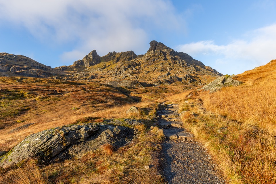
Turn round and cross the A83 and you're at Loch Restil, a small loch under the steep face of Beinn an Lochain. If you want a real walk, Ben Donich starts from a track a few hundred metres along the B828 towards Lochgoilhead: a Corbett of 847 m, about 7.5 km there and back with 575 m of climbing, three and a half to four and a half hours, on a decent path with one short easy scramble.

Getting here and what to expectThe car park is on the A83 at the very top of Glen Croe, at the junction with the B828 to…

The car park is on the A83 at the very top of Glen Croe, at the junction with the B828 to Lochgoilhead. Coming up from Arrochar it's on your left just as the road levels out. It's a big car park, but it's a busy one: coach tours pull in, and on a fine summer morning it can be heaving by mid-morning. Buses between Glasgow and Oban or Campbeltown stop here too. The pass is high and exposed, so cloud often sits on the tops even when the glen is clear. Because landslides close this road from time to time, check the road status before you set out if you're relying on it to get west.

Wildlife

Wildlife in Loch Lomond & The Trossachs

All Loch Lomond & The Trossachs wildlife maps

Sighting maps show where each species has been reported across Loch Lomond & The Trossachs. Wildlife moves, so no sighting is guaranteed.

Parkwolf’s Loch Lomond & The Trossachs ranking

Top sights in Loch Lomond & The Trossachs

All 73 places
  1. 1Ben LomondSight
  2. 2Trossachs PierSight
  3. 3Conic HillSight
  4. 4Falls of DochartSight
  5. 5Ben A’anSight
  6. 6Bracklinn FallsSight

Take Parkwolf to Loch Lomond & The Trossachs.

The audio tour guide for the drive, plus offline maps, trails, and wildlife heatmaps for when the signal drops.

4.7 from 8,600+ ratings

Download Parkwolf on the App StoreGet Parkwolf on Google Play