Prater Ridge South Loop Trail in Mesa Verde National Park

Mesa Verde National Park, CO

Prater Ridge South Loop Trail

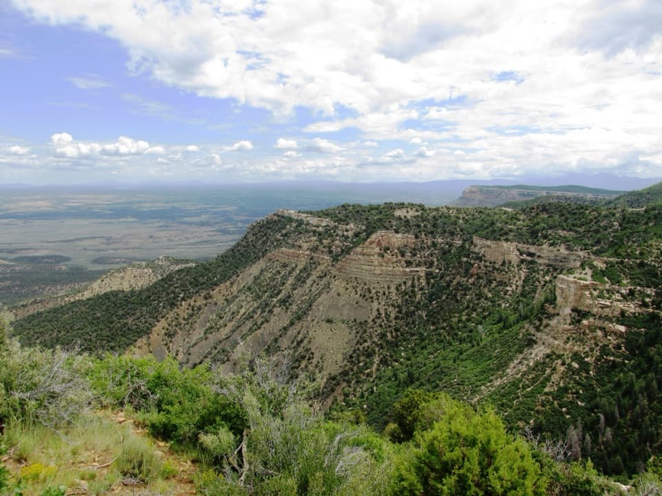
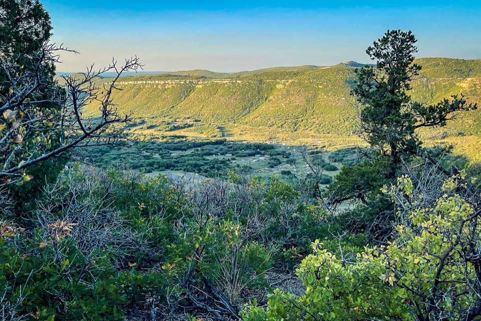
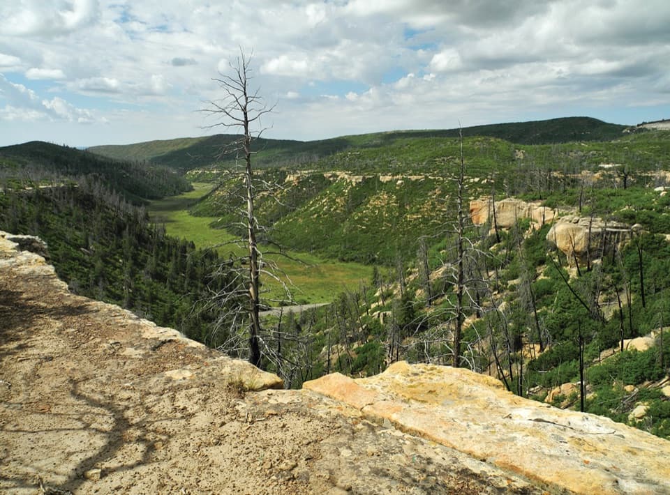
A steady climb buys wide views into two canyon heads.

Photo: National Park Service
Length
4.6mi
Time
2.5hr
Elev. change
459ft
Difficulty
Moderate
  • Loop
  • No dogs
  • High point 8,192 ft

Hear the audio tour

Prater Ridge Trails

Overview

About Prater Ridge South Loop Trail

Why go

  • Open views over Prater and Morefield Canyons.
  • A shorter ridge outing than the North Loop or both-loop route.

Heads up

  • The main climb comes first, then the approach must be retraced.
  • Unfenced, exposed canyon edges need close attention.

Map & elevation

The route

Loading the Mesa Verde map
Full map
Elevation7,733–8,192 ft
TrailheadPrater Ridge Trailhead, west side of Morefield Campground37.29677, -108.41834
Keep this map with you offline in the Parkwolf app

Plan your hike

Before you go

Parking

Begin at Prater Ridge Trailhead on the west side of Morefield Campground. A small surface parking area is mapped beside it; capacity and overflow options are not published. Park entrance fee applies. No water or toilets are listed at the trailhead.


Safety

Unfenced, unstable canyon edges and fragile cryptobiotic soil border parts of the route; stay on trail. The open, dry ridge is exposed to wind and lightning. Carry water and leave the ridge before storms build.

2 active Mesa Verde alerts

  • ClosureRoad improvements close Far View and Cedar Tree Tower access roadsAccess roads to Far View Sites and Cedar Tree Tower are temporarily closed to all traffic for road improvements.Official details
  • CautionKnife Edge Trail rockfall area: do not enterDo not enter the rockfall area along the last quarter of Knife Edge Trail because a serious rockfall occurred there. - The trailhead is at Morefield Campground. - Knife Edge Trail is 2 miles (3.Official details
Mesa Verde alerts
A park ranger sits on a dash-mounted phone, talking, as Parkwolf’s Tour Guide plays “Army Cutworm Moths: A Grizzly Bear Buffet” on Grand Loop Road below Dunraven Pass in Yellowstone
Parkwolf Tour GuideThe highest, rockiest slopes around here are a summer buffet for grizzly bears.

Mesa Verde Tour Guide

Your drive to Prater Ridge South Loop Trail, narrated.

Parkwolf is a GPS audio tour guide for Mesa Verde National Park. As you drive, it chimes in with what’s ahead: hidden gems, upcoming stops, history, geology, and wildlife, right through your car’s speakers.

Recorded for this trailhead

Prater Ridge Trails
0:00 / 0:26
“Up ahead is the Prater Ridge trailhead, where a sustained climb leads to open canyon views. For a shorter outing, I'd choose the South Loop: four-point-six miles round trip and about two to three hours.”

Plays as you drive up to this trailhead in the Parkwolf Mesa Verde Tour Guide.

More stories near here in the app

  • Morefield Campground and Village
  • Knife Edge Trail
  • Mancos Valley Overlook
  • Point Lookout
  • 43 audio storiesacross Mesa Verde’s roads, triggered by GPS as you drive
  • Wildlife heatmapsfor Black Bear, Mule Deer, Golden Eagle, and 13 more
  • Works offlinemaps, 22 trails, 48 places, and audio download before you lose signal
  • CarPlay readysimple controls built for the drive
★★★★★
“Fantastic app with many points of information… It’s great to just turn on while you’re driving and it gives you an audio tour of the national Park. We love it!!!!”
JMJamesApp Store review
Download Parkwolf on the App StoreGet Parkwolf on Google Play

4.7 from 8,600+ ratings

Trail guide

Hiking Prater Ridge South Loop Trail

The shorter way aroundPrater Ridge South Loop is a 4.

Prater Ridge South Loop is a 4.6-mile loop-style hike from Prater Ridge Trailhead at Morefield Campground. That total includes the 1.1-mile shared climb to the ridge, the 2.4-mile South Loop around the canyon heads, and the same approach back down. The 2.4-mile figure sometimes used for this trail is only the upper circuit. Allow about two to three hours; this is a real hike, not a quick campground stroll, but it saves the longer North Loop for another day.

Climb to the rimThe first 1.1 miles do most of the work.

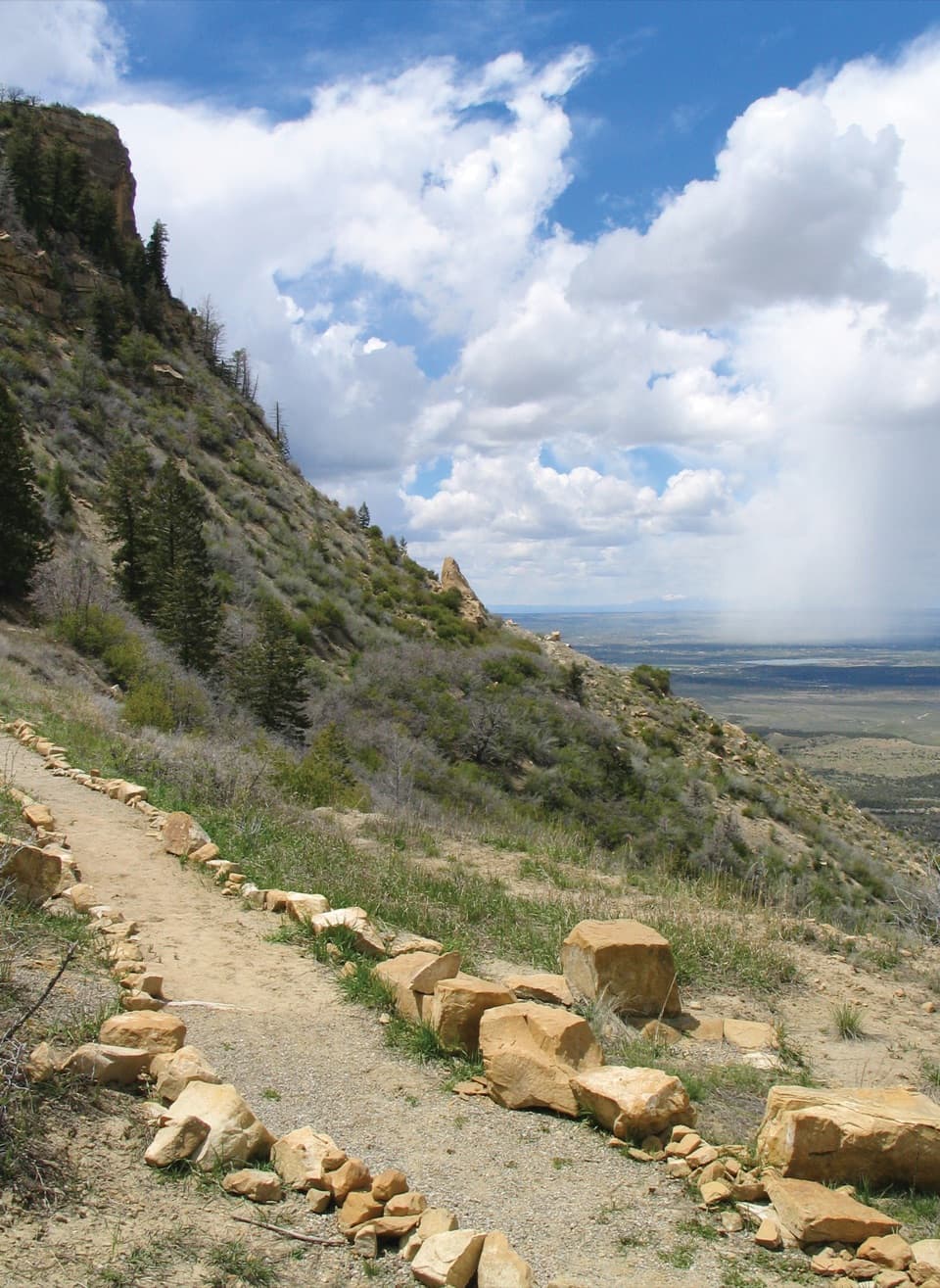
The first 1.1 miles do most of the work. The path climbs steadily from the campground to the ridge junction, with short switchbacks up a cliff band. Turn left for the South Loop. The upper route rolls along the rim and bends around several canyon heads before bringing you back to the same junction; retrace the approach to the campground rather than following the North Loop.

Two canyons from one ridgeThe payoff is a series of open views into Prater Canyon and Morefield Canyon.

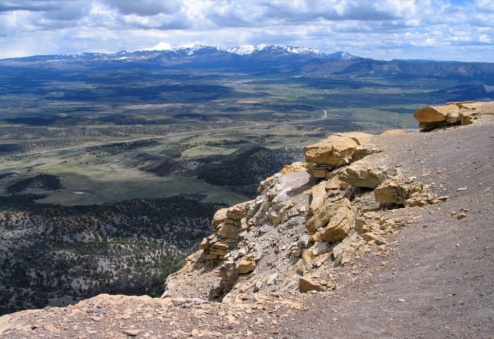
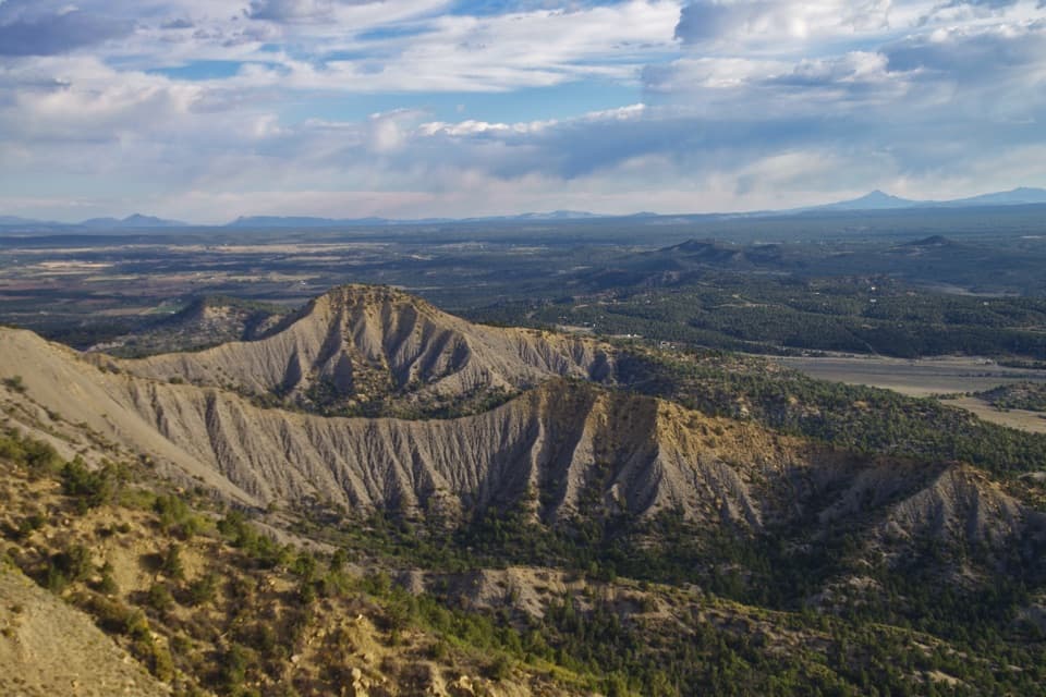
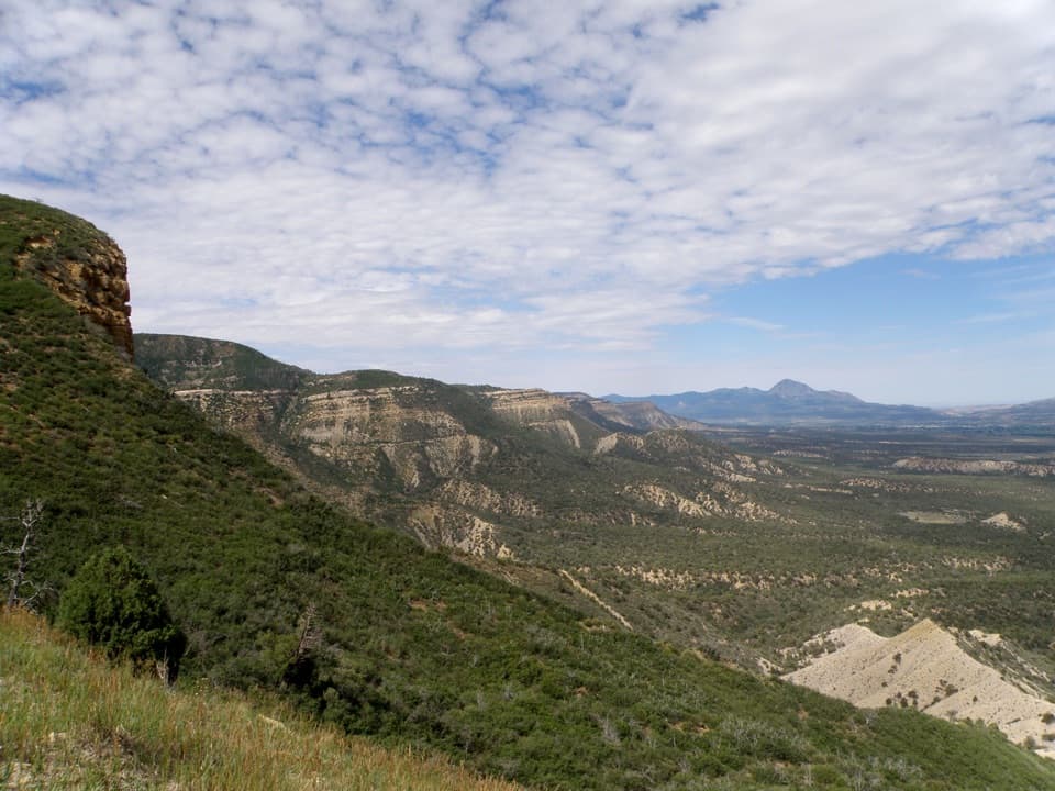
The payoff is a series of open views into Prater Canyon and Morefield Canyon. There is no summit building or cliff dwelling at the end; the ridge itself is the attraction, with sandstone ledges above green canyon slopes. For a photo, include a safe patch of ledge in the foreground so the canyon has a sense of scale.

Keep an eye on the edgeThis is high, dry, exposed country.

This is high, dry, exposed country. The canyon edges are unfenced and can be unstable, and the surrounding soil is fragile, so stay on the trail. Carry water; none is available on the route, and the campground trailhead listing does not show water. The ridge is open to wind and summer storms, so leave it before lightning builds. Mud has been reported on the South Loop after rain. Pets and bicycles are prohibited on the trail.

Wildlife

Wildlife in Mesa Verde

All Mesa Verde wildlife maps

Sighting maps show where each species has been reported across Mesa Verde. Wildlife moves, so no sighting is guaranteed.

Keep exploring

Near Prater Ridge South Loop Trail

See it all on the map

Trails that start nearby

Places near the trailhead

Parkwolf’s Mesa Verde ranking

Top-rated trails in Mesa Verde

All 22 trails
  1. 1Petroglyph Point TrailChallenging · 2.4 mi
  2. 2Long House TourChallenging · 2.3 mi
  3. 3Point Lookout TrailModerate · 2.2 mi
  4. 4Step House TrailModerate · 1 mi
  5. 5Spruce Tree House TrailEasy · 0.5 mi
  6. 6Balcony House TourChallenging · 0.3 mi

Take Parkwolf to Mesa Verde.

The audio tour guide for the drive, plus offline maps, trails, and wildlife heatmaps for when the signal drops.

4.7 from 8,600+ ratings

Download Parkwolf on the App StoreGet Parkwolf on Google Play