Denman Falls in Mount Rainier National Park

Sight · Mount Rainier National Park

Denman Falls

A forest-wrapped, 140-foot plunge on St. Andrews Creek.

Overview

About Denman Falls

Why stop

  • The short loop reaches a viewpoint beside the creek.

Heads up

  • The approach is 7.7 miles each way, and trees partly screen the falls.

Map

Where it is

Loading the Mount Rainier map
Full map
SightDenman Falls46.83591, -121.90785
Keep this map with you offline in the Parkwolf app

Plan your stop

Before you go

7 active Mount Rainier alerts

  • CautionWestside Road rockfall hazard and vehicle restrictionMentions Westside Road, referenced in this guideWestside Road is open but lies in an active geohazard zone with rockfall danger; vehicles must park south of the Dry Creek barricade.Official details
  • ClosureWildfire closures in the northern parkGrand Park 2 and Wonderland Complex fire closures affect trails, backcountry camps, and Sunrise access; stay out of closed areas.Official details

See all 7 alerts
A park ranger sits on a dash-mounted phone, talking, as Parkwolf’s Tour Guide plays “Army Cutworm Moths: A Grizzly Bear Buffet” on Grand Loop Road below Dunraven Pass in Yellowstone
Parkwolf Tour GuideThe highest, rockiest slopes around here are a summer buffet for grizzly bears.

Mount Rainier Tour Guide

Your drive to Denman Falls, narrated.

Parkwolf is a GPS audio tour guide for Mount Rainier National Park. As you drive, it chimes in with what’s ahead: hidden gems, upcoming stops, history, geology, and wildlife, right through your car’s speakers.

See the Mount Rainier audio tour

More stories near here in the app

  • Dry Creek: The Long Approach to Gobblers Knob
  • When Cars Were an Experiment
  • Ski Troops at Paradise
  • 77 audio storiesacross Mount Rainier’s roads, triggered by GPS as you drive
  • Wildlife heatmapsfor Mountain Goat, Black Bear, Wolverine, and 13 more
  • Works offlinemaps, 99 trails, 87 places, and audio download before you lose signal
  • CarPlay readysimple controls built for the drive
★★★★★
“Fantastic app with many points of information… It’s great to just turn on while you’re driving and it gives you an audio tour of the national Park. We love it!!!!”
JMJamesApp Store review
Download Parkwolf on the App StoreGet Parkwolf on Google Play

4.7 from 8,600+ ratings

Guide

More about Denman Falls

A long approach to a short loopDenman Falls is a roughly 140-foot waterfall on St.

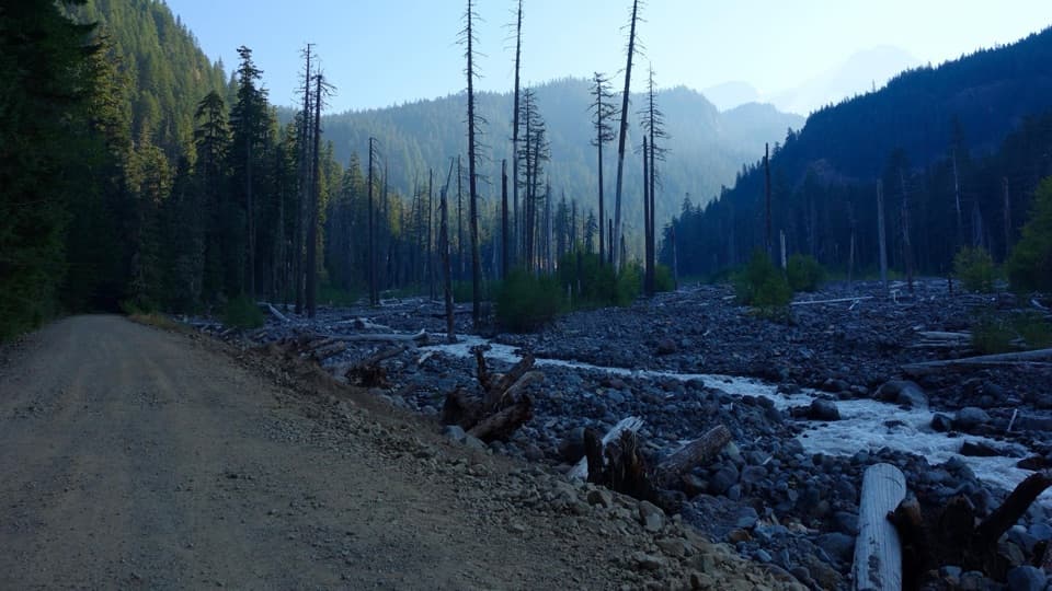
Denman Falls is a roughly 140-foot waterfall on St. Andrews Creek in Mount Rainier’s Westside Road area. This is a deliberate outing, not a roadside stop: from the Dry Creek barricade, follow Westside Road 7.7 miles on foot or bicycle to the St. Andrews Creek trailhead. A short 0.3-mile loop begins beside the bridge and leads to the viewpoint. Bicycles are not allowed on the trail.

The view through the treesThe falls make a freefall plunge into a forested creek ravine.

The falls make a freefall plunge into a forested creek ravine. Trees partly obscure the established viewpoint, so expect a framed glimpse rather than an open panorama; look for a gap in the branches to catch more of the cascade.

Take the road seriouslyVehicle access for this approach ends at the Dry Creek barricade.

Vehicle access for this approach ends at the Dry Creek barricade. The road beyond is a rockfall hazard, and the park advises visitors to avoid lingering in the hazard zone. Check current Westside Road conditions before setting out, since access can change.

A creek with more fallsDenman Falls is named for Asahel Holmes Denman, a photographer who documented Mount Rainier in…

Denman Falls is named for Asahel Holmes Denman, a photographer who documented Mount Rainier in the early 20th century. Farther downstream, St. Andrews Creek has two more named falls, Larrupin and Ethania, but reaching them is very difficult; they are not an easy add-on to this outing.

Wildlife

Wildlife in Mount Rainier

All Mount Rainier wildlife maps

Sighting maps show where each species has been reported across Mount Rainier. Wildlife moves, so no sighting is guaranteed.

Parkwolf’s Mount Rainier ranking

Top sights in Mount Rainier

All 87 places
  1. 1Reflection LakesSight
  2. 2Myrtle FallsSight
  3. 3Panorama PointSight
  4. 4Narada FallsSight
  5. 5Tipsoo LakeSight
  6. 6Sunrise Point OverlookSight

Take Parkwolf to Mount Rainier.

The audio tour guide for the drive, plus offline maps, trails, and wildlife heatmaps for when the signal drops.

4.7 from 8,600+ ratings

Download Parkwolf on the App StoreGet Parkwolf on Google Play