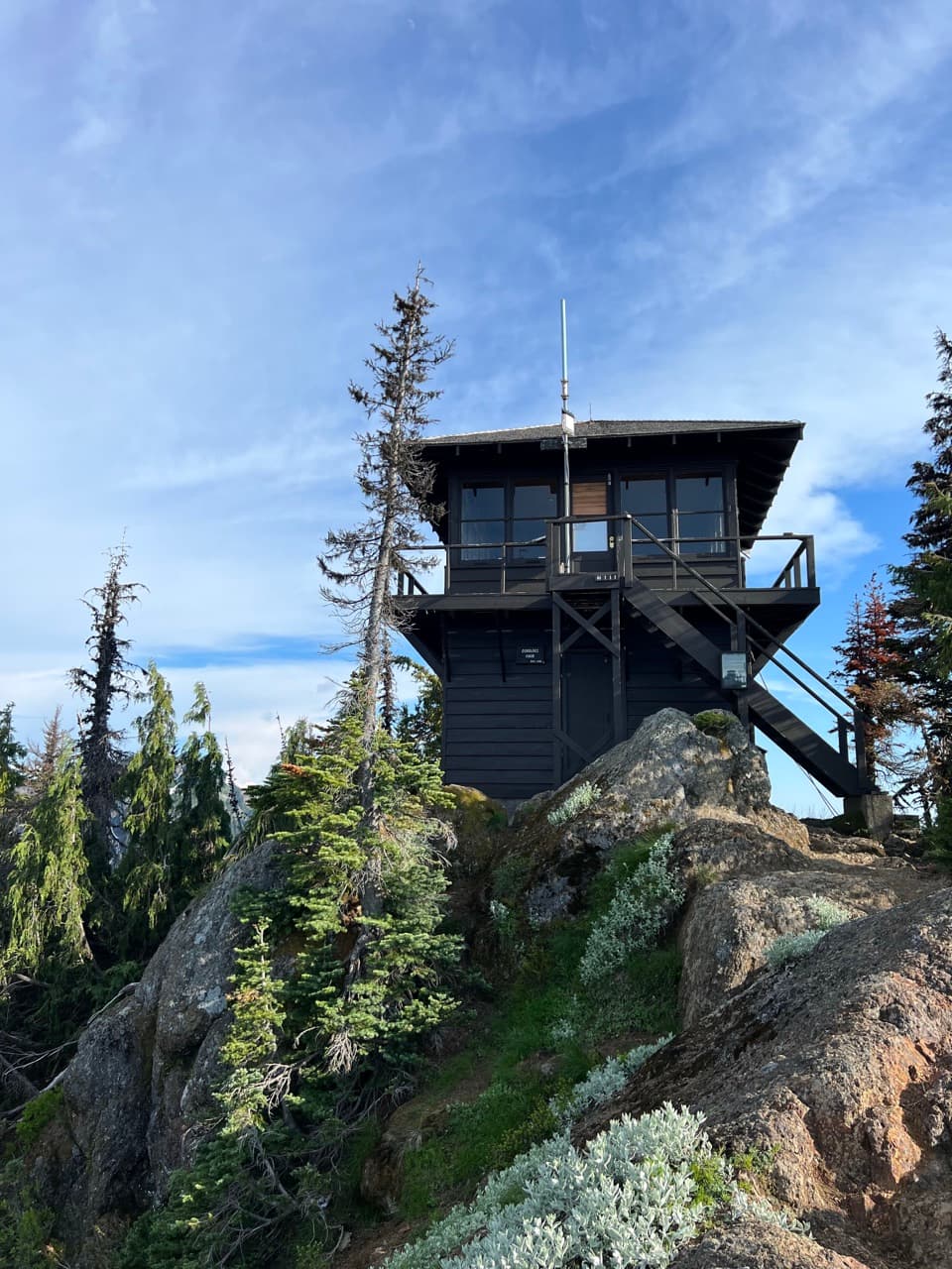
Lake George and Gobblers Knob Trail in Mount Rainier National Park

Mount Rainier National Park, WA

Lake George and Gobblers Knob Trail

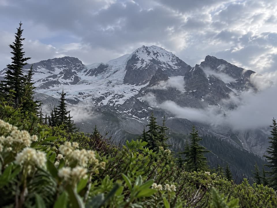
An old road leads to a 1933 lookout above Tahoma Glacier.

Photo: National Park Service
Length
11.2mi
Time
6.5hr
Elev. change
2,595ft
Difficulty
Challenging
  • No dogs
  • High point 5,472 ft
  • #34 of 99 in Mount Rainier

Hear the audio tour

Dry Creek: The Long Approach to Gobblers Knob

Overview

About Lake George and Gobblers Knob Trail

Why go

  • A historic summit lookout with a broad view of Rainier and Tahoma Glacier
  • Lake George makes a worthwhile shorter turnaround on the same route

Heads up

  • The road approach adds 7.6 miles on foot
  • The final climb is steep and rocky

Map & elevation

The route

Loading the Mount Rainier map
Full map
Elevation2,877–5,472 ft
TrailheadWestside Road gate at Dry Creek46.77905, -121.88452
Keep this map with you offline in the Parkwolf app

Plan your hike

Before you go

Parking

Park south of the Westside Road barricade at Dry Creek; vehicles cannot continue past it. Round Pass, 3.8 miles up the closed road, has the actual trailhead and a bike rack, but no motor-vehicle access. The first three miles of Westside Road from SR 706 are seasonal for cars; when closed, reach Dry Creek on foot or skis.

Safety

Westside Road beyond Dry Creek is an active rockfall and geohazard area; keep moving and avoid lingering. The last mile has steep, rocky switchbacks beside a sharp drop, so stay on the trail. Pets are not allowed on the road or trails. Treat natural water before drinking.

7 active Mount Rainier alerts

  • CautionWestside Road rockfall hazard and vehicle restrictionMentions Westside Road, referenced in this guideWestside Road is open but lies in an active geohazard zone with rockfall danger; vehicles must park south of the Dry Creek barricade.Official details
  • ClosureWildfire closures in the northern parkGrand Park 2 and Wonderland Complex fire closures affect trails, backcountry camps, and Sunrise access; stay out of closed areas.Official details
See all 7 alerts
A park ranger sits on a dash-mounted phone, talking, as Parkwolf’s Tour Guide plays “Army Cutworm Moths: A Grizzly Bear Buffet” on Grand Loop Road below Dunraven Pass in Yellowstone
Parkwolf Tour GuideThe highest, rockiest slopes around here are a summer buffet for grizzly bears.

Mount Rainier Tour Guide

Your drive to Lake George and Gobblers Knob Trail, narrated.

Parkwolf is a GPS audio tour guide for Mount Rainier National Park. As you drive, it chimes in with what’s ahead: hidden gems, upcoming stops, history, geology, and wildlife, right through your car’s speakers.

See the Mount Rainier audio tour

Recorded for this trailhead

Dry Creek: The Long Approach to Gobblers Knob
0:00 / 0:31
“You're nearing Dry Creek, where vehicle access on Westside Road ends and the long approach to Gobblers Knob begins.”

Plays as you drive up to this trailhead in the Parkwolf Mount Rainier Tour Guide.

More stories near here in the app

  • When Cars Were an Experiment
  • Ski Troops at Paradise
  • Trees Above a Vanished Log
  • Nisqually Entrance: The Cedar-Log Gateway
  • 77 audio storiesacross Mount Rainier’s roads, triggered by GPS as you drive
  • Wildlife heatmapsfor Mountain Goat, Black Bear, Wolverine, and 13 more
  • Works offlinemaps, 99 trails, 87 places, and audio download before you lose signal
  • CarPlay readysimple controls built for the drive
★★★★★
“Fantastic app with many points of information… It’s great to just turn on while you’re driving and it gives you an audio tour of the national Park. We love it!!!!”
JMJamesApp Store review
Download Parkwolf on the App StoreGet Parkwolf on Google Play

4.7 from 8,600+ ratings

Trail guide

Hiking Lake George and Gobblers Knob Trail

The full walkLake George and Gobblers Knob Trail is an out-and-back from the Dry Creek road gate to a 1933…

Lake George and Gobblers Knob Trail is an out-and-back from the Dry Creek road gate to a 1933 fire lookout above Lake George on Mount Rainier’s west side. The full trip is 11.2 miles round trip, gains 2,585 feet, and usually takes six to seven hours. The distance includes a 3.8-mile approach each way on Westside Road before the actual trail starts at Round Pass. Other route measurements come closer to 12 miles, so leave room for a long day and stops. Lake George is a useful shorter turnaround at 9.2 miles round trip and about five hours from Dry Creek.

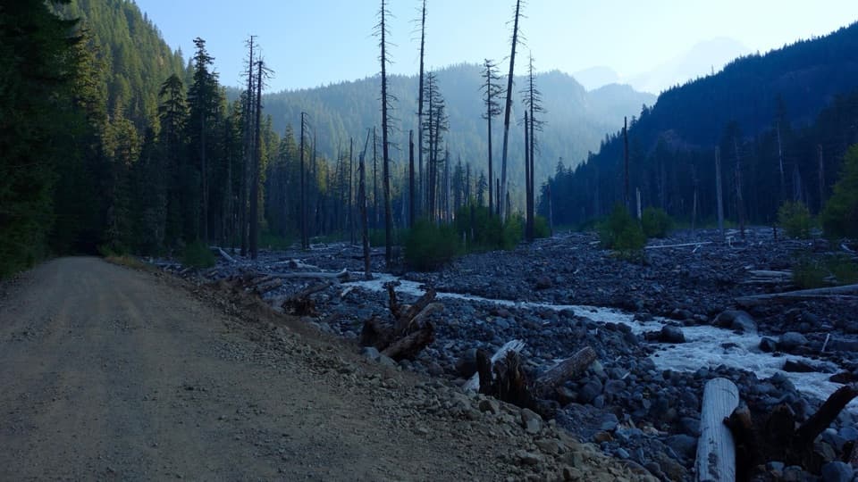
Walk the road to Round PassFrom Dry Creek, Westside Road is closed to motor vehicles but open to hikers and bikes.

From Dry Creek, Westside Road is closed to motor vehicles but open to hikers and bikes. The gravel road climbs gradually for 3.8 miles to Round Pass, where a wide pullout and bike rack mark the actual trailhead. That road is part of the full walk, not just a way to reach the trail. Biking the approach saves the road miles in both directions, but bikes must stay at Round Pass while you hike. Access to Dry Creek is seasonal too: the first three miles of Westside Road are open to cars in summer; when that stretch is closed, visitors continue from the road entrance on foot or skis. The road beyond Dry Creek passes through an active rockfall and geohazard area. Keep moving and do not linger there.

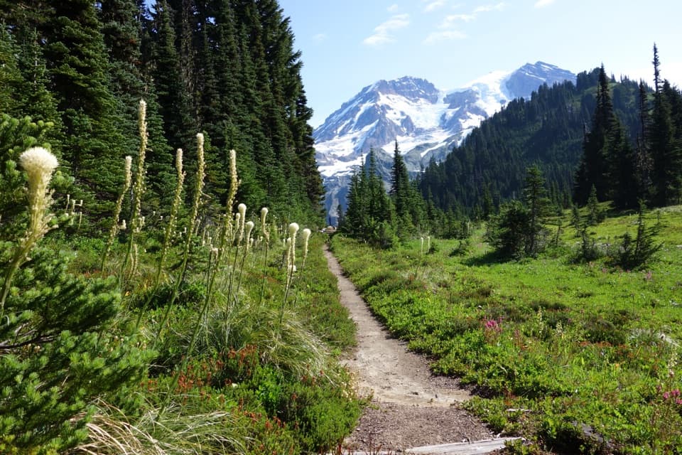
Lake George is a sensible turnaroundFrom Round Pass, the trail climbs gently through forest for 0.8 mile to Lake George.

From Round Pass, the trail climbs gently through forest for 0.8 mile to Lake George. The shoreline and historic patrol cabin make this a worthwhile destination on their own, and the lake is the only camping area on the route. Campsites require a wilderness permit; camping is not allowed on Gobblers Knob. There is a restroom by the lake, but no drinking-water tap on the route. Treat natural water before drinking it.

The last climbFrom the lake, another mile climbs steeply toward the knob, gaining about 800 feet with few…

From the lake, another mile climbs steeply toward the knob, gaining about 800 feet with few level breaks. A small pond sits beside the trail, and a meadow opens a first look at the lookout. At the saddle, take the right branch toward Gobblers Knob; the left fork goes to Goat Lake. The upper trail has rocky switchbacks and can hold snow into July. Near the summit, stay on the trail: the rocky ridge has a sharp drop.

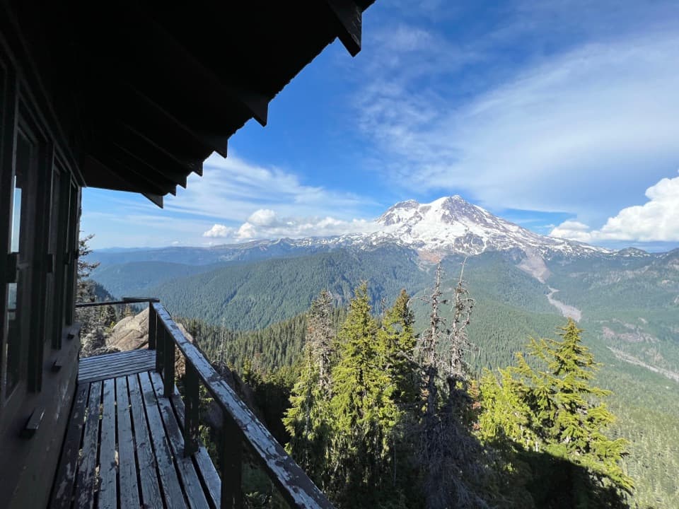
A lookout with a big viewThe fire lookout was built in 1933 and is one of four remaining in the park.

The fire lookout was built in 1933 and is one of four remaining in the park. Fire watchers once used its windows and fire-finding instrument to spot smoke or lightning and report it by telephone; the structure is still used occasionally. From the summit, look for Mount Rainier and Tahoma Glacier. On clear days the view reaches Mount St. Helens, Mount Adams, Mount Hood, Goat Rocks, and the Olympic Mountains. The lookout and rocky pinnacle make the photo payoff here; include part of the tower or catwalk with Rainier behind it so the picture shows both the landmark and its setting.

Wildlife

Wildlife in Mount Rainier

All Mount Rainier wildlife maps

Sighting maps show where each species has been reported across Mount Rainier. Wildlife moves, so no sighting is guaranteed.

Keep exploring

Near Lake George and Gobblers Knob Trail

See it all on the map

Trails that start nearby

Places near the trailhead

Parkwolf’s Mount Rainier ranking

Top-rated trails in Mount Rainier

All 99 trails
  1. 1Wonderland TrailChallenging · 93 mi
  2. 2Skyline Trail LoopChallenging · 5.5 mi
  3. 3Mount Fremont Lookout TrailModerate · 5.6 mi
  4. 4Burroughs Mountain TrailModerate · 6.2 mi
  5. 5Summerland TrailModerate · 8.4 mi
  6. 6Naches Peak Loop TrailModerate · 3.5 mi

Take Parkwolf to Mount Rainier.

The audio tour guide for the drive, plus offline maps, trails, and wildlife heatmaps for when the signal drops.

4.7 from 8,600+ ratings

Download Parkwolf on the App StoreGet Parkwolf on Google Play