Tipsoo Lake in Mount Rainier National Park

#5 of 61 sights in Mount Rainier

Sight · Mount Rainier National Park

Tipsoo Lake

A short loop, wildflowers, and a chance at Rainier's reflection.

Photo: National Park Service
Type
Sight
Nearest trail
0.1 mi
Audio stories
6 nearby
  • Parking
  • Restrooms
  • Picnic tables
  • Scenic viewpoint

Hear the audio tour

Tipsoo Lake and Chinook's Trail Bridge

Overview

About Tipsoo Lake

Why stop

  • A short shoreline walk combines lake, meadow and Mount Rainier views.

Heads up

  • Limited parking can make busy summer visits frustrating.

Map

Where it is

Loading the Mount Rainier map
Full map
SightTipsoo Lake46.86893, -121.51731
Keep this map with you offline in the Parkwolf app

Plan your stop

Before you go

7 active Mount Rainier alerts

  • ClosureWildfire closures in the northern parkGrand Park 2 and Wonderland Complex fire closures affect trails, backcountry camps, and Sunrise access; stay out of closed areas.Official details
  • ClosureSR 165 bridge closed: no public access to Carbon River or Mowich LakeThe SR 165 Carbon River/Fairfax Bridge is closed to vehicles, bicycles, and pedestrians; there is no public access or alternate route to Carbon River or Mowich Lake.Official details
See all 7 alerts
A park ranger sits on a dash-mounted phone, talking, as Parkwolf’s Tour Guide plays “Army Cutworm Moths: A Grizzly Bear Buffet” on Grand Loop Road below Dunraven Pass in Yellowstone
Parkwolf Tour GuideThe highest, rockiest slopes around here are a summer buffet for grizzly bears.

Mount Rainier Tour Guide

Your drive to Tipsoo Lake, narrated.

Parkwolf is a GPS audio tour guide for Mount Rainier National Park. As you drive, it chimes in with what’s ahead: hidden gems, upcoming stops, history, geology, and wildlife, right through your car’s speakers.

See the Mount Rainier audio tour

Recorded for this place

Tipsoo Lake and Chinook's Trail Bridge
0:00 / 0:35
“Up ahead is the Tipsoo Lake area near Chinook Pass, a good stop for a short lakeshore walk among the meadows.”

Plays as you drive up to Tipsoo Lake in the Parkwolf Mount Rainier Tour Guide.

More stories near here in the app

  • When Snow Turns Pink
  • Why the River Looks Milky
  • Worms That Live in Ice
  • The Road That Never Made a Ring
  • 77 audio storiesacross Mount Rainier’s roads, triggered by GPS as you drive
  • Wildlife heatmapsfor Mountain Goat, Black Bear, Wolverine, and 13 more
  • Works offlinemaps, 99 trails, 87 places, and audio download before you lose signal
  • CarPlay readysimple controls built for the drive
★★★★★
“Fantastic app with many points of information… It’s great to just turn on while you’re driving and it gives you an audio tour of the national Park. We love it!!!!”
JMJamesApp Store review
Download Parkwolf on the App StoreGet Parkwolf on Google Play

4.7 from 8,600+ ratings

Guide

More about Tipsoo Lake

Start with the lake loopTipsoo Lake is a small subalpine lake at Chinook Pass, in a glacier-carved basin of meadow and…

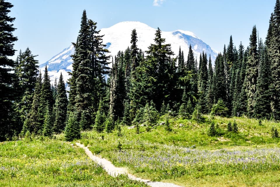
Tipsoo Lake is a small subalpine lake at Chinook Pass, in a glacier-carved basin of meadow and evergreen slopes along Mount Rainier's eastern edge. The half-mile shoreline loop makes this an easy scenic pause; take the longer Naches Peak Loop if you want a real hike. Keep expectations to a compact lakeshore, and allow for a busy stop in summer.

The short loop or the longer hikeThe lake path is about 0.

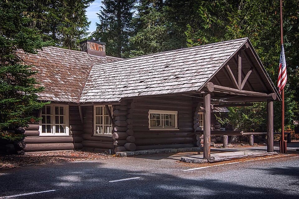
The lake path is about 0.5 mile around, mostly level, hard-packed dirt, with a few wooden bridges and stone steps near the parking area. It is narrow in places. For a bigger outing, Naches Peak Loop is a 3.5-mile circuit with about 500 feet of gain, usually around two hours. Go clockwise for the best Rainier views: that route crosses State Route 410 over the historic wood-and-stone Chinook Entrance Arch, follows the Pacific Crest Trail along Naches Peak's east side, then returns through the park on the west.

Make the stop workState Route 410 reaches the lake from Chinook Pass and closes for winter; vehicle access is…

State Route 410 reaches the lake from Chinook Pass and closes for winter; vehicle access is usually seasonal, around June through October, and snow can linger into June or July. Summer visits can be heavy and parking is limited, so aim for a weekday or an early or late stop and keep another destination in mind. Picnic tables and a vault/composting toilet are listed here. Accessible parking and picnic tables are available, but the narrow lake path has bridges and stone steps, so don't assume the whole loop is accessible. Dogs aren't allowed around the lake or on the park sections of Naches Peak Loop; leashed dogs can use the PCT section outside park boundaries.

Flowers, then fall colorThe meadows are part of the draw.

The meadows are part of the draw. Wildflower bloom typically peaks in mid-to-late July, while fall color usually starts in September. Both shift with the year's weather, and lingering snow can delay an early-season walk. Stay on the marked path: these subalpine plants are easy to damage.

Look back across the waterThe lake's setting does most of the work for a photo: shoreline flowers in front, still water…

The lake's setting does most of the work for a photo: shoreline flowers in front, still water in the middle, and Mount Rainier above the tree line. Walk around the shore to find an open angle, and try a frame across the water when it is calm enough to catch a reflection. Clouds can hide the mountain, and the reflection is never guaranteed.

A basin carved by glaciersThe lake sits in a glacier-carved basin, with small meadows tucked between the water and the…

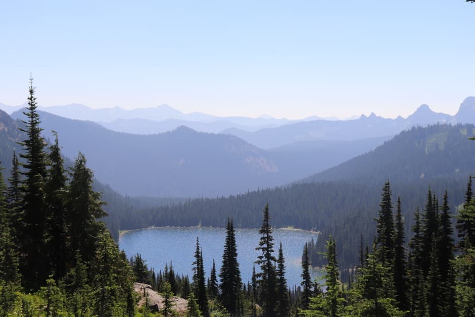
The lake sits in a glacier-carved basin, with small meadows tucked between the water and the surrounding slopes. That close mix of shore, flowers, forest and high peaks is why a short walk feels like more than a roadside viewpoint.

What lives at the shoreLook for birds around the water and meadow, and check the shallows for tadpoles or frogs.

Look for birds around the water and meadow, and check the shallows for tadpoles or frogs. The longer Naches Peak Loop adds a wider alpine landscape, with high mountain ponds and open views as it winds around the peak.

Wildlife

Wildlife in Mount Rainier

All Mount Rainier wildlife maps

Sighting maps show where each species has been reported across Mount Rainier. Wildlife moves, so no sighting is guaranteed.

Keep exploring

Near Tipsoo Lake

See it all on the map

Trails nearby

More stops nearby

Parkwolf’s Mount Rainier ranking

Top sights in Mount Rainier

All 87 places
  1. 1Reflection LakesSight
  2. 2Myrtle FallsSight
  3. 3Panorama PointSight
  4. 4Narada FallsSight
  5. 6Sunrise Point OverlookSight
  6. 7Silver FallsSight

Take Parkwolf to Mount Rainier.

The audio tour guide for the drive, plus offline maps, trails, and wildlife heatmaps for when the signal drops.

4.7 from 8,600+ ratings

Download Parkwolf on the App StoreGet Parkwolf on Google Play