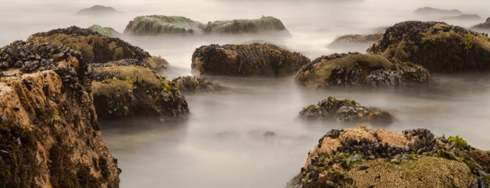
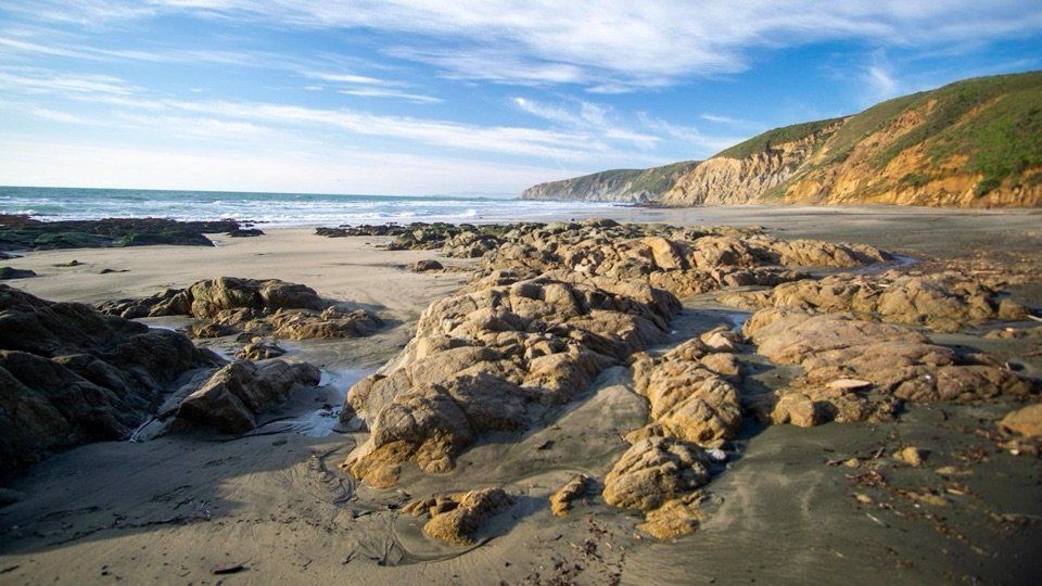
Tomales Point in Point Reyes National Seashore

#7 of 30 sights in Point Reyes

Sight · Point Reyes National Seashore

Tomales Point

Narrow ridge walk between bay and ocean, with tule elk country

Photo: Wikimedia Commons
Type
Sight
Nearest trail
3.2 mi
  • Parking

Hear the audio tour

Pierce Point Ranch and Tomales Point

Overview

About Tomales Point

Why stop

  • Two-sided bay and ocean views
  • Strong chance of seeing tule elk

Heads up

  • Long, exposed walk with wind and fog
  • Sandy, overgrown final miles
This is a crest walk along a narrow peninsula with water on both sides: Tomales Bay and the Bolinas Ridge to the east, Bodega Bay to the north, and the Pacific along the west and south. The first mile is broad and fairly level with west-facing ocean views, so you get the big scenery early and can decide how far to keep going. The peninsula's dairy ranching past is still legible in the land and in the old ranch site along the way.
Parkwolf’s verdictWhy walk out here

Map

Where it is

Loading the Point Reyes map
Full map
SightTomales Point38.22997, -122.98616
Keep this map with you offline in the Parkwolf app

Plan your stop

Before you go

Best time to go

Spring is often green and the best bet for wildflowers, though it can also be windy and cool. Late May and early June tend to run warmer. July through September often brings dense fog and temperatures much cooler than inland Bear Valley, so dress for a different day than the one you left. The first mile can be lovely at sunset when fog is not sitting on the ridge, but leave yourself enough daylight to walk back.


Getting there and parking

From the Bear Valley area the drive is about 16.6 miles and roughly 35 minutes on slow, winding roads, so budget more time than the distance implies. The lot holds about 20 cars and can fill by 10 a.m. on busy weekends and holidays. Nearby McClures Beach parking has a vault restroom.

4 active Point Reyes alerts

  • ClosureOld Tocaloma/Platform Bridge closed to vehiclesDo not drive across the Old Tocaloma/Platform Bridge; it is closed to all vehicular traffic until further notice.Official details
  • ClosurePalomarin Beach Trail closedPalomarin Beach Trail is closed to all visitors, employees, and residents until further notice; do not use the trail. - The trail is closed because unstable and failing sections have made it unsafe.Official details
See all 4 alerts
A park ranger sits on a dash-mounted phone, talking, as Parkwolf’s Tour Guide plays “Army Cutworm Moths: A Grizzly Bear Buffet” on Grand Loop Road below Dunraven Pass in Yellowstone
Parkwolf Tour GuideThe highest, rockiest slopes around here are a summer buffet for grizzly bears.

Point Reyes Tour Guide

Your drive to Tomales Point, narrated.

Parkwolf is a GPS audio tour guide for Point Reyes National Seashore. As you drive, it chimes in with what’s ahead: hidden gems, upcoming stops, history, geology, and wildlife, right through your car’s speakers.

Recorded for this place

Pierce Point Ranch and Tomales Point
0:00 / 0:34
“Pierce Point Ranch is ahead, a cluster of white clapboard barns, dairy buildings, and a schoolhouse at the end of the road.”

Plays as you drive up to Tomales Point in the Parkwolf Point Reyes Tour Guide.

More stories near here in the app

  • McClures Beach Cove
  • The Beach Nursery You Might Miss
  • Kehoe Beach
  • 61 audio storiesacross Point Reyes’s roads, triggered by GPS as you drive
  • Wildlife heatmapsfor Northern Elephant Seal, Grey Whale, Humpback Whale, and 13 more
  • Works offlinemaps, 65 trails, 41 places, and audio download before you lose signal
  • CarPlay readysimple controls built for the drive
★★★★★
“Fantastic app with many points of information… It’s great to just turn on while you’re driving and it gives you an audio tour of the national Park. We love it!!!!”
JMJamesApp Store review
Download Parkwolf on the App StoreGet Parkwolf on Google Play

4.7 from 8,600+ ratings

Guide

More about Tomales Point

Pick your turnaroundPlenty of people turn back at Windy Gap or the ranch pond and still come away with the best of…

Plenty of people turn back at Windy Gap or the ranch pond and still come away with the best of the views. The last stretch is slower going than the mileage suggests.

  • Windy Gap, about 2 miles round trip. A saddle above White Gulch with a view toward Hog Island. A satisfying short outing.
  • Lower Pierce Ranch, about 6 miles round trip. Allow 2 to 3 hours. North of Windy Gap the route climbs to its high point around 2.25 miles from the start, then drops steeply for roughly three quarters of a mile. There is a stock pond here where elk, herons, and ducks are often seen.
  • Tomales Point itself, roughly 9.5 to 10 miles round trip. Allow 4 to 5 hours, plus extra time if you stop to watch elk. The final 1.7 miles is unmaintained, sandy, and often overgrown, with bush lupine hiding multiple faint paths that generally reconnect. Long pants and sleeves help.
Elk, birds, and wildflowersThe area is known for tule elk, birds, and spring wildflowers, and elk sightings are common…

The area is known for tule elk, birds, and spring wildflowers, and elk sightings are common along the open grasslands and near the pond. None of it is guaranteed on any given day. Bring binoculars, keep your distance, and treat every sighting as a bonus.

Come preparedNo potable water out here. Carry more than you think you need.
  • No potable water out here. Carry more than you think you need.
  • No food services west of Inverness. Pack your meals.
  • Cell reception is minimal to nonexistent. Download maps and tell someone your plan.
  • Layers, sun and wind protection. The ridge is exposed for nearly its whole length, with little relief from sun or wind.
  • Most of the area is designated wilderness. Dogs are not allowed beyond Pierce Point Road and the parking lots, aside from working service dogs under park rules.
  • The coastal bluffs are unstable and a section collapsed without warning in 2017. Stay on the official trail and well back from cliff edges.
Honest drawbacksIt is long, exposed, and weather-dependent.

It is long, exposed, and weather-dependent. Wind, heat, or a wall of fog can flatten the payoff, water needs are real, parking is tight, and the closing miles get sandy and brushy. On a clear day with elk on the grass, it is a hike people remember for years.

Wildlife

Wildlife in Point Reyes

All Point Reyes wildlife maps

Sighting maps show where each species has been reported across Point Reyes. Wildlife moves, so no sighting is guaranteed.

Parkwolf’s Point Reyes ranking

Top sights in Point Reyes

All 41 places
  1. 1Point Reyes LighthouseSight
  2. 2Chimney RockSight
  3. 3Drakes BeachBeach
  4. 4Cypress Tree TunnelSight
  5. 5Alamere FallsSight
  6. 6Pierce Point RanchSight

Take Parkwolf to Point Reyes.

The audio tour guide for the drive, plus offline maps, trails, and wildlife heatmaps for when the signal drops.

4.7 from 8,600+ ratings

Download Parkwolf on the App StoreGet Parkwolf on Google Play