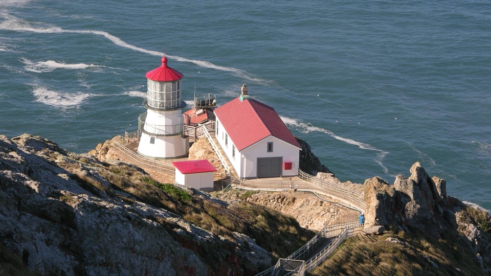
Chimney Rock in Point Reyes National Seashore

#2 of 30 sights in Point Reyes

Sight · Point Reyes National Seashore

Chimney Rock

Short ridge walk above steep ocean cliffs and spring wildflowers

Photo: Public Domain
Type
Sight
Nearest trail
1 mi
Audio stories
2 nearby
  • Parking
  • Restrooms
  • Scenic viewpoint

Hear the audio tour

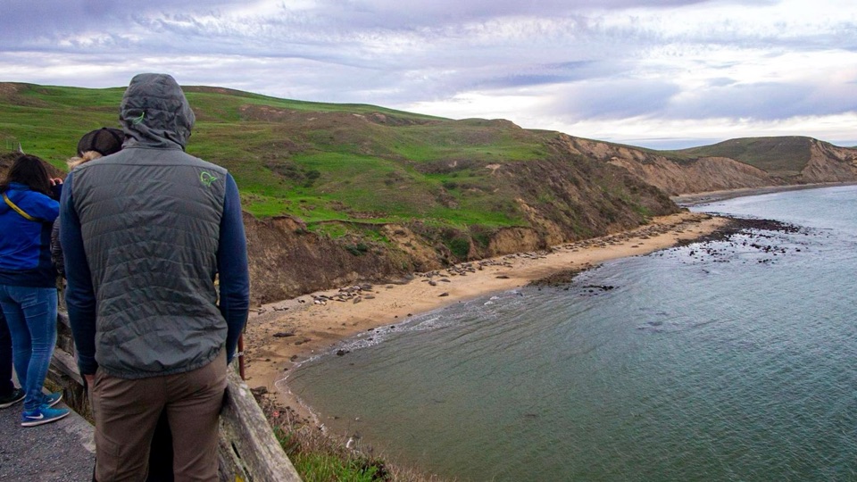
Chimney Rock and Elephant Seal Overlook

Overview

About Chimney Rock

Why stop

  • Steep ocean cliffs and wide bay views
  • Spring wildflowers with seasonal whale viewing

Heads up

  • Wind and fog can erase the views
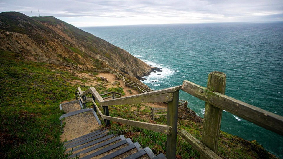
  • Exposed cliffs and loose gravel demand care
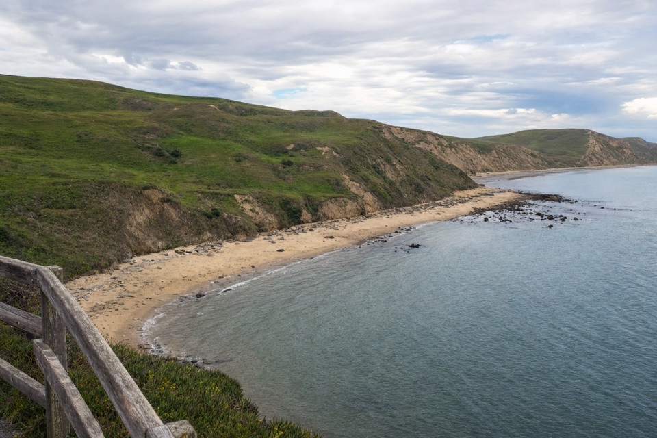
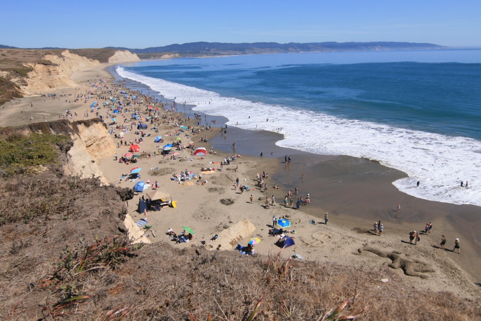
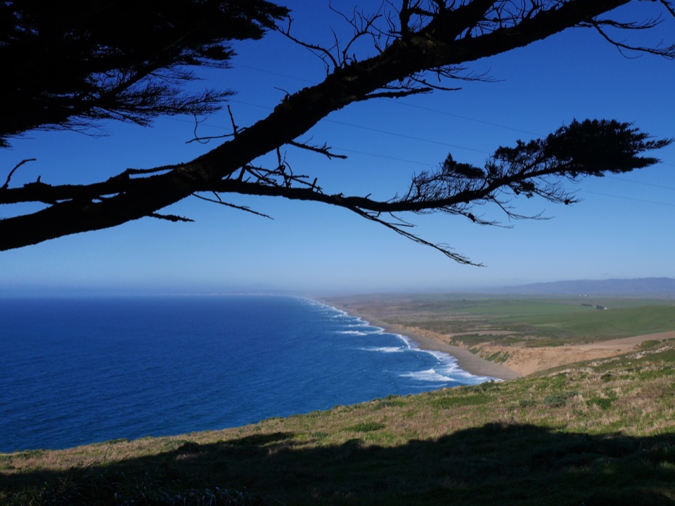
This is the far tip of the Point Reyes Headlands, an eastern spur where a narrow peninsula runs out between Drakes Bay and the open Pacific. The payoff is close to immediate: rocky cliffs falling steeply to the water, the sweep of the bay, and the coastline stretching away to the southeast. A short walk puts you out on an exposed headland with open ocean on one side and the bay on the other.
Parkwolf’s verdictWhy stop here

Map

Where it is

Loading the Point Reyes map
Full map
SightChimney Rock37.98973, -122.96375
Keep this map with you offline in the Parkwolf app

Plan your stop

Before you go

Best time to go

  • Mornings tend to bring better parking odds; the small lot fills and is especially tight in the afternoon.
  • Clear, calm days give the widest views, but summer fog is common and can erase the horizon entirely.
  • Late afternoon light warms the cliffs and the bay side, which is worth planning around if you are photographing.


4 active Point Reyes alerts

  • ClosureOld Tocaloma/Platform Bridge closed to vehiclesDo not drive across the Old Tocaloma/Platform Bridge; it is closed to all vehicular traffic until further notice.Official details
  • ClosurePalomarin Beach Trail closedPalomarin Beach Trail is closed to all visitors, employees, and residents until further notice; do not use the trail. - The trail is closed because unstable and failing sections have made it unsafe.Official details
See all 4 alerts
A park ranger sits on a dash-mounted phone, talking, as Parkwolf’s Tour Guide plays “Army Cutworm Moths: A Grizzly Bear Buffet” on Grand Loop Road below Dunraven Pass in Yellowstone
Parkwolf Tour GuideThe highest, rockiest slopes around here are a summer buffet for grizzly bears.

Point Reyes Tour Guide

Your drive to Chimney Rock, narrated.

Parkwolf is a GPS audio tour guide for Point Reyes National Seashore. As you drive, it chimes in with what’s ahead: hidden gems, upcoming stops, history, geology, and wildlife, right through your car’s speakers.

Recorded for this place

Chimney Rock and Elephant Seal Overlook
0:00 / 0:32
“Up ahead is Chimney Rock, a narrow headland with Drakes Bay on one side and the open Pacific on the other.”

Plays as you drive up to Chimney Rock in the Parkwolf Point Reyes Tour Guide.

More stories near here in the app

  • Where Elephant Seals Go
  • Look for the Whale’s Breath
  • Drakes Beach and Visitor Center
  • Point Reyes Lighthouse Headlands
  • 61 audio storiesacross Point Reyes’s roads, triggered by GPS as you drive
  • Wildlife heatmapsfor Northern Elephant Seal, Grey Whale, Humpback Whale, and 13 more
  • Works offlinemaps, 65 trails, 41 places, and audio download before you lose signal
  • CarPlay readysimple controls built for the drive
★★★★★
“Fantastic app with many points of information… It’s great to just turn on while you’re driving and it gives you an audio tour of the national Park. We love it!!!!”
JMJamesApp Store review
Download Parkwolf on the App StoreGet Parkwolf on Google Play

4.7 from 8,600+ ratings

Guide

More about Chimney Rock

The walkThe Chimney Rock Trail is 1.75 miles (2.8 km) round trip, out and back along the ridge crest.
  • The Chimney Rock Trail is 1.75 miles (2.8 km) round trip, out and back along the ridge crest.
  • Most visitors take roughly one to two hours, including time for stopping and looking.
  • The surface is dirt with dips and patches of loose gravel, and the rolling ups and downs feel more demanding than an "easy" label suggests, especially into a headwind.
  • There is no beach access. The cliffs drop straight to the water, so all viewing is from the bluff tops and designated trail.
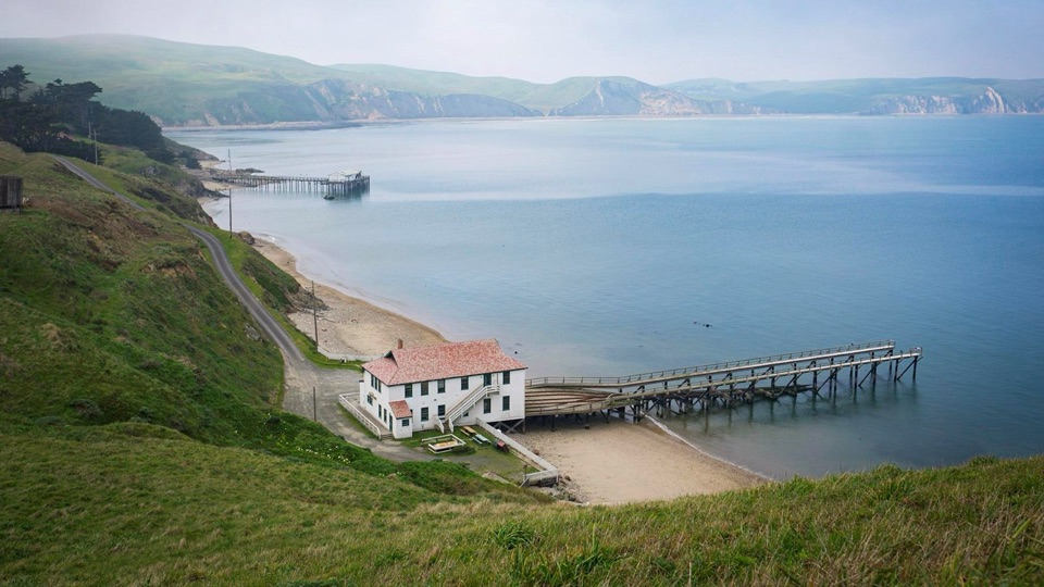
  • The grounds and buildings of the historic lifeboat station are visible from the trail, and wayside exhibits stand on the station grounds below.
Wildlife and wildflowersSpring is the signature season.

Spring is the signature season. The headland is known for its wildflower display, and from March through May dozens to hundreds of gray whales can migrate north past this point on a given day, with a few whales possible at almost any time of year. Nothing is guaranteed on a single visit, particularly in fog.

Elephant seals use the nearby beaches and coves, and the headlands are also a spot for birdwatching. Visitors also report pelicans and occasional coyotes along the peninsula.

Getting there and what to bringAccess is by about 19 miles of winding Sir Francis Drake Boulevard, then roughly 0.

Access is by about 19 miles of winding Sir Francis Drake Boulevard, then roughly 0.9 miles of narrow two-way Chimney Rock Road, only about 10 feet wide in places. Plan on around 45 minutes of driving each way from the Bear Valley, Olema, and Point Reyes Station area, and fuel up before you head out to the headlands.

  • The trailhead lot has 20 vehicle spaces, including one disabled-capacity space, plus a vault toilet. Park only in marked spaces.
  • Bring your own water. There are no potable water sources at Chimney Rock, and no food service nearby.
  • Dress in layers. Wind and fog can make the hike genuinely uncomfortable even when inland weather is mild.
  • Cell reception is minimal to nonexistent, so download maps in advance.
  • Dogs may be walked in the parking lot and along Chimney Rock Road west of the parking lot; otherwise they are prohibited, except for service dogs.
Drawbacks and safetyThe main frustrations are the slow drive, the limited parking, and weather that can hide the…

The main frustrations are the slow drive, the limited parking, and weather that can hide the view. Safety rules here are firm and worth taking seriously: stay on designated trails, keep back from cliff edges, do not climb the bluffs, and do not cross fences. Bluff tops and cliff faces can be unstable, and the drop to the water is sheer with no beach below.

Wildlife

Wildlife in Point Reyes

All Point Reyes wildlife maps

Sighting maps show where each species has been reported across Point Reyes. Wildlife moves, so no sighting is guaranteed.

Parkwolf’s Point Reyes ranking

Top sights in Point Reyes

All 41 places
  1. 1Point Reyes LighthouseSight
  2. 3Drakes BeachBeach
  3. 4Cypress Tree TunnelSight
  4. 5Alamere FallsSight
  5. 6Pierce Point RanchSight
  6. 7Tomales PointSight

Take Parkwolf to Point Reyes.

The audio tour guide for the drive, plus offline maps, trails, and wildlife heatmaps for when the signal drops.

4.7 from 8,600+ ratings

Download Parkwolf on the App StoreGet Parkwolf on Google Play