Mavora–Greenstone Walkway in Queenstown-Lakes District, New Zealand

Queenstown-Lakes District, New Zealand, OT

Mavora–Greenstone Walkway

A 38 km tramp from Greenstone Hut to Mavora Lakes

Photo: nova viator, CC BY-SA 2.0, via Wikimedia Commons

Length
38km
Time
12hr
Elev. change
255m
Difficulty
Moderate
  • No dogs
  • High point 776 m
Parkwolf audio tour298 stories across Queenstown-Lakes District’s roads

Overview

About Mavora–Greenstone Walkway

Why go

  • A genuine hut-to-hut traverse with a marked change from tussock to beech forest
  • Four named stages and huts break the long walk into clear sections

Heads up

  • The 38 km point-to-point route needs a vehicle move between ends
  • Some sections are rough and exposed to mountain weather

Map & elevation

The route

Loading the Queenstown-Lakes District map
Full map
Elevation521–776 m
TrailheadGreenstone Hut-44.97928, 168.26255
Keep this map with you offline in the Parkwolf app

Plan your hike

Before you go

Parking

Greenstone Hut has no road access. From Greenstone Road End, the approach is an 11 km walk taking 3–5 hours; keep it separate from this route’s 38 km. The North Mavora Lakes camping area is the other end, reached from SH94 by 39 km of unsealed road. Arrange your own vehicle transfer; there is no regular public transport to Mavora Lakes in winter.

Safety

This is a remote, multi-day tramp exposed to mountain weather year-round. The descent below Passburn is steep and the stream crossing is over boulders. Hut water at Careys, Boundary and Taipo is turned off May–October; treat natural water in the lower flats. Dogs and firearms are prohibited beyond Boundary Hut.

3 active Queenstown-Lakes District alerts

  • CautionRob Roy Track: stop at lower lookout during avalanche seasonFrom May to November, end your Rob Roy Track hike at the lower lookout: DOC strongly recommends this because the upper section crosses active avalanche paths.Official details
  • ClosureSkippers Bridge closed to all usersSkippers Bridge is closed to all vehicles, cyclists and pedestrians; stay off the bridge and obey closure signs and barriers.Official details
See all 3 alerts
A park ranger sits on a dash-mounted phone, talking, as Parkwolf’s Tour Guide plays “Army Cutworm Moths: A Grizzly Bear Buffet” on Grand Loop Road below Dunraven Pass in Yellowstone
Parkwolf Tour GuideThe highest, rockiest slopes around here are a summer buffet for grizzly bears.

Queenstown-Lakes District Tour Guide

Your drive to Mavora–Greenstone Walkway, narrated.

Parkwolf is a GPS audio tour guide for Queenstown-Lakes District, New Zealand. As you drive, it chimes in with what’s ahead: hidden gems, upcoming stops, history, geology, and wildlife, right through your car’s speakers.

See the Queenstown-Lakes District audio tour

More stories near here in the app

  • Greenstone Road End and the Caples
  • 298 audio storiesacross Queenstown-Lakes District’s roads, triggered by GPS as you drive
  • Wildlife heatmapsfor Kea, Kākā, Kererū, and 13 more
  • Works offlinemaps, 155 trails, 129 places, and audio download before you lose signal
  • CarPlay readysimple controls built for the drive
★★★★★
“Fantastic app with many points of information… It’s great to just turn on while you’re driving and it gives you an audio tour of the national Park. We love it!!!!”
JMJamesApp Store review
Download Parkwolf on the App StoreGet Parkwolf on Google Play

4.7 from 8,600+ ratings

Trail guide

Hiking Mavora–Greenstone Walkway

A hut-to-lake traverseThe Mavora–Greenstone Walkway from Greenstone Hut to the North Mavora Lakes camping area is a…

The Mavora–Greenstone Walkway from Greenstone Hut to the North Mavora Lakes camping area is a 38 km, one-way backcountry tramp through tussock valleys, beech forest and the Passburn saddle. Choose it for a proper hut-to-hut crossing and a big change of scenery; it is not a casual day walk. The four stages add up to about 10½–13 hours of walking, usually spread over two or three days. This route stops at the hut and lake camp: the separate 11 km Greenstone Road End connection is outside this row, so it is shorter than the often-quoted 50 km full itinerary.

Over PassburnFrom Greenstone Hut, the track sidles down to a stream crossing on boulders, then climbs…

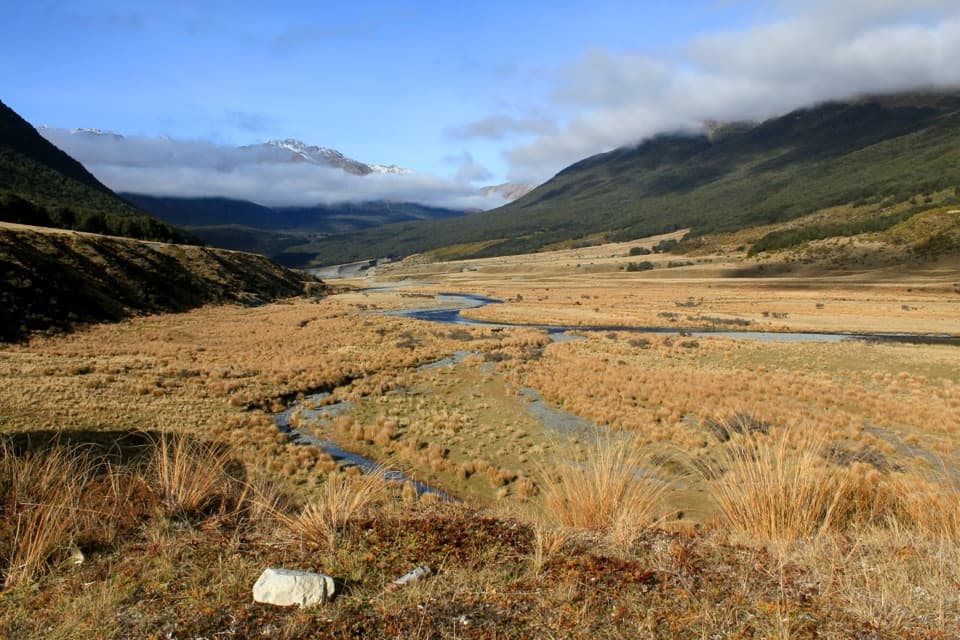
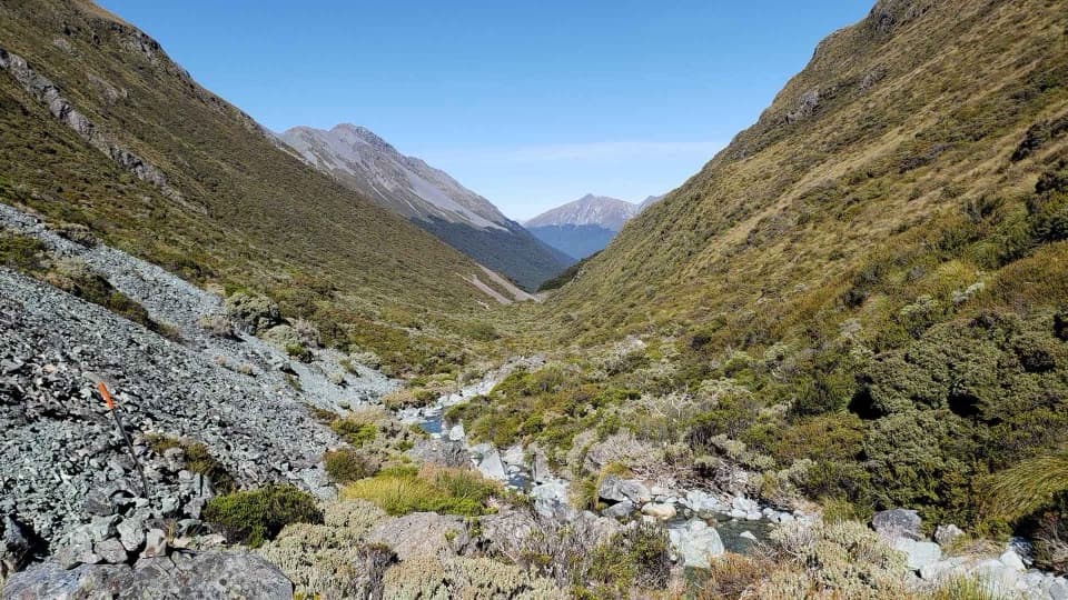
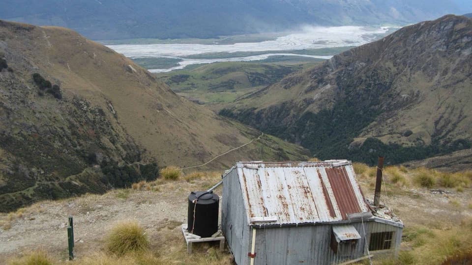
From Greenstone Hut, the track sidles down to a stream crossing on boulders, then climbs steeply on warratahs to the Passburn saddle at 728 m. From there it drops into the Pondburn Valley and follows the valley toe toward Taipo Hut. Marker poles and warratahs help, but this is still a backcountry track. The hut sits in a clearing beneath the rocky Tooth Peaks. The clearing and peaks make a distinctive view worth framing together.

Along the MararoaTaipo to Boundary Hut is the longest stage at 12 km, about three to four hours.

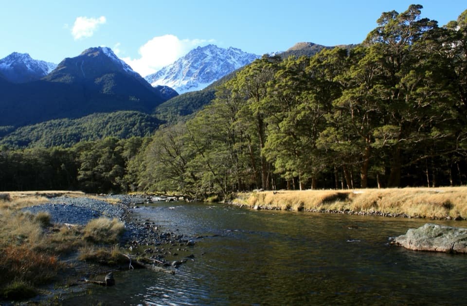
Taipo to Boundary Hut is the longest stage at 12 km, about three to four hours. The track follows the true right side of the Mararoa River and the toe of the valley slope, with a swingbridge at Boundary Hut. From there it is another 6 km, about two hours, to Careys Hut. The route crosses open tussock and forested slopes rather than following one smooth valley-floor path all the way.

Back to Mavora LakesCareys Hut is about 10 km, or 1½–2 hours, from the North Mavora camping area.

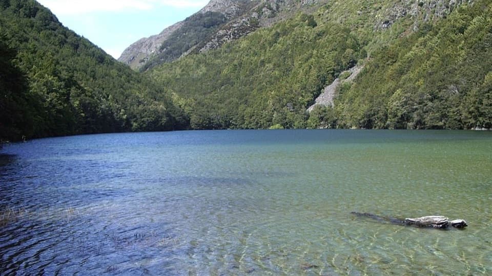
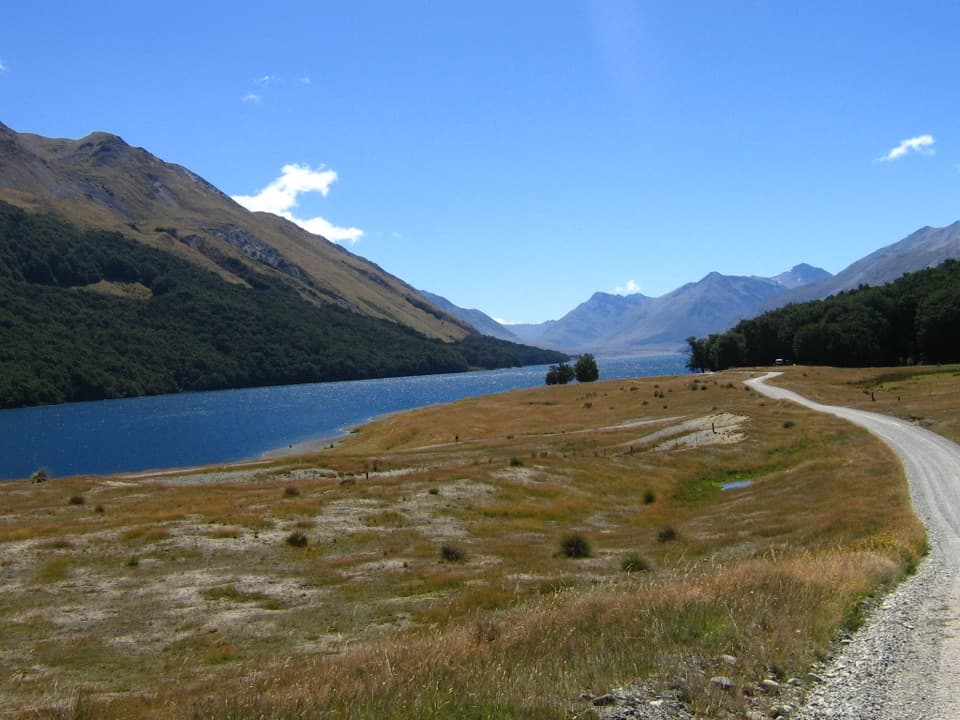
Careys Hut is about 10 km, or 1½–2 hours, from the North Mavora camping area. The route follows the lake-edge four-wheel-drive track. At Careys, stay on the Mavora walkway; the rough left branch toward Forks Hut is a different route. The lake is a satisfying finish after the more enclosed valleys, but the last section is still a remote track, not a serviced road walk.

Huts, water and rulesCarry the required hut tickets for overnight stops.

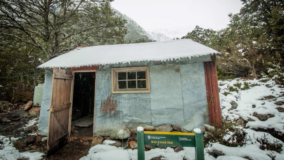
Carry the required hut tickets for overnight stops. Boundary and Taipo huts have no cooking facilities, and the water supply at Careys, Boundary and Taipo is turned off from May through October. Treat stream water in the lower flats where cattle are present. Dogs and firearms are prohibited beyond Boundary Hut, so pets cannot join the whole route. Fires are prohibited except at Greenstone and Careys huts, and there are no rubbish facilities. The route is exposed to mountain weather year-round, so plan for a multi-day tramp in changeable conditions.

A working valleyThe Greenstone Valley and Pass Burn were old stock routes used by early runholders; rabbits…

The Greenstone Valley and Pass Burn were old stock routes used by early runholders; rabbits affected both valleys in the 1880s. Glaciers once flowed through the Greenstone system and split toward Mavora Lakes and Lake Wakatipu. In the beech forest, listen for kākā and mōhua (yellowhead), as well as smaller birds such as fantail, rifleman and South Island robin.

Wildlife

Wildlife in Queenstown-Lakes District

All Queenstown-Lakes District wildlife maps

Sighting maps show where each species has been reported across Queenstown-Lakes District. Wildlife moves, so no sighting is guaranteed.

Parkwolf’s Queenstown-Lakes District ranking

Top-rated trails in Queenstown-Lakes District

All 155 trails
  1. 1Routeburn TrackChallenging · 33.1 km
  2. 2Roys Peak TrackChallenging · 16 km
  3. 3Ben Lomond TrackChallenging · 14 km
  4. 4Rob Roy TrackModerate · 10 km
  5. 5Isthmus Peak TrackChallenging · 16 km
  6. 6Routeburn Falls TrackChallenging · 19.6 km

Take Parkwolf to Queenstown-Lakes District.

The audio tour guide for the drive, plus offline maps, trails, and wildlife heatmaps for when the signal drops.

4.7 from 8,600+ ratings

Download Parkwolf on the App StoreGet Parkwolf on Google Play