Steele Creek Track in Queenstown-Lakes District, New Zealand

Queenstown-Lakes District, New Zealand, OT

Steele Creek Track

A steep, sparsely marked creek route for experienced trampers.

Photo: Department of Conservation (NZ), CC BY 4.0

Length
19.2km
Time
11hr
Elev. change
838m
Difficulty
Challenging
  • No dogs
  • High point 1,320 m
Parkwolf audio tour298 stories across Queenstown-Lakes District’s roads

Overview

About Steele Creek Track

Why go

  • A remote route with open views of Fraser and Kay Creeks from the pass
  • A rare mix of subalpine scrub, creek-bed travel and backcountry huts

Heads up

  • Difficult navigation, scree, windfall and multiple creek crossings
  • The junction takes a five-hour walk from the road end, and the exit adds another six hours

Map & elevation

The route

Loading the Queenstown-Lakes District map
Full map
Elevation482–1,320 m
TrailheadUpper Caples Valley junction (sign-posted)-44.84537, 168.22215
Keep this map with you offline in the Parkwolf app

Plan your hike

Before you go

Parking

There is no road access to the signposted Upper Caples Valley junction. From Greenstone Road end car park, reach it on Caples Track in 16 km (about 5 hr). Greenstone Hut to that road end is another 18 km (about 6 hr); plan hut nights and transport.

Safety

Experienced trampers only. The line is steep, sparsely marked and difficult to find, with dense scrub, scree, windfall and several creek crossings. Flooded crossings can be unsafe. Steele Creek Pass is snow-covered in winter and the area has unclassified avalanche terrain; alpine and avalanche experience and gear may be needed in winter and spring.

3 active Queenstown-Lakes District alerts

  • CautionRob Roy Track: stop at lower lookout during avalanche seasonFrom May to November, end your Rob Roy Track hike at the lower lookout: DOC strongly recommends this because the upper section crosses active avalanche paths.Official details
  • ClosureSkippers Bridge closed to all usersSkippers Bridge is closed to all vehicles, cyclists and pedestrians; stay off the bridge and obey closure signs and barriers.Official details
See all 3 alerts
A park ranger sits on a dash-mounted phone, talking, as Parkwolf’s Tour Guide plays “Army Cutworm Moths: A Grizzly Bear Buffet” on Grand Loop Road below Dunraven Pass in Yellowstone
Parkwolf Tour GuideThe highest, rockiest slopes around here are a summer buffet for grizzly bears.

Queenstown-Lakes District Tour Guide

Your drive to Steele Creek Track, narrated.

Parkwolf is a GPS audio tour guide for Queenstown-Lakes District, New Zealand. As you drive, it chimes in with what’s ahead: hidden gems, upcoming stops, history, geology, and wildlife, right through your car’s speakers.

See the Queenstown-Lakes District audio tour
  • 298 audio storiesacross Queenstown-Lakes District’s roads, triggered by GPS as you drive
  • Wildlife heatmapsfor Kea, Kākā, Kererū, and 13 more
  • Works offlinemaps, 155 trails, 129 places, and audio download before you lose signal
  • CarPlay readysimple controls built for the drive
★★★★★
“Fantastic app with many points of information… It’s great to just turn on while you’re driving and it gives you an audio tour of the national Park. We love it!!!!”
JMJamesApp Store review
Download Parkwolf on the App StoreGet Parkwolf on Google Play

4.7 from 8,600+ ratings

Trail guide

Hiking Steele Creek Track

A full-day creek crossingSteele Creek Track is a one-way route of about 19.1 km (11.

Steele Creek Track is a one-way route of about 19.1 km (11.9 mi) from the signposted Upper Caples Valley junction to Greenstone Hut. DOC allows 10–12 hours and recommends it for experienced trampers only. It climbs to a high saddle, then drops through dense scrub and creek country where the marked line fades. This is a serious backcountry route, not a maintained valley walk.

The approach is part of the tripThe junction has no road access.

The junction has no road access. From Greenstone Road end, reach it on Caples Track in 16 km, about five hours. After the crossing, Greenstone Hut is still 18 km and about six hours from that road end. Plan this as a multi-day trip, with booked hut nights and transport at the ends; summer operators serve the Greenstone car park and the Divide. The public-bookable Upper Caples Hut is near the start junction. Greenstone Hut is a serviced 20-bunk hut, and bookings are required. Carry your own cooker and food; DOC huts have no gas stoves.

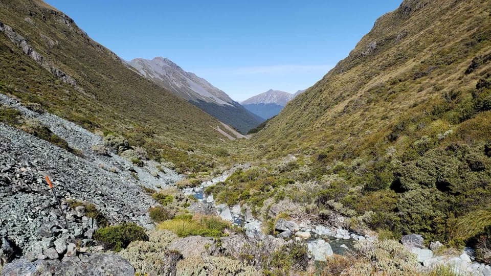
Climb to Steele Creek PassThe route starts uphill through beech forest, then steepens through tussock above the tree line.

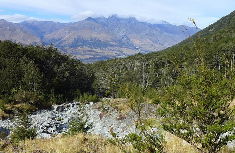
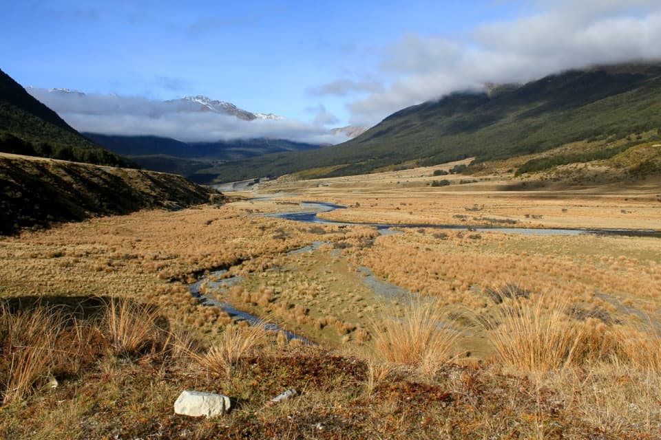
The route starts uphill through beech forest, then steepens through tussock above the tree line. Orange poles mark the climb to Steele Creek Pass at 1,359 m. From the saddle, look across to Fraser and Kay Creeks. It is the clearest viewpoint on this route; frame the tussock and the creek valleys together rather than pointing straight at the skyline.

Find the line on the descentBelow the saddle, dense subalpine scrub can hide the route and there is no defined tread in…

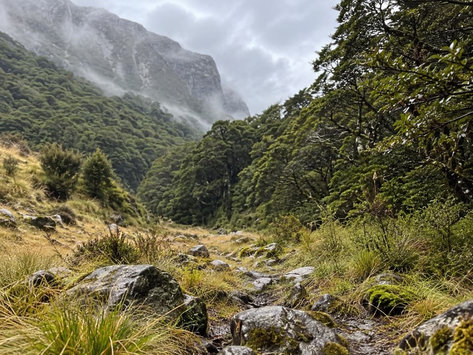
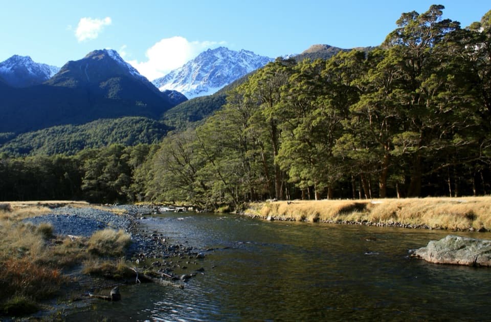
Below the saddle, dense subalpine scrub can hide the route and there is no defined tread in places. The line descends to Steele Creek, then follows its true right side through alternating forest and creek bed, with orange triangles spaced far apart. Expect scree, extensive windfall and several creek crossings. Those crossings can become unsafe after heavy rain; don't enter floodwater. The winter pass holds snow and the area includes unclassified avalanche terrain, so winter and spring travel calls for alpine and avalanche experience and the right gear.

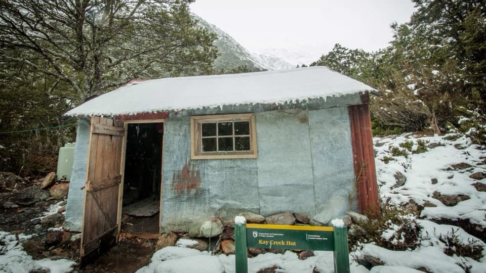
A rustic hut before the Greenstone ValleySteele Creek Hut is a small rustic shelter framed with beech logs.

Steele Creek Hut is a small rustic shelter framed with beech logs. From there, the track descends through forest to the Greenstone Valley and continues to Greenstone Hut. There is no toilet along the track itself. No dogs are allowed.

Wildlife

Wildlife in Queenstown-Lakes District

All Queenstown-Lakes District wildlife maps

Sighting maps show where each species has been reported across Queenstown-Lakes District. Wildlife moves, so no sighting is guaranteed.

Keep exploring

Near Steele Creek Track

See it all on the map

Trails that start nearby

Places near the trailhead

Parkwolf’s Queenstown-Lakes District ranking

Top-rated trails in Queenstown-Lakes District

All 155 trails
  1. 1Routeburn TrackChallenging · 33.1 km
  2. 2Roys Peak TrackChallenging · 16 km
  3. 3Ben Lomond TrackChallenging · 14 km
  4. 4Rob Roy TrackModerate · 10 km
  5. 5Isthmus Peak TrackChallenging · 16 km
  6. 6Routeburn Falls TrackChallenging · 19.6 km

Take Parkwolf to Queenstown-Lakes District.

The audio tour guide for the drive, plus offline maps, trails, and wildlife heatmaps for when the signal drops.

4.7 from 8,600+ ratings

Download Parkwolf on the App StoreGet Parkwolf on Google Play