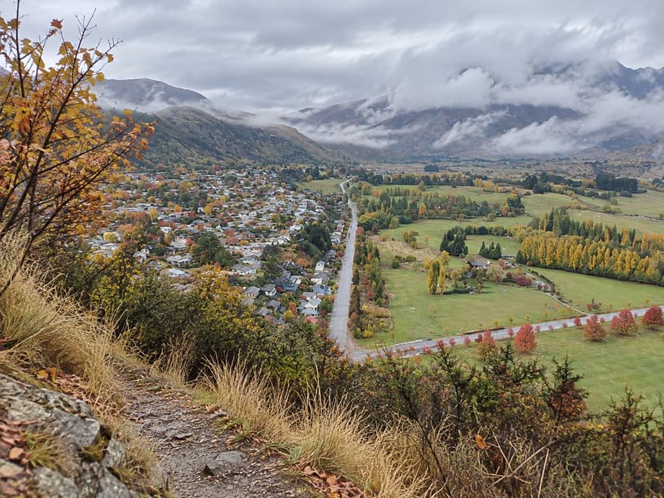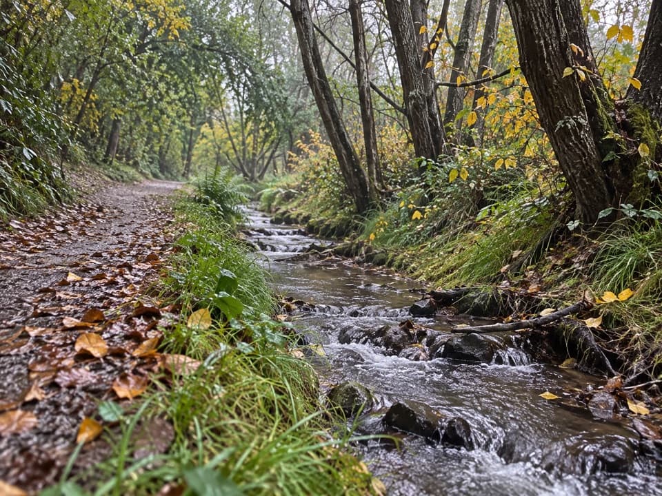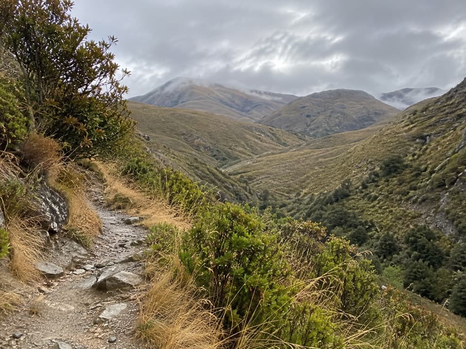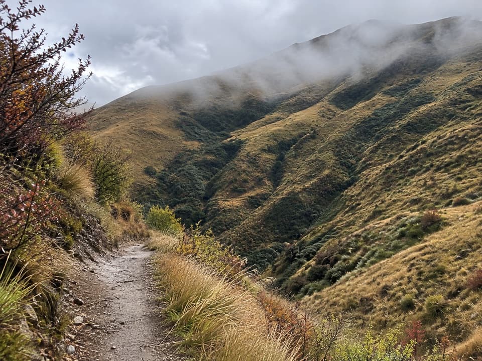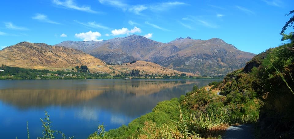
Waiwhakaata Lake Hayes Trail in Queenstown-Lakes District, New Zealand

Queenstown-Lakes District, New Zealand, OT

Waiwhakaata Lake Hayes Trail

Eight-kilometre lake loop with a steep west shore and mountain views.

Photo: André Richard Chalmers, CC BY-SA 3.0, via Wikimedia Commons

Length
9.3km
Time
3hr
Elev. change
28m
Difficulty
Moderate
  • Loop
  • Dogs allowed
  • High point 363 m
  • #24 of 155 in Queenstown-Lakes District

Hear the audio tour

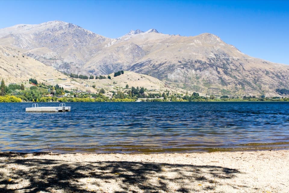
Lake Hayes Beach and Shoreline

Overview

About Waiwhakaata Lake Hayes Trail

Why go

  • Long lake and mountain views, with a boardwalk and birdlife along the way.
  • Several access points make it easy to choose a shorter lakeside walk.

Heads up

  • The western shore climbs beside steep drop-offs.
  • Walkers share parts of the path with cyclists and vehicles.

Map & elevation

The route

Loading the Queenstown-Lakes District map
Full map
Elevation335–363 m
TrailheadNorth Lake Hayes picnic area-44.96349, 168.80377
Keep this map with you offline in the Parkwolf app

Plan your hike

Before you go

Parking

North Lake Hayes picnic area has ample parking. Starting here adds about 700 m to reach the lakeshore circuit and the same distance again on return. Other named access points are Lake Hayes Pavilion and the showgrounds on SH6, Bendemeer Bay, Arrowtown Road, and Rutherford Road off Speargrass Flat Road.

Best time to go

The southern side can occasionally flood; if water covers the track, avoid that section rather than trying to cross it. Summer is often hot and dry, while winter can be cold with ice on the route. Those are the conditions most likely to change how comfortable the full circuit feels.

Safety

Steep drop-offs run beside the track on the western shore. The southern side can flood; avoid that section when water covers the track. Ice is possible in winter.

3 active Queenstown-Lakes District alerts

  • CautionRob Roy Track: stop at lower lookout during avalanche seasonFrom May to November, end your Rob Roy Track hike at the lower lookout: DOC strongly recommends this because the upper section crosses active avalanche paths.Official details
  • ClosureSkippers Bridge closed to all usersSkippers Bridge is closed to all vehicles, cyclists and pedestrians; stay off the bridge and obey closure signs and barriers.Official details
See all 3 alerts
A park ranger sits on a dash-mounted phone, talking, as Parkwolf’s Tour Guide plays “Army Cutworm Moths: A Grizzly Bear Buffet” on Grand Loop Road below Dunraven Pass in Yellowstone
Parkwolf Tour GuideThe highest, rockiest slopes around here are a summer buffet for grizzly bears.

Queenstown-Lakes District Tour Guide

Your drive to Waiwhakaata Lake Hayes Trail, narrated.

Parkwolf is a GPS audio tour guide for Queenstown-Lakes District, New Zealand. As you drive, it chimes in with what’s ahead: hidden gems, upcoming stops, history, geology, and wildlife, right through your car’s speakers.

See the Queenstown-Lakes District audio tour

Recorded for this trailhead

Lake Hayes Beach and Shoreline
0:00 / 0:31
“Up ahead is the northern shore access for Lake Hayes Beach. I'd use the grassed reserve for a picnic or a short pause by the pebbly shore, with the Remarkables across the water.”

Plays as you drive up to this trailhead in the Parkwolf Queenstown-Lakes District Tour Guide.

More stories near here in the app

  • Mora Wines and Artisan Kitchen
  • The Starling That Wears Away Its Spots
  • Still Chewing After the Meal
  • Amisfield Restaurant and Cellar Door
  • 298 audio storiesacross Queenstown-Lakes District’s roads, triggered by GPS as you drive
  • Wildlife heatmapsfor Kea, Kākā, Kererū, and 13 more
  • Works offlinemaps, 155 trails, 129 places, and audio download before you lose signal
  • CarPlay readysimple controls built for the drive
★★★★★
“Fantastic app with many points of information… It’s great to just turn on while you’re driving and it gives you an audio tour of the national Park. We love it!!!!”
JMJamesApp Store review
Download Parkwolf on the App StoreGet Parkwolf on Google Play

4.7 from 8,600+ ratings

Trail guide

Hiking Waiwhakaata Lake Hayes Trail

Walk the full lakeFrom North Lake Hayes picnic area, the Waiwhakaata Lake Hayes Trail is a start-to-start walk:…

From North Lake Hayes picnic area, the Waiwhakaata Lake Hayes Trail is a start-to-start walk: about 700 m to the shoreline circuit, an 8 km lap of the lake, then the same approach back. That makes the complete route 9.3 km (5.8 mi); the lakeshore loop by itself is 8 km (5 mi). Allow about three hours for this full outing. It’s a good pick for mountain views and a satisfying long walk without a summit climb.

Choose your accessThe North Lake Hayes picnic area has ample parking.

The North Lake Hayes picnic area has ample parking. Four other named access points—Lake Hayes Pavilion and the showgrounds on SH6, Bendemeer Bay, Arrowtown Road, and Rutherford Road off Speargrass Flat Road—let you join the circuit elsewhere or walk a shorter section. If you want the full loop without the extra approach, start at one of those lakeside accesses.

The west shoreThe western side climbs along Slope Hill, then carries you beside steep drops at the track edge.

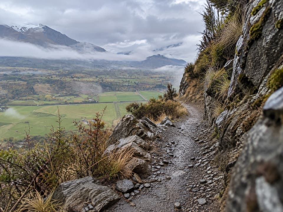
The western side climbs along Slope Hill, then carries you beside steep drops at the track edge. This is the part that feels less like an easy lakeside stroll; keep children close and take the hillside section at a steady pace. The broad water and mountain views open up as you move around the lake, with the west side looking toward Bendemeer.

A shared trackMost of the route is smooth gravel and shared by walkers and cyclists.

Most of the route is smooth gravel and shared by walkers and cyclists. A short section at the north-eastern end also shares with vehicles, so stay aware there. The southern end crosses a boardwalk; cyclists should slow down or get off and walk their bikes.

Birds, reflections, and restorationLake Hayes supports a healthy population of Australasian crested grebes.

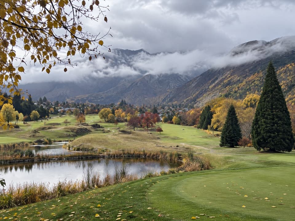
Lake Hayes supports a healthy population of Australasian crested grebes. On a calm morning or evening, the lake reflects the surrounding mountains—the wide water-and-peak view is the reason to linger. The catchment has also been the focus of a large native-plant restoration effort, with close to 140,000 plants put in to replace invasive vegetation.

Wildlife

Wildlife in Queenstown-Lakes District

All Queenstown-Lakes District wildlife maps

Sighting maps show where each species has been reported across Queenstown-Lakes District. Wildlife moves, so no sighting is guaranteed.

Keep exploring

Near Waiwhakaata Lake Hayes Trail

See it all on the map

Trails that start nearby

Places near the trailhead

Parkwolf’s Queenstown-Lakes District ranking

Top-rated trails in Queenstown-Lakes District

All 155 trails
  1. 1Routeburn TrackChallenging · 33.1 km
  2. 2Roys Peak TrackChallenging · 16 km
  3. 3Ben Lomond TrackChallenging · 14 km
  4. 4Rob Roy TrackModerate · 10 km
  5. 5Isthmus Peak TrackChallenging · 16 km
  6. 6Routeburn Falls TrackChallenging · 19.6 km

Take Parkwolf to Queenstown-Lakes District.

The audio tour guide for the drive, plus offline maps, trails, and wildlife heatmaps for when the signal drops.

4.7 from 8,600+ ratings

Download Parkwolf on the App StoreGet Parkwolf on Google Play