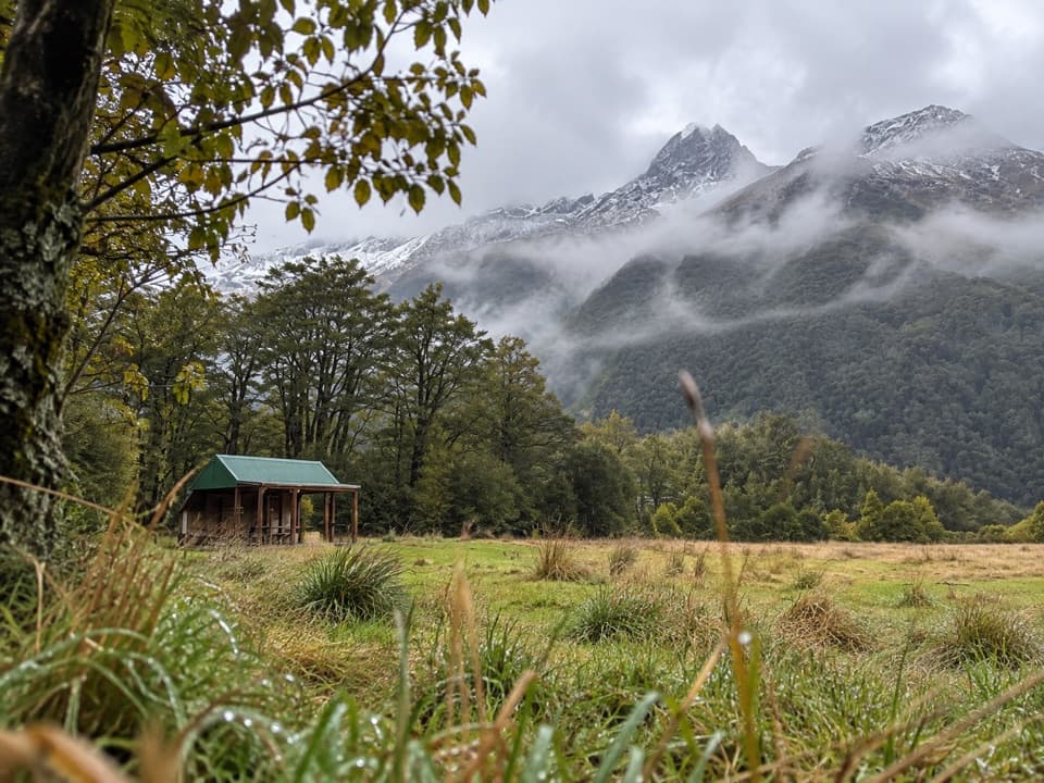
West Matukituki Track in Queenstown-Lakes District, New Zealand

Queenstown-Lakes District, New Zealand, OT

West Matukituki Track

Make the hut your turnaround or carry on into the alpine valley.

Photo: Pseudopanax at English Wikipedia, Public domain, via Wikimedia Commons

Length
34.4km
Time
11.5hr
Elev. change
445m
Difficulty
Challenging
  • No dogs
  • High point 811 m
  • #30 of 155 in Queenstown-Lakes District

Hear the audio tour

Raspberry Creek and Rob Roy Track

Overview

About West Matukituki Track

Why go

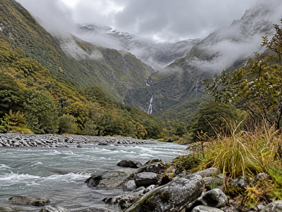
  • The scenery changes from open farm flats to beech forest and upper valley scrub.
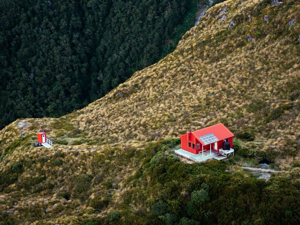
  • Aspiring Hut makes a useful 9 km one-way turnaround for a shorter walk.

Heads up

  • The full out-and-back is 34.4 km and takes most of a day.
  • The upper route crosses challenging and complex avalanche terrain.
West Matukituki Track is a 17.2 km one-way walk from Raspberry Creek car park to the head of West Matukituki Valley, via Aspiring Hut and Pearl Flat. Returning by the same track makes it a 34.4 km (21.4 mi) out-and-back. The published walking stages add to 5.5–6 hours each way; allow 11–12 hours for the full return. This is a serious, remote day. For a shorter trip, turn at Aspiring Hut after 9 km: about 18 km return and 4–5 hours. This route ends at the valley head; Bevan Col is a separate continuation.
Parkwolf’s verdictIs this the full day for you?

Map & elevation

The route

Loading the Queenstown-Lakes District map
Full map
Elevation366–811 m
TrailheadRaspberry Creek car park-44.51031, 168.74344
Keep this map with you offline in the Parkwolf app

Plan your hike

Before you go

Parking

Raspberry Creek car park is at the end of the Wanaka–Mount Aspiring Road, about 54 km west of Wānaka (roughly 1 hour 20 minutes by car). The final 30 km are gravel. Several fords lie in the last 10 km; after heavy rain they may be impassable to 2WD and sometimes 4WD vehicles. If the final two fords are too high, DOC advises parking safely before them and walking the remaining few hundred metres.

Safety

Beyond Aspiring Hut the route passes through challenging avalanche terrain to the Liverpool Track junction, then complex avalanche terrain to the valley head; DOC warns these sections can be hazardous from late autumn to early summer. Avalanche debris may reach Shovel Flat; do not camp there. Shovel Flat is eroded, so follow the orange poles toward the bush rather than the riverbank. The lower approach crosses private farmland: remain on the marked track and leave gates as found.

3 active Queenstown-Lakes District alerts

  • CautionRob Roy Track: stop at lower lookout during avalanche seasonFrom May to November, end your Rob Roy Track hike at the lower lookout: DOC strongly recommends this because the upper section crosses active avalanche paths.Official details
  • ClosureSkippers Bridge closed to all usersSkippers Bridge is closed to all vehicles, cyclists and pedestrians; stay off the bridge and obey closure signs and barriers.Official details
See all 3 alerts
A park ranger sits on a dash-mounted phone, talking, as Parkwolf’s Tour Guide plays “Army Cutworm Moths: A Grizzly Bear Buffet” on Grand Loop Road below Dunraven Pass in Yellowstone
Parkwolf Tour GuideThe highest, rockiest slopes around here are a summer buffet for grizzly bears.

Queenstown-Lakes District Tour Guide

Your drive to West Matukituki Track, narrated.

Parkwolf is a GPS audio tour guide for Queenstown-Lakes District, New Zealand. As you drive, it chimes in with what’s ahead: hidden gems, upcoming stops, history, geology, and wildlife, right through your car’s speakers.

See the Queenstown-Lakes District audio tour

Recorded for this trailhead

Raspberry Creek and Rob Roy Track
0:00 / 0:31
“You're approaching Raspberry Creek car park, the start of the Rob Roy Track. Allow about four hours return for the full walk, climbing through beech forest to hanging ice and waterfalls at the upper lookout.”

Plays as you drive up to this trailhead in the Parkwolf Queenstown-Lakes District Tour Guide.

More stories near here in the app

  • A Sweet Meal from a Hidden Insect
  • East Matukituki and Kitchener Tracks
  • Robins Returned by Helicopter
  • Water Before Gold
  • 298 audio storiesacross Queenstown-Lakes District’s roads, triggered by GPS as you drive
  • Wildlife heatmapsfor Kea, Kākā, Kererū, and 13 more
  • Works offlinemaps, 155 trails, 129 places, and audio download before you lose signal
  • CarPlay readysimple controls built for the drive
★★★★★
“Fantastic app with many points of information… It’s great to just turn on while you’re driving and it gives you an audio tour of the national Park. We love it!!!!”
JMJamesApp Store review
Download Parkwolf on the App StoreGet Parkwolf on Google Play

4.7 from 8,600+ ratings

Trail guide

Hiking West Matukituki Track

From the flats to Aspiring HutThe first 9 km is mostly over open, grassed farm flats, with a couple of short bluffs that are…

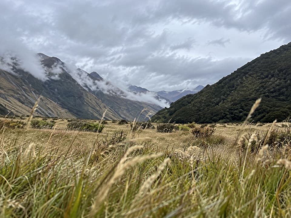
The first 9 km is mostly over open, grassed farm flats, with a couple of short bluffs that are easy to negotiate and open views along the valley. From the last bluff you can see historic Cascade Hut. It is a good place to stop for a photo with the river flats and mountain walls in the frame. Aspiring Hut is about 20 minutes farther on.

Past the hut and Shovel FlatFrom Aspiring Hut the track enters beech forest, crosses Cascade Creek after about 10 minutes,…

From Aspiring Hut the track enters beech forest, crosses Cascade Creek after about 10 minutes, then passes Rough Creek and Shovel Flat on bridges before opening into clearings near Pearl Flat. This 5 km leg takes about 1.5 hours. Shovel Flat is eroded: find the orange poles and follow them toward the bush, not along the riverbank. The poles are easy to miss if you simply follow the river.

Into the upper valleyPearl Flat to the head of the valley is another 3.2 km, about 2 hours.

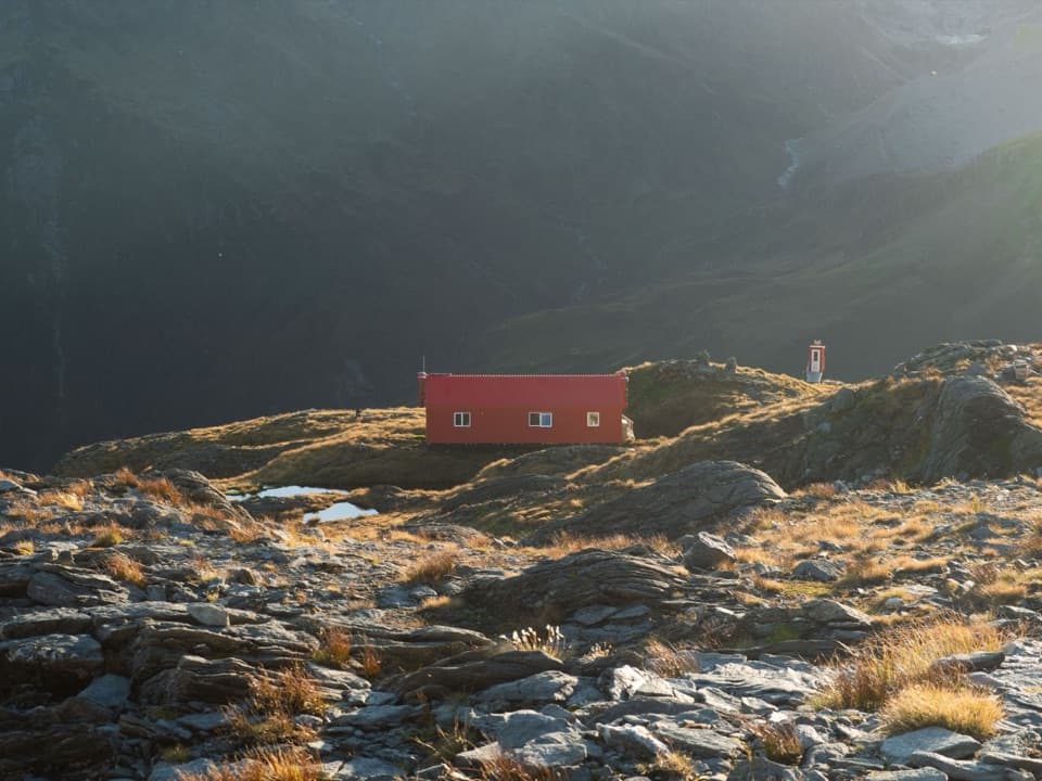
Pearl Flat to the head of the valley is another 3.2 km, about 2 hours. The track follows the river through beech forest, crossing Liverpool Swing Bridge and then French Ridge Swing Bridge. A climb of about 100 m leads to a branch that sidles through beech before emerging into open scrub. Scotts Rock Biv is roughly 500 m upstream from there and about 50 m from the river; look for its cairn. It is a small rock shelter, not fully weatherproof. Stop at the valley head unless you are deliberately taking on the much more demanding Bevan Col route.

A farm valley and a beech forestThe approach crosses private farmland, so stay on the marked track and leave gates as you found…

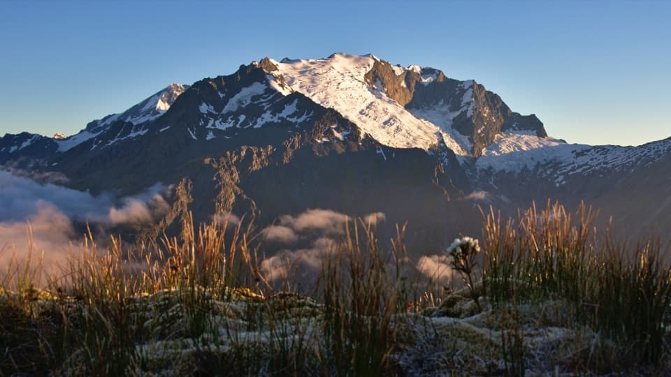
The approach crosses private farmland, so stay on the marked track and leave gates as you found them. Farming began in the valley in the 1870s; explorer James Hector travelled into West Matukituki in 1862. Farther up, red beech is common below Aspiring Hut, with silver beech more frequent toward the wetter western reaches. South Island robins were released in the valley in 2008, and fantails, tomtits and riflemen inhabit the beech forest. Tititea, the Māori name for Mount Aspiring, means “steep peak of glistening white.”

Getting to the startRaspberry Creek car park is at the end of the Wanaka–Mount Aspiring Road, about 54 km west of…

Raspberry Creek car park is at the end of the Wanaka–Mount Aspiring Road, about 54 km west of Wānaka. The last 30 km are gravel, and several fords cross the road in its final 10 km; after heavy rain they can become impassable, even to some four-wheel drives. No food stop is identified at the trailhead or along the route, so carry what you need. Water at Aspiring Hut is untreated and should be boiled. Dogs and other domestic animals are not permitted in national parks.

Wildlife

Wildlife in Queenstown-Lakes District

All Queenstown-Lakes District wildlife maps

Sighting maps show where each species has been reported across Queenstown-Lakes District. Wildlife moves, so no sighting is guaranteed.

Parkwolf’s Queenstown-Lakes District ranking

Top-rated trails in Queenstown-Lakes District

All 155 trails
  1. 1Routeburn TrackChallenging · 33.1 km
  2. 2Roys Peak TrackChallenging · 16 km
  3. 3Ben Lomond TrackChallenging · 14 km
  4. 4Rob Roy TrackModerate · 10 km
  5. 5Isthmus Peak TrackChallenging · 16 km
  6. 6Routeburn Falls TrackChallenging · 19.6 km

Take Parkwolf to Queenstown-Lakes District.

The audio tour guide for the drive, plus offline maps, trails, and wildlife heatmaps for when the signal drops.

4.7 from 8,600+ ratings

Download Parkwolf on the App StoreGet Parkwolf on Google Play