Ten Taypo-Hope Creek Loop Trail in Redwood National Park

Redwood National Park, CA

Ten Taypo-Hope Creek Loop Trail

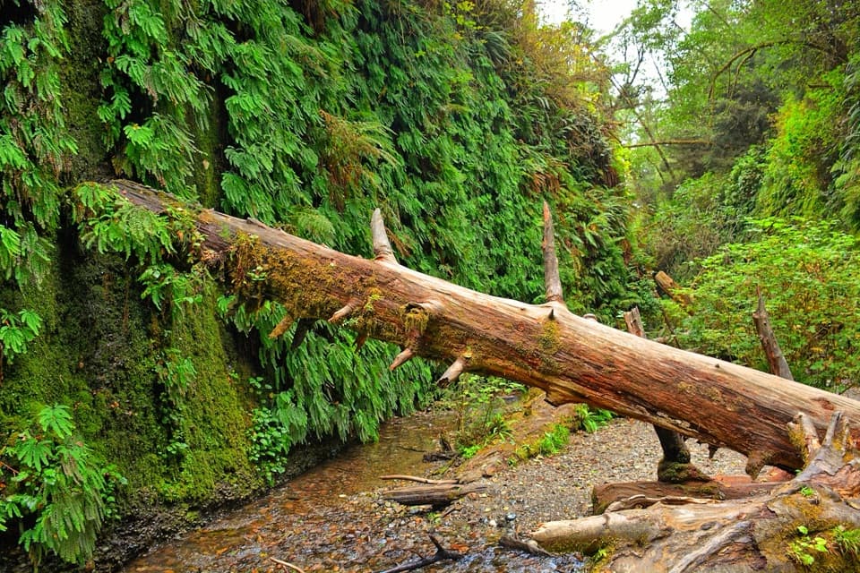
Ferny creek canyons, a winding footbridge, and a redwood ridge loop.

Length
3.6mi
Time
2hr
Elev. change
485ft
Difficulty
Moderate
  • Loop
  • No dogs
  • High point 1,106 ft
  • #21 of 83 in Redwood

Hear the audio tour

Hope Creek and Ten Taypo Loop

Overview

About Ten Taypo-Hope Creek Loop Trail

Why go

  • The winding footbridge and ferny creek canyon make a memorable opening.
  • A short ridge remnant and changing forest keep the loop varied.

Heads up

  • Steep grades and switchbacks; this is not a flat redwood-grove stroll.

Map & elevation

The route

Loading the Redwood map
Full map
Elevation621–1,106 ft
TrailheadHope Creek Trailhead, east side of Newton B. Drury Scenic Parkway opposite Ossagon41.43898, -124.04060
Keep this map with you offline in the Parkwolf app

Plan your hike

Before you go

Parking

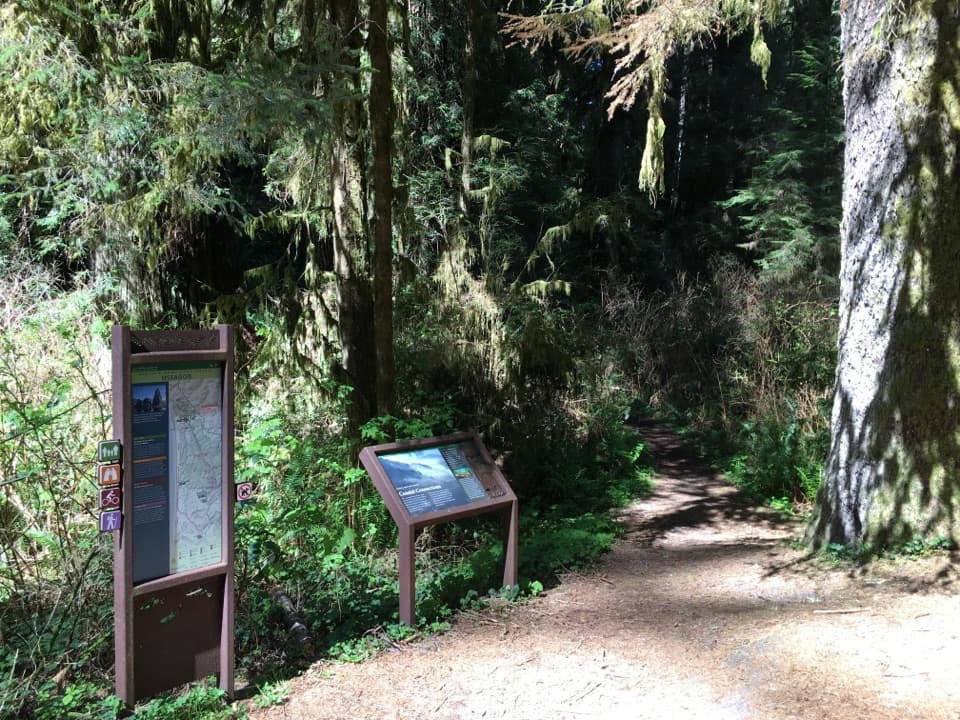
Use the Hope Creek Trailhead on the east side of Newton B. Drury Scenic Parkway at mile marker 132.74, opposite the separate Ossagon Trailhead. Parking is limited. On the first Saturday of each month October through May, the parkway is closed to vehicles for Hike and Bike Day.

Safety

Some steep grades and switchbacks make this more demanding than a flat grove walk.

6 active Redwood alerts

  • CautionU.S. 101 construction traffic controlsExpect construction-related traffic stops and one-way controlled traffic on U.S. 101; allow extra time and drive cautiously. - NPS reports multiple stops between Orick and Crescent City; delays vary.Official details
  • CautionU.S. 199 construction traffic controlsExpect 24/7 one-way controlled traffic on three U.S. 199 segments because of construction. - 6–6.2 miles north of Gasquet: through 6:00 p.m. December 15, 2026; delays up to 10 minutes. - 9.6–9.Official details
See all 6 alerts
A park ranger sits on a dash-mounted phone, talking, as Parkwolf’s Tour Guide plays “Army Cutworm Moths: A Grizzly Bear Buffet” on Grand Loop Road below Dunraven Pass in Yellowstone
Parkwolf Tour GuideThe highest, rockiest slopes around here are a summer buffet for grizzly bears.

Redwood Tour Guide

Your drive to Ten Taypo-Hope Creek Loop Trail, narrated.

Parkwolf is a GPS audio tour guide for Redwood National Park. As you drive, it chimes in with what’s ahead: hidden gems, upcoming stops, history, geology, and wildlife, right through your car’s speakers.

See the Redwood audio tour

Recorded for this trailhead

Hope Creek and Ten Taypo Loop
0:00 / 0:27
“You're approaching the Hope Creek trailhead, where the Ten Taypo loop takes you through ferny canyons and across a redwood ridge.”

Plays as you drive up to this trailhead in the Parkwolf Redwood Tour Guide.

More stories near here in the app

  • Ah-Pah Interpretive Trail
  • The Anemone Under the Shells
  • Carruthers Cove
  • Moorman-Pond Trail
  • 85 audio storiesacross Redwood’s roads, triggered by GPS as you drive
  • Wildlife heatmapsfor Black Bear, Elk, California Condor, and 13 more
  • Works offlinemaps, 83 trails, 48 places, and audio download before you lose signal
  • CarPlay readysimple controls built for the drive
★★★★★
“Fantastic app with many points of information… It’s great to just turn on while you’re driving and it gives you an audio tour of the national Park. We love it!!!!”
JMJamesApp Store review
Download Parkwolf on the App StoreGet Parkwolf on Google Play

4.7 from 8,600+ ratings

Trail guide

Hiking Ten Taypo-Hope Creek Loop Trail

What the loop coversThe Ten Taypo-Hope Creek Loop is a forest circuit in Prairie Creek Redwoods State Park.

The Ten Taypo-Hope Creek Loop is a forest circuit in Prairie Creek Redwoods State Park. From the east side of Newton B. Drury Scenic Parkway, it climbs the ferny Hope Creek canyon to a junction, follows Ten Taypo across the ridge, then returns on Hope Creek. Use 3.6 miles for the full walk, including the short access leg out and back; NPS lists four miles, while detailed route measurements range from 3.3 to 3.7. Expect a moderate hike with some steep grades and allow about two hours. Counterclockwise puts the longer Ten Taypo side first and saves the shorter, more direct Hope Creek leg for the return.

Hope Creek and the footbridgeThe first climb follows a steep-sided canyon with an open understory, big redwoods and…

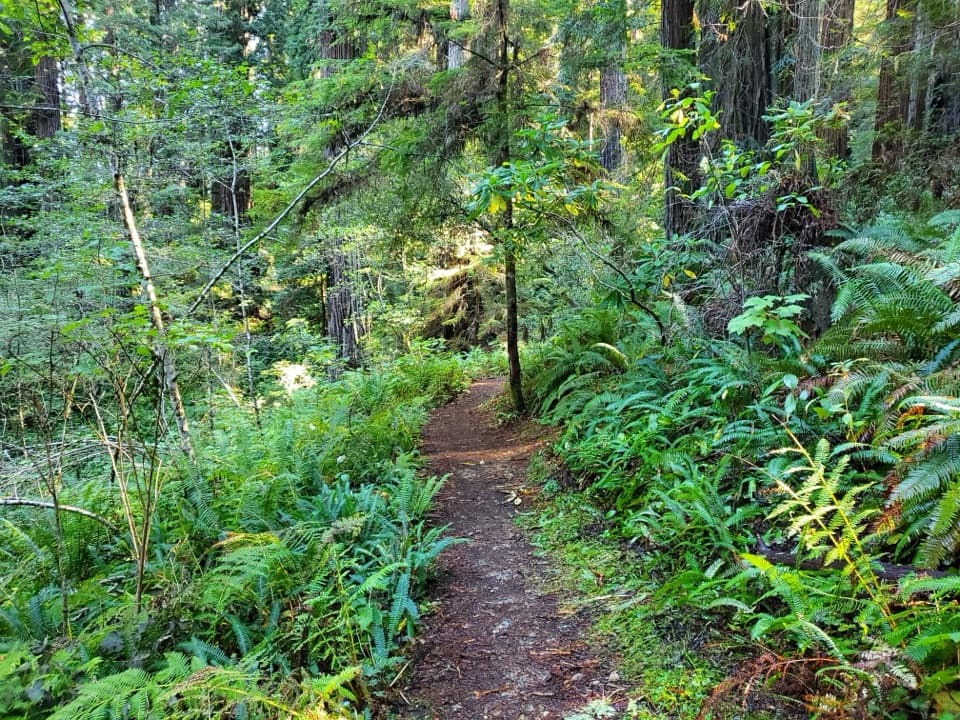
The first climb follows a steep-sided canyon with an open understory, big redwoods and fern-covered banks. At the first junction, turn right onto Ten Taypo over a long, winding footbridge. It is one of the walk's clearest landmarks; frame its curves with the ferny slopes and trunks to show how the creek cuts through the forest.

Ten Taypo and the old ridge roadTen Taypo winds in and out of small drainages along the hillside.

Ten Taypo winds in and out of small drainages along the hillside. The south-facing slope has smaller, more even trees, with huckleberry and rhododendron in the understory; redwood views return near the ridge. There the trail follows a short remnant of East Ridge Road, now mostly narrowed to singletrack. It was once a logging connection between Ah Pah and Cal Barrel roads, then was abandoned after Highway 101 was built; most of the old road has disappeared.

Watch the forest changeThe ridge briefly passes through a darker, sparse fir grove before switchbacks descend the…

The ridge briefly passes through a darker, sparse fir grove before switchbacks descend the hillside. The understory thins and larger redwoods return. Look for colossal trunks scarred by fire but still standing, a detail noted along the route. In the lowland woods, listen for the varied thrush's clear, flute-like single note.

Access and rulesStart at the Hope Creek Trailhead on the east side of the parkway at mile marker 132.

Start at the Hope Creek Trailhead on the east side of the parkway at mile marker 132.74, opposite the separate Ossagon Trailhead. Parking is limited. On the first Saturday of each month from October through May, the parkway is closed to vehicles for Hike and Bike Day but remains open to people on foot and bicycles. Dogs are not allowed on park trails; service animals are exempt.

Wildlife

Wildlife in Redwood

All Redwood wildlife maps

Sighting maps show where each species has been reported across Redwood. Wildlife moves, so no sighting is guaranteed.

Keep exploring

Near Ten Taypo-Hope Creek Loop Trail

See it all on the map

Trails that start nearby

Places near the trailhead

Parkwolf’s Redwood ranking

Top-rated trails in Redwood

All 83 trails
  1. 1Fern Canyon Loop TrailModerate · 1 mi
  2. 2Miners Ridge and James Irvine LoopChallenging · 12 mi
  3. 3Boy Scout Tree TrailModerate · 5.6 mi
  4. 4Stout Memorial Grove TrailEasy · 0.6 mi
  5. 5Grove of Titans TrailEasy · 1.8 mi
  6. 6Tall Trees TrailChallenging · 3.7 mi

Take Parkwolf to Redwood.

The audio tour guide for the drive, plus offline maps, trails, and wildlife heatmaps for when the signal drops.

4.7 from 8,600+ ratings

Download Parkwolf on the App StoreGet Parkwolf on Google Play