Lewis Mountain and Laurel Prong Traverse in Shenandoah National Park

Shenandoah National Park, VA

Lewis Mountain and Laurel Prong Traverse

A three-day traverse through Rapidan Camp to Lewis Falls

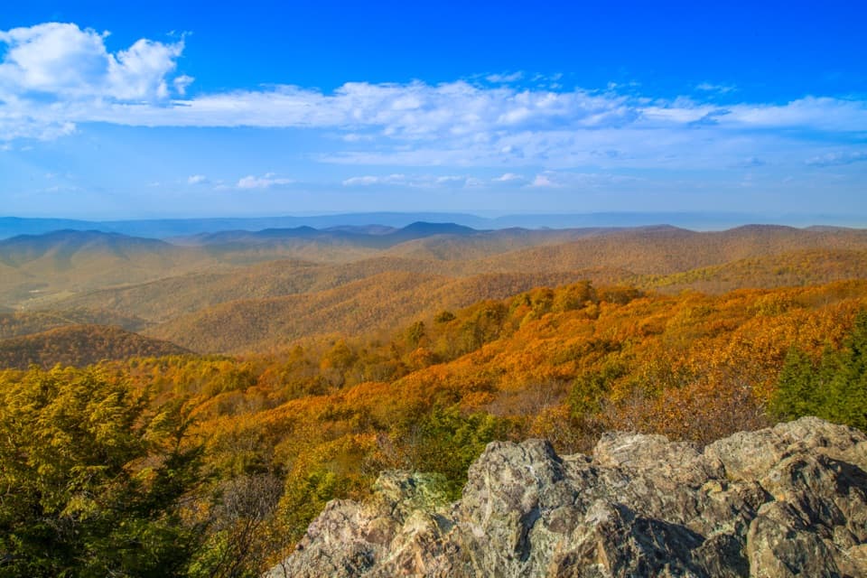
Photo: Wikimedia Commons
Length
17.3mi
Time
15hr
Elev. change
922ft
Difficulty
Moderate
  • Dogs allowed
  • High point 3,612 ft

Hear the audio tour

South River: Picnic Grounds and the Waterfall Overlook

Overview

About Lewis Mountain and Laurel Prong Traverse

Why go

  • Links Rapidan Camp and Lewis Falls on a single through-hike
  • The three-day itinerary spreads 17.3 miles across distinct ridge and stream trails

Heads up

  • Requires a shuttle between separate Skyline Drive access points
  • The exact itinerary is old and needs a current route check

Map & elevation

The route

Loading the Shenandoah map
Full map
Elevation2,690–3,612 ft
TrailheadSouth River Picnic Area38.38139, -78.51852
Keep this map with you offline in the Parkwolf app

Plan your hike

Before you go

Parking

Start at South River Picnic Area on Skyline Drive near mile 63. Finish at Big Meadows Picnic Area/Rapidan Road near mile 51; leave a vehicle at both ends or arrange another return plan. The documented Appalachian Trail access is about 0.1 mile from the picnic area.

Safety

The exact through-route itinerary was last updated in 2006, and its current maintenance status was not confirmed. Check current closures, access, and backcountry camping zones before departure. An overnight backcountry permit is required and must be purchased before arrival; park-issued permits are no longer available. Current rules prohibit camping within 0.5 mile of Rapidan Camp buildings. The first-night campground or cabin requires separate planning. Water reliability along the route was not verified.

2 active Shenandoah alerts

  • ClosureOld Rag Trailhead main lot closedThe Old Rag Trailhead main parking lot is closed to vehicles and pedestrians for infrastructure improvements; use the existing overflow lots. - Work is expected to be completed by November 2026.Official details
  • ClosureBackcountry camping and zone closuresBackcountry camping is prohibited on the Appalachian Trail from Lewis Mountain to Big Meadows, and the Naked Creek backcountry zone is closed.Official details
Shenandoah alerts
A park ranger sits on a dash-mounted phone, talking, as Parkwolf’s Tour Guide plays “Army Cutworm Moths: A Grizzly Bear Buffet” on Grand Loop Road below Dunraven Pass in Yellowstone
Parkwolf Tour GuideThe highest, rockiest slopes around here are a summer buffet for grizzly bears.

Shenandoah Tour Guide

Your drive to Lewis Mountain and Laurel Prong Traverse, narrated.

Parkwolf is a GPS audio tour guide for Shenandoah National Park. As you drive, it chimes in with what’s ahead: hidden gems, upcoming stops, history, geology, and wildlife, right through your car’s speakers.

See the Shenandoah audio tour

Recorded for this area

South River: Picnic Grounds and the Waterfall Overlook
0:00 / 0:30
“You're coming up on South River Picnic Grounds, the starting point for South River Falls.”

Plays on the road 0.1 mi from the trailhead in the Parkwolf Shenandoah Tour Guide.

More stories near here in the app

  • Baldface Mountain Overlook: A Brief Valley Stop
  • Hensley Hollow Overlook: Follow the Valley Toward Elkton
  • Five Dollars to Keep
  • The Newt's Years on Land
  • 146 audio storiesacross Shenandoah’s roads, triggered by GPS as you drive
  • Wildlife heatmapsfor Black Bear, Bald Eagle, White-tailed Deer, and 13 more
  • Works offlinemaps, 163 trails, 142 places, and audio download before you lose signal
  • CarPlay readysimple controls built for the drive
★★★★★
“Fantastic app with many points of information… It’s great to just turn on while you’re driving and it gives you an audio tour of the national Park. We love it!!!!”
JMJamesApp Store review
Download Parkwolf on the App StoreGet Parkwolf on Google Play

4.7 from 8,600+ ratings

Trail guide

Hiking Lewis Mountain and Laurel Prong Traverse

A three-day through-hikeThis is a 17.3-mile, point-to-point backcountry itinerary, not a loop.

This is a 17.3-mile, point-to-point backcountry itinerary, not a loop. It starts at South River Picnic Area, follows the Appalachian Trail to Lewis Mountain, crosses Laurel Prong through Rapidan Camp, then uses Mill Prong Horse Trail, Mill Prong, more Appalachian Trail, and Lewis Falls Trail to reach Big Meadows Picnic Area. Plan for three days and roughly 15 hours on trail across the three days, including ordinary stops; add camp setup, meals, and the two nights. The written itinerary is old, so confirm the exact route and access before setting out.

How the days break downThe first day follows 5.

The first day follows 5.3 miles of the Appalachian Trail to Lewis Mountain; the itinerary suggests a developed campground or cabin for the first night. On day two, continue 3.6 miles north on the Appalachian Trail, with an optional 0.3-mile Bearfence view, then turn onto Laurel Prong and find a legal backcountry site in the allowed zone. On day three, follow Laurel Prong to Rapidan Camp, then Mill Prong Horse Trail, Mill Prong, the Appalachian Trail, and Lewis Falls Trail before a short final approach through Big Meadows Amphitheater to the picnic area.

Rapidan CampThe route passes Rapidan Camp, the rustic retreat used by President Herbert Hoover and First…

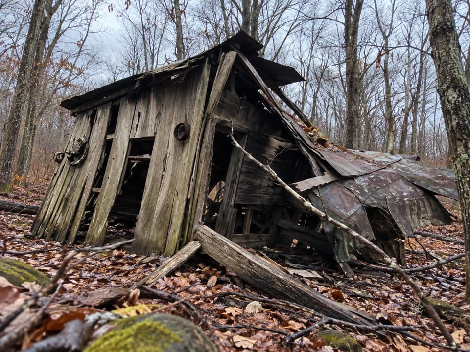
The route passes Rapidan Camp, the rustic retreat used by President Herbert Hoover and First Lady Lou Henry Hoover. Its buildings and exhibits give the middle of the trip a historic destination between the Laurel and Mill Prong sections. Camping is prohibited within 0.5 mile of the Camp buildings; use the current camping-zone map to plan the night before and after this section.

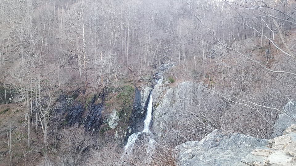
Lewis Falls finishThe last named trail section reaches an overlook above Lewis Falls, an 81-foot waterfall,…

The last named trail section reaches an overlook above Lewis Falls, an 81-foot waterfall, before the route turns toward the Big Meadows Amphitheater and picnic area. This is a through-hike: arrange a vehicle shuttle or another return plan between the two ends.

Permits and overnight plansA backcountry camping permit is required for each overnight and must be obtained before…

A backcountry camping permit is required for each overnight and must be obtained before arriving at the park. The first-night campground or cabin is a separate developed-area stay, so check its current reservation and operating requirements. Water reliability and facilities along the route were not verified; plan from current park information rather than assuming services at either picnic area.

Pets and the Bearfence spurPets may use the core route trails on a physical leash no longer than six feet.

Pets may use the core route trails on a physical leash no longer than six feet. The optional Bearfence Mountain Trail is closed to pets, so skip that side trip when hiking with a dog.

Check current conditionsThe available through-route itinerary was last updated in 2006.

The available through-route itinerary was last updated in 2006. Current access maps show the South River and Big Meadows trail connections, and the component trails remain in the park's backcountry network, but the present maintenance and status of this exact three-day itinerary were not confirmed. Check current closures, road access, trail conditions, and permitted campsite zones before departure.

Wildlife

Wildlife in Shenandoah

All Shenandoah wildlife maps

Sighting maps show where each species has been reported across Shenandoah. Wildlife moves, so no sighting is guaranteed.

Keep exploring

Near Lewis Mountain and Laurel Prong Traverse

See it all on the map

Trails that start nearby

Places near the trailhead

Parkwolf’s Shenandoah ranking

Top-rated trails in Shenandoah

All 163 trails
  1. 1Old Rag Summit via Berry HollowChallenging · 5.4 mi
  2. 2Hawksbill LoopModerate · 2.9 mi
  3. 3Marys Rock Summit TrailModerate · 3.7 mi
  4. 4Stony Man HikeEasy · 1.6 mi
  5. 5Cedar Run - Whiteoak CircuitChallenging · 8.1 mi
  6. 6Blackrock Summit LoopEasy · 1 mi

Take Parkwolf to Shenandoah.

The audio tour guide for the drive, plus offline maps, trails, and wildlife heatmaps for when the signal drops.

4.7 from 8,600+ ratings

Download Parkwolf on the App StoreGet Parkwolf on Google Play