North Manitou Island Life-Saving Station in Sleeping Bear Dunes National Lakeshore

Sight · Sleeping Bear Dunes National Lakeshore

North Manitou Island Life-Saving Station

A rare 1854 rescue station anchors this remote island village.

Photo: Wikimedia Commons
Type
Sight
Nearest trail
0.2 mi
  • Exhibit
  • #33 of 72 sights
Parkwolf audio tour73 stories across Sleeping Bear Dunes’s roads

Overview

About North Manitou Island Life-Saving Station

Why stop

  • Five buildings show how rescue work grew into village life.

Heads up

  • Getting here takes a boat-dependent North Manitou Island outing.
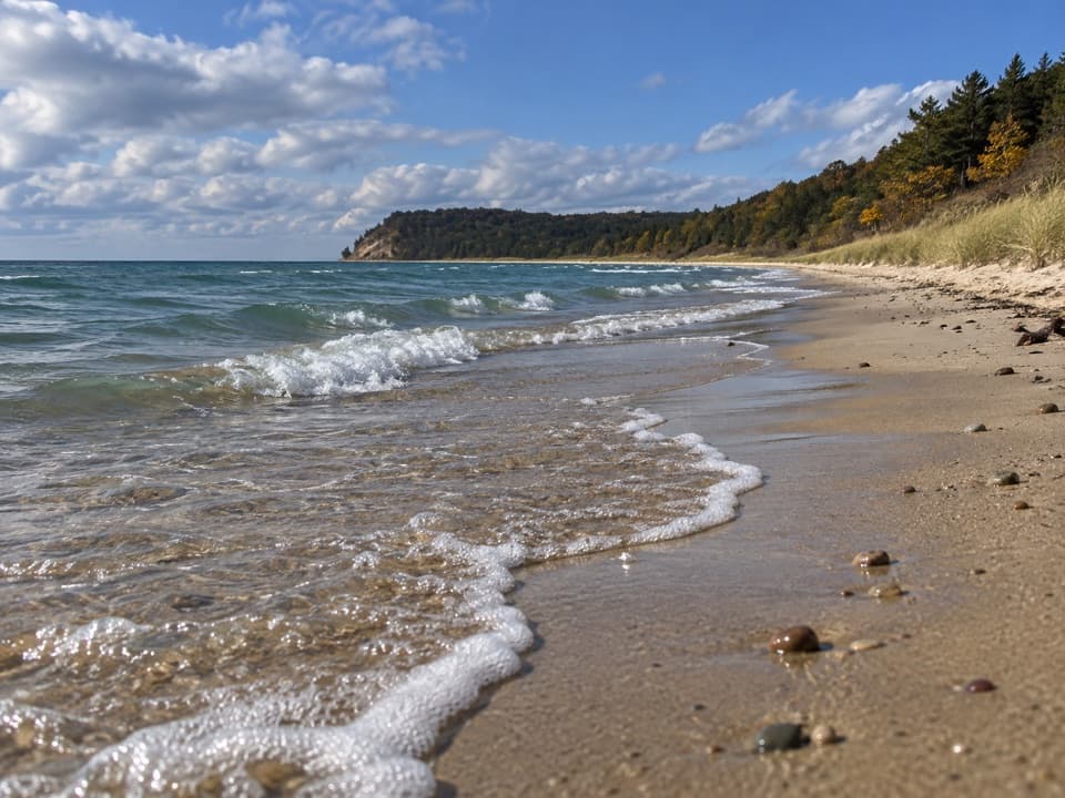
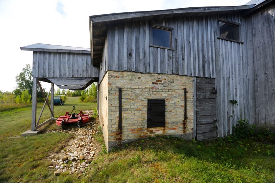
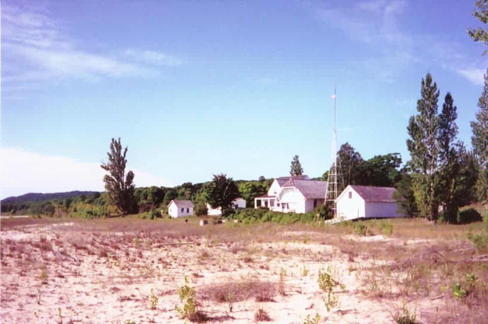
North Manitou Island Life-Saving Station is a maritime historic campus along the beach at North Manitou Village. Its five surviving service buildings trace the island’s rescue station from its 1854 volunteer beginnings to the end of the 19th century. Make time for the group if you’re exploring the island; getting here takes a boat-dependent North Manitou Island outing, not a quick detour.
Parkwolf’s verdictWhy the station is worth the stop

Map

Where it is

Loading the Sleeping Bear Dunes map
Full map
SightNorth Manitou Island Life-Saving Station45.12089, -85.97719
Keep this map with you offline in the Parkwolf app

Plan your stop

Before you go

1 active Sleeping Bear Dunes alert

  • ClosureManitou Islands access closures during 2026 constructionNorth and South Manitou Islands have limited visitor access throughout the 2026 season: all facilities, docks, and utilities on both islands remain closed during major construction.Official details

Sleeping Bear Dunes alerts
A park ranger sits on a dash-mounted phone, talking, as Parkwolf’s Tour Guide plays “Army Cutworm Moths: A Grizzly Bear Buffet” on Grand Loop Road below Dunraven Pass in Yellowstone
Parkwolf Tour GuideThe highest, rockiest slopes around here are a summer buffet for grizzly bears.

Sleeping Bear Dunes Tour Guide

Your drive to North Manitou Island Life-Saving Station, narrated.

Parkwolf is a GPS audio tour guide for Sleeping Bear Dunes National Lakeshore. As you drive, it chimes in with what’s ahead: hidden gems, upcoming stops, history, geology, and wildlife, right through your car’s speakers.

  • 73 audio storiesacross Sleeping Bear Dunes’s roads, triggered by GPS as you drive
  • Wildlife heatmapsfor Piping Plover, Bald Eagle, White-tailed Deer, and 13 more
  • Works offlinemaps, 34 trails, 89 places, and audio download before you lose signal
  • CarPlay readysimple controls built for the drive
★★★★★
“Fantastic app with many points of information… It’s great to just turn on while you’re driving and it gives you an audio tour of the national Park. We love it!!!!”
JMJamesApp Store review
Download Parkwolf on the App StoreGet Parkwolf on Google Play

4.7 from 8,600+ ratings

Guide

More about North Manitou Island Life-Saving Station

Read the village as a campusThe buildings sit along the beach, with Cottage Row on the bluff behind them.

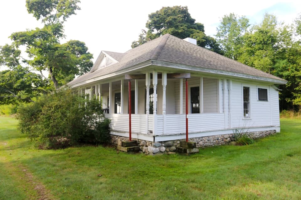
The buildings sit along the beach, with Cottage Row on the bluff behind them. The village walk links the 1854 rescue station, the 1877 boathouse, and the 1887 dwelling, with a crew ready room and root cellar nearby. Look at them as parts of one working station rather than five unrelated cottages.

The 1854 volunteer stationNicholas Pickard built the first rescue station here to Treasury Department plans.

Nicholas Pickard built the first rescue station here to Treasury Department plans. The building is the oldest structure associated with the U.S. Life-Saving Service on the Great Lakes, and it’s believed to be the only surviving example of its kind nationally. A surfboat was central to the work: Pickard accepted a bond for a Francis metal boat to be kept at the station and used by the volunteer crew.

A boathouse with a missing lookoutFrancis Chandler designed the 1877 boathouse for the Treasury Department.

Francis Chandler designed the 1877 boathouse for the Treasury Department. Its roof once carried a lookout tower, and the boat door was later replaced by a large window during alterations. The neighboring 1887 dwelling was designed by Treasury architect Albert Bibb; it was remodeled by the Coast Guard in 1932 and later adapted for island use.

More than rescue workFor nearly 80 years, the station was one of North Manitou Village’s main employers and service…

For nearly 80 years, the station was one of North Manitou Village’s main employers and service centers. The crew kept watch for people in trouble, gave first aid, helped with fire protection and policing, and carried news between the island and mainland. Local farming families sold produce to the station, which stored vegetables in a fieldstone root cellar built in 1899.

Take in the buildings from outsideSome station buildings are used for staff housing, so respect residents’ privacy and don’t…

Some station buildings are used for staff housing, so respect residents’ privacy and don’t assume historic interiors are open. For a photo, step back until the tall mast and several white buildings fit together; that shows the waterfront campus better than a close shot of one roof.

Wildlife

Wildlife in Sleeping Bear Dunes

All Sleeping Bear Dunes wildlife maps

Sighting maps show where each species has been reported across Sleeping Bear Dunes. Wildlife moves, so no sighting is guaranteed.

Parkwolf’s Sleeping Bear Dunes ranking

Top sights in Sleeping Bear Dunes

All 89 places
  1. 1Dune ClimbSight
  2. 2Lake Michigan OverlookSight
  3. 3Pyramid Point OverlookSight
  4. 4Empire Bluff OverlookSight
  5. 5South Manitou Lighthouse ComplexSight
  6. 6North Bar BeachBeach

Take Parkwolf to Sleeping Bear Dunes.

The audio tour guide for the drive, plus offline maps, trails, and wildlife heatmaps for when the signal drops.

4.7 from 8,600+ ratings

Download Parkwolf on the App StoreGet Parkwolf on Google Play