Overview
About Magnúsarfoss and Historic Power Station
Why stop
- An unusual farm-scale power story beside a waterfall.
Heads up
- The falls are modest, and reaching them takes a hike.
Map
Where it is

The highest, rockiest slopes around here are a summer buffet for grizzly bears.
Vatnajökull Tour Guide
Your drive to Magnúsarfoss and Historic Power Station, narrated.
Parkwolf is a GPS audio tour guide for Vatnajökull National Park. As you drive, it chimes in with what’s ahead: hidden gems, upcoming stops, history, geology, and wildlife, right through your car’s speakers.
Recorded for this place
Skaftafell: Waterfall or Glacier Walk“You're nearing Skaftafell, the starting point for walks to Svartifoss and the glacier. Start at the visitor centre if you haven't chosen a route.”
Plays as you drive up to Magnúsarfoss and Historic Power Station in the Parkwolf Vatnajökull Tour Guide.
More stories near here in the app
- The Woods Iceland Lost
- Skeiðará Bridge Monument: The 1996 Flood
- Svínafellsjökull Viewpoint
- The Last Gap in the Ring Road
- 298 audio storiesacross Vatnajökull’s roads, triggered by GPS as you drive
- Wildlife heatmapsfor Grey Seal, Harbor Seal, Caribou, and 13 more
- Works offlinemaps, 92 trails, 75 places, and audio download before you lose signal
- CarPlay readysimple controls built for the drive
“Fantastic app with many points of information… It’s great to just turn on while you’re driving and it gives you an audio tour of the national Park. We love it!!!!”


Guide
More about Magnúsarfoss and Historic Power Station
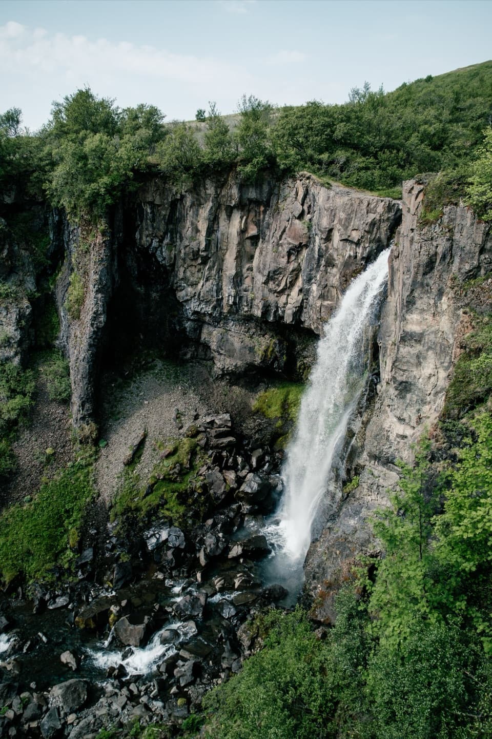
A waterfall with an unusual neighborMagnúsarfoss is a roughly 10 m waterfall in Vestragil, with a restored power station nearby.
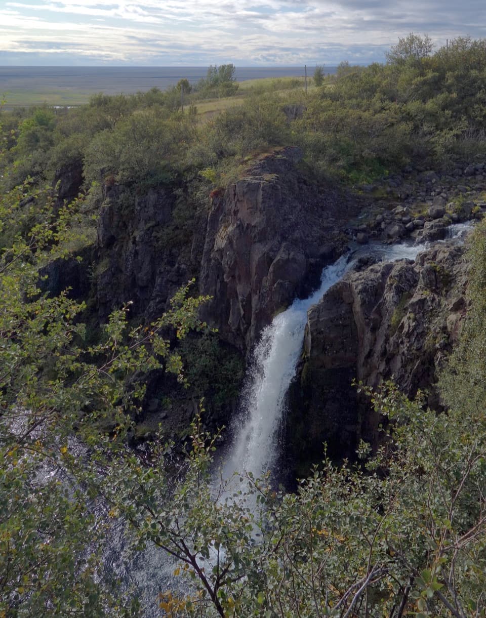
Magnúsarfoss is a roughly 10 m waterfall in Vestragil, with a restored power station nearby. It’s a smaller stop on the Skaftafell hiking network, but the station gives you a good reason to pause before carrying on. The park says the rebuilt station is open to visitors, though it doesn’t say when the interior is accessible.
Add it to the Svartifoss walkThe 5.
The 5.8 km S2 loop starts beside Skaftafell Visitor Centre and takes about two hours, with 250 m of climbing. It passes Hundafoss and Magnúsarfoss before reaching Svartifoss, then loops back via Sel and Lambhagi. Treat this as an extra waterfall along that route rather than making a long walk just for a modest cascade; some visitors find it small beside the other falls. Wooden and stone steps make the route more than a flat stroll, and wet or icy sections can be slippery.
A little power for two farmsThe station began operating in 1925, built by self-taught electricians Helgi Arason and…
The station began operating in 1925, built by self-taught electricians Helgi Arason and Skarphéðinn Gíslason. Its 3.45 kW output served the farms Bölti and Sel for cooking, lighting, and heat. Instead of using the waterfall’s drop, it used the flow of nearby Stórilækur—an unusual arrangement for a station of its time. It shut down in 1973 when the state grid reached the farms, then was rebuilt between 2001 and 2003.
Use the viewpoint above the fallsThe marked route reaches a viewpoint above Magnúsarfoss before descending into the ravine and…
The marked route reaches a viewpoint above Magnúsarfoss before descending into the ravine and crossing a footbridge. For a photo of the cascade, use that higher view to show the water dropping through the dark gorge; the lower route is for seeing the ravine and crossing, not a reason to push toward an unmarked edge.
Wildlife
Wildlife in Vatnajökull
 23 sightingsGrey SealMost seen around 5 AMSighting map
 260 sightingsHarbor SealMost seen around 11 AMSighting map
 184 sightingsCaribouMost seen around 7 PMSighting map
 62 sightingsArctic FoxMost seen around 8 PMSighting map
 169 sightingsWhooper SwanMost seen around 5 PMSighting map
 68 sightingsAtlantic PuffinMost seen around 7 PMSighting map
Sighting maps show where each species has been reported across Vatnajökull. Wildlife moves, so no sighting is guaranteed.